Category:Old maps of the history of Hungary
Jump to navigation
Jump to search
Subcategories
This category has the following 2 subcategories, out of 2 total.
B
Media in category "Old maps of the history of Hungary"
The following 7 files are in this category, out of 7 total.
-
 A harom reszre szakadt Magyar allam terkepe (1567).JPG 2,730 × 1,675; 986 KB
-
 Europe mediterranean 1190 cropped.jpg 796 × 753; 257 KB
-
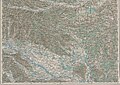
 Josephinische Landaufnahme Kingdom of Hungary.jpg 3,033 × 2,145; 1.02 MB
-
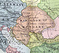 Kingdom of Hungary 1102.jpg 464 × 418; 261 KB
-
 Memorial at the foot of Csókakő-fortress - panoramio.jpg 2,272 × 1,704; 716 KB
-
 Petrovaradin BV044698772.jpg 1,490 × 1,749; 790 KB
-
 Őrség, Vendvidék 1910.jpg 3,443 × 2,438; 3.22 MB
.JPG)


