Category:OpenStreetMap maps of Iran
Jump to navigation
Jump to search
Countries of Asia: Armenia‡ · Azerbaijan‡ · Bangladesh · People's Republic of China · Cyprus‡ · East Timor · Egypt‡ · Georgia‡ · India · Indonesia‡ · Iran · Iraq · Israel · Japan · Jordan · Kazakhstan‡ · Kuwait · Kyrgyzstan · Lebanon · Malaysia · Mongolia · Myanmar · Nepal · North Korea · Pakistan · Philippines · Qatar · Russia‡ · Saudi Arabia · Singapore · South Korea · Sri Lanka · Syria · Thailand · Turkey‡ · Turkmenistan · United Arab Emirates · Uzbekistan · Vietnam · Yemen
Limited recognition: Taiwan · State of Palestine – Other territories: Hong Kong · Macau
‡: partly located in Asia
Limited recognition: Taiwan · State of Palestine – Other territories: Hong Kong · Macau
‡: partly located in Asia
Media in category "OpenStreetMap maps of Iran"
The following 19 files are in this category, out of 19 total.
-
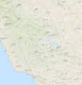
 Alborz Province.jpg 584 × 468; 130 KB
-
 Cheshmeh Ali - Rey - Iran - map.png 670 × 585; 540 KB
-
 Fars Province OpenStreetMap.PNG 929 × 972; 148 KB
-
 Fars Province relief OpenStreetMap.PNG 929 × 972; 1.38 MB
-
 Golestan Province OpenStreetMap.PNG 971 × 777; 137 KB
-
 Golestan Province relief OpenStreetMap.PNG 971 × 776; 1.07 MB
-
 Isfahan arr jms.gif 944 × 710; 227 KB
-
 Isfahan city location map.svg 779 × 832; 5.14 MB
-
 Karaj OpenStreetMap.png 820 × 662; 292 KB
-
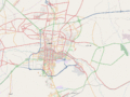
 Kashan OpenStreetMap.png 1,606 × 1,108; 392 KB
-
 Locations-Iran-Space-Agency.png 1,316 × 743; 547 KB
-
 Map of Tehran.png 567 × 422; 309 KB
-
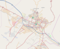
 Qazvin OpenStreetMap.png 1,012 × 750; 240 KB
-
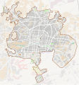
 Sabzevar Historic District.svg 798 × 745; 6.6 MB
-
 Shiraz OpenStreetMap.png 886 × 768; 343 KB
-
 Tehran arr jms.gif 934 × 787; 221 KB
-
 Tehran Province OpenStreetMap.PNG 863 × 545; 113 KB
-
 Tehran Province relief OpenStreetMap.PNG 854 × 543; 798 KB
-
 Tehran Province-4.png 929 × 629; 857 KB


