Category:Orthographic projection (cartography)
둘러보기로 이동
검색으로 이동
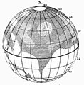
English: Orthographic projection is an azimuthal projection orthogonally onto a tangent plane or secant plane. It depicts a hemisphere of the globe as it appears from outer space (the point of perspective is at infinite distance).
English: This map-projection-related category exists in the following hierarchy:
- Category:Map projections
- Category:Maps by projection
- Category:Orthographic projection (cartography) – media related to the Orthographic projection (cartography) other than maps
- Category:Maps with orthographic projection (“Category:orthographic projections”) – maps made using the Orthographic projection (cartography)
azimuthal perspective map projection | |||||
| 미디어 올리기 | |||||
| 다음 종류에 속함 | |||||
|---|---|---|---|---|---|
| 다음의 하위 개념임 | |||||
| |||||
하위 분류
다음은 이 분류에 속하는 하위 분류 2개 가운데 2개입니다.
O
P
"Orthographic projection (cartography)" 분류에 속하는 미디어
다음은 이 분류에 속하는 파일 20개 가운데 20개입니다.
-
Orthographic projection 118.png 118 × 118; 14 KB
-
Orthographic projection of northern hemisphere with grid.png 295 × 295; 56 KB
-
Orthographic Projection Transversal.jpg 2,048 × 2,048; 873 KB
-
Worldmap northern.svg 553 × 553; 589 KB
-
Worldmap southern.svg 553 × 553; 257 KB
-
Comparison azimuthal projections.svg 512 × 171; 113 KB
-
Different map projections.png 1,049 × 462; 166 KB
-
Earth orthographic projection Earthmap1000x500.jpg 6,144 × 2,560; 2 MB
-
Earth orthographic projection SMIL.svg 512 × 512; 2.84 MB
-
Equatorial mount.svg 512 × 410; 110 KB
-
Flammarion - La planète Mars, Tome 1-f257-1.jpg 540 × 548; 76 KB
-
Lahaina noon subsolar point.svg 512 × 384; 47 KB
-
Polar chart-azimuthal ortho proj-blank.png 1,600 × 1,600; 410 KB
-
Projection azimutale orthographique.jpg 360 × 232; 17 KB
-
Proyección ortoecua.png 116 × 116; 811 바이트
-
Proyección ortopolar.png 278 × 140; 2 KB
-
Sphere wireframe.svg 400 × 400; 8 KB
-
Triangles (spherical geometry).jpg 2,489 × 2,048; 2.14 MB
-
Zasada rzutu ortograficznego.PNG 402 × 363; 8 KB


