Category:Pelserstraat 25, Dordrecht
Jump to navigation
Jump to search
| Object location | | View all coordinates using: OpenStreetMap |
|---|
 | |||||
| Upload media | |||||
| Instance of |
| ||||
|---|---|---|---|---|---|
| Location | Dordrecht, South Holland, Netherlands | ||||
| Street address |
| ||||
| Located on street | |||||
| Heritage designation |
| ||||
 | |||||
|
This is a category about rijksmonument number 13609
|
| Address |
|
Media in category "Pelserstraat 25, Dordrecht"
The following 6 files are in this category, out of 6 total.
-
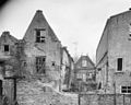 Achterzijde - Dordrecht - 20062457 - RCE.jpg 1,200 × 955; 259 KB
-
 En lager, overzicht - Dordrecht - 20062459 - RCE.jpg 962 × 1,200; 217 KB
-
 Geveltop - Dordrecht - 20062458 - RCE.jpg 1,200 × 1,017; 247 KB
-
 Overzicht van de voorgevels - Dordrecht - 20379311 - RCE.jpg 1,200 × 1,195; 283 KB
-
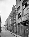 Voorgevels - Dordrecht - 20062455 - RCE.jpg 948 × 1,200; 224 KB
-
 Voorgevels - Dordrecht - 20062456 - RCE.jpg 956 × 1,200; 242 KB


