Category:Penhow
Jump to navigation
Jump to search
village and comunity in Newport, Wales  | |||||
| Upload media | |||||
| Pronunciation audio | |||||
|---|---|---|---|---|---|
| Instance of | |||||
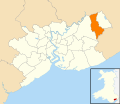
| Location | Newport, Wales | ||||
 | |||||

Cymraeg: Pentref a chymuned ym mwrdeisdref sirol Casnewydd yw Pen-hŵ (Saesneg: Penhow). Saif ar ffîn ddwyreiniol sir Casnewydd. Roedd poblogaeth y gymuned yn 2001 yn 770.
English: Penhow is a small village and community parish just inside the eastern edge of the boundary of the city of Newport, South Wales, within the historic county of Monmouthshire.
Subcategories
This category has the following 4 subcategories, out of 4 total.
P
- Parc-Seymour (1 F)
R
- Rock and Fountain, Penhow (9 F)
Media in category "Penhow"
The following 158 files are in this category, out of 158 total.
-
 50 mph speed limit on the A48 in Penhow - geograph.org.uk - 2806617.jpg 640 × 480; 108 KB
-
 A natural moat - geograph.org.uk - 5703059.jpg 10,102 × 5,022; 7.9 MB
-
 A48 - geograph.org.uk - 5703095.jpg 6,032 × 4,014; 6.37 MB
-

-
 A48 at Penhow village boundary - geograph.org.uk - 3274876.jpg 640 × 481; 50 KB
-
 A48 at Penhow, 1 - geograph.org.uk - 5853269.jpg 1,600 × 899; 600 KB
-
 A48 at Penhow, 2 - geograph.org.uk - 5853905.jpg 1,600 × 900; 574 KB
-
 A48 bus stop and shelter east of Penhow - geograph.org.uk - 6026381.jpg 1,024 × 635; 177 KB
-
 A48 bus stop, Penhow - geograph.org.uk - 6025126.jpg 1,024 × 966; 277 KB
-
 A48 crossroads ahead, Penhow - geograph.org.uk - 3360149.jpg 640 × 529; 127 KB
-
 A48 eastbound at Penhow - geograph.org.uk - 3274882.jpg 640 × 480; 50 KB
-
 A48 heads through Penhow - geograph.org.uk - 2806209.jpg 640 × 434; 58 KB
-

-
 A48 near Penhow Castle - geograph.org.uk - 3274887.jpg 640 × 480; 76 KB
-
 A48 road junction - geograph.org.uk - 1969957.jpg 4,288 × 2,848; 6.26 MB
-
 Agitated cows - geograph.org.uk - 3190803.jpg 640 × 480; 84 KB
-
 Approaching Wentwood summit - geograph.org.uk - 5854469.jpg 1,600 × 1,200; 938 KB
-

-
 Boundary of Newport and Penhow - geograph.org.uk - 3359969.jpg 640 × 446; 87 KB
-
 Bowden's Lane, Penhow - geograph.org.uk - 2267244.jpg 480 × 640; 94 KB
-
-

-
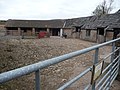
 Castle Farm, Penhow - geograph.org.uk - 2806700.jpg 640 × 436; 64 KB
-
 Chapel farm, Llandevaud - geograph.org.uk - 5854421.jpg 1,600 × 1,200; 989 KB
-
 Children's play area, Parc Seymour - geograph.org.uk - 2248664.jpg 640 × 480; 100 KB
-
 Comms Tower - panoramio - Ray Ok.jpg 1,536 × 2,048; 761 KB
-

-
 Curious cows - geograph.org.uk - 3190812.jpg 640 × 480; 71 KB
-
 Curious cows - geograph.org.uk - 3190817.jpg 640 × 480; 100 KB
-

-
 Cyclists dismount, Penhow - geograph.org.uk - 2806133.jpg 640 × 587; 90 KB
-
 Danger Keep Out of Penhow Quarry - geograph.org.uk - 2806782.jpg 640 × 480; 132 KB
-
-
 Disused Quarry - geograph.org.uk - 5703091.jpg 6,032 × 4,014; 7.72 MB
-
 Disused quarry, Penhow - geograph.org.uk - 1725902.jpg 3,296 × 2,472; 1.87 MB
-
 Duckpool Farm, Monmouthshire - geograph.org.uk - 2248831.jpg 640 × 480; 78 KB
-
 Duckpool Lane near Parc Seymour - geograph.org.uk - 2248813.jpg 640 × 480; 97 KB
-
 End of the 50 zone, Pike Road, Llanvaches - geograph.org.uk - 6025582.jpg 1,024 × 797; 168 KB
-

-
 Evening at Penhow, Monmouthshire - geograph.org.uk - 2825866.jpg 640 × 480; 48 KB
-

-
 Farm buildings at Chapel Farm, Llandevaud - geograph.org.uk - 5854418.jpg 1,600 × 1,200; 925 KB
-
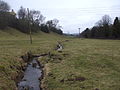
 Field access over a brook, Penhow - geograph.org.uk - 3935850.jpg 800 × 600; 205 KB
-

-
 Field at Penhow - geograph.org.uk - 5703071.jpg 11,999 × 3,728; 7.44 MB
-
 Field edge footpath - geograph.org.uk - 3190694.jpg 640 × 480; 81 KB
-
 Field edge path near Penhow - geograph.org.uk - 3190710.jpg 640 × 480; 80 KB
-
-
 Footpath across a field - geograph.org.uk - 3190783.jpg 640 × 480; 59 KB
-
 Footpath and gate on Bowden's Lane - geograph.org.uk - 3190780.jpg 640 × 480; 110 KB
-
 Footpath fingerpost and stile - geograph.org.uk - 3190806.jpg 640 × 480; 133 KB
-
 Footpath near Penhow - geograph.org.uk - 3190765.jpg 640 × 480; 73 KB
-
 Footpath on the edge of Penhow - geograph.org.uk - 3190758.jpg 640 × 480; 96 KB
-
 Forest near Curley Oak - geograph.org.uk - 3192054.jpg 680 × 1,024; 327 KB
-
 Forest road at Little Oak - geograph.org.uk - 3192059.jpg 1,024 × 680; 253 KB
-
 Forest track - geograph.org.uk - 3192049.jpg 680 × 1,024; 333 KB
-
 Former entrance to Penhow Quarry - geograph.org.uk - 1725909.jpg 3,296 × 2,472; 1.84 MB
-
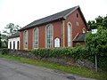
 Front view of Penhow Baptist Chapel - geograph.org.uk - 2267329.jpg 640 × 466; 61 KB
-
 Gate into Penhow Woods - panoramio.jpg 1,600 × 1,200; 609 KB
-
 Grazing land south of Penhow, 1 - geograph.org.uk - 5853907.jpg 1,600 × 900; 567 KB
-
 Grazing land south of Penhow, 2 - geograph.org.uk - 5853908.jpg 1,600 × 899; 457 KB
-
 Greenmeadow Drive, Parc Seymour - geograph.org.uk - 2248669.jpg 640 × 430; 47 KB
-
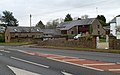
 Groes Wen Inn, Penhow - geograph.org.uk - 2267223.jpg 640 × 412; 55 KB
-
 Holly House near Parc Seymour - geograph.org.uk - 2254538.jpg 640 × 480; 105 KB
-

-
 Junction of Pike Road and the A48 east of Penhow - geograph.org.uk - 6026376.jpg 1,024 × 768; 132 KB
-

-
-
 Lane from Parc Seymour to Wentwood - geograph.org.uk - 2248817.jpg 640 × 527; 110 KB
-

-

-

-

-

-
-

-
 North side of the Groes Wen Inn, Penhow (geograph 7212503).jpg 1,600 × 1,594; 888 KB
-
 Northern edge of Parc Seymour - geograph.org.uk - 2248712.jpg 640 × 416; 58 KB
-
 Old lime kilns - geograph.org.uk - 3190770.jpg 640 × 480; 141 KB
-
 Old lime kilns - geograph.org.uk - 3190775.jpg 640 × 480; 115 KB
-
 Old shed on the field edge - geograph.org.uk - 3190786.jpg 640 × 480; 107 KB
-
 Parc Seymour this way - geograph.org.uk - 2267285.jpg 640 × 358; 51 KB
-
 Parc-Seymour - geograph.org.uk - 5854426.jpg 1,600 × 903; 492 KB
-

-

-
 Path and sheep pen - geograph.org.uk - 5854436.jpg 1,600 × 1,200; 1.07 MB
-
 Path through Castell-prin Wood - geograph.org.uk - 5854440.jpg 1,600 × 1,200; 1,014 KB
-
 Pen-coed Castle from Waun Arw - panoramio.jpg 2,592 × 1,944; 1.16 MB
-
 Penhow - Please drive carefully - geograph.org.uk - 6025159.jpg 1,024 × 805; 263 KB
-
 Penhow Baptist Chapel - geograph.org.uk - 3664798.jpg 640 × 480; 84 KB
-
 Penhow Bookshop - geograph.org.uk - 2806175.jpg 640 × 430; 56 KB
-
 Penhow Castle & Church (1133349).jpg 1,000 × 714; 209 KB
-
 Penhow Castle - geograph.org.uk - 5703108.jpg 6,032 × 4,014; 5.92 MB
-
 Penhow Castle - panoramio - Ray Ok (1).jpg 1,600 × 1,200; 600 KB
-
 Penhow Castle - panoramio - Ray Ok.jpg 1,000 × 319; 73 KB
-
 Penhow Castle - panoramio.jpg 1,600 × 1,200; 571 KB
-
 Penhow in autumn - geograph.org.uk - 3190719.jpg 640 × 480; 74 KB
-
 Penhow village - geograph.org.uk - 3190715.jpg 640 × 480; 77 KB
-
 Penhow Village Shop - geograph.org.uk - 5854422.jpg 1,600 × 900; 697 KB
-
 Penhow Village Shop, Parc Seymour - geograph.org.uk - 2254548.jpg 640 × 480; 78 KB
-
 Penhow Village Shop, Parc Seymour - geograph.org.uk - 3664813.jpg 640 × 480; 84 KB
-
 Pike Road towards the A48, Llanvaches - geograph.org.uk - 6025094.jpg 1,024 × 726; 189 KB
-
 Pool at the field edge - geograph.org.uk - 3190704.jpg 640 × 480; 105 KB
-
 Public footpath west of St Brides Brook - geograph.org.uk - 3935963.jpg 737 × 800; 191 KB
-
 Quarry entrance - geograph.org.uk - 5703092.jpg 6,032 × 4,014; 7.07 MB
-
 Quarry wall - geograph.org.uk - 5703090.jpg 6,032 × 4,014; 6.11 MB
-
 Recreation ground, Parc Seymour - geograph.org.uk - 2254593.jpg 640 × 480; 95 KB
-
 Replanted forest - geograph.org.uk - 3192065.jpg 1,024 × 680; 258 KB
-
 Road junction at Penhow - geograph.org.uk - 1969945.jpg 4,288 × 2,848; 5.25 MB
-
 Road junction, Parc Seymour - geograph.org.uk - 2267203.jpg 640 × 403; 54 KB
-
 Road to castle and church, Penhow - geograph.org.uk - 2806722.jpg 640 × 416; 72 KB
-
 Road to Llanvaches - geograph.org.uk - 3360170.jpg 640 × 480; 76 KB
-
 Road to St Brides Netherwent - geograph.org.uk - 3360162.jpg 640 × 496; 83 KB
-

-
 Rock at Penhow Quarry - geograph.org.uk - 1725907.jpg 3,296 × 2,472; 1.86 MB
-
 Rockfield Glade, Parc Seymour - geograph.org.uk - 2254582.jpg 640 × 429; 60 KB
-
 Roman Road - A48 - with lay-by - geograph.org.uk - 360301.jpg 640 × 480; 113 KB
-
 Row of three white cottages, Penhow - geograph.org.uk - 2806131.jpg 640 × 480; 78 KB
-
 Sheep grazing north of Parc Seymour - geograph.org.uk - 2254529.jpg 640 × 581; 108 KB
-
 Shooting strictly prohibited, Penhow - geograph.org.uk - 2806772.jpg 640 × 515; 133 KB
-
 Side view of Penhow Baptist Chapel - geograph.org.uk - 2267334.jpg 640 × 480; 59 KB
-
 Signs alongside the A48, Penhow - geograph.org.uk - 2806764.jpg 640 × 528; 116 KB
-
 Spring Flowers in Woods - panoramio.jpg 2,048 × 1,536; 785 KB
-
 St Brides Brook near Penhow - geograph.org.uk - 3935859.jpg 800 × 600; 183 KB
-
 St Brides Brook, at Penhow - geograph.org.uk - 1725860.jpg 3,296 × 2,472; 1.92 MB
-
 Stableyard at Penhow - geograph.org.uk - 3190748.jpg 640 × 480; 97 KB
-
 Start of Footpath to Penhow Castle - panoramio.jpg 1,000 × 491; 167 KB
-

-

-
 Stream, footpath and road, Penhow - geograph.org.uk - 2806748.jpg 640 × 480; 133 KB
-
 SW end of Pike Road, Penhow - geograph.org.uk - 3360186.jpg 640 × 451; 79 KB
-
 Swallow Barn, Penhow - geograph.org.uk - 2806162.jpg 640 × 398; 59 KB
-

-
 Telephone kiosk on A48 at Penhow - geograph.org.uk - 1969939.jpg 4,288 × 2,848; 6.92 MB
-
 The A48 - geograph.org.uk - 5703094.jpg 6,032 × 4,014; 6.71 MB
-
 The Gables near Parc Seymour - geograph.org.uk - 2267540.jpg 640 × 343; 53 KB
-
 The Groes Wen Inn, Penhow - geograph.org.uk - 3664826.jpg 640 × 480; 54 KB
-
 The house on the hill - geograph.org.uk - 5703052.jpg 10,000 × 3,487; 7.29 MB
-

-
 The Row, Penhow - geograph.org.uk - 2806188.jpg 640 × 520; 71 KB
-
 The track to Castle Farm - geograph.org.uk - 5703044.jpg 7,999 × 5,356; 7.9 MB
-
 Towards Penhow Castle and church - geograph.org.uk - 3935824.jpg 800 × 547; 90 KB
-
 Towards The Knoll, St Brides Netherwent - geograph.org.uk - 3936090.jpg 800 × 494; 110 KB
-
 Track into Wentwood - geograph.org.uk - 5864650.jpg 1,600 × 899; 873 KB
-
 Tree-lined A48, Penhow - geograph.org.uk - 2806214.jpg 640 × 480; 99 KB
-
-
 Two houses, Penhow - geograph.org.uk - 2806130.jpg 640 × 484; 64 KB
-
 Valley Floor en route to Penhow Castle - panoramio.jpg 1,000 × 356; 114 KB
-
 Village Farm House, Penhow - geograph.org.uk - 2806136.jpg 640 × 518; 87 KB
-
 Wales Newport Community Penhow map.svg 512 × 443; 416 KB
-
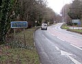
 Welcome to the City of Newport - geograph.org.uk - 6025138.jpg 842 × 1,024; 258 KB
-
 Wentwood - geograph.org.uk - 5854444.jpg 1,600 × 1,200; 1.35 MB
-
 Wentwood Forest - geograph.org.uk - 5854446.jpg 1,600 × 1,200; 1.11 MB
-
 Wentwood Forest road - geograph.org.uk - 5854443.jpg 1,600 × 901; 802 KB
-
 Wentwood Trig - geograph.org.uk - 3363472.jpg 2,592 × 1,944; 1.91 MB
-
 Winding brook in Penhow - geograph.org.uk - 3935841.jpg 800 × 600; 134 KB
-
 Woodland with trig point on 'Wentwood' - geograph.org.uk - 2617732.jpg 1,125 × 1,500; 2.04 MB
-
 Penhow Baptist Chapel - geograph.org.uk - 120787.jpg 640 × 480; 53 KB


.jpg)


.jpg)

.jpg)


