Category:Plate carrée projection
Vai alla navigazione
Vai alla ricerca
English: Plate carrée projection (geographic projection) is an orthogonal (square) equirectangular projection (equidistant cylindrical projection, plane chart, plain chart). It simply maps geographic to orthogonal coordinates (trueness of coordinates).
- (de) Plattkarte
- (en) Plate carrée projection
- (fr) Plate carrée
English: This map-projection-related category exists in the following hierarchy:
- Category:Map projections
- Category:Maps by projection
- Category:Plate carrée projection – media related to the Plate carrée projection other than maps
- Category:Maps with Plate carrée projection (“Category:Plate carrée projections”) – maps made using the Plate carrée projection
map projection that maps meridians and parallels to vertical and horizontal straight lines, respectively, producing a rectangular grid  | |||||
| Carica un file multimediale | |||||
| Sottoclasse di |
| ||||
|---|---|---|---|---|---|
| |||||
Sottocategorie
Questa categoria contiene le 2 sottocategorie indicate di seguito, su un totale di 2.
P
File nella categoria "Plate carrée projection"
Questa categoria contiene 3 file, indicati di seguito, su un totale di 3.
-
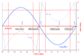
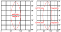 2xPlattkarte-Verzerrung.PNG 514 × 272; 12 KB
-
 Ecliptic vs equator.PNG 1 213 × 832; 66 KB
-
 Latvija Plate Carrée projekcijā.svg 1 054 × 623; 29 KB


