Category:Plate tectonics
Jump to navigation
Jump to search
Italiano: Tettonica delle placche
· Magyar: Lemeztektonika
· Македонски: Тектоника на плочите
· 日本語: プレートテクトニクス
· scientific theory that describes the large-scale motions of Earth's lithosphere   | |||||
| Upload media | |||||
| Instance of | |||||
|---|---|---|---|---|---|
| Subclass of |
| ||||
| Part of | |||||
| Publication date |
| ||||
| |||||
Mga ubos-nga-kaarangay
Ini nga kaarangay mayda han mga nasunod nga 32 nga mga ubos-nga-kaarangay, tikang hin 32 nga kabug-osan.
+
- Diagrams of mid-ocean ridges (45 F)
A
- Accreted terrane (3 F)
C
- Continental breakup (2 F)
E
F
I
L
M
O
P
R
S
T
V
Mga pakli ha kaarangay nga "Plate tectonics"
Ini nga kaarangay mayda han amo la nga nasunod nga pakli.
Media ha kaarangay nga "Plate tectonics"
An mga nasunod nga 88 ka mga fayl aada han hini nga kaarangay, tikang hin 88 nga kabug-osan.
-
 2008 age of ocean plates.png 2,560 × 1,346; 6.13 nga MB
-
 2008 age of oceans plates.jpg 2,560 × 1,539; 2.94 nga MB
-
 Age of oceanic lithosphere.png 2,000 × 1,432; 2.52 nga MB
-
 Age-ocean-floor.jpg 750 × 350; 252 nga KB
-
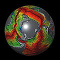 Antarctica Oceanic-Crust.jpg 600 × 600; 314 nga KB
-
 Antonio Snider-Pellegrini Opening of the Atlantic.jpg 1,834 × 1,079; 1.15 nga MB
-
 At Catavento, São Paulo 2019 143.jpg 5,184 × 3,456; 17.98 nga MB
-
 At Catavento, São Paulo 2019 144.jpg 3,456 × 5,184; 18.22 nga MB
-
 At San Francisco 2015 032.jpg 5,184 × 3,456; 2.79 nga MB
-
 At San Francisco 2015 033.jpg 5,184 × 3,456; 4.82 nga MB
-
 Atlantic Oceanic-Crust.jpg 600 × 600; 301 nga KB
-
 BAB of the World -Converted-.jpg 2,279 × 1,395; 462 nga KB
-
 Bac-arc-basin hg.png 1,625 × 1,155; 926 nga KB
-
 Carnegie Ridge.png 1,276 × 739; 933 nga KB
-
 Coiba & Malpelo Plates and major seismic faults of Colombia.jpg 768 × 759; 476 nga KB
-
 CourtHotspots.png 682 × 398; 60 nga KB
-
 Earth seafloor crust age 1996 - 2.png 1,624 × 1,020; 1.2 nga MB
-
 Earth seafloor crust age 1996.png 1,624 × 1,020; 958 nga KB
-
 Earth seafloor crust age poster.png 1,728 × 2,232; 2.13 nga MB
-
 Earth's global heat flow map.png 5,240 × 2,930; 1.6 nga MB
-
 Earth's seafloor age.png 5,585 × 2,742; 3.63 nga MB
-
 East Pacific Rise Oceanic-Crust.jpg 600 × 600; 320 nga KB
-
 Great Rift Valley map-gl.svg 1,403 × 1,808; 1.05 nga MB
-
 Grouse Creek block location1.jpg 1,131 × 1,206; 565 nga KB
-
 HotspotHighway.jpg 2,159 × 1,535; 1.67 nga MB
-
 Iberian Tectonic EN.svg 382 × 485; 695 nga KB
-
 India-Oceanic-Crustal-Map-with legend.jpg 450 × 450; 186 nga KB
-
 Ja-Platetechsimple.png 2,000 × 2,000; 67 nga KB
-
 Japan separation.png 1,500 × 1,056; 3.32 nga MB
-
 JPVD-NGTM2023-Comp2.jpg 15,007 × 6,858; 10.58 nga MB
-
 JPVD-NGTM2023-Terranes.jpg 6,000 × 2,747; 2.06 nga MB
-
 Legend-for-Oceanic-Crustal-Map.jpg 448 × 93; 56 nga KB
-
 Magnetic anomalies off west coast of North America.gif 435 × 664; 69 nga KB
-
 Magnetic anomalies off west coast of North America.png 435 × 664; 131 nga KB
-
 Map of tectonics in Asia.jpg 2,671 × 3,372; 1.54 nga MB
-
 Map of the Sumatra Trench.jpg 946 × 549; 638 nga KB
-
 Mape seyisses.jpg 350 × 219; 23 nga KB
-
 Mount Meager tectonics.png 470 × 575; 362 nga KB
-
 NASA fiordland 2009 earthquake.png 720 × 480; 363 nga KB
-
 NewEngland Seamount Chain.jpg 1,291 × 889; 194 nga KB
-
 North America and Europe Oceanic-Crust.jpg 600 × 600; 264 nga KB
-
 North Atlantic crust age 1996.gif 607 × 520; 174 nga KB
-
 Northeastern Philippine Sea Plate.jpg 748 × 600; 136 nga KB
-
 Northern end of the Philippine Sea Plate.jpg 813 × 601; 171 nga KB
-
 NZ faults.png 963 × 1,034; 765 nga KB
-
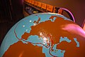
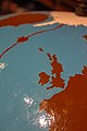
 Oceanic Crust Sphere Map1.jpg 6,100 × 6,090; 7.79 nga MB
-
 Pacific seafloor crust age 2.gif 883 × 908; 439 nga KB
-
 Paleomagnetismoa.jpg 1,280 × 687; 75 nga KB
-
 Panoramica Plegamiento de Campodola.jpg 5,200 × 1,328; 3.82 nga MB
-
 Plate.png 855 × 601; 264 nga KB
-
 RISE project region.svg 916 × 793; 3.94 nga MB
-
 SDFE GNSS reference station Esbjerg, 2020-09-12.jpg 2,268 × 4,032; 1.49 nga MB
-
 Sezione vulcanologica del museo eoliano 07.jpg 4,272 × 2,848; 3.21 nga MB
-
 Sfbay srt 1906108.jpg 540 × 458; 105 nga KB
-
 Southwest Indian Ridge Oceanic-Crust.jpg 600 × 600; 306 nga KB
-
 Subduction of the Pacific Plate beneath the North American Plate.jpg 850 × 723; 191 nga KB
-
 Tectonic plates boundary types & movement.png 2,806 × 2,162; 355 nga KB
-
 Tectonic plates rotation IT.png 1,280 × 720; 117 nga KB
-
 Tectonic plates rotation passive margins IT.png 1,280 × 720; 107 nga KB
-
 Tektonik Kurve von Isparta.jpg 1,193 × 1,282; 487 nga KB
-
 The New Glocal Tectonic Map - Hemisphere Projections.jpg 1,753 × 919; 531 nga KB
-
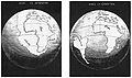
 The origin of continents and oceans - Wegener (1924) - figure 01.jpg 1,351 × 2,081; 809 nga KB
-
 The origin of continents and oceans - Wegener (1924) - figure 02.jpg 1,355 × 2,127; 836 nga KB
-
 The origin of continents and oceans - Wegener (1924) - figure 08.jpg 2,392 × 1,635; 1.12 nga MB
-
 The origin of continents and oceans - Wegener (1924) - figure 09.jpg 1,285 × 1,854; 901 nga KB
-
 The origin of continents and oceans - Wegener (1924) - figure 10.jpg 1,291 × 1,433; 515 nga KB
-
 The origin of continents and oceans - Wegener (1924) - figure 11.jpg 1,076 × 1,066; 651 nga KB
-
 The origin of continents and oceans - Wegener (1924) - figure 12.jpg 612 × 229; 77 nga KB
-
 The origin of continents and oceans - Wegener (1924) - figure 13.jpg 1,250 × 722; 429 nga KB
-
 The origin of continents and oceans - Wegener (1924) - figure 14.jpg 2,555 × 2,017; 913 nga KB
-
 The origin of continents and oceans - Wegener (1924) - figure 16.jpg 2,532 × 857; 635 nga KB
-
 The origin of continents and oceans - Wegener (1924) - figure 17.jpg 1,252 × 639; 113 nga KB
-
 The origin of continents and oceans - Wegener (1924) - figure 18.jpg 1,942 × 1,025; 1.03 nga MB
-
 The origin of continents and oceans - Wegener (1924) - figure 20.jpg 1,280 × 1,120; 467 nga KB
-
 The origin of continents and oceans - Wegener (1924) - figure 22.jpg 1,152 × 559; 96 nga KB
-
 The origin of continents and oceans - Wegener (1924) - figure 23.jpg 1,144 × 573; 87 nga KB
-
 The origin of continents and oceans - Wegener (1924) - figure 24.jpg 1,263 × 658; 451 nga KB
-
 The origin of continents and oceans - Wegener (1924) - figure 25.jpg 1,230 × 2,427; 518 nga KB
-
 The origin of continents and oceans - Wegener (1924) - figure 27.jpg 2,229 × 3,141; 1,024 nga KB
-
 The origin of continents and oceans - Wegener (1924) - figure 30.jpg 1,232 × 455; 350 nga KB
-
 The origin of continents and oceans - Wegener (1924) - figure 31.jpg 1,197 × 1,914; 682 nga KB
-
 The origin of continents and oceans - Wegener (1924) - figure 34.jpg 1,026 × 2,859; 1.05 nga MB
-
 The origin of continents and oceans - Wegener (1924) - figure 39.jpg 620 × 1,411; 325 nga KB
-
 The origin of continents and oceans - Wegener (1924) - figure 41.jpg 1,368 × 2,129; 495 nga KB
-
 The origin of continents and oceans - Wegener (1924) - figure 43.jpg 630 × 736; 138 nga KB
-
 Vematransform.svg 1,020 × 609; 393 nga KB
-
 WestcoastSeaplates.svg 878 × 666; 106 nga KB
-
 WorldCrustalAge - Hawaii hotspot.png 1,364 × 900; 584 nga KB


_-_figure_01.jpg)
_-_figure_02.jpg)
_-_figure_08.jpg)
_-_figure_09.jpg)
_-_figure_10.jpg)
_-_figure_11.jpg)
_-_figure_13.jpg)
_-_figure_14.jpg)
_-_figure_17.jpg)
_-_figure_18.jpg)
_-_figure_20.jpg)
_-_figure_22.jpg)
_-_figure_23.jpg)
_-_figure_24.jpg)
_-_figure_25.jpg)
_-_figure_27.jpg)
_-_figure_31.jpg)
_-_figure_39.jpg)
_-_figure_41.jpg)
_-_figure_43.jpg)


_-_figure_12.jpg)
_-_figure_16.jpg)
_-_figure_30.jpg)
_-_figure_34.jpg)