Category:Polegate
Vai alla navigazione
Vai alla ricerca
town and civil parish in East Sussex, United Kingdom  | |||||
| Carica un file multimediale | |||||
| Istanza di | |||||
|---|---|---|---|---|---|
| Luogo | Wealden, East Sussex, Sud Est dell'Inghilterra, Inghilterra | ||||
| Superficie |
| ||||
| sito web ufficiale | |||||
 | |||||
English: Polegate is a town and civil parish in the Wealden District of East Sussex, England, United Kingdom. It is located five miles (8 km) north of the seaside resort of Eastbourne, and is part of the greater area of that town. Although once a railway settlement, its importance as such has now waned with closures of routes. The parish of Polegate had a population of 7929 on the 2001 census of which 37% were aged 65 and over.
Nederlands: Polegate is een plaats in het bestuurlijke gebied Wealden, in het Engelse graafschap East Sussex. De plaats telt 7929 inwoners.
Sottocategorie
Questa categoria contiene le 10 sottocategorie indicate di seguito, su un totale di 10.
A
- Abbot's Wood, Polegate (8 F)
F
- Filching Manor Motor Museum (1 F)
O
- Ovenden's Mill (6 F)
P
- St John's Church, Polegate (29 F)
- Polegate Free Church (19 F)
- Polegate railway station (24 F)
- Polegate Town (58 F)
S
File nella categoria "Polegate"
Questa categoria contiene 200 file, indicati di seguito, su un totale di 271.
(pagina precedente) (pagina successiva)-

-

-
 A telecommunications monopole tree mast at PJ Skips - geograph.org.uk - 5558096.jpg 2 044 × 1 664; 1,06 MB
-
 A22 and wind turbine - geograph.org.uk - 5511076.jpg 2 478 × 3 304; 1,78 MB
-

-
 A22 Dual Carriageway - geograph.org.uk - 2513107.jpg 640 × 480; 101 KB
-
 A22 looking north - geograph.org.uk - 2040365.jpg 1 024 × 679; 207 KB
-
 A22 northbound from the entrance to PJ Skips - geograph.org.uk - 3567738.jpg 3 264 × 2 448; 3,89 MB
-

-
 A22 passing PJ Skips - geograph.org.uk - 4773030.jpg 640 × 426; 73 KB
-
 A22 Polegate looking north - geograph.org.uk - 1451340.jpg 640 × 480; 58 KB
-
 A22 to Eastbourne - geograph.org.uk - 4764206.jpg 640 × 401; 45 KB
-
 A22 towards Polegate - geograph.org.uk - 2040362.jpg 1 600 × 1 061; 438 KB
-
 A22, Bay Tree Lane turn off - geograph.org.uk - 2381715.jpg 640 × 430; 47 KB
-
 A22, Golden Jubilee Way - geograph.org.uk - 5511080.jpg 4 000 × 3 000; 2,39 MB
-
 A22, northbound - geograph.org.uk - 4773027.jpg 640 × 426; 61 KB
-
 A22, northbound - geograph.org.uk - 4773029.jpg 640 × 426; 66 KB
-
 A22, southbound - geograph.org.uk - 4764198.jpg 640 × 426; 62 KB
-
 A2270 - A27 junction - geograph.org.uk - 4773006.jpg 640 × 426; 68 KB
-
 A2270 - geograph.org.uk - 4764367.jpg 640 × 426; 68 KB
-
 A2270 towards the A27 and Brighton - geograph.org.uk - 2840832.jpg 1 024 × 768; 154 KB
-
 A2270, Polegate - geograph.org.uk - 4773000.jpg 640 × 426; 64 KB
-
 A2270, Polegate, East Sussex - geograph.org.uk - 2741388.jpg 1 024 × 768; 206 KB
-
 A2270, Polgate - geograph.org.uk - 2751014.jpg 640 × 480; 75 KB
-
 A27 - A2270 junction - geograph.org.uk - 4764363.jpg 640 × 426; 63 KB
-
 A27 - geograph.org.uk - 4773008.jpg 640 × 426; 75 KB
-
 A27 heading west - geograph.org.uk - 2840834.jpg 640 × 480; 46 KB
-
 A27 Lewes Road junction with Folkington Road - geograph.org.uk - 3008041.jpg 3 648 × 2 450; 1,7 MB
-
 A27 Polegate Bypass - geograph.org.uk - 3070188.jpg 1 600 × 1 061; 489 KB
-
 Allotments, Polegate - geograph.org.uk - 4742137.jpg 640 × 426; 66 KB
-
 Apartments at Bluebell Way - geograph.org.uk - 4434008.jpg 1 440 × 1 080; 540 KB
-
 Apartments at Bluebell Way - geograph.org.uk - 4434009.jpg 1 440 × 1 080; 404 KB
-
 Apartments at Bluebell Way - geograph.org.uk - 4434010.jpg 1 440 × 1 080; 422 KB
-
 Apartments at Bluebell Way - geograph.org.uk - 4434011.jpg 1 440 × 1 080; 394 KB
-
 At the sign of the cuckoo - geograph.org.uk - 3230909.jpg 768 × 1 024; 258 KB
-
 Axle bench on the Cuckoo Trail - geograph.org.uk - 3231999.jpg 1 024 × 768; 590 KB
-
 B2247 Station Road junction with High Street - geograph.org.uk - 3008032.jpg 3 648 × 2 736; 1,27 MB
-
 B2247 Station Road south of Junction Street - geograph.org.uk - 3008026.jpg 3 648 × 2 554; 1,45 MB
-
 Back alley, Polegate - geograph.org.uk - 2584182.jpg 640 × 480; 109 KB
-
 Barn Field - geograph.org.uk - 1767227.jpg 1 024 × 768; 198 KB
-
 Bay Tree Lane - geograph.org.uk - 1161854.jpg 640 × 427; 78 KB
-
 Bend, A22 - geograph.org.uk - 4764194.jpg 640 × 426; 62 KB
-
 Bluebells development - geograph.org.uk - 4433989.jpg 1 620 × 1 080; 666 KB
-
 Bluebells development - geograph.org.uk - 4433992.jpg 720 × 1 080; 251 KB
-
 Bluebells development - geograph.org.uk - 4433993.jpg 720 × 1 080; 388 KB
-
 Bluebells development - geograph.org.uk - 4433994.jpg 1 440 × 1 080; 424 KB
-
 Bridge KJE3 649, Eastbourne line - geograph.org.uk - 2584231.jpg 640 × 480; 134 KB
-
 Bridge over Bay Tree Lane - geograph.org.uk - 2040485.jpg 1 024 × 679; 180 KB
-
 Bridleway towards Shepham Lane - geograph.org.uk - 5315152.jpg 3 000 × 4 000; 5,35 MB
-
 Brook Street, Polegate - geograph.org.uk - 460694.jpg 446 × 640; 119 KB
-
 Bungalows on Pevensey Road - geograph.org.uk - 1372729.jpg 640 × 427; 91 KB
-
 Bus Shelter, B2247 Polegate - geograph.org.uk - 2439765.jpg 2 256 × 1 496; 944 KB
-
 Chalk Farm Hotel, Polegate - geograph.org.uk - 1624399.jpg 640 × 452; 126 KB
-
 Chaucer Business Park - geograph.org.uk - 1767282.jpg 1 024 × 768; 150 KB
-
 Chippy in Polegate High Street - geograph.org.uk - 4760416.jpg 480 × 640; 86 KB
-
 Christmas lights, Polegate - geograph.org.uk - 3464354.jpg 1 600 × 1 581; 372 KB
-
 Church Road, Polegate - geograph.org.uk - 3492878.jpg 1 600 × 1 028; 396 KB
-
 Cows in field off Otham Court Lane - geograph.org.uk - 3070200.jpg 2 256 × 1 496; 886 KB
-
 Cuckoo Trail - geograph.org.uk - 5315175.jpg 2 907 × 3 876; 3,48 MB
-
 Cuckoo Trail - geograph.org.uk - 5511090.jpg 4 000 × 3 000; 4,09 MB
-
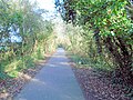 Cuckoo Trail - Polegate - geograph.org.uk - 6024185.jpg 1 600 × 1 200; 1 004 KB
-
 Cuckoo Trail - Polegate - geograph.org.uk - 6024193.jpg 1 600 × 1 200; 857 KB
-
 Cuckoo Trail at Junction with Sayerlands Lane - geograph.org.uk - 5799880.jpg 4 896 × 3 672; 5,47 MB
-
 Cuckoo Trail bridge over A27 - geograph.org.uk - 2584086.jpg 640 × 480; 94 KB
-
 Cuckoo Trail near Polegate - geograph.org.uk - 5799856.jpg 4 896 × 3 672; 5,34 MB
-
 Cuckoo Trail near Willingdon - geograph.org.uk - 6024212.jpg 1 600 × 1 200; 635 KB
-
 Cycle path alongside the bypass - geograph.org.uk - 3230933.jpg 1 024 × 768; 224 KB
-
 Cycle route sign - geograph.org.uk - 3230943.jpg 1 024 × 768; 558 KB
-
 Cycle route sign - geograph.org.uk - 5315166.jpg 4 000 × 3 000; 4,34 MB
-
 Cycle route sign, School Lane - geograph.org.uk - 3230904.jpg 1 024 × 768; 179 KB
-
 Cyclists on route 21 - geograph.org.uk - 3230924.jpg 1 024 × 768; 654 KB
-
 Daffodils in Wannock Lane, Polegate - geograph.org.uk - 3451305.jpg 1 600 × 1 203; 375 KB
-
 Devotedly Discus - geograph.org.uk - 2585105.jpg 640 × 480; 97 KB
-
 Ditton's Corner - geograph.org.uk - 1767273.jpg 1 024 × 768; 203 KB
-
 Ditton's Corner, Polegate - geograph.org.uk - 178965.jpg 640 × 479; 143 KB
-
 Ditton's Road - geograph.org.uk - 1767277.jpg 1 024 × 768; 237 KB
-
 Dittons, Dittons Road - geograph.org.uk - 5511082.jpg 4 000 × 3 000; 3,74 MB
-
 Dover Road, Polegate - geograph.org.uk - 2268280.jpg 640 × 480; 59 KB
-
 Dover Road, Polegate - geograph.org.uk - 2268291.jpg 640 × 480; 59 KB
-
 Dual carriageway - geograph.org.uk - 4764199.jpg 640 × 426; 68 KB
-
 Eastbourne Road at the A27 junction - geograph.org.uk - 4898644.jpg 2 048 × 1 536; 1,52 MB
-
 Electricity Pylon, Levett Road - geograph.org.uk - 5802131.jpg 4 896 × 3 672; 6,76 MB
-
 Electricity sub station - geograph.org.uk - 4369127.jpg 640 × 566; 132 KB
-
 Electricity sub station, Central Avenue - geograph.org.uk - 4369125.jpg 480 × 640; 110 KB
-
 Entering Polegate, Eastbourne Rd - geograph.org.uk - 2381695.jpg 640 × 430; 83 KB
-
 Entrance to farm depot off the A27 - geograph.org.uk - 3366475.jpg 3 264 × 2 448; 4,99 MB
-

-
 Farm buildings by Sayerland Lane - geograph.org.uk - 5315173.jpg 4 000 × 3 000; 5,03 MB
-
 Farm track across field off Sayerland Lane - geograph.org.uk - 3613400.jpg 3 264 × 2 448; 3,66 MB
-
 Field off Ditton Road - geograph.org.uk - 2439771.jpg 2 256 × 1 496; 880 KB
-
 Field with Sheep, off Otham Court Lane - geograph.org.uk - 2783266.jpg 2 256 × 1 496; 876 KB
-
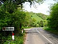 Filching - geograph.org.uk - 168758.jpg 640 × 479; 197 KB
-
 Footbridge over the bypass - geograph.org.uk - 3230928.jpg 1 024 × 768; 154 KB
-
 Game over, Polegate FC - geograph.org.uk - 2834572.jpg 1 600 × 1 036; 570 KB
-
 Gardens at High Street Polegate - geograph.org.uk - 1405181.jpg 640 × 616; 73 KB
-
 Gate at Saylands House - geograph.org.uk - 5315169.jpg 2 931 × 3 907; 5,08 MB
-
 Gilda Crescent, Polegate - geograph.org.uk - 893071.jpg 640 × 414; 74 KB
-
 Greenleaf Gardens - geograph.org.uk - 3203743.jpg 640 × 480; 59 KB
-
 Hailsham Road - geograph.org.uk - 2597344.jpg 640 × 480; 100 KB
-
 Hailsham Road, Polegate - geograph.org.uk - 893270.jpg 640 × 385; 66 KB
-
 Hastings Close, Polegate - geograph.org.uk - 5789098.jpg 640 × 480; 80 KB
-
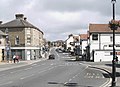
 High St - geograph.org.uk - 4733700.jpg 640 × 426; 48 KB
-
 High St, Polegate - geograph.org.uk - 4742135.jpg 640 × 426; 57 KB
-
 High Street Polegate - geograph.org.uk - 3137871.jpg 3 264 × 2 448; 3,87 MB
-
 High Street Polegate level crossing - geograph.org.uk - 6264253.jpg 640 × 480; 58 KB
-

-
 High Street, Polegate - geograph.org.uk - 2843697.jpg 4 320 × 3 240; 3,79 MB
-
 High Street, Polegate - geograph.org.uk - 864059.jpg 640 × 464; 73 KB
-

-
 House on Lavender Grove - geograph.org.uk - 4433997.jpg 1 620 × 1 080; 586 KB
-
 Houses off Bluebell Way - geograph.org.uk - 4434002.jpg 1 440 × 1 080; 571 KB
-
 Houses off Bluebell Way - geograph.org.uk - 4434007.jpg 720 × 1 080; 346 KB
-
 Houses under construction, West Close - geograph.org.uk - 5315155.jpg 4 000 × 3 000; 4,93 MB
-
 Kensington Way - geograph.org.uk - 5315149.jpg 4 000 × 3 000; 3,87 MB
-
 Kontour Cycles - geograph.org.uk - 3230896.jpg 1 024 × 768; 195 KB
-
 Level Crossing at Polegate - geograph.org.uk - 4043946.jpg 1 920 × 1 029; 451 KB
-
 Level Crossing, High St, Polegate - geograph.org.uk - 2118700.jpg 640 × 430; 128 KB
-
 Level crossing, Polegate - geograph.org.uk - 2418177.jpg 640 × 430; 63 KB
-
 Level Crossing, Polegate - geograph.org.uk - 2818218.jpg 1 600 × 1 200; 299 KB
-
 Level Crossing, Polegate - geograph.org.uk - 893284.jpg 640 × 449; 80 KB
-
 Levett Road - geograph.org.uk - 1372726.jpg 640 × 427; 96 KB
-
 Lidl Store, Polegate - geograph.org.uk - 5682233.jpg 4 896 × 3 672; 5,48 MB
-
 Lidl, Polegate - geograph.org.uk - 5740392.jpg 3 635 × 2 423; 1,42 MB
-
 Lidl, Polegate - geograph.org.uk - 5740394.jpg 4 000 × 3 000; 1,5 MB
-
 Little Egret on ash tree, Polegate - geograph.org.uk - 2820319.jpg 1 600 × 1 201; 349 KB
-
 Little Friars Farm - geograph.org.uk - 2584027.jpg 640 × 480; 121 KB
-

-

-

-

-
 Middle Hip Holes - geograph.org.uk - 1767230.jpg 1 024 × 768; 221 KB
-
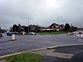
 New Cophall roundabout at Polegate - geograph.org.uk - 355862.jpg 640 × 480; 98 KB
-

-
 New houses at West Close - geograph.org.uk - 5802148.jpg 4 000 × 2 667; 2,19 MB
-
 New houses on Bluebells development - geograph.org.uk - 4431473.jpg 1 620 × 1 080; 568 KB
-
 New houses on Sunflower Lane - geograph.org.uk - 4431412.jpg 1 620 × 1 080; 865 KB
-
 New houses on Sunflower Lane - geograph.org.uk - 4431413.jpg 1 620 × 1 080; 996 KB
-
 New houses on Sunflower Lane - geograph.org.uk - 4431415.jpg 1 620 × 1 080; 830 KB
-
 Old railway bridge, Polegate - geograph.org.uk - 2584270.jpg 640 × 480; 162 KB
-
 On to the A27 - geograph.org.uk - 4764347.jpg 640 × 371; 47 KB
-
 Otteham Court Lane, Polegate - geograph.org.uk - 1557678.jpg 640 × 480; 98 KB
-
 Parker Building Supplies - geograph.org.uk - 5802108.jpg 4 896 × 3 672; 6,13 MB
-
 Parkers Building Supplies offices - geograph.org.uk - 5511088.jpg 4 000 × 3 000; 3,88 MB
-
 Penalty hits the bar, Polegate - geograph.org.uk - 3225552.jpg 1 600 × 1 188; 537 KB
-
 PJ Skips entrance on the A22 between Polegate and Hailsham - geograph.org.uk - 4898646.jpg 2 048 × 1 536; 1,12 MB
-
 PJ Skips waste transfer station by the A22 at Polegate - geograph.org.uk - 5558080.jpg 2 816 × 2 112; 2,02 MB
-
 Polegate - Stagecoach 19053 (MX56FSC) (Flickr 14895632185).jpg 2 632 × 1 891; 2,73 MB
-
 Polegate By-Pass - geograph.org.uk - 1767237.jpg 1 024 × 768; 153 KB
-
 Polegate Bypass - A22, viewed from Cuckoo Trail - geograph.org.uk - 5799866.jpg 4 896 × 3 672; 5,66 MB
-
 Polegate Bypass - geograph.org.uk - 2059500.jpg 1 024 × 768; 121 KB
-
 Polegate Bypass - geograph.org.uk - 5315161.jpg 4 000 × 3 000; 2,13 MB
-
 Polegate Bypass and Shepham Windfarm - geograph.org.uk - 5315128.jpg 4 000 × 3 000; 2,44 MB
-
 Polegate Car Boot Sale - geograph.org.uk - 3606498.jpg 3 264 × 2 448; 2,22 MB
-
 Polegate Crossing signal box - geograph.org.uk - 2237388.jpg 1 200 × 1 600; 313 KB
-
 Polegate Crossing signal box - geograph.org.uk - 3230877.jpg 1 024 × 768; 246 KB
-

-

-
 Polegate Fisheries (15667677602).jpg 3 154 × 2 306; 4,02 MB
-
 Polegate High Street - geograph.org.uk - 5333680.jpg 1 600 × 1 272; 467 KB
-
 Polegate level crossing - geograph.org.uk - 2268209.jpg 640 × 480; 99 KB
-
 Polegate level crossing - geograph.org.uk - 2843669.jpg 4 320 × 3 240; 3,61 MB
-
 Polegate Level Crossing - geograph.org.uk - 3008037.jpg 3 648 × 2 469; 1,43 MB
-
 Polegate Library - geograph.org.uk - 1110009.jpg 640 × 480; 85 KB
-
 Polegate Library Entrance - geograph.org.uk - 1110035.jpg 640 × 480; 75 KB
-

-
 Polegate pylon - geograph.org.uk - 3634965.jpg 651 × 1 024; 101 KB
-

-
 Polegate signal box - geograph.org.uk - 2268224.jpg 640 × 480; 63 KB
-
 Polegate sorting office - geograph.org.uk - 4609666.jpg 800 × 451; 188 KB
-
 Polegate town council offices - geograph.org.uk - 2843692.jpg 4 320 × 3 240; 3,81 MB
-
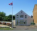
 Polegate Town Hall - geograph.org.uk - 2237389.jpg 1 600 × 1 200; 288 KB
-
-
 Polegate Town v Three Bridges A (11404538654).jpg 2 363 × 1 726; 2,84 MB
-
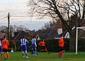 Polegate Town v Three Bridges A (11437140104).jpg 2 856 × 2 078; 4,28 MB
-
 Polegate Village Sign - geograph.org.uk - 4773003.jpg 640 × 426; 75 KB
-

-

-
 Polgate Station view of Combe Hill on Horizon - geograph.org.uk - 4919888.jpg 3 264 × 1 840; 1,77 MB
-
 Poppy Close - geograph.org.uk - 4431474.jpg 1 620 × 1 080; 946 KB
-
 Post box on Polegate High Street - geograph.org.uk - 2268241.jpg 640 × 480; 75 KB
-
 Postbox on Coldthorn Lane, Summer Hill near Hailsham - geograph.org.uk - 2113230.jpg 1 600 × 1 200; 629 KB
-
 Primrose Cottage, Dittons Road - geograph.org.uk - 5511073.jpg 4 000 × 3 000; 3,77 MB
-
 Queen Victoria (14580114587).jpg 2 654 × 1 774; 3,81 MB
-
 Rebar sculpture - geograph.org.uk - 3230937.jpg 768 × 1 024; 622 KB
-
 Road north of Polegate, East Sussex - geograph.org.uk - 1928699.jpg 1 600 × 1 200; 696 KB
-
 Roundabout at the A22-A27 junction - geograph.org.uk - 4894505.jpg 2 304 × 1 728; 823 KB
-
 Roundabout at the A22-A27, Polegate - geograph.org.uk - 4896964.jpg 2 048 × 1 536; 888 KB
-
 Roundabout on A22, Polegate - geograph.org.uk - 2040480.jpg 1 600 × 1 061; 296 KB
-
 Roundabout on Eastbourne Bypass - geograph.org.uk - 2423799.jpg 1 600 × 1 200; 248 KB
-
 Roundabout on the Polegate Bypass entrance - geograph.org.uk - 4894513.jpg 2 207 × 1 655; 898 KB
-
 Roundabout where the A22 connects with the A27 - geograph.org.uk - 3366519.jpg 3 264 × 2 448; 3,22 MB
-
 Route of the old line - geograph.org.uk - 4742277.jpg 640 × 426; 51 KB
-
 Route of the old railway - geograph.org.uk - 2418167.jpg 640 × 430; 56 KB
-
 Row of shops, Station Road, Polegate - geograph.org.uk - 4609662.jpg 800 × 451; 185 KB
-
 Sayerland House (geograph 6677478).jpg 1 024 × 684; 147 KB
-
 Sayerland Lane - geograph.org.uk - 1161849.jpg 640 × 427; 104 KB
-
 Scrubland, Station Road, Polegate - geograph.org.uk - 2834559.jpg 1 600 × 1 194; 446 KB
-
 Sculpture on Cuckoo Trail - geograph.org.uk - 5799873.jpg 4 896 × 3 672; 5,15 MB
-
 Shepham Lane - geograph.org.uk - 1767265.jpg 1 024 × 768; 224 KB
-
 Shepham Lane - geograph.org.uk - 5802099.jpg 4 896 × 3 672; 5,74 MB


_(Flickr_14895632185).jpg)


.jpg)


.jpg)
.jpg)


.jpg)


.jpg)


