Category:Political maps of Erie County, Ohio as of the 2000 United States Census
Jump to navigation
Jump to search
Media in category "Political maps of Erie County, Ohio as of the 2000 United States Census"
The following 21 files are in this category, out of 21 total.
-
 Map of Erie County Ohio Highlighting Bay View Village.png 655 × 597; 27 KB
-
 Map of Erie County Ohio Highlighting Bellevue City.png 655 × 597; 27 KB
-
 Map of Erie County Ohio Highlighting Berlin Heights Village.png 655 × 597; 27 KB
-
 Map of Erie County Ohio Highlighting Berlin Township.png 655 × 597; 27 KB
-
 Map of Erie County Ohio Highlighting Castalia Village.png 655 × 597; 27 KB
-
 Map of Erie County Ohio Highlighting Florence Township.png 655 × 597; 27 KB
-
 Map of Erie County Ohio Highlighting Groton Township.png 655 × 597; 27 KB
-
 Map of Erie County Ohio Highlighting Huron City.png 655 × 597; 27 KB
-
 Map of Erie County Ohio Highlighting Huron Township.png 655 × 597; 27 KB
-
 Map of Erie County Ohio Highlighting Kelleys Island Village.png 655 × 597; 27 KB
-
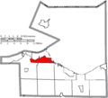
 Map of Erie County Ohio Highlighting Margaretta Township.png 655 × 597; 28 KB
-
 Map of Erie County Ohio Highlighting Milan Township.png 655 × 597; 27 KB
-
 Map of Erie County Ohio Highlighting Milan Village.png 655 × 597; 27 KB
-
 Map of Erie County Ohio Highlighting Oxford Township.png 655 × 597; 27 KB
-
 Map of Erie County Ohio Highlighting Perkins Township.png 655 × 597; 27 KB
-
 Map of Erie County Ohio Highlighting Sandusky City.png 655 × 597; 28 KB
-
 Map of Erie County Ohio Highlighting Vermilion City.png 655 × 597; 27 KB
-
 Map of Erie County Ohio Highlighting Vermilion Township.png 655 × 597; 27 KB
-
 Map of Erie County Ohio With Municipal and Township Labels.PNG 655 × 597; 44 KB
-
 Map of Erie County, Ohio No Text, Municipalities Distinct.png 655 × 597; 27 KB
-
 Map of Erie County, Ohio No Text.png 655 × 597; 27 KB


