Category:Postling
Vai alla navigazione
Vai alla ricerca
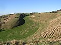
English: Postling village and civil parish is situated near the Roman road of Stone Street, about south of Canterbury, Kent, in South East England. There is much archaeological evidence of continued occupation of the area. Postling Place is the old manor house.
parrocchia del Kent .jpg) | |||||
| Carica un file multimediale | |||||
| Istanza di | |||||
|---|---|---|---|---|---|
| Luogo | Folkestone and Hythe, Kent, Sud Est dell'Inghilterra, Inghilterra | ||||
| Considerato essere uguale a | Postling (pagina Wikimedia duplicata, parrocchia civile dell'Inghilterra) | ||||
 | |||||
Sottocategorie
Questa categoria contiene le 3 sottocategorie indicate di seguito, su un totale di 3.
O
- Oasts in Postling (1 F)
P
File nella categoria "Postling"
Questa categoria contiene 105 file, indicati di seguito, su un totale di 105.
-

-
 Ashford Road - geograph.org.uk - 1978072.jpg 1 024 × 768; 207 KB
-
 B2068 approaches M20 junction 11 - geograph.org.uk - 3918003.jpg 3 200 × 2 329; 808 KB
-
 Barn in Douglas Farm - geograph.org.uk - 2161619.jpg 3 072 × 2 304; 1,64 MB
-
 Barns at Douglas Farm, Cuckoo Lane - geograph.org.uk - 4019910.jpg 1 044 × 783; 212 KB
-
 Bartholomew's Wood - geograph.org.uk - 4224107.jpg 640 × 480; 291 KB
-
 Bench and kissing gate on North Downs near Postling - geograph.org.uk - 3168882.jpg 4 288 × 3 216; 3,79 MB
-
 Bridleway to Tolsford Hill - geograph.org.uk - 2161714.jpg 3 072 × 2 304; 1,41 MB
-
 Building work at Staple Farm - geograph.org.uk - 3611242.jpg 816 × 612; 191 KB
-
 Byway near Stone Street - geograph.org.uk - 2079578.jpg 3 072 × 2 304; 2,03 MB
-
 Byway to Bartholomew's Wood - geograph.org.uk - 2161575.jpg 3 072 × 2 304; 1,87 MB
-
 Byway to Postling Wents - geograph.org.uk - 2079567.jpg 3 072 × 2 304; 2,12 MB
-
 Byway to Stone Street - geograph.org.uk - 2079571.jpg 3 072 × 2 304; 3,69 MB
-
 Cattle on North Downs Way - geograph.org.uk - 3168755.jpg 4 288 × 3 216; 3,43 MB
-
 Chalk downland above Postling - geograph.org.uk - 2115834.jpg 1 280 × 960; 655 KB
-
 Crop Field towards Lyminge - geograph.org.uk - 3550451.jpg 3 696 × 2 448; 2,49 MB
-
 Cuckoo Lane - geograph.org.uk - 2161611.jpg 3 072 × 2 304; 1,68 MB
-
 Cuckoo Lane - geograph.org.uk - 4224093.jpg 640 × 480; 173 KB
-
 Douglas Farm - geograph.org.uk - 2161623.jpg 3 072 × 2 304; 2,16 MB
-
 Downland, North Downs - geograph.org.uk - 4224074.jpg 640 × 480; 140 KB
-
 Dry valley followed by the North Downs way - geograph.org.uk - 2115788.jpg 1 280 × 960; 649 KB
-

-
 Farm track to Bartholomew's Wood - geograph.org.uk - 2161561.jpg 3 072 × 2 304; 2,21 MB
-
 Farmland by the railway line - geograph.org.uk - 2706194.jpg 640 × 430; 38 KB
-
 Farthing Common, evening view towards Straits of Dover - geograph.org.uk - 2987337.jpg 1 600 × 1 067; 198 KB
-
 Fields near Court Lodge Farm, Newbarn - geograph.org.uk - 3168955.jpg 4 288 × 3 216; 3,53 MB
-
 Footpath junction near Shrine Farm - geograph.org.uk - 2161551.jpg 3 072 × 2 304; 2,06 MB
-
 Footpath to Farthing Common - geograph.org.uk - 3168717.jpg 4 288 × 3 216; 3,66 MB
-
 Footpath to Farthing Common - geograph.org.uk - 3168721.jpg 4 288 × 3 216; 3,75 MB
-
 Footpath to Postling Wood Road - geograph.org.uk - 3168960.jpg 4 288 × 3 216; 3,48 MB
-
 Footpath to Standford - geograph.org.uk - 2079562.jpg 3 072 × 2 304; 1,96 MB
-
 Golden Wheat Field - geograph.org.uk - 1955915.jpg 1 024 × 768; 301 KB
-
 House at Douglas Farm, Cuckoo Lane - geograph.org.uk - 4019926.jpg 910 × 782; 199 KB
-
 Information Board about Tolsford Hill Open Access Land - geograph.org.uk - 2161744.jpg 1 728 × 3 072; 1,46 MB
-
 Kissing Gate and fence on North Downs Way - geograph.org.uk - 3168730.jpg 4 288 × 3 216; 3,79 MB
-
 Looking towards Postling - geograph.org.uk - 2115863.jpg 1 280 × 960; 622 KB
-
 M20 Motorway to Junction 11 - geograph.org.uk - 2161530.jpg 3 072 × 2 304; 1,5 MB
-
 Muddy kissing gate on the North Downs Way - geograph.org.uk - 3168737.jpg 4 288 × 3 216; 3,74 MB
-
 North Downs near Posting (2) - geograph.org.uk - 3168804.jpg 4 288 × 3 216; 3,85 MB
-
 North Downs near Postling - geograph.org.uk - 3168785.jpg 4 288 × 3 216; 3,24 MB
-
 North Downs near Postling - geograph.org.uk - 3168791.jpg 4 288 × 3 216; 3,66 MB
-
 North Downs near Postling - geograph.org.uk - 3168827.jpg 4 288 × 3 216; 3,28 MB
-
 North Downs Valley - geograph.org.uk - 3168750.jpg 4 288 × 3 216; 3,69 MB
-
 North Downs Way junction at Staple Farm - geograph.org.uk - 3168940.jpg 4 288 × 3 216; 3,76 MB
-
 North Downs Way near Farthing Common - geograph.org.uk - 2115749.jpg 1 280 × 960; 641 KB
-
 North Downs Way on Postling Downs - geograph.org.uk - 3168799.jpg 4 288 × 3 216; 3,32 MB
-
 North Downs Way S of Farthing Common - geograph.org.uk - 2781372.jpg 640 × 480; 376 KB
-
 North Downs Way SE of Farthing Common - geograph.org.uk - 2781371.jpg 640 × 480; 413 KB
-
 North Downs Way to Farthing Common - geograph.org.uk - 3168723.jpg 4 288 × 3 216; 3,6 MB
-
 North Downs Way to Staple Farm - geograph.org.uk - 3168894.jpg 4 288 × 3 216; 3,72 MB
-
 North Downs Way to Staple Farm - geograph.org.uk - 3168930.jpg 4 288 × 3 216; 3,74 MB
-
 North Downs Way towards Postling Downs - geograph.org.uk - 3168917.jpg 4 288 × 3 216; 3,7 MB
-
 Old chalk working - geograph.org.uk - 2115777.jpg 1 280 × 960; 640 KB
-
 Page Farm, Postling (geograph 4224085).jpg 640 × 428; 117 KB
-
 Panorama of North Downs near Postling - geograph.org.uk - 3168772.jpg 4 608 × 1 296; 2,87 MB
-
 Panorama of Postling (geograph 3168806).jpg 4 656 × 1 296; 2,47 MB
-
 Panorama of Tolsford Hill - geograph.org.uk - 3168909.jpg 4 624 × 1 312; 3,17 MB
-
 Panorama view from Postling Downs - geograph.org.uk - 3168892.jpg 4 640 × 1 312; 2,68 MB
-
 Path to Staple Farm - geograph.org.uk - 3168950.jpg 4 288 × 3 216; 3,61 MB
-
 Paths on the chalk downland above Postling - geograph.org.uk - 2115846.jpg 1 280 × 960; 618 KB
-
 Pent Farm, Postling (geograph 3467328).jpg 1 600 × 1 066; 346 KB
-
 Postling - Old fingerpost - geograph.org.uk - 4290675.jpg 1 024 × 768; 278 KB
-
 Postling from the Downs - geograph.org.uk - 1414721.jpg 640 × 460; 222 KB
-
 Postling from the south - geograph.org.uk - 3340264.jpg 1 600 × 1 067; 428 KB
-
 Postling Wood - geograph.org.uk - 3169051.jpg 4 288 × 3 216; 3,6 MB
-
 Postling Wood Road - geograph.org.uk - 3169043.jpg 4 288 × 3 216; 3,5 MB
-
 Power line near Etchinghill - geograph.org.uk - 4776002.jpg 640 × 480; 116 KB
-
 Pumping station - geograph.org.uk - 6134338.jpg 2 448 × 3 264; 2,65 MB
-
 Ridged side of North Downs near Postling - geograph.org.uk - 3168839.jpg 4 288 × 3 216; 3,93 MB
-
 Road to Lyminge - geograph.org.uk - 4775990.jpg 640 × 480; 96 KB
-
 Road towards Lyminge and Etchinghill - geograph.org.uk - 5939473.jpg 1 024 × 684; 245 KB
-
 Sandling Road at the junction of Ashford Road - geograph.org.uk - 4908285.jpg 2 304 × 1 728; 861 KB
-
 Shrine Barn - geograph.org.uk - 2161541.jpg 3 072 × 2 304; 2,21 MB
-
 Shrine Farm Barns - geograph.org.uk - 2161544.jpg 3 072 × 2 304; 1,52 MB
-
 Something underneath^ - geograph.org.uk - 4223587.jpg 640 × 480; 144 KB
-
 St Mary ^ St Radigund church - geograph.org.uk - 5507071.jpg 1 066 × 800; 215 KB
-
 Staple Farm - geograph.org.uk - 6134346.jpg 3 264 × 2 448; 3,56 MB
-
 Stile and gate near Postling - geograph.org.uk - 2161600.jpg 3 072 × 2 304; 1,96 MB
-
 Stile near Perry Wood - geograph.org.uk - 2161555.jpg 3 072 × 2 304; 2,27 MB
-
 Stile on Tolsford Hill bridleway - geograph.org.uk - 2161734.jpg 3 072 × 2 304; 1,85 MB
-
 The A20, Westenhanger - geograph.org.uk - 4908283.jpg 2 304 × 1 728; 840 KB
-
 The A20-M20 roundabout, Westenhanger - geograph.org.uk - 4908278.jpg 2 194 × 1 570; 914 KB
-
 The North Downs Way entering a dry valley - geograph.org.uk - 2115768.jpg 1 280 × 960; 589 KB
-
 The North Downs Way near Pent Farm - geograph.org.uk - 4923383.jpg 4 608 × 3 456; 5,39 MB
-
 The North Downs Way near Postling - geograph.org.uk - 4923388.jpg 4 608 × 3 456; 5,42 MB
-
 The North Downs Way near Staple Farm - geograph.org.uk - 4923400.jpg 4 608 × 3 456; 5,44 MB
-
 Tree on the North Downs - geograph.org.uk - 3168782.jpg 4 288 × 3 216; 3,47 MB
-
 View from The North Downs Way near Postling - geograph.org.uk - 2115808.jpg 1 280 × 960; 652 KB
-
 View from Tolsford Hill bridleway - geograph.org.uk - 2161725.jpg 3 072 × 1 728; 1,07 MB
-
 View of Pent Farm - geograph.org.uk - 2161582.jpg 3 072 × 2 304; 1,73 MB
-
 View of Postling - geograph.org.uk - 3168913.jpg 4 288 × 3 216; 3,39 MB
-
 View of Postling, from the Downs - geograph.org.uk - 3168810.jpg 4 288 × 3 216; 3,98 MB
-

-
 Byway at Postling Wents - geograph.org.uk - 454031.jpg 480 × 640; 99 KB
-
 Entrance to Training area - geograph.org.uk - 429124.jpg 640 × 480; 191 KB
-
 Farthing Common - geograph.org.uk - 161070.jpg 640 × 480; 53 KB
-
 Hills behind Beachborough House - geograph.org.uk - 429086.jpg 640 × 480; 188 KB
-
 Little Hollow Farm from Brady Road - geograph.org.uk - 643513.jpg 640 × 480; 193 KB
-

-
 Pilgrim's Way crossing the B2068 - geograph.org.uk - 137038.jpg 640 × 480; 148 KB
-
 Postling Downs - geograph.org.uk - 392107.jpg 640 × 480; 86 KB
-

-
 View from Brady Road - geograph.org.uk - 415355.jpg 640 × 480; 52 KB
-
 View towards Postling - geograph.org.uk - 411085.jpg 640 × 480; 53 KB
-
 Wents Cottage - geograph.org.uk - 454054.jpg 640 × 480; 123 KB


_-_geograph.org.uk_-_3168804.jpg)


.jpg)


.jpg)


.jpg)