Category:Prestatyn
跳转到导航
跳转到搜索
Cymraeg: Delweddau Prestatyn, Sir Ddinbych, Cymru
English: Images of Prestatyn, Denbighshire, Wales
town in Denbighshire, Wales, UK _1km_East_of_Prestatyn,_Wales_-_Bryniau_Clwyd_a_Dyffryn_Dyfrdwy_AONB_03_(cropped).jpg) | |||||
| 上传媒体 | |||||
| 隶属于 | |||||
|---|---|---|---|---|---|
| 位置 | 登比郡, 威爾斯 | ||||
| 官方网站 | |||||
 | |||||
分类“Prestatyn”中的媒体文件
以下200个文件属于本分类,共666个文件。
(上一页)(下一页)-
 "The Beach Hut" - geograph.org.uk - 5924060.jpg 6,032 × 4,014;4.8 MB
-
 1st Class Clothes shop in Prestatyn - geograph.org.uk - 5413058.jpg 800 × 772;122 KB
-
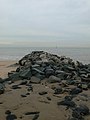
 A breakwater on Prestatyn Beach - geograph.org.uk - 2111553.jpg 1,500 × 996;107 KB
-

-

-
 A548 distances from Prestatyn - geograph.org.uk - 5280132.jpg 800 × 637;104 KB
-
 A548 Prestatyn Road towards Gronant - geograph.org.uk - 6212917.jpg 800 × 600;141 KB
-
 A548 Prestatyn Road, Prestatyn - geograph.org.uk - 5280138.jpg 800 × 666;97 KB
-
 Abandoned house becomes walkers' rest stop - geograph.org.uk - 6155529.jpg 1,024 × 683;292 KB
-
 Aber Road, Prestatyn - geograph.org.uk - 5278594.jpg 800 × 515;77 KB
-
 Above Prestatyn - geograph.org.uk - 1336082.jpg 640 × 480;97 KB
-

-
 Accent Software Ltd Prestatyn - geograph.org.uk - 5278593.jpg 800 × 675;97 KB
-
 Acrobatics at Barkby Beach - geograph.org.uk - 4310920.jpg 1,024 × 577;175 KB
-

-
 Alexandra Drive, Meliden - geograph.org.uk - 4092007.jpg 640 × 480;50 KB
-
 Allt Prestatyn - Prestatyn Hillside - geograph.org.uk - 3939504.jpg 3,264 × 2,448;3.85 MB
-

-

-
 Autumn House and Landscape.jpg 960 × 539;95 KB
-
 Autumn Landscape and House (enhanced).jpg 960 × 539;94 KB
-
 Banastre Avenue, Prestatyn - geograph.org.uk - 2483762.jpg 640 × 480;68 KB
-

-
-

-

-

-

-

-

-
 Barkby Avenue, Prestatyn - geograph.org.uk - 5280036.jpg 800 × 540;78 KB
-
 Barkby Beach - geograph.org.uk - 1230882.jpg 640 × 480;75 KB
-
 Barkby Beach - geograph.org.uk - 3490078.jpg 5,184 × 3,456;3.03 MB
-
 Barkby Beach - geograph.org.uk - 3490103.jpg 5,184 × 3,456;3.04 MB
-
 Barkby Beach - geograph.org.uk - 3490177.jpg 5,184 × 3,456;2.66 MB
-
 Barkby Beach - geograph.org.uk - 3490419.jpg 5,184 × 3,456;3.3 MB
-
 Barkby Beach - geograph.org.uk - 4656881.jpg 4,184 × 2,789;3.27 MB
-
 Barkby Beach at very low tide - geograph.org.uk - 1078001.jpg 640 × 480;41 KB
-

-
 Barkby Beach, Prestatyn - geograph.org.uk - 3488575.jpg 5,034 × 3,282;2.88 MB
-
 Bastion Close, Prestatyn - geograph.org.uk - 5282124.jpg 800 × 570;72 KB
-

-
 Bastion Gardens, Prestatyn - geograph.org.uk - 2789993.jpg 640 × 480;45 KB
-
 Bastion Gardens, Prestatyn - geograph.org.uk - 5282076.jpg 800 × 492;64 KB
-
 Bastion Road houses, Prestatyn - geograph.org.uk - 5649412.jpg 800 × 636;134 KB
-

-
 Bastion Road, Prestatyn - geograph.org.uk - 1839336.jpg 1,280 × 856;204 KB
-
 Bastion Road, Prestatyn - geograph.org.uk - 3500281.jpg 1,024 × 682;145 KB
-

-

-
 Beach Close, Prestatyn - geograph.org.uk - 5413076.jpg 800 × 504;67 KB
-

-
 Beach Road East, Prestatyn - geograph.org.uk - 4084380.jpg 3,290 × 1,801;3.33 MB
-
 Beach Road West, Prestatyn - geograph.org.uk - 2789997.jpg 640 × 480;51 KB
-
 Beaches Hotel Prestatyn. - geograph.org.uk - 3505021.jpg 1,600 × 1,200;337 KB
-

-

-
 Bench mark in Fforddlas, Prestatyn - geograph.org.uk - 5765554.jpg 767 × 1,024;272 KB
-
 Bench mark in Fforddlas, Prestatyn - geograph.org.uk - 5769715.jpg 767 × 1,024;348 KB
-

-
 Benkid77 Prestatyn sign 290609.JPG 1,280 × 1,024;259 KB
-

-
 Boardwalk along the Wales Coast Path - geograph.org.uk - 6214681.jpg 800 × 565;171 KB
-
 Boardwalk at Gronant Dunes Nature Reserve - geograph.org.uk - 4310930.jpg 768 × 1,024;258 KB
-
 Boardwalk through the Nature Reserve - geograph.org.uk - 3490156.jpg 5,184 × 3,456;4.45 MB
-
 Boardwalk to the Viewpoint - geograph.org.uk - 4656813.jpg 3,184 × 2,123;3.15 MB
-
 Bodnant Community School.jpg 1,442 × 683;121 KB
-
 Bodnant Infants School - geograph.org.uk - 32204.jpg 576 × 432;75 KB
-

-

-
 Brook Park Avenue, Prestatyn - geograph.org.uk - 5278604.jpg 800 × 558;86 KB
-

-
 Bungalow, Beverley Drive - geograph.org.uk - 4548394.jpg 640 × 426;36 KB
-
 Bungalow, Beverley Drive - geograph.org.uk - 4548395.jpg 640 × 426;38 KB
-
 Bungalows, Garnet Drive - geograph.org.uk - 4548391.jpg 640 × 426;36 KB
-
 Bungalows, Garnet Drive - geograph.org.uk - 4548393.jpg 640 × 426;37 KB
-
 Bus stop in Presthaven Sands Caravan Park - geograph.org.uk - 3504663.jpg 4,608 × 3,456;5.72 MB
-
 Business end of the Nova Centre complex - geograph.org.uk - 3505220.jpg 1,600 × 1,200;257 KB
-
 By the railway gate, Prestatyn NLW3363788.jpg 425 × 305;34 KB
-
 Bylaws notice at Prestatyn Beach - geograph.org.uk - 2790006.jpg 640 × 480;44 KB
-

-
 Car Centre Ltd in Prestatyn - geograph.org.uk - 5278685.jpg 800 × 530;89 KB
-
 Car park - Central Beach, Prestatyn - geograph.org.uk - 1840653.jpg 3,872 × 2,592;1.2 MB
-
 Car park for the Beaches Hotel - geograph.org.uk - 5912338.jpg 6,032 × 4,014;4.94 MB
-
 Caradoc Road, Prestatyn - geograph.org.uk - 5277760.jpg 800 × 492;71 KB
-
 Carr Holm, Prestatyn - geograph.org.uk - 5649462.jpg 800 × 520;94 KB
-

-

-

-
 Central Beach Club, Prestatyn - geograph.org.uk - 5282109.jpg 800 × 575;83 KB
-
 Central Beach, Prestatyn - geograph.org.uk - 1839231.jpg 1,280 × 869;105 KB
-
 Central Beach, Prestatyn - geograph.org.uk - 1840395.jpg 3,918 × 2,660;704 KB
-

-
 Centrum Prestatyn.JPG 1,280 × 960;328 KB
-
-
 Chester to Holyhead railway line - geograph.org.uk - 656000.jpg 640 × 480;66 KB
-
 Chester to Holyhead railway line - geograph.org.uk - 656003.jpg 640 × 480;44 KB
-
 Children's Holiday Camp - geograph.org.uk - 1911263.jpg 900 × 528;81 KB
-
 Choice of access - geograph.org.uk - 3504703.jpg 3,264 × 2,448;3.76 MB
-
 Clearing sand from the promenade - geograph.org.uk - 3505373.jpg 1,600 × 1,200;346 KB
-

-
 Club House, Prerstatyn Golf Club - geograph.org.uk - 4548419.jpg 640 × 426;32 KB
-
 Clwydian Range Car Park, Prestatyn - geograph.org.uk - 4890133.jpg 2,184 × 1,456;1.28 MB
-
 Clwydian Way meets Offa's Dyke path - geograph.org.uk - 2631433.jpg 640 × 480;135 KB
-
 Coast off Prestatyn - geograph.org.uk - 30716.jpg 512 × 384;13 KB
-
 Coastal defenses at Prestatyn - geograph.org.uk - 4310904.jpg 1,024 × 768;171 KB
-
 Coastline......West of Prestatyn - geograph.org.uk - 1854040.jpg 640 × 480;280 KB
-

-
 Conwy Grove, Prestatyn - geograph.org.uk - 2483759.jpg 640 × 480;66 KB
-

-
 Corbett Sports in Prestatyn - geograph.org.uk - 5278017.jpg 800 × 661;104 KB
-

-

-

-
 Coronation Gardens, Prestatyn - geograph.org.uk - 5277952.jpg 800 × 579;115 KB
-
 Crazy Golf course in Prestatyn - geograph.org.uk - 5282131.jpg 800 × 501;88 KB
-
 Crispy Cod in Prestatyn - geograph.org.uk - 5278013.jpg 800 × 797;104 KB
-

-

-

-
 Daisy Chains Day Nursery, Prestatyn - geograph.org.uk - 5278601.jpg 800 × 608;118 KB
-

-

-

-
 Dechrau a Diwedd, Prestatyn.jpg 1,024 × 766;177 KB
-
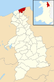 Denbighshire UK community map (Prestatyn).svg 864 × 1,305;813 KB
-

-

-

-
 Drainage channel in Prestatyn - geograph.org.uk - 5278687.jpg 688 × 800;161 KB
-
 Driveway of the Lyons Nant Hall Hotel - geograph.org.uk - 4653583.jpg 2,184 × 1,456;1.4 MB
-
 Dunes and Coastal Path at Frith Beach - geograph.org.uk - 4963099.jpg 5,100 × 3,400;4.23 MB
-
 Durable public seating - geograph.org.uk - 3505204.jpg 4,608 × 3,456;5.54 MB
-
 Dwyfor Court, Meliden - geograph.org.uk - 4092019.jpg 640 × 480;89 KB
-

-
 East side of Hafod Road, Prestatyn - geograph.org.uk - 5280164.jpg 800 × 690;112 KB
-
 Edward VII post-box in Fforddlas, Prestatyn - geograph.org.uk - 5765572.jpg 768 × 1,024;227 KB
-
 Eglwys Crist ym Mhrestatyn - Christ Church in Prestatyn - geograph.org.uk - 3939443.jpg 3,264 × 2,448;3.84 MB
-
 Elevate your sole, shop front in Prestatyn 2020.jpg 4,032 × 3,024;2.64 MB
-

-
 Elizabeth II Postbox, Bastion Road - geograph.org.uk - 3500283.jpg 682 × 1,024;173 KB
-
 Elizabeth II Postbox, Meliden Road - geograph.org.uk - 3500297.jpg 682 × 1,024;173 KB
-
 Empty car park - geograph.org.uk - 4548415.jpg 640 × 426;55 KB
-
 Essential maintenance - geograph.org.uk - 3505246.jpg 1,600 × 1,200;586 KB
-
-
 Farmhouse near Coed Bell - geograph.org.uk - 4310025.jpg 1,024 × 768;220 KB
-
 Farmland and Terfyn Covert - geograph.org.uk - 4506908.jpg 640 × 426;50 KB
-

-

-

-

-

-
 Fforddlas-Offa's Dyke LDP, Prestatyn - geograph.org.uk - 5769756.jpg 1,024 × 769;214 KB
-
 Ffordlass, Prestatyn - geograph.org.uk - 1336091.jpg 640 × 480;90 KB
-
 Ffrith Arena Park Prestatyn Lake view.jpg 1,249 × 937;353 KB
-

-
 Ffrith beach complex - geograph.org.uk - 30909.jpg 512 × 384;35 KB
-
 Ffrith Beach Festival Gardens - geograph.org.uk - 655377.jpg 640 × 480;66 KB
-
 Ffrith Beach in the early 1980`s - geograph.org.uk - 1302814.jpg 640 × 423;95 KB
-
 Ffrith beach, Prestatyn - geograph.org.uk - 2790007.jpg 640 × 480;37 KB
-
 Ffrith Beach, Prestatyn - geograph.org.uk - 3505365.jpg 1,600 × 1,200;372 KB
-
 Finger post on the Offa's Dyke path - geograph.org.uk - 6155536.jpg 1,024 × 683;213 KB
-
 First Avenue, Prestatyn - geograph.org.uk - 5282129.jpg 800 × 596;74 KB
-
 Fishing in the Gutter - geograph.org.uk - 655998.jpg 640 × 480;77 KB
-
 Fix Up Look Sharp in Prestatyn - geograph.org.uk - 5278612.jpg 800 × 706;114 KB
-
 Flat farmland - geograph.org.uk - 4507111.jpg 640 × 426;43 KB
-
 Flat grassland - geograph.org.uk - 4507137.jpg 640 × 426;39 KB
-
 Flat pasture - geograph.org.uk - 4507140.jpg 640 × 395;44 KB
-
 Flats, Prestatyn - geograph.org.uk - 4548410.jpg 640 × 426;52 KB
-

-
 Footbridge over the North Wales Coast Line - geograph.org.uk - 4651495.jpg 3,184 × 2,123;3 MB
-

-

-
 Footpath and cycleway, Prestatyn - geograph.org.uk - 5501300.jpg 800 × 693;129 KB
-
 Footpath East of The Dingle near Prestatyn - geograph.org.uk - 4310030.jpg 1,024 × 768;345 KB
-
 Footpath headed down - geograph.org.uk - 6155520.jpg 1,024 × 683;212 KB
-
 Footpath-Cycle Track through Prestatyn Golf Course - geograph.org.uk - 4891676.jpg 3,184 × 2,123;1.9 MB
-
-
 Glan Traeth, Prestatyn - geograph.org.uk - 5282102.jpg 800 × 687;91 KB
-
 Gothic Trees and Hill (enhanced).jpg 960 × 720;128 KB
-
 Gothic Trees and Hilll.jpg 4,896 × 3,672;7.59 MB
-
 Grazing field and The Dingle - geograph.org.uk - 3399309.jpg 2,592 × 1,944;2.53 MB
-
 Greenacres Caravan Park - geograph.org.uk - 6028465.jpg 2,304 × 1,728;1.5 MB
-
 Gronant Dunes at Barkby Beach - geograph.org.uk - 3490116.jpg 5,184 × 3,456;4.25 MB
-
 Gronant Dunes Nature Reserve - geograph.org.uk - 3504766.jpg 1,600 × 1,200;413 KB
-
 Gronant Dunes Nature Reserve - geograph.org.uk - 4656843.jpg 7,984 × 5,322;6.3 MB
-
 Gronant Road at Terfyn Hall - geograph.org.uk - 3394214.jpg 640 × 480;41 KB
-
 Gronant sand dunes - geograph.org.uk - 151646.jpg 640 × 480;66 KB
-
 Groom Room in Prestatyn - geograph.org.uk - 5277738.jpg 667 × 800;142 KB
-
 Grosvenor Road, Prestatyn - geograph.org.uk - 2789990.jpg 640 × 480;58 KB
-
 Groyne on Barkby Beach - geograph.org.uk - 3490069.jpg 5,184 × 3,456;3.26 MB
-
 Groyne on Ffrith Beach - geograph.org.uk - 3505397.jpg 1,600 × 1,200;359 KB
-
 Groyne on Ffrith Beach - geograph.org.uk - 6223681.jpg 684 × 800;91 KB
-
 Groyne, Ffrith beach, Prestatyn - geograph.org.uk - 655387.jpg 640 × 480;52 KB
-
 Groyne, Ffrith beach, Prestatyn - geograph.org.uk - 655388.jpg 480 × 640;48 KB
-
 Hafod Road, Prestatyn - geograph.org.uk - 5280160.jpg 800 × 706;101 KB
-
 Hair Sanctuary in Prestatyn - geograph.org.uk - 5582233.jpg 654 × 800;81 KB
-

-
 High tide - geograph.org.uk - 5915816.jpg 6,032 × 4,014;3.65 MB
-
 High Tide at Prestatyn - geograph.org.uk - 5907522.jpg 6,032 × 4,014;3.86 MB


.jpg)


_-_geograph.org.uk_-_1334711.jpg)


.svg)


.jpg)

.jpg)


