Category:Preston-next-Wingham
Aller à la navigation
Aller à la recherche
English: Preston or Preston-next-Wingham is a village and civil parish in the valley of the Little Stour in the Dover District of Kent, England. The village is on the B2076 secondary road. The Preston parish includes the hamlet of Elmstone.
Polski: Preston - niewielka wieś i gmina we wschodnim Kencie. Znajduje się w dystrykcie Dover, w 2001 miała 713 mieszkańców.

localité britannique du comté anglais du Kent  | |||||
| Téléverser des médias | |||||
| Nature de l’élément | |||||
|---|---|---|---|---|---|
| Lieu | Dover, Kent, Angleterre du Sud-Est, Angleterre | ||||
| Population |
| ||||
 | |||||
Sous-catégories
Cette catégorie comprend 4 sous-catégories, dont les 4 ci-dessous.
C
E
O
P
Média dans la catégorie « Preston-next-Wingham »
Cette catégorie comprend 330 fichiers, dont les 200 ci-dessous.
(page précédente) (page suivante)-
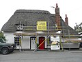 1 ^ 2, Thatch Cottages, The Street - geograph.org.uk - 5825399.jpg 3 264 × 2 448 ; 1,69 Mio
-
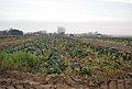
 A cauliflower field, Preston Court Farm - geograph.org.uk - 3854673.jpg 640 × 445 ; 87 kio
-
 A converted chapel - geograph.org.uk - 3378429.jpg 640 × 430 ; 67 kio
-
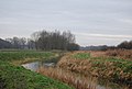
 A Eutrophic ditch - geograph.org.uk - 3384158.jpg 640 × 430 ; 109 kio
-
 A field of Brassicas - geograph.org.uk - 3441402.jpg 640 × 430 ; 73 kio
-
 A small pump house - geograph.org.uk - 3390315.jpg 640 × 430 ; 122 kio
-
 A temporary pond in the Deerson Valley - geograph.org.uk - 3390271.jpg 640 × 430 ; 43 kio
-
 A young crop - geograph.org.uk - 3376313.jpg 640 × 430 ; 60 kio
-
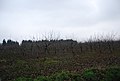
 Apple orchard - geograph.org.uk - 3376298.jpg 640 × 430 ; 87 kio
-
 Apple orchard - geograph.org.uk - 3376315.jpg 640 × 430 ; 68 kio
-
 Barn and farm shop at Parsonage Farm - geograph.org.uk - 859916.jpg 640 × 480 ; 211 kio
-
 Barn at Walmestone Court Farm - geograph.org.uk - 1971554.jpg 1 024 × 768 ; 208 kio
-
 Barn, Perry Farm - geograph.org.uk - 3441212.jpg 640 × 430 ; 71 kio
-
 Barn, Perry Farm - geograph.org.uk - 3441214.jpg 640 × 430 ; 59 kio
-
 Barn, The Forstal - geograph.org.uk - 3384033.jpg 640 × 430 ; 45 kio
-
 Barn, The Gables - geograph.org.uk - 3376317.jpg 640 × 430 ; 61 kio
-
 Barn, The Gables - geograph.org.uk - 3376319.jpg 640 × 430 ; 58 kio
-
 Barn, Walmestone Court Farm, Walmestone Road - geograph.org.uk - 5800074.jpg 3 264 × 2 448 ; 3,94 Mio
-
 Bend on the Little Stour River - geograph.org.uk - 1961683.jpg 3 072 × 2 304 ; 1,69 Mio
-
 Bridleway across the Deerson Valley - geograph.org.uk - 3384181.jpg 640 × 430 ; 48 kio
-
 Bridleway from Preston - geograph.org.uk - 3384039.jpg 640 × 430 ; 99 kio
-
 Bridleway through the orchards - geograph.org.uk - 3441140.jpg 640 × 430 ; 76 kio
-
 Bridleway to the Little Stour - geograph.org.uk - 3384205.jpg 640 × 430 ; 53 kio
-
 Building site, Grove Road - geograph.org.uk - 4824399.jpg 3 264 × 2 448 ; 1,84 Mio
-
 Building site, Grove Road - geograph.org.uk - 4824404.jpg 3 264 × 2 448 ; 1,68 Mio
-
 Buildings lining Sheerwater Rd - geograph.org.uk - 3529407.jpg 640 × 430 ; 74 kio
-
 Cabbages - geograph.org.uk - 3441398.jpg 640 × 430 ; 63 kio
-
 Cabbages - geograph.org.uk - 3450720.jpg 640 × 430 ; 74 kio
-
 Cabbages - geograph.org.uk - 3539662.jpg 640 × 430 ; 58 kio
-
 Cabbages, Nash Rd - geograph.org.uk - 3441339.jpg 640 × 430 ; 77 kio
-
 Cabbages, Park Rd - geograph.org.uk - 3539657.jpg 640 × 430 ; 60 kio
-
 Cattle grazing near the Little Stour - geograph.org.uk - 859752.jpg 640 × 480 ; 226 kio
-
 Chequersfield Farm - geograph.org.uk - 3529449.jpg 640 × 430 ; 52 kio
-
 Chequersfield Farm - geograph.org.uk - 3529451.jpg 640 × 430 ; 50 kio
-
 Colindale, The Street - geograph.org.uk - 6420439.jpg 3 264 × 2 448 ; 1,91 Mio
-
 Construction of houses, Grove Road - geograph.org.uk - 4967573.jpg 3 264 × 2 448 ; 3,74 Mio
-
 Construction of houses, Grove Road - geograph.org.uk - 4967576.jpg 3 264 × 2 448 ; 1,86 Mio
-
 Coppiced woodland - geograph.org.uk - 3384038.jpg 640 × 430 ; 132 kio
-
 Coppiced woodland - geograph.org.uk - 3384059.jpg 640 × 430 ; 132 kio
-
 Cottage, Mill Lane - geograph.org.uk - 3529433.jpg 640 × 430 ; 54 kio
-
 Cottage, Preston Rd - geograph.org.uk - 3376327.jpg 640 × 430 ; 101 kio
-
 Court Farmhouse - geograph.org.uk - 2237646.jpg 3 072 × 2 304 ; 1,35 Mio
-
 Court Lane with felled trees - geograph.org.uk - 715073.jpg 640 × 480 ; 139 kio
-
 Cropland by Sheerwater Rd - geograph.org.uk - 3521281.jpg 640 × 430 ; 55 kio
-
 Crops by Sheerwater Rd - geograph.org.uk - 3521283.jpg 640 × 430 ; 56 kio
-
 Deadmill Bridge to Wenderton Hoath - geograph.org.uk - 856759.jpg 480 × 640 ; 231 kio
-
 Deerson Valley - geograph.org.uk - 3390255.jpg 640 × 430 ; 44 kio
-
 Deerson Valley - geograph.org.uk - 3390308.jpg 640 × 430 ; 46 kio
-
 Deerson Wood - geograph.org.uk - 3390349.jpg 640 × 430 ; 43 kio
-
 Deerson Wood across the Deerson Valley - geograph.org.uk - 3390320.jpg 640 × 430 ; 58 kio
-
 Deerson Wood across the Deerson Valley - geograph.org.uk - 3390337.jpg 640 × 430 ; 47 kio
-
 Derelict site, Grove Road - geograph.org.uk - 5101541.jpg 3 264 × 2 448 ; 3,85 Mio
-
 Derelict site, Grove Road - geograph.org.uk - 5107365.jpg 3 264 × 2 351 ; 2,15 Mio
-
 Development land, The Street - geograph.org.uk - 6032712.jpg 2 870 × 2 448 ; 1,92 Mio
-
 Drain at Sheerwater - geograph.org.uk - 3521261.jpg 640 × 430 ; 89 kio
-
 Drainage ditch near Preston - geograph.org.uk - 3384162.jpg 640 × 430 ; 50 kio
-
 Drainage ditch near Preston - geograph.org.uk - 3384176.jpg 640 × 430 ; 44 kio
-
 Drainage ditch next to the Little Stour - geograph.org.uk - 856793.jpg 480 × 640 ; 274 kio
-
 Drainage ditch to the east of the Little Stour - geograph.org.uk - 858891.jpg 640 × 480 ; 237 kio
-
 Drainage ditch, Deerson Valley - geograph.org.uk - 3384198.jpg 640 × 430 ; 52 kio
-
 Drainage ditch, Preston Valley - geograph.org.uk - 3384207.jpg 640 × 430 ; 54 kio
-
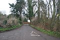
 Entering the village of Preston - geograph.org.uk - 3378382.jpg 640 × 430 ; 73 kio
-
 Family of Mute Swans - geograph.org.uk - 463400.jpg 640 × 480 ; 127 kio
-
 Farm buildings at Little Walmestone - geograph.org.uk - 1167401.jpg 640 × 480 ; 133 kio
-
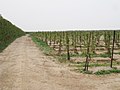
 Farm track in an orchard in East Stourmouth - geograph.org.uk - 2182968.jpg 3 072 × 2 304 ; 2,34 Mio
-
 Farmhouse, Perry Lane - geograph.org.uk - 3441216.jpg 640 × 430 ; 112 kio
-
 Farmland and woodland - geograph.org.uk - 3521137.jpg 640 × 430 ; 42 kio
-
 Farmland by Nash Rd - geograph.org.uk - 3441410.jpg 640 × 430 ; 50 kio
-
 Farmland by Stourmouth Rd - geograph.org.uk - 3376334.jpg 640 × 430 ; 57 kio
-
 Field of Cabbages - geograph.org.uk - 3450716.jpg 640 × 430 ; 78 kio
-
 Field off Heart's Delight Road - geograph.org.uk - 1971562.jpg 1 024 × 683 ; 155 kio
-
 Fields near Preston - geograph.org.uk - 3477091.jpg 3 696 × 2 448 ; 2,25 Mio
-
 Flat farmland - geograph.org.uk - 3376316.jpg 640 × 430 ; 64 kio
-
 Flower filled meadow near Deerson Farm - geograph.org.uk - 848946.jpg 640 × 480 ; 253 kio
-
 Footbridge on Stour Valley Walk (2) - geograph.org.uk - 2182995.jpg 3 072 × 2 304 ; 2,25 Mio
-
 Footbridge on Stour Valley Walk in East Stourmouth - geograph.org.uk - 2182993.jpg 3 072 × 2 304 ; 2,7 Mio
-
 Footbridge on the Stour Valley Walk - geograph.org.uk - 2182965.jpg 3 072 × 2 304 ; 2,27 Mio
-
 Footbridge, Sheerwater - geograph.org.uk - 3521250.jpg 640 × 430 ; 86 kio
-
 Footpath along shelterbelt - geograph.org.uk - 3376300.jpg 640 × 430 ; 72 kio
-
 Footpath along shelterbelt - geograph.org.uk - 3376302.jpg 640 × 430 ; 80 kio
-
 Footpath by the River Little Stour - geograph.org.uk - 3390374.jpg 640 × 430 ; 106 kio
-
 Footpath crosses Court Lane - geograph.org.uk - 2181993.jpg 3 072 × 2 304 ; 1,83 Mio
-
 Footpath crosses Lower Santon Lane - geograph.org.uk - 2182912.jpg 3 072 × 2 304 ; 2,6 Mio
-
 Footpath crosses Santon Lane - geograph.org.uk - 2182932.jpg 3 072 × 2 304 ; 2,33 Mio
-
 Footpath from Preston - geograph.org.uk - 2182030.jpg 3 072 × 2 304 ; 1,65 Mio
-
 Footpath joins the Stour Valley Walk near East Stourmouth - geograph.org.uk - 2182958.jpg 3 072 × 2 304 ; 3,65 Mio
-
 Footpath junction near Mill Lane - geograph.org.uk - 2182895.jpg 3 072 × 2 304 ; 2,18 Mio
-
 Footpath junction near the River Little Stour - geograph.org.uk - 1961728.jpg 3 072 × 2 304 ; 1,91 Mio
-
 Footpath junction on Mill Lane - geograph.org.uk - 2182886.jpg 3 072 × 2 304 ; 2,15 Mio
-
 Footpath junction on Preston Road - geograph.org.uk - 2181971.jpg 3 072 × 2 304 ; 2,11 Mio
-
 Footpath off Mill Lane - geograph.org.uk - 3529434.jpg 640 × 430 ; 36 kio
-
 Footpath off Park Rd - geograph.org.uk - 3539664.jpg 640 × 430 ; 54 kio
-
 Footpath off Santon Lane - geograph.org.uk - 3539681.jpg 640 × 430 ; 103 kio
-
 Footpath off Santon Lane - geograph.org.uk - 3539682.jpg 640 × 430 ; 62 kio
-
 Footpath off Sheerwater Rd - geograph.org.uk - 3521264.jpg 640 × 430 ; 69 kio
-
 Footpath off Sheerwater Rd - geograph.org.uk - 3521878.jpg 640 × 430 ; 75 kio
-
 Footpath off Stourmouth Rd - geograph.org.uk - 3376340.jpg 640 × 430 ; 84 kio
-
 Footpath off The Street - geograph.org.uk - 3381442.jpg 640 × 430 ; 93 kio
-
 Footpath on Gladstone Lane - geograph.org.uk - 2237645.jpg 3 072 × 2 304 ; 1,31 Mio
-
 Footpath through orchard - geograph.org.uk - 3374958.jpg 640 × 430 ; 92 kio
-
 Footpath to Court Lane - geograph.org.uk - 2181987.jpg 3 072 × 2 304 ; 2,45 Mio
-
 Footpath to Grove Road - geograph.org.uk - 2182019.jpg 3 072 × 2 304 ; 2,15 Mio
-
 Footpath to Little Court Farm - geograph.org.uk - 2181977.jpg 3 072 × 2 304 ; 2,13 Mio
-
 Footpath to Longmete Road - geograph.org.uk - 2182882.jpg 3 072 × 2 304 ; 3,31 Mio
-
 Footpath to Lower Santon Lane - geograph.org.uk - 2182898.jpg 3 072 × 2 304 ; 2,05 Mio
-
 Footpath to Perry Lane - geograph.org.uk - 2181123.jpg 3 072 × 2 304 ; 1,97 Mio
-
 Footpath to Preston - geograph.org.uk - 2182880.jpg 3 072 × 2 304 ; 1,91 Mio
-
 Footpath towards Preston - geograph.org.uk - 1961708.jpg 3 072 × 2 304 ; 2,38 Mio
-
 Footpath towards Wenderton Hoath - geograph.org.uk - 1961926.jpg 3 072 × 2 304 ; 1,98 Mio
-
 Forstal Farmhouse - geograph.org.uk - 3381447.jpg 640 × 430 ; 92 kio
-
 Forstal Farmhouse, The Forstal, Preston, Kent - geograph.org.uk - 1393728.jpg 640 × 427 ; 116 kio
-
 Forstal House - geograph.org.uk - 3381449.jpg 640 × 430 ; 109 kio
-
 Forstal House - geograph.org.uk - 3381450.jpg 640 × 430 ; 88 kio
-
 Front of the Old Vicarage on Longmete Road - geograph.org.uk - 1171458.jpg 640 × 480 ; 149 kio
-
 Frozen Cabbage - geograph.org.uk - 2181989.jpg 3 072 × 2 304 ; 2,83 Mio
-
 Gate beside the River Little Stour - geograph.org.uk - 1961919.jpg 3 072 × 2 304 ; 1,55 Mio
-
 Grassland, Preston Valley - geograph.org.uk - 3384191.jpg 640 × 430 ; 45 kio
-
 Grove Hill Sewage Works - geograph.org.uk - 3390297.jpg 640 × 388 ; 56 kio
-
 Grove Rd - geograph.org.uk - 3378407.jpg 640 × 430 ; 48 kio
-
 Grove Road - geograph.org.uk - 5825350.jpg 3 264 × 2 448 ; 1,86 Mio
-
 Grove Road - geograph.org.uk - 5825356.jpg 2 998 × 2 448 ; 1,73 Mio
-
 Grubbed up orchard - geograph.org.uk - 3376304.jpg 640 × 430 ; 49 kio
-
 Hatchers Farm - geograph.org.uk - 3378404.jpg 640 × 430 ; 62 kio
-
 Hatchers Farm - geograph.org.uk - 3378406.jpg 640 × 430 ; 56 kio
-
 House on Mill Lane - geograph.org.uk - 3529437.jpg 640 × 430 ; 39 kio
-
 House on Santon Lane - geograph.org.uk - 3539683.jpg 640 × 430 ; 59 kio
-
 House on Sheerwater Rd - geograph.org.uk - 3521291.jpg 640 × 430 ; 47 kio
-
 House on Stourmouth Rd - geograph.org.uk - 3378380.jpg 640 × 430 ; 64 kio
-
 House on The Street - geograph.org.uk - 3378412.jpg 640 × 430 ; 82 kio
-
 Houses, Sheerwater Rd - geograph.org.uk - 3521286.jpg 640 × 430 ; 53 kio
-
 In the Preston Valley - geograph.org.uk - 3384201.jpg 640 × 430 ; 46 kio
-
 Japonica Cottage - geograph.org.uk - 3381440.jpg 640 × 485 ; 99 kio
-
 Junction of Lower Santon Lane and Santon Lane at Preston Kent England.jpg 3 000 × 2 250 ; 8,08 Mio
-
 Lake by the Little Stour - geograph.org.uk - 3390281.jpg 640 × 430 ; 58 kio
-
 Lambourne Way - geograph.org.uk - 5559615.jpg 3 264 × 2 448 ; 1,95 Mio
-
 Lambourne Way - geograph.org.uk - 5825337.jpg 3 158 × 2 448 ; 1,57 Mio
-
 Lane to Walmestone - geograph.org.uk - 3441230.jpg 640 × 430 ; 57 kio
-
 Little House - geograph.org.uk - 3381439.jpg 640 × 430 ; 51 kio
-
 Little Perry Farm - geograph.org.uk - 2181112.jpg 3 072 × 2 304 ; 1,44 Mio
-
 Little Perry Farm - geograph.org.uk - 3441224.jpg 640 × 430 ; 61 kio
-
 Little Stour - geograph.org.uk - 3384212.jpg 640 × 412 ; 34 kio
-
 Little Stour - geograph.org.uk - 3390312.jpg 640 × 430 ; 56 kio
-
 Little Stour - geograph.org.uk - 3390339.jpg 640 × 430 ; 57 kio
-
 Localised flooding, Deerson Valley - geograph.org.uk - 3390332.jpg 640 × 430 ; 56 kio
-
 Localised flooding, Deerson Valley - geograph.org.uk - 3390343.jpg 640 × 430 ; 61 kio
-
 Lockesley, The Forstal - geograph.org.uk - 5824143.jpg 3 264 × 2 448 ; 3,27 Mio
-
 Lockesley, The Forstal - geograph.org.uk - 5824144.jpg 3 264 × 2 448 ; 2,63 Mio
-
 Lodge, Sheerwater Rd - geograph.org.uk - 3529387.jpg 640 × 430 ; 80 kio
-
 Longmete Rd - geograph.org.uk - 3529418.jpg 640 × 430 ; 92 kio
-
 Looking NE along the Deerson Valley - geograph.org.uk - 858922.jpg 640 × 480 ; 222 kio
-

-

-
 Looking SW along the Little Stour - geograph.org.uk - 859792.jpg 640 × 480 ; 262 kio
-
 Luckett Cottages - geograph.org.uk - 3381426.jpg 640 × 430 ; 91 kio
-
 Marleybrooks Farm (nursery) Preston. - geograph.org.uk - 316017.jpg 640 × 480 ; 277 kio
-
 Marshy pond - geograph.org.uk - 3529368.jpg 640 × 430 ; 98 kio
-
 Mellands Farm - geograph.org.uk - 3376332.jpg 640 × 430 ; 56 kio
-
 Mill House - geograph.org.uk - 3529444.jpg 640 × 424 ; 85 kio
-
 Mill Lane - geograph.org.uk - 3529427.jpg 640 × 430 ; 56 kio
-
 Muddy field by Stourmouth Rd - geograph.org.uk - 3376336.jpg 640 × 430 ; 55 kio
-
 Muddy field off Sheerwater Rd - geograph.org.uk - 3521269.jpg 640 × 430 ; 49 kio
-
 Newly built house, The Forstal - geograph.org.uk - 5824136.jpg 3 264 × 2 448 ; 1,88 Mio
-
 Oast House - geograph.org.uk - 6109518.jpg 4 565 × 3 044 ; 1,06 Mio
-
 Old steam engines at Preston Court Farm - geograph.org.uk - 3854635.jpg 640 × 480 ; 55 kio
-
 Ongoing construction of Preston Grange, Grove Road - geograph.org.uk - 5101566.jpg 3 264 × 2 448 ; 1,9 Mio
-
 Ongoing construction of Preston Grange, Grove Road - geograph.org.uk - 5101573.jpg 3 264 × 2 448 ; 1,92 Mio
-
 Ongoing construction of Preston Grange, Grove Road - geograph.org.uk - 5102676.jpg 3 264 × 2 448 ; 2,41 Mio
-
 Ongoing construction of Preston Grange, Grove Road - geograph.org.uk - 5102689.jpg 3 264 × 2 448 ; 1,92 Mio
-
 Orchard - geograph.org.uk - 3376306.jpg 640 × 430 ; 60 kio
-
 Orchard by Sheerwater Rd - geograph.org.uk - 3529386.jpg 640 × 430 ; 78 kio
-
 Orchard by the footpath - geograph.org.uk - 3376296.jpg 640 × 430 ; 75 kio
-
 Orchard, Mill Lane - geograph.org.uk - 3529429.jpg 640 × 430 ; 56 kio
-
 Orchard, Mill Lane - geograph.org.uk - 3529430.jpg 640 × 430 ; 60 kio
-
 Orchard, Mill Lane - geograph.org.uk - 3529435.jpg 640 × 430 ; 57 kio
-
 Orchard, Santon Lane - geograph.org.uk - 3539680.jpg 640 × 430 ; 56 kio
-
 Orchards off Nash Road - geograph.org.uk - 1971551.jpg 1 024 × 768 ; 209 kio
-
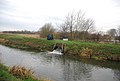 Outfall into the Little Stour - geograph.org.uk - 3390290.jpg 640 × 430 ; 67 kio
-
 Padbrook Lane - geograph.org.uk - 3521874.jpg 640 × 430 ; 96 kio
-
 Park Rd - geograph.org.uk - 3529447.jpg 640 × 430 ; 78 kio
-
 Park Rd - geograph.org.uk - 3539661.jpg 640 × 430 ; 37 kio
-
 Park Rd becomes Santon Lane - geograph.org.uk - 3539666.jpg 640 × 430 ; 51 kio
-
 Perry Farm Barn - geograph.org.uk - 2181115.jpg 3 072 × 2 304 ; 1,34 Mio
-
 Perry, near Wingham. Kent, UK. - panoramio.jpg 2 048 × 1 536 ; 619 kio
-
 Pleasant View Cottages - geograph.org.uk - 3441319.jpg 640 × 430 ; 79 kio
-
 Bend in the ditch - geograph.org.uk - 463406.jpg 640 × 480 ; 65 kio
-
 Pond at Little Walmestone - geograph.org.uk - 1167394.jpg 640 × 480 ; 190 kio
-

-
 Pond, Walmestone Court Farm, Walmestone Road - geograph.org.uk - 5800064.jpg 3 264 × 2 448 ; 2,6 Mio
-
 Posts for supporting fruit trees - geograph.org.uk - 5798883.jpg 3 264 × 2 448 ; 2,33 Mio
-
 Preston - geograph.org.uk - 3378434.jpg 640 × 430 ; 57 kio
-
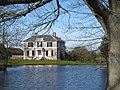
 Preston Court - geograph.org.uk - 467940.jpg 640 × 480 ; 122 kio
-
 Preston Court from Court Lane - geograph.org.uk - 715084.jpg 640 × 480 ; 118 kio
-
 Preston Court in the distance - geograph.org.uk - 3384172.jpg 640 × 430 ; 45 kio
-
 Preston Court, Court Lane - geograph.org.uk - 3854643.jpg 640 × 480 ; 128 kio
-
 Preston Court, Court Lane - geograph.org.uk - 3854650.jpg 480 × 640 ; 109 kio
-
 Preston Court, Court Lane - geograph.org.uk - 3854652.jpg 640 × 480 ; 114 kio
-
 Preston Family Butchers - geograph.org.uk - 3378416.jpg 640 × 430 ; 85 kio
-
 Preston Grange, Grove Road - geograph.org.uk - 5559583.jpg 3 264 × 2 448 ; 2,61 Mio
-
 Preston Grange, Grove Road - geograph.org.uk - 5559601.jpg 3 264 × 2 448 ; 2,2 Mio
-
 Preston Grange, Grove Road - geograph.org.uk - 5559623.jpg 3 264 × 2 448 ; 2,1 Mio


_-_geograph.org.uk_-_2182995.jpg)


_Preston._-_geograph.org.uk_-_316017.jpg)


