Category:Primrose Hill
둘러보기로 이동
검색으로 이동
district in the London Borough of Camden, in England, UK | |||||
| 미디어 올리기 | |||||
| 다음 종류에 속함 | |||||
|---|---|---|---|---|---|
| 위치 | 캠던구, 그레이터런던, London, 잉글랜드 | ||||
 | |||||
하위 분류
다음은 이 분류에 속하는 하위 분류 13개 가운데 13개입니다.
G
K
P
- Primrose Hill railway station (28 F)
- Primrose Hill Tunnel (23 F)
R
S
V
- Views from Primrose Hill (129 F)
"Primrose Hill" 분류에 속하는 미디어
다음은 이 분류에 속하는 파일 45개 가운데 45개입니다.
-

-
 AGNES ARBER - 9 Elsworthy Terrace Primrose Hill London NW3 3DR.jpg 1,500 × 2,000; 1.17 MB
-
 Adelaide Medical Centre - geograph.org.uk - 707632.jpg 640 × 480; 102 KB
-
 Adelaide Road - geograph.org.uk - 1079639.jpg 640 × 480; 81 KB
-
 Adelaide Road - geograph.org.uk - 544402.jpg 640 × 480; 98 KB
-
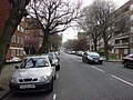
 Adelaide Road, Chalk Farm - geograph.org.uk - 706774.jpg 640 × 480; 101 KB
-
 Adelaide Road, Chalk Farm - geograph.org.uk - 707549.jpg 640 × 480; 98 KB
-
 Adelaide Road, Chalk Farm - geograph.org.uk - 707555.jpg 480 × 640; 128 KB
-
 Adelaide Road, Chalk Farm - geograph.org.uk - 707575.jpg 640 × 480; 112 KB
-
 Albert Terrace London NW 1 7 SU Houses - geograph.org.uk - 31892.jpg 640 × 480; 23 KB
-
 Allitsen Road - geograph.org.uk - 784358.jpg 640 × 480; 108 KB
-
 Avenue Road, looking north - geograph.org.uk - 784348.jpg 640 × 480; 84 KB
-
 Avenue Road, looking south - geograph.org.uk - 784349.jpg 640 × 480; 84 KB
-
 BT Tower from Primrose Hill - geograph.org.uk - 3277279.jpg 1,920 × 1,080; 517 KB
-
 BT Tower from Primrose Hill - geograph.org.uk - 3277324.jpg 1,920 × 1,080; 355 KB
-
 Cafe Rouge, St John's Wood High Street - geograph.org.uk - 546294.jpg 640 × 480; 135 KB
-
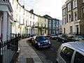 Chalcot Crescent, near Primrose Hill - geograph.org.uk - 527098.jpg 640 × 480; 158 KB
-
 Chalcot Road - geograph.org.uk - 1006358.jpg 640 × 480; 77 KB
-
 Charlbert Street - geograph.org.uk - 768577.jpg 640 × 480; 86 KB
-
 Drinking fountain Primrose Hill night shot.jpg 2,160 × 3,840; 3.67 MB
-
 Druids on Primrose Hill Autumn Equinox.jpg 1,500 × 1,000; 921 KB
-
 Edis Street - geograph.org.uk - 1006341.jpg 640 × 480; 89 KB
-
 Egbert Street - geograph.org.uk - 1006314.jpg 640 × 480; 81 KB
-
 Elsworthy Terrace - 49774471997.jpg 3,888 × 2,592; 4.88 MB
-
 Eton Villas, NW3 - geograph.org.uk - 268560.jpg 640 × 480; 141 KB
-

-
 Fitzroy Road - geograph.org.uk - 1006301.jpg 640 × 480; 85 KB
-
 Fitzroy Road, NW1 - geograph.org.uk - 379336.jpg 640 × 480; 113 KB
-
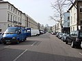
 Gloucester Avenue, Primrose Hill - geograph.org.uk - 216972.jpg 640 × 480; 104 KB
-
 Lamppost and cranes, Primrose Hill - geograph.org.uk - 3600641.jpg 480 × 640; 167 KB
-
 Lower Merton Rise - 49774141381.jpg 3,888 × 2,592; 4.66 MB
-
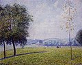 Pissarro - primrose-hill-regent-s-park-1892.jpg 280 × 224; 15 KB
-

-
 Primrose Hill (7263649972).jpg 4,137 × 2,619; 7.18 MB
-
 Primrose Hill (8627951980).jpg 1,600 × 862; 936 KB
-
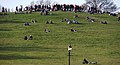
 Primrose Hill COVID crowd bins 1.jpg 6,000 × 4,000; 14.17 MB
-
 Primrose Hill COVID crowd bins 2.jpg 6,000 × 4,000; 12.22 MB
-
 Primrose Hill District Map.svg 1,052 × 744; 805 KB
-
 Regent's Park Road, Primrose Hill - geograph.org.uk - 216952.jpg 640 × 480; 134 KB
-
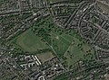 Satellite image of Primrose Hill, 2018.jpg 3,188 × 2,371; 2.48 MB
-
 Summit of Primrose Hill NW1 - geograph.org.uk - 2553830.jpg 4,752 × 3,168; 5.51 MB
-
 The British Army in the United Kingdom 1939-1945 H869.jpg 800 × 604; 55 KB
-
 The British Army in the United Kingdom 1939-45 H853.jpg 800 × 594; 55 KB
-
 The British Army in the United Kingdom 1939-45 H868.jpg 800 × 602; 62 KB
-
 Trees, Primrose Hill NW1 - geograph.org.uk - 3600630.jpg 480 × 640; 164 KB


.jpg)
.jpg)


