Category:Prince Edward Island
Sari la navigare
Sari la căutare
Provinciile și teritoriile Canadei: Alberta · British Columbia · Manitoba · New Brunswick · Newfoundland and Labrador · Nova Scotia · Ontario · Prince Edward Island · Quebec · Saskatchewan · Northwest Territories · Nunavut · Yukon
province of Canada    _2.svg) | |||||
| Încarcă multimedia | |||||
| Este un/o |
| ||||
|---|---|---|---|---|---|
| Numit(ă) după |
| ||||
| Locul actual | Canada | ||||
| Localizat pe malul | |||||
| Capitală | |||||
| Formă de guvernare |
| ||||
| Organ legislativ |
| ||||
| Executiv | |||||
| Limbă oficială | |||||
| Monedă |
| ||||
| Șef de stat |
| ||||
| Șef de guvern |
| ||||
| Constând în |
| ||||
| Înființare |
| ||||
| Cel mai înalt punct |
| ||||
| Populație |
| ||||
| Suprafață |
| ||||
| Înlocuiește |
| ||||
| Diferit(ă) de | |||||
| site oficial | |||||
 | |||||

For the islands in the southern Indian Ocean see Category:Prince Edward Islands
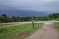
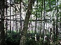
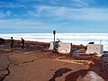
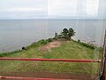
English: Media related to Prince Edward Island, a province in the Gulf of Saint Lawrence in southeastern Canada.
Français : Île-du-Prince-Édouard
Latina: Insula Principis Eduardi
Subcategorii
Această categorie conține următoarele 32 de subcategorii, dintr-un total de 32.
Pagini din categoria „Prince Edward Island”
Această categorie conține doar următoarea pagină.
Fișiere media din categoria „Prince Edward Island”
Următoarele 92 fișiere se află în această categorie, dintr-un total de 92.
-
 Abandoned railroad ties, near Elmira, PEI. (35078267016).jpg 4.608x3.456; 6,61 MB
-
 Bald Eagle perched on tree this morning (29172812140).jpg 4.608x3.456; 3,08 MB
-
 Beach at Skinner's Pond, PEI (28273915881).jpg 4.608x3.456; 2,97 MB
-
 Bear River Bog, PEI (28664771292).jpg 4.608x3.456; 4,12 MB
-
 Bedford Bogs, PEI (28354155740).jpg 4.608x3.456; 3,31 MB
-
 Between Iona and Uigg, PEI (19337624875).jpg 4.608x3.456; 3,21 MB
-
 Big Pond, PEI (28155012433).jpg 4.608x3.456; 4,26 MB
-
 Boat Over Wheat (34687109).jpg 1.800x1.198; 1,55 MB
-
 Boats Rotting in a Field of Flowers (34685539).jpg 1.800x1.198; 1,95 MB
-
 Bog near Bear River Road, PEI (6141722625).jpg 1.800x1.200; 610 KB
-
 Bog near Bear River, PEI (198443467).jpg 600x400; 84 KB
-
 Bog near Bear River, PEI (198443468).jpg 600x400; 77 KB
-
 Bog near Bear River, PEI (198443469).jpg 600x400; 67 KB
-
 Bog near Bear River, PEI (35325315011).jpg 4.608x3.456; 3,9 MB
-
 Bog near Bedford, PEI (26142087174).jpg 4.608x3.456; 5,23 MB
-
 Bog near Bedford, PEI (7909225978).jpg 3.648x2.736; 3,72 MB
-
 Bog, Bedford, PEI (43369626470).jpg 4.608x3.456; 3,69 MB
-
 Bog, Bedford, PEI (44461526384).jpg 4.608x3.456; 4,08 MB
-
 Brackley Coastal Drive, PEI (1159072395).jpg 600x400; 79 KB
-
 Brackley Day-use Park, National Park, PEI (11906300514).jpg 4.608x3.456; 11,89 MB
-
 BW rotting boat (34692091).jpg 599x900; 253 KB
-
 Cabin on Winter River Trail, PEI (12642890684).jpg 4.608x3.456; 3,46 MB
-
 Cape Turner, PEI National Park (36179267653).jpg 4.608x3.456; 3,62 MB
-
 Cliff and Sky (37231518).jpg 1.800x1.198; 1,31 MB
-
 Close Look at the Rock (34682844).jpg 1.198x1.800; 1,66 MB
-
 Coastal Clouds - HDR (7995246095).jpg 1.800x1.200; 1,26 MB
-
 Cove (6309683762).jpg 4.000x3.000; 2,47 MB
-
 Cow underpass on Confederation Trail (31144981241).jpg 4.608x3.456; 4,85 MB
-
 Dalvay, National Park, PEI (8331440278).jpg 1.800x1.200; 1,66 MB
-
 Dirt Road near Wellington, PEI (27788389800).jpg 4.608x3.456; 4,17 MB
-
 Discarded railway tie with metal "S" support still attached (42371069191).jpg 4.608x3.456; 4,43 MB
-
 Discarded steel rail track segment and wood tie, East Baltic, PEI (28521425048).jpg 4.608x3.456; 7,03 MB
-
 E Point Rd, South Lake (471436) (13487810053).jpg 3.722x2.092; 2,54 MB
-
 East Uigg Road, PEI (42629342971).jpg 4.608x3.456; 3,54 MB
-
 End of trail (and former railway line), Murray Harbour, PEI (42007533015).jpg 4.608x3.456; 5,34 MB
-
 Ever get that Feeling (34682845).jpg 1.800x1.198; 2,16 MB
-
 Field beside Murray Road, Wood Islands, PEI (28288132168).jpg 4.608x3.456; 4,27 MB
-
 Field near Bedford, PEI (34781656465).jpg 4.608x3.456; 7,04 MB
-
 Field near Charlottetown Rural High School, PEI (16435512781).jpg 4.608x3.456; 8,03 MB
-
 Field near Iona, PEI (28333979675).jpg 4.608x3.456; 3,79 MB
-
 Fishing Boat (34680894).jpg 1.800x1.198; 1,64 MB
-
 Fishing Boat Heading Out to Sea, Naufrage, PEI (14499905752).jpg 4.608x3.456; 6,94 MB
-
 Fredericton Station, PEI (14129491088).jpg 4.608x3.456; 4,92 MB
-
 Frog in grass (poking up from middle-bottom edge) (19228698478).jpg 4.608x3.456; 14,33 MB
-
 Getting Muscles (mussels?) (37229656).jpg 1.800x1.198; 1,6 MB
-
 Golden Lakes (34500119).jpg 1.800x1.198; 1,45 MB
-
 Goose River Road Beach, PEI (28759758026).jpg 4.608x3.456; 8,07 MB
-
 Gotta Check The Ocean (33785647).jpg 1.198x1.800; 1,31 MB
-
 Gulf of Saint Lawrence, Cavendish, PEI (36179266233).jpg 4.608x3.456; 3,39 MB
-
 Gulf of Saint Lawrence, Cavendish, PEI (36847714071).jpg 4.608x3.456; 3,88 MB
-
 H.M.C.S. Charlottetown (Reserves), PEI (8872223299).jpg 1.800x1.200; 562 KB
-
 Hauling hay (465598627).jpg 1.024x768; 260 KB
-
 Home display of my sister's natural products (36314016796).jpg 4.608x3.456; 3,76 MB
-
 Hudson River Bikeway (5640745300).jpg 650x488; 85 KB
-
 Ice in the Gulf, MacKenzies Brook, PEI National Park (32556103082).jpg 4.608x3.456; 3,91 MB
-
 Ice in the Gulf, MacKenzies Brook, PEI National Park (32556105662).jpg 4.608x3.456; 3,69 MB
-
 Impending Storm, Union Road, PEI (5982963500).jpg 600x400; 56 KB
-
 Irish Moss drying, North Cape, PEI (7532008780).jpg 3.648x2.736; 1,94 MB
-
 Jack's Road, Wood Islands, PEI (14635443548).jpg 4.608x3.456; 12,75 MB
-
 Little Vole looking for food near my place (32300910753).jpg 4.608x3.456; 4,12 MB
-
 Load of hay (465598737).jpg 1.024x768; 321 KB
-
 Looking onto Byways Trailor Park (78264937).jpg 600x400; 58 KB
-
 Looking out at the Gulf of St. Lawrence (3438421592).jpg 600x450; 45 KB
-
 Looking out Cupola of Yeo House, Green Park, PEI (28133866644).jpg 4.608x3.456; 4,7 MB
-
 Looking out from Souris Lighthouse, PEI (21120205258).jpg 4.608x3.456; 3,92 MB
-
 Looking out from the Cape Bear Lighthouse, PEI (27597819034).jpg 4.608x3.456; 3,56 MB
-
 Looking out to Gulf of Saint Lawrence, PEI (33536949421).jpg 4.608x3.456; 3,87 MB
-
 MacEwen Road near Morell, PEI (30518549460).jpg 4.608x3.456; 4,56 MB
-
 Mackenzie's Brook, PEI (8668475459).jpg 3.648x2.736; 6,88 MB
-
 Marshland near St. Peter's, PEI (26152251483).jpg 4.608x3.456; 5,41 MB
-
 Morell, PEI, & Saint Peters Bay (11078270896).jpg 2.121x1.414; 1,85 MB
-
 Morning bike ride to work, Confederation Trail, PEI (32488545584).jpg 4.608x3.456; 4,47 MB
-
 Morning Coffee and Reflection (34499395).jpg 1.800x1.198; 1,26 MB
-
 Moss, Greenwich, PEI (22616333844).jpg 960x720; 298 KB
-
 Murray Road, near Wood Islands, PEI (29172813740).jpg 4.608x3.456; 3,49 MB
-
 Murray Road, Near Wood Islands, PEI (36106904842).jpg 4.608x3.456; 4,06 MB
-
 Murray Road, PEI (35637492962).jpg 4.608x3.456; 4,14 MB
-
 Near Bedford, PEI (219975493).jpg 600x400; 67 KB
-
 Near Borden-Carleton, PEI (14277426875).jpg 4.608x3.456; 6,95 MB
-
 Near Brackley, PEI (5934696611).jpg 600x400; 39 KB
-
 Near Cape Ray lighthouse, Newfoundland (14585937572).jpg 4.608x3.456; 3,35 MB
-
 Near Cardigan, PEI (15020166606).jpg 4.608x3.456; 9,51 MB
-
 Near Douglas Station Road, PEI (5886141120).jpg 600x400; 116 KB
-
 Near Fredericton Station, PEI (19563860955).jpg 4.608x3.456; 14,34 MB
-
 Near Grandview, PEI (41911737724).jpg 4.608x3.456; 5,23 MB
-
 Open Road, Rear View Mirror, Prince Edward Island - 001.jpg 5.184x3.456; 6,85 MB
-
 Open Road, Rear View Mirror, Prince Edward Island - 002.jpg 5.184x3.456; 7,23 MB
-
 Open Road, Rear View Mirror, Prince Edward Island - 003.jpg 5.184x3.456; 6,83 MB
-
 Raindrops in PEI (35070437752).jpg 4.079x2.719; 8,54 MB
-
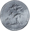 Seal of Prince Edward Island, Canada (1820–1830).png 285x290; 159 KB
-
 Seal of Prince Edward Island, Canada (1839–1949).png 290x292; 128 KB
-
 Shells along the Prince Edward Island shoreline.jpg 5.184x3.456; 7,49 MB
.jpg)
.jpg)
.jpg)
.jpg)
.jpg)
.jpg)
.jpg)
.jpg)
.jpg)
.jpg)
.jpg)
.jpg)
.jpg)
.jpg)
.jpg)
.jpg)
.jpg)
.jpg)
.jpg)
.jpg)
.jpg)
.jpg)
.jpg)
.jpg)
.jpg)
.jpg)
.jpg)
.jpg)
.jpg)
.jpg)
.jpg)
.jpg)
_(13487810053).jpg)
.jpg)
,_Murray_Harbour,_PEI_(42007533015).jpg)
.jpg)
.jpg)
.jpg)
.jpg)
.jpg)
.jpg)
.jpg)
.jpg)
_(19228698478).jpg)
_(37229656).jpg)
.jpg)
.jpg)
.jpg)
.jpg)
.jpg)
,_PEI_(8872223299).jpg)
.jpg)
.jpg)
.jpg)
.jpg)
.jpg)
.jpg)
.jpg)
.jpg)
.jpg)
.jpg)
.jpg)
.jpg)
.jpg)
.jpg)
.jpg)
.jpg)
.jpg)
.jpg)
.jpg)
.jpg)
.jpg)
.jpg)
.jpg)
.jpg)
.jpg)
.jpg)
.jpg)
.jpg)
.jpg)
.jpg)
.jpg)
.jpg)
.jpg)
.jpg)


.jpg)
.png)
.png)
