Category:Public footpaths in the London Borough of Bexley
Jump to navigation
Jump to search

Subcategories
This category has the following 4 subcategories, out of 4 total.
Media in category "Public footpaths in the London Borough of Bexley"
The following 82 files are in this category, out of 82 total.
-
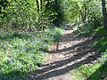
 A springtime path in Lesnes Abbey Woods - geograph.org.uk - 1899545.jpg 1,280 × 960; 652 KB
-
 A wet path approaching Danson House - geograph.org.uk - 3800385.jpg 4,000 × 3,000; 4.46 MB
-
 A wet path in Danson Park - geograph.org.uk - 3800377.jpg 4,000 × 3,000; 3.97 MB
-
 Access track into Danson Park - geograph.org.uk - 2559216.jpg 4,288 × 3,216; 4.84 MB
-
 Avenue of trees near Hall Place - geograph.org.uk - 2319069.jpg 1,280 × 960; 628 KB
-
 Avenue Road in Frank's Park - geograph.org.uk - 2822940.jpg 4,288 × 3,216; 7.54 MB
-
 Blackberry picking at Crossness - geograph.org.uk - 936096.jpg 640 × 480; 171 KB
-
 Bluebell time along a path in Lesnes Abbey Woods - geograph.org.uk - 4444564.jpg 4,000 × 3,000; 4.18 MB
-
 Bluebell time along a path in Lesnes Abbey Woods - geograph.org.uk - 4444567.jpg 4,000 × 3,000; 4.27 MB
-
 Bluebells alongside a path in Lesnes Abbey Woods - geograph.org.uk - 3953726.jpg 4,000 × 3,000; 4.3 MB
-
 Bluebells alongside a path in Lesnes Abbey Woods - geograph.org.uk - 3953753.jpg 4,000 × 3,000; 4.2 MB
-
 Crossness, Thames Path - geograph.org.uk - 575909.jpg 640 × 480; 77 KB
-
 Danson House - geograph.org.uk - 3787394.jpg 4,000 × 3,000; 3.88 MB
-
 Footpath behind Rowley Avenue - geograph.org.uk - 4421350.jpg 1,024 × 768; 1 MB
-
 Footpath between Marden Crescent and Grazeley Close - geograph.org.uk - 3284319.jpg 2,048 × 1,536; 1.54 MB
-
 Footpath by a playing field - geograph.org.uk - 3713738.jpg 640 × 430; 71 KB
-
 Footpath crosses Stansted Crescent - geograph.org.uk - 2560300.jpg 4,288 × 3,216; 4.41 MB
-
 Footpath in Foot's Cray Meadows - geograph.org.uk - 2003331.jpg 3,072 × 2,304; 1.85 MB
-
 Footpath junction - geograph.org.uk - 3704841.jpg 640 × 430; 99 KB
-

-

-

-
 Footpath junction on the Thames Path near Southmere Lake - geograph.org.uk - 2571189.jpg 4,288 × 3,216; 5.88 MB
-

-
 Footpath leading to Wyatt Road, Barnehurst - geograph.org.uk - 1957312.jpg 1,280 × 960; 630 KB
-
 Footpath leading up to the A2 - East Rochester Way - geograph.org.uk - 4829679.jpg 4,608 × 3,456; 3.36 MB
-
 Footpath leading up to the A2 - East Rochester Way - geograph.org.uk - 4829703.jpg 4,608 × 3,456; 3.33 MB
-
 Footpath looking towards Ruxley - geograph.org.uk - 2479513.jpg 4,000 × 3,000; 4.08 MB
-
 Footpath near Home Close Farm, North Cray - geograph.org.uk - 2006934.jpg 1,280 × 960; 609 KB
-
 Footpath near St Mary the Virgin Church - geograph.org.uk - 2003264.jpg 3,072 × 2,304; 2.42 MB
-
 Footpath near Upper Ruxley - geograph.org.uk - 2435404.jpg 1,280 × 960; 655 KB
-
 Footpath off Belvedere Road - geograph.org.uk - 4451807.jpg 1,024 × 768; 178 KB
-
 Footpath on Erith Marshes - geograph.org.uk - 2302563.jpg 1,280 × 960; 654 KB
-
 Footpath through the bluebells in Lesnes Abbey Woods - geograph.org.uk - 3452644.jpg 4,000 × 3,000; 4.11 MB
-
 Footpath to Crayford - geograph.org.uk - 2003267.jpg 3,072 × 2,304; 3.23 MB
-
 Footpath to Danson Park - geograph.org.uk - 4426706.jpg 1,024 × 768; 719 KB
-
 Footpath to North End - geograph.org.uk - 2549120.jpg 3,072 × 2,304; 2.29 MB
-
 Footpath to Rochester Close - geograph.org.uk - 4426687.jpg 768 × 1,024; 738 KB
-
 Footpath to Waring Rd - geograph.org.uk - 3713748.jpg 640 × 430; 60 KB
-
 Footpath towards Coldblow - geograph.org.uk - 2475450.jpg 4,000 × 3,000; 4.25 MB
-
 Footpath towards Joyden's Wood - geograph.org.uk - 2406057.jpg 1,280 × 960; 621 KB
-
 Footpath towards Manorway Green - geograph.org.uk - 3886289.jpg 1,024 × 768; 329 KB
-
 Footpath, Longlands Road allotments - geograph.org.uk - 872443.jpg 640 × 480; 91 KB
-
 Green Chain Walk in Lesnes Abbey Woods - geograph.org.uk - 2394354.jpg 1,280 × 960; 655 KB
-
 Green Chain Walk in Lesnes Abbey Woods - geograph.org.uk - 2547713.jpg 3,072 × 2,304; 3.07 MB
-
 Green Chain Walk in Lesnes Abbey Woods - geograph.org.uk - 2547861.jpg 3,072 × 2,304; 3.2 MB
-
 Green Chain Walk in Lesnes Abbey Woods - geograph.org.uk - 5175113.jpg 1,600 × 1,067; 764 KB
-
 Green Chain Walk, Lesnes Abbey Wood - geograph.org.uk - 3845345.jpg 640 × 430; 136 KB
-
 Green Chain Walk, Lesnes Abbey Wood - geograph.org.uk - 3845347.jpg 640 × 430; 124 KB
-
 Green Chain Walk, Lesnes Abbey Wood - geograph.org.uk - 3845353.jpg 640 × 430; 127 KB
-
 Green Chain Walk, Lesnes Abbey Wood - geograph.org.uk - 3845362.jpg 640 × 430; 129 KB
-
 Green Chain Walk, Lesnes Abbey Wood - geograph.org.uk - 3845364.jpg 640 × 430; 131 KB
-
 Green Chain Walk, Lesnes Abbey Wood - geograph.org.uk - 3845365.jpg 640 × 430; 131 KB
-
 Green Chain Walk, Lesnes Abbey Wood - geograph.org.uk - 3845375.jpg 640 × 430; 131 KB
-
 Green Chain Walk, Lesnes Abbey Wood - geograph.org.uk - 3845376.jpg 640 × 430; 116 KB
-
 Hill path in Lesnes Abbey Wood - geograph.org.uk - 2824224.jpg 3,216 × 4,288; 6.92 MB
-
 Lesnes Abbey Woods - geograph.org.uk - 3845387.jpg 640 × 430; 132 KB
-
 Lesnes Abbey Woods - geograph.org.uk - 3845391.jpg 640 × 430; 135 KB
-
 Path alongside Hall Place - geograph.org.uk - 3485545.jpg 1,024 × 768; 412 KB
-
 Path beside Danson Park lake - geograph.org.uk - 2559221.jpg 4,288 × 3,216; 5.21 MB
-
 Path by the lake in Danson Park - geograph.org.uk - 3800363.jpg 4,000 × 3,000; 4.32 MB
-
 Path in Frank's Path - geograph.org.uk - 2822936.jpg 4,288 × 3,216; 6.78 MB
-
 Path in Lesnes Abbey Woods - geograph.org.uk - 2547850.jpg 3,072 × 2,304; 3.24 MB
-
 Path in Lesnes Abbey Woods - geograph.org.uk - 2711436.jpg 4,000 × 3,000; 4.4 MB
-
 Path in Lesnes Abbey Woods - geograph.org.uk - 2824332.jpg 4,288 × 3,216; 6.98 MB
-
 Path in Lesnes Abbey Woods - geograph.org.uk - 2850010.jpg 640 × 480; 207 KB
-
 Path in Lesnes Abbey Woods - geograph.org.uk - 3845380.jpg 640 × 430; 119 KB
-
 Path junction in Frank's Park woods - geograph.org.uk - 2548004.jpg 3,072 × 2,304; 3.25 MB
-
 Path through Lesnes Abbey Woods.jpg 3,448 × 4,592; 22.21 MB
-
 Path through the heathland in Lesnes Abbey Woods - geograph.org.uk - 2070378.jpg 1,280 × 960; 654 KB
-
 Path, Danson Park - geograph.org.uk - 3886661.jpg 640 × 430; 89 KB
-
 Path, Danson Park - geograph.org.uk - 3886684.jpg 640 × 430; 65 KB
-
 Pergola, Danson Park - geograph.org.uk - 3742045.jpg 640 × 480; 175 KB
-
 Springtime path in Lesnes Abbey Woods - geograph.org.uk - 2394341.jpg 1,280 × 960; 640 KB
-
 Sunlit path in Lesnes Abbey Woods - geograph.org.uk - 2438198.jpg 960 × 1,280; 658 KB
-
 T-Junction in Joyden's Wood - geograph.org.uk - 1279357.jpg 640 × 480; 147 KB
-
 Thames-side path - geograph.org.uk - 1278389.jpg 426 × 640; 90 KB
-
 The Erith Alps - geograph.org.uk - 198218.jpg 480 × 640; 47 KB
-
 The gardens at Lesnes Abbey - geograph.org.uk - 3953757.jpg 4,000 × 3,000; 4.22 MB
-
 Woodland path at bluebell time in Lesnes Abbey Woods - geograph.org.uk - 4444562.jpg 4,000 × 3,000; 4.38 MB
-
 Woodland path in Frank's Park - geograph.org.uk - 2548079.jpg 3,072 × 2,304; 2.86 MB
-
 Woodland Path in Lesnes Abbey Woods - geograph.org.uk - 2547882.jpg 3,072 × 2,304; 2.87 MB


