Category:Pubs in Surrey
Jump to navigation
Jump to search

Wikimedia category | |||||
| Upload media | |||||
| Instance of | |||||
|---|---|---|---|---|---|
| |||||
Subcategories
This category has the following 86 subcategories, out of 86 total.
- Pubs in Gomshall (5 F)
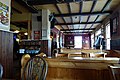
- Pub interiors in Surrey (6 F)
A
- Albert Arms, Esher (3 F)
B
- Barley Mow, Tilford (18 F)
- Black Horse pub, Hookwood (7 F)
- Bulls Head, Ewhurst (6 F)
- Cherry Tree pub, Burstow (6 F)
- Shipley Bridge Inn, Burstow (5 F)
C
- Cricketers pub, Downside (4 F)
- Crossways Inn, Churt (8 F)
D
- Derby Arms pub, Epsom Downs (3 F)
E
- Elstead Mill (22 F)
G
- Greyhound pub, Charlwood (2 F)
H
- Half Moon pub, Charlwood (5 F)
- The Harrow, Compton (8 F)
- Harvester, Puttenham (3 F)
- Jolly Farmer pub, Horne (6 F)
- Hurtwood Inn, Peaslake (8 F)
J
K
L
- Pubs in Long Ditton (5 F)
M
- Mayford Arms pub, Woking (8 F)
- The Mint, Banstead (6 F)
N
- Nag's Head Inn, Knaphill (3 F)
- New Inn, Send (8 F)
O
- Bell Inn, Outwood (4 F)
- Castle pub, Outwood (7 F)
- Dog and Duck pub, Outwood (3 F)
P
- Percy Arms pub, Chilworth (3 F)
Q
- Queen Victoria pub, Shalford (6 F)
R
- Pubs in Redhill, Surrey (27 F)
- Royal Oak pub, Brockham (10 F)
- Royal Oak pub, Knaphill (4 F)
S
- Six Bells, Newdigate (5 F)
- The Sportsman, Mogador (5 F)
- The Swan Inn, Chiddingfold (2 F)
T
- The Albion pub, East Molesey (4 F)
- The Anchor pub, Wisley (5 F)
- The Crown pub, Knaphill (4 F)
- The Crown pub. Horsell (3 F)
- The Donkey pub, Charleshill (5 F)
- The Dover Arms, Ash (4 F)
- The Good Intent, Puttenham (9 F)
- The Plough pub, Effingham (4 F)
- The Star pub, Lingfield (4 F)
- The Woolpack, Banstead (6 F)
W
- Pubs in Walton-on-Thames (7 F)
- Wheatsheaf Inn, Grayswood (4 F)
- White Hart pub, Pirbright (4 F)
- White Hart pub, Tongham (5 F)
- The Withies Inn (7 F)
- Woolpack pub, Elstead (10 F)
Media in category "Pubs in Surrey"
The following 200 files are in this category, out of 228 total.
(previous page) (next page)-
 A country pub in Surrey - geograph.org.uk - 58829.jpg 640 × 480; 106 KB
-
 Abbey Street - geograph.org.uk - 1622084.jpg 640 × 480; 74 KB
-
 Anchor and Horseshoes pub, 194 London Road, Burpham (May 2014).jpg 3,600 × 2,400; 1.91 MB
-
 Anchor and Horseshoes, Burpham - geograph.org.uk - 599463.jpg 640 × 480; 108 KB
-
 Bagshot Centre and Kings Arms - geograph.org.uk - 1000081.jpg 640 × 480; 63 KB
-
 Bricklayers Arms pub, 6 Queens Road, Hersham (June 2015).jpg 3,400 × 2,800; 1.7 MB
-
 British Volunteer pub (now Waverley Inn), Heath Road, Weybridge (June 2015).jpg 3,600 × 2,800; 3.03 MB
-
 Charleshill, Surrey, The 'Donkey' - geograph.org.uk - 3467483.jpg 2,580 × 1,891; 2.9 MB
-
 Charleshill, Surrey, The 'Donkey' - geograph.org.uk - 3467494.jpg 3,198 × 2,412; 5.14 MB
-
 Chertsey Road, Windlesham - geograph.org.uk - 166281.jpg 640 × 480; 468 KB
-
 Chobham Road, Woking - geograph.org.uk - 601377.jpg 640 × 480; 119 KB
-
 Church Road - geograph.org.uk - 1124081.jpg 426 × 640; 73 KB
-
 Clifton Arms, Caterham, Surrey - geograph.org.uk - 350345.jpg 640 × 546; 105 KB
-
 The Duke of Cambridge pub - geograph.org.uk - 1745506.jpg 1,200 × 1,600; 338 KB
-
 The 'Duke's Head', Brockham Green, Surrey - geograph.org.uk - 517265.jpg 640 × 427; 107 KB
-
 Forresters, 18 Cooper Road - geograph.org.uk - 1749681.jpg 1,024 × 749; 201 KB
-
 Frimley Green - geograph.org.uk - 574060.jpg 640 × 480; 99 KB
-
 Garibaldi pub, 134 High Street, Knaphill (June 2015).jpg 4,200 × 3,200; 2.02 MB
-
 Good Companions, Warlingham, CR6 (3834408457).jpg 3,076 × 2,051; 2.69 MB
-
 Hare and Hounds - Lingfield Common Road - geograph.org.uk - 55661.jpg 640 × 480; 237 KB
-
 Hen And Chickens Pub, Bisley - geograph.org.uk - 1742034.jpg 640 × 480; 74 KB
-
 High Street, Ripley - geograph.org.uk - 1089970.jpg 640 × 480; 83 KB
-
 Horse-friendly pub - geograph.org.uk - 1162829.jpg 640 × 480; 95 KB
-
 Kings Head pub, Holmbury Hill Road, Holmbury St Mary (March 2014).jpg 2,400 × 1,600; 736 KB
-
 Penny Black - geograph.org.uk - 688113.jpg 640 × 480; 81 KB
-
 Penny Black pub Leatherhead.jpg 2,338 × 3,117; 848 KB
-
 Lower Kingswood main road junction - geograph.org.uk - 363963.jpg 640 × 290; 46 KB
-
 Marquis of Granby pub, Scilly Isles Roundabout, Esher (July 2015).jpg 4,600 × 2,800; 2.44 MB
-
 Merstham - Railway Arms Public House - geograph.org.uk - 1296377.jpg 640 × 480; 75 KB
-
 Napiers pub (now The Admiral), 72 Vale Road, Ash Vale (May 2014) (1).jpg 2,400 × 1,600; 551 KB
-
 Napiers pub (now The Admiral), 72 Vale Road, Ash Vale (May 2014) (2).jpg 2,400 × 1,400; 494 KB
-

-
 O'Neill's - geograph.org.uk - 1188070.jpg 640 × 480; 89 KB
-
 Old Plough pub, Station Road, Stoke D'Abernon (June 2015).jpg 4,400 × 2,600; 2.24 MB
-
 Old west Surrey (Page 285) BHL41412996.jpg 2,215 × 3,411; 553 KB
-
 Onslow Arms, West Clandon. - geograph.org.uk - 140730.jpg 640 × 429; 137 KB
-
 Prince of Wales, East Molesey, KT8 (2433623058).jpg 960 × 1,280; 368 KB
-
 Queens Arms pub, 107 Church Road, Addlestone (June 2015).jpg 3,400 × 2,800; 1.5 MB
-
 Railway Arms, Merstham - geograph.org.uk - 1809151.jpg 1,000 × 671; 142 KB
-
 Ram Cider House, Catteshall in 1990 - geograph.org.uk - 351117.jpg 640 × 402; 70 KB
-
 Ripley High Street 01.jpg 4,128 × 3,096; 4.75 MB
-
 Saddlers Arms - geograph.org.uk - 642679.jpg 640 × 480; 119 KB
-
 Sands at Bleak House pub, Chertsey Road, Anthonys, near Horsell (June 2015) (1).jpg 4,400 × 2,800; 2.57 MB
-
 Sands at Bleak House pub, Chertsey Road, Anthonys, near Horsell (June 2015) (2).jpg 4,200 × 2,600; 2.09 MB
-
 Stanwell SirJohnGibson WSW.jpg 1,280 × 639; 486 KB
-

-
 Stephen Langton - geograph.org.uk - 575620.jpg 480 × 640; 122 KB
-
 Sunbury Village - panoramio.jpg 3,072 × 2,304; 2.56 MB
-
 Swan Inn - geograph.org.uk - 1203643.jpg 640 × 480; 97 KB
-
 Tattenham Corner - geograph.org.uk - 730257.jpg 640 × 428; 102 KB
-
 Tattenham Corner pub.JPG 1,600 × 1,200; 597 KB
-
 Thames Court - geograph.org.uk - 648537.jpg 640 × 480; 88 KB
-
 The "Pride of the Valley" - geograph.org.uk - 1549282.jpg 640 × 360; 55 KB
-
 The 'Old Ship', Tatsfield, Surrey - geograph.org.uk - 1548316.jpg 640 × 480; 98 KB
-
 The 'Plough', Coldharbour, Surrey - geograph.org.uk - 784665.jpg 640 × 406; 79 KB
-
 The 'Tally Ho', Caterham on the Hill - geograph.org.uk - 1349223.jpg 640 × 480; 70 KB
-
 The Abinger Arms - geograph.org.uk - 580022.jpg 640 × 480; 147 KB
-
 The Abinger Hatch - geograph.org.uk - 817511.jpg 640 × 480; 122 KB
-
 The Alma pub, Alma Road, Heath End, Farnham (May 2015) (1).jpg 2,200 × 1,600; 540 KB
-
 The Alma pub, Alma Road, Heath End, Farnham (May 2015) (2).jpg 2,400 × 1,600; 628 KB
-
 The Arkle Manor - geograph.org.uk - 316060.jpg 640 × 480; 131 KB
-
 The Armstrong Gun - geograph.org.uk - 1168169.jpg 640 × 436; 72 KB
-

-
 The Bat and Ball pub, Bat and Ball Lane, Boundstone, Farnham (May 2015) (1).jpg 2,400 × 1,600; 813 KB
-
 The Bat and Ball pub, Bat and Ball Lane, Boundstone, Farnham (May 2015) (2).jpg 2,400 × 1,800; 876 KB
-
 The Bear, Camberley.jpg 4,128 × 3,096; 4.79 MB
-
 The Beehive - geograph.org.uk - 1270643.jpg 640 × 426; 75 KB
-
 The Beer's In^ - geograph.org.uk - 820773.jpg 640 × 480; 99 KB
-
 The Bell Inn, The Street, Fetcham (July 2013).jpg 2,400 × 1,600; 815 KB
-
 The Bell, Fetcham - geograph.org.uk - 64467.jpg 640 × 480; 98 KB
-
 The Bird in Hand, Mayford - geograph.org.uk - 1213774.jpg 640 × 480; 113 KB
-
 The Black Swan in Cobham, England - Stierch.jpg 3,175 × 2,720; 4.29 MB
-
 The Blue Bell pub, Batts Corner, Dockenfield (May 2021).jpg 3,000 × 2,000; 2.01 MB
-
 The Bluebell, Dockenfield - geograph.org.uk - 3818523.jpg 1,632 × 1,385; 623 KB
-
 The Carpenters Arms, Camberley 01.jpg 1,914 × 2,553; 1,017 KB
-
 The Carpenters Arms, Camberley 02.jpg 3,964 × 1,875; 1.67 MB
-
 The Castle pub, Brox Road, Ottershaw (June 2015).jpg 4,600 × 3,000; 2.95 MB
-
 The Castle, Ottershaw - geograph.org.uk - 4497983.jpg 2,048 × 1,536; 2.2 MB
-
 The Causeway - geograph.org.uk - 817934.jpg 640 × 432; 46 KB
-
 The Charterhouse Arms (2).jpg 4,288 × 3,216; 3.38 MB
-
 The Charterhouse Arms (3).jpg 1,024 × 759; 284 KB
-
 The Charterhouse Arms.jpg 4,288 × 3,216; 3.6 MB
-
 The Claremont - geograph.org.uk - 1042268.jpg 640 × 480; 101 KB
-
 The Cricketers (side view), Westfield Road - geograph.org.uk - 1758054.jpg 1,024 × 754; 268 KB
-
 The Cricketers Arms - geograph.org.uk - 1221206.jpg 640 × 480; 92 KB
-
 The Cricketers pub, Badshot Lea Road, Badshot Lea (June 2015) (1).jpg 4,600 × 3,400; 2.48 MB
-
 The Cricketers pub, Badshot Lea Road, Badshot Lea (June 2015) (2).jpg 4,200 × 2,800; 1.95 MB
-
 The Cricketers, Westfield Road - geograph.org.uk - 1758038.jpg 1,024 × 745; 222 KB
-
 The Crown - geograph.org.uk - 1565919.jpg 640 × 426; 85 KB
-

-
 The Crown, Alfold - geograph.org.uk - 243698.jpg 640 × 421; 355 KB
-
 The Crown, Loxwood Road - geograph.org.uk - 1434625.jpg 640 × 465; 96 KB
-
 The Donkey - geograph.org.uk - 2995491.jpg 4,288 × 3,216; 3.51 MB
-
 The Donkey, Charles Hill - geograph.org.uk - 4601570.jpg 640 × 480; 157 KB
-
 The Firs - geograph.org.uk - 1199727.jpg 640 × 426; 79 KB
-
 The Foley Arms - geograph.org.uk - 1022373.jpg 640 × 480; 107 KB
-
 The Fox - geograph.org.uk - 845639.jpg 640 × 480; 70 KB
-
 The Fox and Hounds, Bishopsgate - geograph.org.uk - 376861.jpg 640 × 480; 82 KB
-
 The Fox Revived - geograph.org.uk - 1568668.jpg 640 × 426; 138 KB
-
 The Garibaldi - geograph.org.uk - 1214938.jpg 640 × 426; 93 KB
-
 The Garibaldi - geograph.org.uk - 1598205.jpg 640 × 480; 70 KB
-

-
 The Golden Fleece, Elstead.jpg 4,128 × 3,096; 3.78 MB
-
 The Goodies, Hamsey Green - geograph.org.uk - 1175436.jpg 640 × 479; 49 KB
-
 The Grasshopper, Limpsfield, Surrey - geograph.org.uk - 184044.jpg 640 × 480; 112 KB
-
 The Grotto - geograph.org.uk - 903422.jpg 640 × 480; 92 KB
-
 The Half Moon - geograph.org.uk - 1771618.jpg 2,272 × 1,704; 1.83 MB
-
 The Half Moon - geograph.org.uk - 518348.jpg 640 × 480; 112 KB
-
 The Hand in Hand public house - geograph.org.uk - 28969.jpg 640 × 480; 131 KB
-
 The Happy Man, Englefield Green - geograph.org.uk - 498018.jpg 486 × 640; 80 KB
-
 The Hare and Hounds, Vicarage Road - geograph.org.uk - 3134617.jpg 640 × 480; 104 KB
-
 The Harrow - geograph.org.uk - 794836.jpg 640 × 426; 91 KB
-
 The Holly Tree in St Jude's Road - geograph.org.uk - 1359072.jpg 640 × 480; 64 KB
-
 The Inn at Maybury - geograph.org.uk - 1186205.jpg 640 × 480; 87 KB
-
 The Inn on the Lake - geograph.org.uk - 441014.jpg 640 × 480; 67 KB
-
 The Iron Horse - geograph.org.uk - 1363523.jpg 640 × 480; 77 KB
-
 The Iron Horse - geograph.org.uk - 874629.jpg 640 × 426; 80 KB
-
 The Jolly Brickmakers - geograph.org.uk - 1564309.jpg 640 × 426; 96 KB
-
 The Jolly Farmer Runfold - geograph.org.uk - 99429.jpg 640 × 480; 104 KB
-
 The King's Head, Holmbury St Mary - geograph.org.uk - 1320473.jpg 640 × 480; 320 KB
-
 The Kings Arms, Bagshot - geograph.org.uk - 1262527.jpg 640 × 480; 77 KB
-

-
 The Lagham, South Godstone - geograph.org.uk - 1764581.jpg 1,280 × 856; 217 KB
-
 The Lobster Pot pub, Upper Hale Road, Upper Hale, Farnham (May 2015).jpg 2,500 × 1,500; 585 KB
-
 The Manor Inn Gardens, Farncombe.jpg 640 × 425; 520 KB
-
 The Marquis of Granby Pub - geograph.org.uk - 48679.jpg 640 × 426; 148 KB
-
 The Merry Harriers PH at Hambledon - geograph.org.uk - 1036628.jpg 640 × 360; 110 KB
-
 The Merry Harriers, Hambledon - geograph.org.uk - 388682.jpg 640 × 480; 78 KB
-
 The New Inn - geograph.org.uk - 702535.jpg 640 × 480; 83 KB
-
 The Oatlands Chaser pub, Oatlands Drive, Oatlands, Weybridge (June 2015).jpg 4,600 × 3,000; 3.83 MB
-
 The Old Crown - geograph.org.uk - 675213.jpg 640 × 480; 81 KB
-
 The Old Crown, Great Bookham - geograph.org.uk - 675221.jpg 480 × 640; 87 KB
-
 The Old Oak - geograph.org.uk - 726271.jpg 640 × 480; 68 KB
-
 The Old Plough public house, Stoke D'abernon - geograph.org.uk - 2387059.jpg 4,320 × 3,240; 4.68 MB
-
 The Old Wheatsheaf, Frimley Green 01.jpg 4,000 × 3,000; 2.97 MB
-
 The Old Wheatsheaf, Frimley Green 02.jpg 4,000 × 3,000; 2.75 MB
-

-
 The Parade - geograph.org.uk - 1022366.jpg 640 × 480; 96 KB
-
 The Parrot in the fog - geograph.org.uk - 1162827.jpg 640 × 480; 74 KB
-
 The Parrott Inn - geograph.org.uk - 1294651.jpg 640 × 480; 119 KB
-
 The Phoenix - geograph.org.uk - 793267.jpg 480 × 640; 93 KB
-
 The Plough - geograph.org.uk - 575510.jpg 640 × 480; 110 KB
-
 The Plough at Effingham - geograph.org.uk - 1430165.jpg 640 × 480; 57 KB
-
 The Plough pub, High Road, Byfleet (June 2015) (1).jpg 4,000 × 2,400; 1.79 MB
-
 The Plough pub, High Road, Byfleet (June 2015) (2).jpg 4,600 × 3,400; 2.8 MB
-
 The Plough, Coldharbour, Surrey - geograph.org.uk - 1403264.jpg 640 × 480; 84 KB
-
 The Plough, Coldharbour, Surrey - geograph.org.uk - 1403273.jpg 480 × 640; 109 KB
-
 The Priory - geograph.org.uk - 1305087.jpg 480 × 640; 70 KB
-
 The Queens Head - geograph.org.uk - 773971.jpg 640 × 426; 121 KB
-
 The Railway Arms, Merstham - geograph.org.uk - 1407569.jpg 640 × 480; 75 KB
-
 The Railway Arms, Merstham - geograph.org.uk - 872833.jpg 640 × 426; 83 KB
-
 The Ramblers Rest, Chipstead Valley - geograph.org.uk - 1566521.jpg 640 × 428; 74 KB
-
 The Refectory pub, Portsmouth Road, Milford (June 2015) (1).jpg 4,600 × 3,000; 3.06 MB
-
 The Refectory pub, Portsmouth Road, Milford (June 2015) (2).jpg 4,600 × 2,600; 2.72 MB
-
 The Rifleman pub, Epsom - Geograph 2983709.jpg 600 × 800; 106 KB
-
 The Rising Sun, Charlwood - geograph.org.uk - 1752293.jpg 2,560 × 1,920; 1.91 MB
-
 The Rose and Crown, Thorpe Green - geograph.org.uk - 1383889.jpg 640 × 379; 59 KB
-
 The Rowbarge, 7 Riverside, Guildford - geograph.org.uk - 1754025.jpg 1,024 × 714; 222 KB
-
 The Royal Oak - geograph.org.uk - 1327918.jpg 640 × 427; 99 KB
-

-
 The Rubbing House - geograph.org.uk - 796591.jpg 640 × 479; 158 KB
-
 The Six Bells public house - geograph.org.uk - 499875.jpg 640 × 480; 68 KB
-
 The Square - geograph.org.uk - 830056.jpg 640 × 480; 109 KB
-
 The Star - geograph.org.uk - 1213820.jpg 640 × 480; 83 KB
-
 The Star Inn and Hotel, Felbridge - geograph.org.uk - 1379838.jpg 640 × 480; 63 KB
-
 The Station Hotel - geograph.org.uk - 1761841.jpg 640 × 426; 113 KB
-
 The Stephan Langton Inn, Friday Street - geograph.org.uk - 1285481.jpg 640 × 480; 397 KB
-
 The Streets of London, East Molesey - geograph.org.uk - 11043.jpg 640 × 424; 192 KB
-
 The Sun Inn, Dunsfold - geograph.org.uk - 242899.jpg 640 × 362; 283 KB
-
 The Sun public house - geograph.org.uk - 555530.jpg 640 × 425; 88 KB
-
 The Sun, Wick Lane - geograph.org.uk - 1361770.jpg 640 × 480; 62 KB
-
 The Sundial - geograph.org.uk - 1222431.jpg 640 × 480; 104 KB
-
 The Surrey Oaks at Parkgate - geograph.org.uk - 650205.jpg 640 × 480; 333 KB
-
 The Swan Inn (2) - geograph.org.uk - 1034793.jpg 640 × 480; 104 KB
-
 The Swan Inn - geograph.org.uk - 1034790.jpg 640 × 480; 93 KB
-
 The Tattenham Corner pub - geograph.org.uk - 1591680.jpg 640 × 428; 109 KB
-
 The Three Crowns - geograph.org.uk - 333148.jpg 640 × 480; 133 KB
-
 The Victoria, Oxshott (geograph 2117394).jpg 2,560 × 1,920; 1.74 MB
-
 The Village Inn, Caterham - geograph.org.uk - 1353111.jpg 640 × 480; 82 KB
-
 The Villagers - geograph.org.uk - 624475.jpg 640 × 480; 96 KB
-
 The Wheatsheaf and Pigeon - geograph.org.uk - 1021746.jpg 640 × 480; 101 KB
-
 The Wheatsheaf, Ellen's Green - geograph.org.uk - 862220.jpg 640 × 329; 76 KB
-

-
 The White Hart - geograph.org.uk - 1184823.jpg 640 × 480; 84 KB
-
 The White Hart pub, Woodham Lane, New Haw (June 2015).jpg 4,400 × 2,800; 2.34 MB
-
 The White Hart Public House - geograph.org.uk - 1227093.jpg 640 × 427; 72 KB
-
 The William Bray public house at Shere, Surrey.jpg 640 × 480; 83 KB
-
 The Woodman pub - geograph.org.uk - 1342663.jpg 640 × 480; 106 KB
-
 The Woodman, Woodmansterne - geograph.org.uk - 1386323.jpg 480 × 640; 81 KB
-
 Thurlow Arms, Baynards - geograph.org.uk - 243806.jpg 640 × 368; 235 KB
-
 Time, Gentlemen, Please^ - geograph.org.uk - 1153756.jpg 640 × 480; 62 KB
-
 Toby Carvery, 45 Cheam Road, Ewell (July 2020).jpg 3,000 × 1,600; 1.79 MB
-
 Trawlers, Upper Halliford - geograph.org.uk - 172042.jpg 640 × 480; 79 KB
-
 Waggon and Horses pub, 43 Simplemarsh Road, Addlestone (June 2015) (1).jpg 3,200 × 3,000; 1.66 MB
-
 Waggon and Horses pub, 43 Simplemarsh Road, Addlestone (June 2015) (2).jpg 3,400 × 3,200; 1.78 MB
-
 Weir at Sunbury Lock - geograph.org.uk - 232709.jpg 640 × 480; 81 KB
-

-
 Whyteleafe Tavern - geograph.org.uk - 1175447.jpg 640 × 459; 55 KB
-
 William IV - geograph.org.uk - 1564566.jpg 640 × 426; 106 KB
-
 William IV - geograph.org.uk - 1564568.jpg 640 × 426; 122 KB


.jpg)


.jpg)
,_Heath_Road,_Weybridge_(June_2015).jpg)


.jpg)
.jpg)


.jpg)


.jpg)

,_72_Vale_Road,_Ash_Vale_(May_2014)_(1).jpg)
,_72_Vale_Road,_Ash_Vale_(May_2014)_(2).jpg)


.jpg)
_BHL41412996.jpg)

.jpg)
.jpg)


_(1).jpg)
_(2).jpg)


_(1).jpg)
_(2).jpg)


_(1).jpg)
_(2).jpg)


.jpg)


.jpg)


.jpg)


.jpg)
.jpg)


,_Westfield_Road_-_geograph.org.uk_-_1758054.jpg)

_(1).jpg)
_(2).jpg)


.jpg)


.jpg)


_(1).jpg)
_(2).jpg)


_(1).jpg)
_(2).jpg)


_-_geograph.org.uk_-_1034793.jpg)


.jpg)


.jpg)


.jpg)

_(1).jpg)
_(2).jpg)


