Category:Purley on Thames
Jump to navigation
Jump to search
English: Purley on Thames, (referred to as Purley), is a village and civil parish in Berkshire, England. It forms part of the Reading urban area, but remains outside the borough, in West Berkshire.
village and civil parish in Berkshire, United Kingdom  | |||||
| Upload media | |||||
| Instance of | |||||
|---|---|---|---|---|---|
| Location | West Berkshire, Berkshire, South East England, England | ||||
| Located in or next to body of water | |||||
| Population |
| ||||
| Area |
| ||||
 | |||||
Subcategories
This category has the following 2 subcategories, out of 2 total.
M
- Mapledurham Lock (19 F)
Media in category "Purley on Thames"
The following 200 files are in this category, out of 236 total.
(previous page) (next page)-
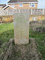 2nd Lieutenant C A Elliot - geograph.org.uk - 3340691.jpg 600 × 800; 164 KB
-
 A329 Oxford Road, Purley on Thames - geograph.org.uk - 6578178.jpg 1,024 × 684; 360 KB
-
 A329 Oxford Road, Purley on Thames - geograph.org.uk - 6578183.jpg 1,024 × 684; 446 KB
-
 A329 roundabout south of Purley Park - geograph.org.uk - 3506055.jpg 3,537 × 2,660; 1.6 MB
-
 Aesculus hippocastanum leaves - geograph.org.uk - 916032.jpg 640 × 427; 96 KB
-

-
 Along the bridge - geograph.org.uk - 3013315.jpg 600 × 800; 113 KB
-
 Approaching Hardwick House estate - geograph.org.uk - 5908248.jpg 3,730 × 1,968; 1.56 MB
-
 Base on the far side - geograph.org.uk - 2756630.jpg 1,024 × 683; 189 KB
-

-

-
 Benchmark on traffic island in New Hill - geograph.org.uk - 2868578.jpg 683 × 1,024; 301 KB
-
 Benchmarked letter box outside ^35 Long Lane - geograph.org.uk - 2868422.jpg 683 × 1,024; 213 KB
-
 Between the bridges - geograph.org.uk - 2756632.jpg 533 × 800; 96 KB
-
 Boats near the Lock - geograph.org.uk - 4673278.jpg 1,024 × 683; 193 KB
-
 Brading Way, Purley - geograph.org.uk - 2331395.jpg 640 × 480; 177 KB
-
 Brook under the A329 - geograph.org.uk - 916003.jpg 640 × 427; 123 KB
-
 Bucknell's Meadow - geograph.org.uk - 926523.jpg 640 × 427; 190 KB
-
 Container train passing Tilehurst - geograph.org.uk - 3862812.jpg 1,024 × 682; 1.01 MB
-
 CrossCountry train near Purley-on-Thames - geograph.org.uk - 926537.jpg 640 × 427; 193 KB
-
 Duncan Gardens off Hazel Road, Purley Park - geograph.org.uk - 6636339.jpg 1,600 × 1,065; 566 KB
-
 End of the line - geograph.org.uk - 924902.jpg 640 × 427; 146 KB
-
 Entrance to Purley Gardens Moorings - geograph.org.uk - 4500664.jpg 640 × 427; 417 KB
-
 Excavator by the footbridge - geograph.org.uk - 2753317.jpg 1,024 × 683; 167 KB
-
 Farmland in the Thames Valley - geograph.org.uk - 3914678.jpg 640 × 430; 45 KB
-
 Farmland, Purley - geograph.org.uk - 747221.jpg 640 × 480; 148 KB
-
 Farmland, Purley - geograph.org.uk - 747241.jpg 640 × 480; 110 KB
-
 Farmland, Purley - geograph.org.uk - 747255.jpg 640 × 480; 126 KB
-

-
 Fence in the road - geograph.org.uk - 2753310.jpg 1,024 × 683; 152 KB
-
 Field north of the railway - geograph.org.uk - 916042.jpg 640 × 427; 61 KB
-

-

-
 Floodplain - geograph.org.uk - 5367458.jpg 640 × 426; 46 KB
-
 Footpath beside the railway - geograph.org.uk - 2753328.jpg 1,024 × 683; 134 KB
-
 Footpath beside the railway - geograph.org.uk - 3014180.jpg 1,024 × 768; 130 KB
-
 Footpath to Pangbourne - geograph.org.uk - 3013006.jpg 600 × 800; 93 KB
-
 Footpath to Purley - geograph.org.uk - 916093.jpg 640 × 427; 69 KB
-
 Footpath towards Purley - geograph.org.uk - 926512.jpg 640 × 427; 178 KB
-
 Footpath towards Westbury Farm - geograph.org.uk - 916025.jpg 640 × 427; 99 KB
-
 Freight Train at Purley on Thames - geograph.org.uk - 4471361.jpg 1,200 × 817; 1.22 MB
-
 From near the mast - geograph.org.uk - 3012873.jpg 1,024 × 768; 153 KB
-
 From the Village side - geograph.org.uk - 3013310.jpg 1,024 × 768; 154 KB
-
 Gate and kissing gate - geograph.org.uk - 3014177.jpg 1,024 × 768; 144 KB
-

-

-
 George VI letter box - geograph.org.uk - 916084.jpg 427 × 640; 106 KB
-
 Grassland north of the railway - geograph.org.uk - 916016.jpg 640 × 427; 84 KB
-
 Grassland, Purley - geograph.org.uk - 747185.jpg 640 × 480; 204 KB
-
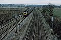
 Great Western main line west of Tilehurst - geograph.org.uk - 611106.jpg 640 × 477; 107 KB
-
 Great Western Railway at Purley - geograph.org.uk - 916046.jpg 640 × 413; 79 KB
-
 Hardwick Boathouse - geograph.org.uk - 6453534.jpg 1,200 × 803; 1.05 MB
-
 Hardwick House - geograph.org.uk - 2555163.jpg 1,024 × 680; 223 KB
-
 Hardwick House - geograph.org.uk - 4442445.jpg 2,592 × 1,944; 2.01 MB
-

-
 Hardwick Stud Farm - geograph.org.uk - 4018240.jpg 640 × 480; 53 KB
-
 Hardwick Stud Farm - geograph.org.uk - 4442463.jpg 2,592 × 1,944; 2.02 MB
-
 Hazel Road, Purley on Thames - geograph.org.uk - 4442427.jpg 2,592 × 1,944; 1.95 MB
-
 Headstones on the wall - geograph.org.uk - 3339352.jpg 1,024 × 768; 339 KB
-
 Hedge at Scrace's Farm - geograph.org.uk - 916028.jpg 640 × 427; 80 KB
-
 Hedge at Westbury Farm - geograph.org.uk - 916036.jpg 640 × 427; 66 KB
-
 Join on the bridge - geograph.org.uk - 3013317.jpg 600 × 800; 107 KB
-
 Junction of Long Lane and Oxford Road - geograph.org.uk - 2859833.jpg 1,024 × 683; 251 KB
-
 Junction of New Hill and Oxford Road - geograph.org.uk - 2868591.jpg 1,024 × 683; 155 KB
-
 Junction on a corner - geograph.org.uk - 3341876.jpg 1,024 × 768; 120 KB
-
 Kingsland Farm - geograph.org.uk - 3914674.jpg 640 × 379; 44 KB
-
 Kissing gate at Beech Road - geograph.org.uk - 916088.jpg 640 × 427; 125 KB
-

-
 Line from the new bridge - geograph.org.uk - 3013009.jpg 1,024 × 768; 176 KB
-
 Localised flooding - geograph.org.uk - 3914682.jpg 640 × 389; 82 KB
-
 Localised flooding near Pangbourne - geograph.org.uk - 3914685.jpg 640 × 430; 63 KB
-
 Looking along the rail line from the new bridge - geograph.org.uk - 3013308.jpg 1,024 × 768; 192 KB
-
 Looking over the finished bridge - geograph.org.uk - 3011927.jpg 1,024 × 768; 220 KB
-
 Looking towards the lights - geograph.org.uk - 3011201.jpg 1,024 × 768; 198 KB
-
 Loop of the old Oxford Road, now footpath - geograph.org.uk - 2868635.jpg 1,024 × 683; 322 KB
-
 Main line from the bridge - geograph.org.uk - 2753322.jpg 1,024 × 683; 107 KB
-

-
 Mapledurham Drive - geograph.org.uk - 3338181.jpg 640 × 480; 132 KB
-
 Mapledurham Lock - geograph.org.uk - 6453527.jpg 1,200 × 800; 1.33 MB
-
 Marshall Close off Skerritt Way, Purley Park - geograph.org.uk - 6636322.jpg 1,600 × 1,065; 586 KB
-
 Miles at Mapledurham Weir - geograph.org.uk - 6735943.jpg 1,600 × 1,078; 602 KB
-
 Millpond Thames with liveaboard boats - geograph.org.uk - 6131990.jpg 3,040 × 1,470; 1.38 MB
-
 Mirrors both ways - geograph.org.uk - 916039.jpg 640 × 427; 93 KB
-
 Monkey Puzzle tree on Hazel Road - geograph.org.uk - 3583646.jpg 800 × 600; 117 KB
-
 Moss covered benchmark - geograph.org.uk - 3340619.jpg 600 × 800; 215 KB
-
 Mosshall Wood - geograph.org.uk - 916095.jpg 640 × 427; 115 KB
-
 Mosshall Wood - geograph.org.uk - 916098.jpg 640 × 427; 95 KB
-
 Mosshall Wood - geograph.org.uk - 916109.jpg 427 × 640; 123 KB
-
 Near side of the bridge - geograph.org.uk - 3012860.jpg 1,024 × 768; 200 KB
-
 New and old - geograph.org.uk - 2753343.jpg 533 × 800; 124 KB
-
 North of the railway - geograph.org.uk - 916019.jpg 640 × 427; 78 KB
-
 On the Corner, Purley Village - geograph.org.uk - 3830370.jpg 1,600 × 1,142; 330 KB
-
 One of the embrasures - geograph.org.uk - 2814225.jpg 1,024 × 768; 358 KB
-
 Orange Way after Wiltshire (307) - geograph.org.uk - 3583518.jpg 800 × 600; 187 KB
-
 Orange Way after Wiltshire (308) - geograph.org.uk - 3583533.jpg 800 × 600; 143 KB
-
 Orange Way after Wiltshire (309) - geograph.org.uk - 3583538.jpg 800 × 600; 160 KB
-
 Orange Way after Wiltshire (310) - geograph.org.uk - 3583550.jpg 800 × 600; 111 KB
-
 Orange Way after Wiltshire (311) - geograph.org.uk - 3583551.jpg 800 × 600; 135 KB
-
 Orange Way after Wiltshire (314) - geograph.org.uk - 3583615.jpg 800 × 600; 141 KB
-
 Orange Way after Wiltshire (315) - geograph.org.uk - 3583618.jpg 800 × 600; 118 KB
-
 Over the wall - geograph.org.uk - 2814222.jpg 600 × 800; 197 KB
-
 Oxford 24 - geograph.org.uk - 3011470.jpg 600 × 800; 178 KB
-
 Oxford Road, A329 - geograph.org.uk - 3251827.jpg 1,024 × 683; 220 KB
-
 Oxford Road, Purley on Thames - geograph.org.uk - 5955838.jpg 1,920 × 1,280; 1.4 MB
-
 Paddock, Purley on Thames - geograph.org.uk - 3914671.jpg 640 × 376; 49 KB
-
 Part of the bridge - geograph.org.uk - 2756636.jpg 1,024 × 683; 150 KB
-
 Passing Purley-on-Thames - geograph.org.uk - 3773176.jpg 1,572 × 1,044; 810 KB
-
 Passing Purley-on-Thames - geograph.org.uk - 3773238.jpg 1,572 × 1,050; 840 KB
-
 Pillbox on Oxford Road, Purley on Thames - geograph.org.uk - 6636195.jpg 1,600 × 1,065; 958 KB
-
 Pillbox on the corner - geograph.org.uk - 2814220.jpg 1,024 × 768; 284 KB
-
 Play area, Lister Close - geograph.org.uk - 3338166.jpg 640 × 480; 123 KB
-
 Postbox on Westbury Lane - geograph.org.uk - 2756640.jpg 1,024 × 683; 245 KB
-
 Purley Heights - geograph.org.uk - 926545.jpg 640 × 427; 189 KB
-
 Purley Magna private estate - geograph.org.uk - 950949.jpg 640 × 480; 82 KB
-
 Purley Marina - geograph.org.uk - 5367468.jpg 640 × 426; 89 KB
-
 Purley Marina - geograph.org.uk - 5367471.jpg 640 × 426; 90 KB
-
 Purley Milestone - geograph.org.uk - 3011205.jpg 600 × 800; 195 KB
-
 Purley On Thames - geograph.org.uk - 2814215.jpg 1,024 × 768; 244 KB
-
 Purley on Thames Churchyard, New Years Day 2012 - geograph.org.uk - 3797111.jpg 1,400 × 1,050; 679 KB
-
 Purley Park - geograph.org.uk - 2549142.jpg 1,024 × 680; 174 KB
-
 Purley Village - geograph.org.uk - 9716.jpg 640 × 428; 91 KB
-

-
 Purley-on-Thames, Main line railway - geograph.org.uk - 1158492.jpg 640 × 480; 38 KB
-
 Pylon - geograph.org.uk - 5367464.jpg 640 × 426; 52 KB
-
 Pylon and localised flooding - geograph.org.uk - 3949002.jpg 640 × 363; 52 KB
-
 Pylon near Scrace's Farm - geograph.org.uk - 3949004.jpg 640 × 430; 56 KB
-
 Pylon near Scrace's Farm - geograph.org.uk - 3949005.jpg 640 × 430; 54 KB
-
 Pylon near Scrace's Farm - geograph.org.uk - 5371340.jpg 640 × 416; 68 KB
-
 Pylon, Westbury Farm - geograph.org.uk - 3949006.jpg 640 × 315; 38 KB
-

-
 Railway from Purley Lane - geograph.org.uk - 3338161.jpg 640 × 480; 66 KB
-
 Railway near Scours Lane - geograph.org.uk - 610110.jpg 640 × 477; 80 KB
-
 Raymond and Ronald Rawlings - geograph.org.uk - 3340696.jpg 1,024 × 768; 340 KB
-
 Reading 4 - geograph.org.uk - 3011473.jpg 1,024 × 768; 232 KB
-
 Repairs to an Old Building - geograph.org.uk - 3830367.jpg 1,600 × 1,150; 423 KB
-
 River Gardens, Purley - geograph.org.uk - 4500663.jpg 640 × 427; 344 KB
-
 River Thames (geograph 3949008).jpg 640 × 430; 60 KB
-
 River Thames - geograph.org.uk - 3949010.jpg 640 × 430; 74 KB
-
 River Thames at Purley-on-Thames - geograph.org.uk - 1158150.jpg 640 × 480; 45 KB
-
 River Thames near Hardwick - geograph.org.uk - 6453536.jpg 1,200 × 805; 1.28 MB
-
 River Thames near Hardwick House - geograph.org.uk - 1141980.jpg 640 × 480; 59 KB
-
 River Thames near Mapledurham - geograph.org.uk - 2549151.jpg 1,024 × 680; 154 KB
-
 Roebuck Ferry Cottage - geograph.org.uk - 4500666.jpg 640 × 427; 375 KB
-
 Roebuck Rise - geograph.org.uk - 916138.jpg 640 × 427; 66 KB
-
 Roundabout at Purley - geograph.org.uk - 3011197.jpg 1,024 × 768; 188 KB
-
 Roundabout on A329, Purley on Thames - geograph.org.uk - 6578187.jpg 1,024 × 684; 305 KB
-
 Roundabout on the A329 Purley Rise - geograph.org.uk - 5955837.jpg 1,878 × 1,216; 1.18 MB
-
 Route 16 arrives in Purley - geograph.org.uk - 926531.jpg 640 × 427; 177 KB
-
 Signs on Westbury Lane - geograph.org.uk - 2756642.jpg 1,024 × 683; 179 KB
-
 Skerritt Way, Purley Park - geograph.org.uk - 6636318.jpg 1,600 × 1,065; 367 KB
-
 Small stream at Pangbourne - geograph.org.uk - 4869277.jpg 3,264 × 2,448; 3.31 MB
-
 Speeding through - geograph.org.uk - 2756638.jpg 1,024 × 683; 190 KB
-
 St Mary's Avenue - geograph.org.uk - 3341883.jpg 1,024 × 768; 224 KB
-
 Stream at Saltney Mead - geograph.org.uk - 4869273.jpg 2,448 × 3,264; 3.16 MB
-
 Sulham Brook joining the Thames - geograph.org.uk - 1418889.jpg 640 × 480; 101 KB
-
 Sulham Lane north of Home Farm - geograph.org.uk - 3505364.jpg 3,648 × 2,736; 1.78 MB
-

-

-

-
 Telephone mast and base station - geograph.org.uk - 3012869.jpg 1,024 × 768; 154 KB
-
 Thames Path - geograph.org.uk - 2203392.jpg 640 × 480; 96 KB
-
 Thames Path - geograph.org.uk - 2203401.jpg 640 × 480; 86 KB
-
 Thames Path - geograph.org.uk - 2203412.jpg 640 × 480; 52 KB
-
 Thames Path - geograph.org.uk - 2203420.jpg 640 × 480; 79 KB
-
 Thames Path - geograph.org.uk - 2203441.jpg 640 × 480; 71 KB
-
 Thames Path above Mapledurham - geograph.org.uk - 924897.jpg 640 × 427; 202 KB
-
 Thames Path above Mapledurham - geograph.org.uk - 924914.jpg 640 × 427; 149 KB
-
 Thames path at Mapledurham Lock - geograph.org.uk - 6636848.jpg 1,600 × 1,065; 502 KB
-
 Thames path at Mapledurham Lock - geograph.org.uk - 6636851.jpg 1,600 × 1,065; 605 KB
-
 Thames path at Mapledurham Weir - geograph.org.uk - 6636843.jpg 1,600 × 1,065; 524 KB
-
 Thames Path at Purley on Thames - geograph.org.uk - 4018262.jpg 640 × 480; 92 KB
-
 Thames path on Mapledurham Drive - geograph.org.uk - 6636831.jpg 1,600 × 1,065; 722 KB
-
 Thames path on Mapledurham Drive - geograph.org.uk - 6636835.jpg 1,600 × 1,065; 682 KB
-
 Thames path towards Mapledurham Lock - geograph.org.uk - 6636837.jpg 1,600 × 1,065; 532 KB
-
 Thames path towards Pangbourne - geograph.org.uk - 6636865.jpg 1,600 × 1,065; 408 KB
-
 Thames path towards Pangbourne - geograph.org.uk - 6636872.jpg 1,600 × 1,065; 431 KB
-
 Thames path towards Pangbourne - geograph.org.uk - 6636917.jpg 1,600 × 1,065; 592 KB
-
 Thames Path towards Pangbourne - geograph.org.uk - 6636921.jpg 1,600 × 1,065; 431 KB
-
 Thames path towards Pangbourne - geograph.org.uk - 6636930.jpg 1,600 × 1,065; 687 KB
-
 Thames path towards Pangbourne - geograph.org.uk - 6636959.jpg 1,600 × 1,065; 744 KB
-
 Thames path towards Pangbourne - geograph.org.uk - 6636963.jpg 1,600 × 1,065; 495 KB
-
 Thames path towards Pangbourne - geograph.org.uk - 6636966.jpg 1,600 × 1,065; 799 KB
-
 Thames path towards Pangbourne - geograph.org.uk - 6636970.jpg 1,600 × 1,065; 642 KB
-
 Thames path towards Pangbourne - geograph.org.uk - 6637260.jpg 1,600 × 1,065; 761 KB
-
 Thames path towards Pangbourne - geograph.org.uk - 6637266.jpg 1,600 × 1,065; 559 KB
-
 Thames Path ^ gate - geograph.org.uk - 4018249.jpg 640 × 480; 46 KB
-
 The Barn, Goosecroft Lane - geograph.org.uk - 3830499.jpg 800 × 600; 123 KB
-
 The centre section - geograph.org.uk - 3013321.jpg 1,024 × 768; 186 KB
-
 The farm side - geograph.org.uk - 3011476.jpg 1,024 × 768; 150 KB
-
 The Great Western Railway - geograph.org.uk - 2549146.jpg 1,024 × 680; 256 KB
-
 The Join - geograph.org.uk - 3014175.jpg 600 × 800; 148 KB
-
 The last pylon - geograph.org.uk - 950925.jpg 640 × 480; 53 KB
-
 The new bridge - geograph.org.uk - 2753320.jpg 533 × 800; 114 KB
-
 The new bridge at Purley - geograph.org.uk - 2753339.jpg 1,024 × 683; 174 KB
-
 The Next two bridges - geograph.org.uk - 2758028.jpg 1,024 × 683; 154 KB
-
 The Princess Marina - geograph.org.uk - 4442440.jpg 2,592 × 1,944; 1.9 MB
-
 The Purley Milestone - geograph.org.uk - 3011208.jpg 600 × 800; 186 KB
-
 The River Thames above Mapledurham Lock - geograph.org.uk - 4442442.jpg 2,592 × 1,944; 1.5 MB
-
 The Sulham Brook goes under the railway - geograph.org.uk - 3829264.jpg 1,600 × 1,176; 643 KB
-
 The temporary bridge - geograph.org.uk - 2756635.jpg 1,024 × 683; 261 KB


_-_geograph.org.uk_-_3583518.jpg)
_-_geograph.org.uk_-_3583533.jpg)
_-_geograph.org.uk_-_3583538.jpg)
_-_geograph.org.uk_-_3583550.jpg)
_-_geograph.org.uk_-_3583551.jpg)
_-_geograph.org.uk_-_3583615.jpg)
_-_geograph.org.uk_-_3583618.jpg)


.jpg)


_-_geograph.org.uk_-_3662661.jpg)