Category:Pyrton
Jump to navigation
Jump to search
village and civil parish in South Oxfordshire district, Oxfordshire, England  | |||||
| Upload media | |||||
| Instance of | |||||
|---|---|---|---|---|---|
| Location | South Oxfordshire, Oxfordshire, South East England, England | ||||
| Area |
| ||||
| official website | |||||
 | |||||
Subcategories
This category has the following 5 subcategories, out of 5 total.
Media in category "Pyrton"
The following 31 files are in this category, out of 31 total.
-
 Loranthus mistletoe St Mary's churchyard Pyrton Oxfordshire England.jpg 4,160 × 6,240; 35.39 MB
-
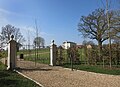
 The White House Knightsbridge Lane Pyrton Oxfordshire England.jpg 6,240 × 4,160; 38.44 MB
-
 B4009 enters Watlington - geograph.org.uk - 2894358.jpg 3,648 × 2,736; 2 MB
-
 Clare Court, a bit of a difference - geograph.org.uk - 4864982.jpg 1,600 × 1,166; 651 KB
-
 Clarehill Farm - geograph.org.uk - 2893616.jpg 3,648 × 2,736; 1.46 MB
-
 Former Plough pub, Pyrton.jpg 3,456 × 2,304; 1.68 MB
-
 Half a Wall in the Brook - geograph.org.uk - 2341846.jpg 3,264 × 2,448; 1.56 MB
-
 Home Farm, Pyrton - geograph.org.uk - 2162836.jpg 3,444 × 2,548; 1.91 MB
-
 Joggers by Pyrton Field Farm - geograph.org.uk - 4198060.jpg 3,592 × 2,544; 1.48 MB
-
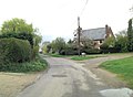 Knightsbridge Lane passes New Farm - geograph.org.uk - 2893604.jpg 3,415 × 2,509; 1.45 MB
-

-
 Leaving Watlington on B4009 - geograph.org.uk - 3924003.jpg 640 × 339; 69 KB
-
 Logs at Pyrton Hill House - geograph.org.uk - 1435265.jpg 640 × 427; 256 KB
-
 Mast at Christmas Common - geograph.org.uk - 3492046.jpg 1,852 × 2,476; 1.15 MB
-
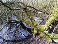 Overgrown Pond by Stoney Lane - geograph.org.uk - 2437323.jpg 3,264 × 2,448; 2.2 MB
-
 Oxfordshire Way near Pyrton - geograph.org.uk - 123133.jpg 640 × 473; 209 KB
-
 Pyrton Lane beside the entrance to the church - geograph.org.uk - 2893597.jpg 3,594 × 2,599; 2.37 MB
-
 Rectory, Pyrton - geograph.org.uk - 1860326.jpg 640 × 427; 92 KB
-
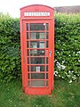 Red K6 Telephone Box at Pyrton - geograph.org.uk - 5462097.jpg 1,944 × 2,592; 950 KB
-
 Ridgeway Path near Watlington - geograph.org.uk - 3558908.jpg 4,000 × 3,000; 2.81 MB
-

-
 Road Closed (23670163833).jpg 1,280 × 720; 263 KB
-
 Squelch Hazard - geograph.org.uk - 2785658.jpg 1,600 × 995; 570 KB
-
 Straw Bales at New Farm - geograph.org.uk - 4456644.jpg 3,848 × 2,912; 2.67 MB
-
 Thatched Cottage, Pyrton - geograph.org.uk - 123136.jpg 640 × 480; 128 KB
-
 The Oxfordshire Way - geograph.org.uk - 1173003.jpg 640 × 480; 80 KB
-
 The Ridgeway - geograph.org.uk - 1172981.jpg 640 × 480; 89 KB
-
 The Ridgeway near Watlington - geograph.org.uk - 4481119.jpg 4,000 × 3,000; 2.5 MB
-
 Tree-lined track to North Farm near Clare - geograph.org.uk - 3905542.jpg 4,320 × 3,240; 7.25 MB
-
 Two Tanks near Golder Manor - geograph.org.uk - 2057370.jpg 3,208 × 2,352; 2.42 MB
-
 Un-named lane east of Clare - geograph.org.uk - 2894001.jpg 3,300 × 2,342; 1.56 MB


_and_Pyrton_Hill_(right)_-_geograph.org.uk_-_3301100.jpg)
.jpg)


