Category:Qatra
Jump to navigation
Jump to search
Palestinian village, depopulated in 1948 | |||||
| Upload media | |||||
| Instance of | |||||
|---|---|---|---|---|---|
| Location | Ramle Subdistrict | ||||
 | |||||
Media in category "Qatra"
The following 7 files are in this category, out of 7 total.
-
 Historical map series for the area of Qatra (1870s).jpg 738 × 742; 167 KB
-
 Gedera & Qatra 1930.jpg 4,515 × 3,913; 4.53 MB
-

-
 Historical map series for the area of Qatra (1940s).jpg 738 × 742; 245 KB
-
 Bashshit 1945.jpg 552 × 283; 95 KB
-
 Kidron Aerial View.jpg 4,497 × 2,990; 7.46 MB
-
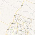 Historical map series for the area of Qatra (modern).jpg 738 × 742; 141 KB
.jpg)

.jpg)
.jpg)


.jpg)