Category:Rijksweg 36
Jump to navigation
Jump to search
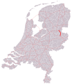
Dutch highway, managed by Rijkswaterstaat between the N48 near Arriërveld and the A36 near Wierden, and hereby is an important north south connection route in the province of Overijssel   | |||||
| Upload media | |||||
| Instance of |
| ||||
|---|---|---|---|---|---|
| Location | Overijssel, Netherlands | ||||
| Transport network |
| ||||
| Maintained by | |||||
| Inception |
| ||||
| Length |
| ||||
| Terminus |
| ||||
| |||||
Nederlands: Rijksweg 36
Media in category "Rijksweg 36"
The following 2 files are in this category, out of 2 total.
-
 NL-N36.png 557 × 288; 11 KB
-
 Rijksweg36.svg 801 × 924; 959 KB