Category:Ripponden
Jump to navigation
Jump to search
village and civil parish in Calderdale, West Yorkshire, UK  | |||||
| Upload media | |||||
| Instance of | |||||
|---|---|---|---|---|---|
| Location | Calderdale, West Yorkshire, Yorkshire and the Humber, England | ||||
 | |||||
English: Ripponden is a village and civil parish within the Metropolitan Borough of Calderdale, in West Yorkshire, England, near Halifax, on the River Ryburn. It is the site of a Roman settlement, and there is a Roman Road over nearby Blackstone Edge, a rocky ridge of millstone grit. It has a population of 6,412.
Nederlands: Ripponden is een dorp (village) en civil parish in het bestuurlijke gebied Calderdale, in het Engelse graafschap West Yorkshire. De civil parish telt
Subcategories
This category has the following 28 subcategories, out of 28 total.
B
- Baitings Reservoir (41 F)
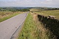
- Blackstone Edge Road (35 F)
- Booth Wood (10 F)
- Booth Wood Reservoir (42 F)
F
- Firth House Mills (9 F)
G
- Great Manshead Hill (18 F)
- Green Withens Reservoir (56 F)
H
- Hey Wood (2 F)
O
- Oxygrains packhorse bridge (10 F)
P
R
- Ringstone Edge Reservoir (13 F)
- Ripponden Old Bridge (12 F)
- Ripponden War Memorial (4 F)
- Ryburn Reservoir (22 F)
S
- Soyland Town (25 F)
- Spa Clough Reservoir (5 F)
- Stott Hall Farm (13 F)
W
- White Holme Reservoir (29 F)
Media in category "Ripponden"
The following 200 files are in this category, out of 1,853 total.
(previous page) (next page)-
 'Erics' Bench and the Calder Valley - geograph.org.uk - 498548.jpg 640 × 480; 93 KB
-
 'Keep Out' sign on public footpath - geograph.org.uk - 3454144.jpg 2,000 × 1,500; 830 KB
-

-
 11 miles to Halifax - geograph.org.uk - 4388029.jpg 640 × 480; 69 KB
-
 89738 - Flickr - rustyruth1959.jpg 3,484 × 2,576; 2.44 MB
-
 A bend in Oldham Road (A672) - geograph.org.uk - 4389109.jpg 640 × 480; 87 KB
-
 A branch of Ripponden FP75 - geograph.org.uk - 4305434.jpg 2,000 × 1,500; 1.5 MB
-
 A branch of Ripponden FP75 alongside a field boundary ditch - geograph.org.uk - 4305444.jpg 2,000 × 1,500; 1.35 MB
-
 A Forth Bridge job on Ripponden FP83, Barkisland - geograph.org.uk - 4741790.jpg 2,048 × 1,536; 1.35 MB
-
 A lay-by on the Rochdale Road - geograph.org.uk - 2773520.jpg 800 × 600; 93 KB
-
-
 A little valley on the hillside below Blackwood Edge Road - geograph.org.uk - 3989963.jpg 2,000 × 1,500; 1.67 MB
-
 A path off the Saddleworth Road - geograph.org.uk - 2774119.jpg 800 × 600; 114 KB
-
 A profusion of cotton grass - geograph.org.uk - 2442495.jpg 2,592 × 1,944; 1.6 MB
-
 A sharp bend on Ryburn Lane, Ripponden FP59 - geograph.org.uk - 3914871.jpg 2,000 × 1,500; 1.75 MB
-
 A summit of Rishworth Moor, 434m - geograph.org.uk - 3988514.jpg 2,000 × 1,500; 1.29 MB
-
 A track onto Rishworth Moor - geograph.org.uk - 1160903.jpg 640 × 480; 91 KB
-
 A view of Ripponden - geograph.org.uk - 518911.jpg 359 × 640; 79 KB
-
 A58 at Kebroyd Lane - geograph.org.uk - 5823328.jpg 1,024 × 746; 132 KB
-
 A58 Halifax Road - geograph.org.uk - 5823323.jpg 1,024 × 742; 174 KB
-
 A58, heading towards Ripponden - geograph.org.uk - 2442208.jpg 2,592 × 1,944; 1.38 MB
-
 A58, Rochdale Road - geograph.org.uk - 4927925.jpg 640 × 480; 450 KB
-
 A672 at Rishworth village boundary - geograph.org.uk - 5216805.jpg 640 × 513; 55 KB
-
 A672 descending from the M62 - geograph.org.uk - 5213684.jpg 640 × 513; 47 KB
-
 A672 heading north east - geograph.org.uk - 4388982.jpg 640 × 480; 63 KB
-

-

-
 A672 next to the Booth Wood Reservoir - geograph.org.uk - 5737657.jpg 800 × 501; 126 KB
-
 A672 Oldham Road - geograph.org.uk - 2049012.jpg 800 × 600; 222 KB
-
 A672 Oldham Road at Booth Wood Reservoir - geograph.org.uk - 2489157.jpg 2,592 × 1,944; 2.63 MB
-
 A672 Oldham Road at Little London - geograph.org.uk - 5216803.jpg 640 × 512; 38 KB
-
 A672 Oldham Road at Spinners Hollow - geograph.org.uk - 5216812.jpg 640 × 512; 42 KB
-
 A672 Oldham Road at Turner Wood - geograph.org.uk - 5216807.jpg 640 × 513; 77 KB
-
 A672 Oldham Road with M62 beyond - geograph.org.uk - 5213685.jpg 640 × 513; 37 KB
-
 A672 Oldham Road, Rishworth - geograph.org.uk - 5216810.jpg 640 × 480; 40 KB
-
 A672 Rockingstone - geograph.org.uk - 713673.jpg 640 × 427; 50 KB
-
 A672 towards Ripponden - geograph.org.uk - 4388987.jpg 640 × 480; 66 KB
-
 A672 towards Ripponden - geograph.org.uk - 4388995.jpg 640 × 480; 61 KB
-
 A672 towards Ripponden - geograph.org.uk - 4389072.jpg 640 × 480; 66 KB
-
 A672 towards Ripponden - geograph.org.uk - 4389096.jpg 640 × 480; 71 KB
-
 A672, Moss Moor - geograph.org.uk - 2454398.jpg 1,280 × 853; 619 KB
-
 Access stile opposite the driveway to Green Holes - geograph.org.uk - 3453955.jpg 2,000 × 1,500; 1.05 MB
-

-
 Across Boothwood Reservoir to the M62 - geograph.org.uk - 4377756.jpg 3,347 × 2,012; 2.89 MB
-

-

-
 Agricultural buildings, Soyland - geograph.org.uk - 2885261.jpg 2,000 × 1,414; 699 KB
-
 Alien Invader - geograph.org.uk - 518943.jpg 640 × 359; 128 KB
-
 Along the dam at Green Withens Reservoir - geograph.org.uk - 3814401.jpg 1,600 × 1,200; 381 KB
-
 An early stage of stream formation - geograph.org.uk - 3991089.jpg 2,000 × 1,500; 1.74 MB
-
 An inconvenient 'stile' on Ripponden FP2 - geograph.org.uk - 4812075.jpg 2,048 × 1,536; 955 KB
-
 An older house in Rishworth - geograph.org.uk - 2100906.jpg 3,695 × 2,471; 3.27 MB
-
 Animal Shelter, Ash Hall Lane - geograph.org.uk - 1803595.jpg 2,560 × 1,920; 963 KB
-
 Animal track across rough pasture - geograph.org.uk - 4866948.jpg 2,048 × 1,536; 1.14 MB
-

-
 Approaching Blackwood Farm - geograph.org.uk - 4334819.jpg 1,600 × 1,200; 568 KB
-
 Approaching Ryburn Reservoir - geograph.org.uk - 4927956.jpg 640 × 480; 421 KB
-
 Approaching Soyland Town on Ripponden Footpath 24 - geograph.org.uk - 2885378.jpg 2,000 × 1,500; 821 KB
-
 Aqueduct carrying stream over mill goit - geograph.org.uk - 3888471.jpg 2,000 × 1,500; 1.63 MB
-
 Aqueduct over mill goit - geograph.org.uk - 3888467.jpg 2,000 × 1,500; 1.75 MB
-
 At the Way Stone - geograph.org.uk - 4519739.jpg 1,600 × 1,200; 461 KB
-
 At the Way Stone - geograph.org.uk - 6184382.jpg 1,024 × 768; 147 KB
-
 Awkward gate on Ripponden Footpath 9 - geograph.org.uk - 3461800.jpg 2,000 × 1,500; 1.02 MB
-
 B6113 at Lightcliffe Royd Farm - geograph.org.uk - 5216833.jpg 640 × 512; 52 KB
-
 B6113 Elland Road - geograph.org.uk - 5216815.jpg 640 × 480; 81 KB
-
 B6113 Greetland Road, Barkisland - geograph.org.uk - 5216823.jpg 640 × 513; 49 KB
-
 B6114 at Ringstone Edge Reservoir - geograph.org.uk - 5503850.jpg 640 × 481; 33 KB
-

-

-
 B6114 Saddleworth Road at Krumlin - geograph.org.uk - 5503848.jpg 640 × 480; 34 KB
-
 Back Fold, Ripponden - geograph.org.uk - 1805225.jpg 640 × 480; 138 KB
-
 Back Fold, Ripponden - geograph.org.uk - 1805227.jpg 640 × 480; 172 KB
-
 Back Halifax Road, Ripponden - geograph.org.uk - 3847712.jpg 2,000 × 1,619; 831 KB
-
 Back Lane, Ripponden - geograph.org.uk - 1805221.jpg 480 × 640; 85 KB
-
 Back Lane, Ripponden - geograph.org.uk - 2774014.jpg 800 × 600; 141 KB
-
 Back Lane, Soyland - geograph.org.uk - 4929234.jpg 2,048 × 1,536; 1.19 MB
-
 Back Lane, Soyland - geograph.org.uk - 4929290.jpg 2,048 × 1,536; 1.16 MB
-
 Back Lane, Soyland - geograph.org.uk - 4958693.jpg 2,048 × 1,536; 1.12 MB
-
 Back Lane, Soyland - This is Ripponden Bridleway 21. - geograph.org.uk - 2885210.jpg 2,000 × 1,500; 816 KB
-
 Back Lane, Soyland. - geograph.org.uk - 2885277.jpg 2,000 × 1,500; 948 KB
-
 Back o'th'Height (3714190254).jpg 1,449 × 2,174; 2.86 MB
-

-
 Bad stile on Ripponden FP78, Barkisland - geograph.org.uk - 4741805.jpg 2,048 × 1,536; 795 KB
-
 Baitings and Baitings Pasture - geograph.org.uk - 52840.jpg 640 × 480; 94 KB
-
 Baitings Dam - geograph.org.uk - 4927146.jpg 640 × 481; 454 KB
-
 Baitings Gate Pasture - geograph.org.uk - 6193299.jpg 5,746 × 3,830; 2.67 MB
-
 Baitings Pasture - geograph.org.uk - 5454385.jpg 5,184 × 3,888; 6.23 MB
-
 Baitings Reservoir - geograph.org.uk - 4927193.jpg 640 × 480; 342 KB
-
 Baitings Reservoir - geograph.org.uk - 6192633.jpg 5,710 × 3,806; 4.51 MB
-
 Baitings Reservoir - geograph.org.uk - 6192657.jpg 6,000 × 4,000; 5.05 MB
-

-
 Baitings Reservoir Dam - geograph.org.uk - 4927205.jpg 640 × 481; 414 KB
-
 Baitings Reservoir, North Shore - geograph.org.uk - 4927192.jpg 640 × 481; 395 KB
-
 Baitings Reservoir, Shore Path - geograph.org.uk - 4927234.jpg 640 × 483; 518 KB
-
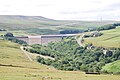
 Baitings Viaduct - geograph.org.uk - 2129269.jpg 1,408 × 982; 728 KB
-
 Baitings Viaduct - geograph.org.uk - 4036661.jpg 5,472 × 3,648; 2.77 MB
-
 Baitings Viaduct - geograph.org.uk - 4039911.jpg 5,472 × 3,648; 1.64 MB
-
 Bank Bridge - geograph.org.uk - 2914658.jpg 2,000 × 1,500; 1.31 MB
-

-
 Bar Lane, Ripponden (1967308051).jpg 2,208 × 1,972; 2.15 MB
-
 Barkisland Cricket Club - geograph.org.uk - 1127015.jpg 640 × 480; 66 KB
-

-

-
 Barkisland Hall - geograph.org.uk - 5974934.jpg 5,184 × 3,888; 5.22 MB
-
 Barkisland Mill - geograph.org.uk - 4005872.jpg 1,600 × 1,200; 511 KB
-

-
 Barkisland Post Office - geograph.org.uk - 4389168.jpg 640 × 480; 53 KB
-
 Barn (11196876036).jpg 2,761 × 2,761; 7.92 MB
-
 Base of Boothwood dam, overflowing - geograph.org.uk - 1160207.jpg 480 × 640; 154 KB
-
 Beech trees near Ripponden FP62 - geograph.org.uk - 3888194.jpg 2,000 × 1,500; 1.7 MB
-

-
 Beside the M62 slip road - geograph.org.uk - 4388026.jpg 640 × 480; 89 KB
-
 Between Manshead End and Great Manshead Hill - geograph.org.uk - 3814501.jpg 1,600 × 1,200; 487 KB
-
 Bins on Back Lane, Soyland - geograph.org.uk - 4958705.jpg 2,048 × 1,536; 1.08 MB
-
 Birks Lane - geograph.org.uk - 1129388.jpg 640 × 480; 129 KB
-
 Birks Lane - geograph.org.uk - 3913943.jpg 2,000 × 1,500; 1.41 MB
-
 Birks Lane, Ripponden - geograph.org.uk - 3847706.jpg 2,000 × 1,500; 1.65 MB
-
 Birks Lane, Ripponden - geograph.org.uk - 3847708.jpg 2,000 × 1,458; 1.4 MB
-
 Birks lane, Ripponden FP58 - geograph.org.uk - 3913956.jpg 2,000 × 1,500; 1.52 MB
-
 Birks Lane, Ripponden FP58, at Birks Farm - geograph.org.uk - 3913951.jpg 2,000 × 1,500; 1.66 MB
-
 Birks lane, Ripponden FP59 - geograph.org.uk - 3913964.jpg 2,000 × 1,500; 1.6 MB
-
 Birks Lane, Ripponden FP59 - geograph.org.uk - 3913973.jpg 2,000 × 1,500; 1.42 MB
-
 Birks Lane. Ripponden FP59 - geograph.org.uk - 3913892.jpg 2,000 × 1,500; 1.39 MB
-
 Birls Lane, Ripponden FP59 - geograph.org.uk - 3913982.jpg 2,000 × 1,500; 1.81 MB
-
 Black Brook - Beestonley Lane - geograph.org.uk - 4280483.jpg 640 × 480; 92 KB
-
 Black Brook - Beestonley Lane - geograph.org.uk - 4280485.jpg 640 × 480; 146 KB
-
 Black Brook - geograph.org.uk - 1387462.jpg 640 × 480; 129 KB
-
 Black Castle Drain - geograph.org.uk - 4920522.jpg 1,600 × 1,200; 514 KB
-
 Black Castle Drain - geograph.org.uk - 4920530.jpg 1,600 × 1,200; 590 KB
-
 Black cattle on the moor - geograph.org.uk - 3990257.jpg 2,000 × 1,500; 1.05 MB
-
 Blackburn House - Stainland Road - geograph.org.uk - 4280497.jpg 640 × 480; 127 KB
-
 Blackhouse Reservoir - geograph.org.uk - 1166084.jpg 640 × 480; 80 KB
-
 Blackshaw Clough - geograph.org.uk - 3456965.jpg 2,000 × 1,500; 1.43 MB
-
 Blackshaw Clough - geograph.org.uk - 38147.jpg 640 × 427; 113 KB
-
 Blackshaw Clough Bridge - geograph.org.uk - 2021657.jpg 640 × 480; 116 KB
-
 Blackshaw Clough Road, Soyland - geograph.org.uk - 978423.jpg 640 × 480; 120 KB
-
 Blackstone Edge Road - geograph.org.uk - 2046825.jpg 800 × 600; 256 KB
-
 Blackstone Edge Road - geograph.org.uk - 2047092.jpg 800 × 600; 210 KB
-
 Blackstone Edge Road - geograph.org.uk - 4949777.jpg 5,184 × 2,981; 1.92 MB
-
 Blackstone Edge Road, Blackstone Edge - geograph.org.uk - 42964.jpg 640 × 427; 78 KB
-
 Blackwood Edge Road (Path) - geograph.org.uk - 3217587.jpg 800 × 600; 122 KB
-
 Blackwood Edge Road - geograph.org.uk - 2100828.jpg 3,872 × 2,592; 3.47 MB
-
 Blackwood Edge Road at Joiner Stones Hill - geograph.org.uk - 4334918.jpg 1,600 × 1,200; 622 KB
-
 Blackwood Edge Road, Rishworth - geograph.org.uk - 937685.jpg 640 × 457; 75 KB
-
 Blackwood Farm - geograph.org.uk - 2100844.jpg 3,872 × 2,592; 3.75 MB
-
 Blockage on Ripponden Footpath 20 - geograph.org.uk - 3457269.jpg 2,000 × 1,500; 1.21 MB
-
 Blue Ball Road (14765735866).jpg 4,608 × 2,592; 6.17 MB
-
 Blue Ball Road - geograph.org.uk - 38154.jpg 640 × 427; 92 KB
-

-
 Boan Cottage - geograph.org.uk - 5072395.jpg 5,184 × 3,888; 4.75 MB
-
 Boan Cottage Farm - geograph.org.uk - 4334839.jpg 1,600 × 1,200; 655 KB
-

-
 Bog trotting on Rishworth Moor - geograph.org.uk - 4807841.jpg 3,300 × 2,343; 6.97 MB
-
 Booth Dean - geograph.org.uk - 388794.jpg 640 × 478; 114 KB
-
 Booth Dean Clough - geograph.org.uk - 3938653.jpg 2,000 × 1,500; 1.51 MB
-
 Booth Dean Clough - geograph.org.uk - 3939827.jpg 2,000 × 1,500; 1.73 MB
-
 Booth Dean Clough upstream of the weir - geograph.org.uk - 3938655.jpg 2,000 × 1,500; 1.65 MB
-
 Booth Dean Reservoirs - geograph.org.uk - 4114214.jpg 3,801 × 2,290; 1.7 MB
-
 Booth Dean Upper Reservoir Weir - geograph.org.uk - 1941217.jpg 640 × 480; 104 KB
-
 Booth Moor - geograph.org.uk - 2100834.jpg 3,872 × 2,592; 2.7 MB
-
 Booth Moor above Boan Cottage - geograph.org.uk - 4334843.jpg 1,600 × 1,200; 505 KB
-
 Booth Wood - geograph.org.uk - 4377759.jpg 2,365 × 1,884; 2.35 MB
-
 Booth Wood along the Oldham Road - geograph.org.uk - 5737643.jpg 800 × 569; 125 KB
-
 Booth Wood Dam - geograph.org.uk - 2099815.jpg 3,872 × 2,592; 3.99 MB
-
 Booth Wood Dam - geograph.org.uk - 5286488.jpg 5,184 × 3,888; 4.22 MB
-
 Booth Wood hamlet , Rishworth - geograph.org.uk - 938471.jpg 640 × 480; 84 KB
-
 Booth Wood Reservoir - geograph.org.uk - 2048925.jpg 800 × 600; 307 KB
-
 Booth Wood Reservoir - geograph.org.uk - 2489102.jpg 2,592 × 1,944; 2.02 MB
-
 Booth Wood Reservoir - geograph.org.uk - 2489132.jpg 2,592 × 1,944; 1.57 MB
-
 Booth Wood Reservoir - geograph.org.uk - 4388997.jpg 640 × 480; 85 KB
-
 Booth Wood Reservoir - geograph.org.uk - 4597336.jpg 1,024 × 768; 185 KB
-
 Booth Wood Reservoir - geograph.org.uk - 5737795.jpg 800 × 512; 96 KB
-
 Booth Wood Reservoir Car Park - geograph.org.uk - 2489146.jpg 2,081 × 1,562; 851 KB
-
 Booth Wood Reservoir from M62 - geograph.org.uk - 3422307.jpg 640 × 393; 55 KB
-

-
 Boothwood.JPG 3,872 × 2,592; 3.96 MB
-
 Boundary stone (^4) on Blackstone Edge Moor - geograph.org.uk - 5581178.jpg 2,000 × 1,500; 875 KB
-
 Boundary stone - geograph.org.uk - 1974113.jpg 1,681 × 2,000; 1.09 MB
-
 Boundary Stone and Sykes Gate - geograph.org.uk - 1974107.jpg 2,000 × 1,500; 920 KB
-
 Boundary stone and wall - geograph.org.uk - 1974119.jpg 2,000 × 1,500; 1.19 MB
-

-
 Boundary stone on Ripponden Bridleway 8 - geograph.org.uk - 3461702.jpg 2,000 × 1,498; 882 KB
-
 Boundary Stone ^1 - geograph.org.uk - 2354860.jpg 2,000 × 1,500; 1.29 MB
-
 Boundary Stone ^2 - geograph.org.uk - 2354898.jpg 2,000 × 1,462; 1.19 MB
-
 Boundary Stone ^3 - geograph.org.uk - 2354916.jpg 2,000 × 1,500; 1.2 MB
-
 Boundary stone, Blackstone Edge Road - geograph.org.uk - 2358791.jpg 1,463 × 2,000; 935 KB
-
 Boundary stone, Blackstone Edge Road - geograph.org.uk - 2358810.jpg 1,524 × 2,000; 764 KB
-
 Boundary stone, Sowerby and Soyland, near Rake head - geograph.org.uk - 5007698.jpg 1,488 × 2,000; 1.08 MB
-
 Boundary stone, Soyland - geograph.org.uk - 1976817.jpg 1,500 × 2,000; 1.24 MB
-
 Boundary stone, Soyland and Sowerby - geograph.org.uk - 5007687.jpg 1,500 × 2,000; 1.1 MB
-
 Boundary Stone, Sykes Gate - geograph.org.uk - 1974103.jpg 1,790 × 2,000; 1.37 MB
-
 Bowers Lane at Shaw Head - geograph.org.uk - 3408249.jpg 2,000 × 1,463; 985 KB
-
 Bowers Lane south of Shaw Head - geograph.org.uk - 3408256.jpg 2,000 × 1,500; 1.36 MB
-
 Bowers Mill - geograph.org.uk - 4005880.jpg 1,600 × 1,200; 412 KB
-
 Bowers Mills - geograph.org.uk - 5299768.jpg 5,184 × 3,888; 3.82 MB
-
 Bowers Mills, Barkisland - geograph.org.uk - 65523.jpg 640 × 480; 148 KB
-
 Brambly patch on Ripponden FP64 - geograph.org.uk - 3915713.jpg 2,000 × 1,500; 1.79 MB
-
 Branch Road at a branch of Ripponden FP75 - geograph.org.uk - 4305419.jpg 2,000 × 1,500; 1.04 MB
-
 Bridge - geograph.org.uk - 63090.jpg 640 × 480; 103 KB
-
 Bridge carrying footpath over catchwater drain - geograph.org.uk - 3988451.jpg 2,000 × 1,481; 1.3 MB


_-_geograph.org.uk_-_4389109.jpg)


_-_geograph.org.uk_-_859816.jpg)


_-_geograph.org.uk_-_1935585.jpg)


.jpg)


_-_geograph.org.uk_-_4925724.jpg)


.jpg)


.jpg)


_-_geograph.org.uk_-_3217587.jpg)


.jpg)


_on_Blackstone_Edge_Moor_-_geograph.org.uk_-_5581178.jpg)


