Category:River Derwent, Derbyshire
둘러보기로 이동
검색으로 이동
principal river of Derbyshire, England  Derwent blízko Hathersage | |||||
| 미디어 올리기 | |||||
| 다음 종류에 속함 | |||||
|---|---|---|---|---|---|
| 위치 | 더비셔주, 이스트미들랜즈, 잉글랜드 | ||||
| 길이 |
| ||||
| 수원지 |
| ||||
| 물길이 끝나는 곳 | |||||
| 여기로 흐르는 지류들 |
| ||||
| 하천 중간에 있는 호수들 | |||||
| 다음과 다름 | |||||
 | |||||
하위 분류
다음은 이 분류에 속하는 하위 분류 10개 가운데 10개입니다.
"River Derwent, Derbyshire" 분류에 속하는 미디어
다음은 이 분류에 속하는 파일 409개 가운데 200개입니다.
(이전 페이지) (다음 페이지)-
 A bench by the River Derwent - geograph.org.uk - 1058298.jpg 640 × 426; 114 KB
-
 A Bend in the Derwent - geograph.org.uk - 1098010.jpg 426 × 640; 81 KB
-
 A Bend in the River - geograph.org.uk - 1024269.jpg 640 × 426; 227 KB
-
 A Boggy Derwent - geograph.org.uk - 1491005.jpg 427 × 640; 119 KB
-
 A Burnished Derwent - geograph.org.uk - 1024247.jpg 640 × 426; 212 KB
-
 A Classic River Cliff - geograph.org.uk - 932397.jpg 640 × 426; 254 KB
-
 A Cold River - geograph.org.uk - 1107109.jpg 426 × 640; 143 KB
-
 A Fisherman on The Derwent - geograph.org.uk - 1013010.jpg 640 × 426; 236 KB
-
 A Glimpse of The Derwent - geograph.org.uk - 1354752.jpg 427 × 640; 165 KB
-
 A Misty Derwent - geograph.org.uk - 1107118.jpg 640 × 426; 188 KB
-
 A Pipe Bridge Over the Derwent - geograph.org.uk - 1058351.jpg 640 × 426; 102 KB
-
 A Precarious Fishing Peg - geograph.org.uk - 1107128.jpg 640 × 426; 277 KB
-
 A Prospect of the City of Derby.jpg 600 × 304; 67 KB
-
 A Rain Splattered Derwent - geograph.org.uk - 1350580.jpg 427 × 640; 150 KB
-
 A River "U" turn - geograph.org.uk - 1025175.jpg 640 × 366; 170 KB
-
 A River with Wooded Banks - geograph.org.uk - 1354815.jpg 427 × 640; 162 KB
-
 A Swollen Derwent Passes Under The Bridge - geograph.org.uk - 994005.jpg 640 × 427; 326 KB
-
 A Swollen River Derwent from Allestree Ford Bridge - geograph.org.uk - 3852978.jpg 4,000 × 3,000; 2.29 MB
-
 A Tree Reflected in the Derwent - geograph.org.uk - 1511956.jpg 427 × 640; 144 KB
-
 A Tributary joins the Derwent - geograph.org.uk - 1058272.jpg 640 × 426; 184 KB
-
 A Typical Dark Peak Stream - geograph.org.uk - 1494210.jpg 480 × 640; 132 KB
-
 A Young Meander - geograph.org.uk - 1490612.jpg 640 × 427; 147 KB
-
 A Young River Derwent - geograph.org.uk - 1494208.jpg 427 × 640; 150 KB
-
 A6 and River Derwent, Derwent Valley (geograph 6126350).jpg 1,024 × 768; 209 KB
-
 Abstracted Water Returns - geograph.org.uk - 1103010.jpg 426 × 640; 97 KB
-

-
 An Ash reaches over the Derwent - geograph.org.uk - 1013064.jpg 640 × 426; 270 KB
-
 Aqueduct over the Derwent - geograph.org.uk - 1003250.jpg 640 × 427; 288 KB
-
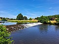
 Bamford Mill and Weir - geograph.org.uk - 1748488.jpg 3,296 × 2,472; 1.09 MB
-
 Barbrook Reservoir - geograph.org.uk - 1585458.jpg 640 × 480; 72 KB
-
 Barn and tree near the River Derwent - geograph.org.uk - 1598095.jpg 640 × 480; 121 KB
-
 Barn in the Derwent Valley - geograph.org.uk - 571840.jpg 640 × 428; 90 KB
-
 St. Anne's Church, Baslow - panoramio (1).jpg 3,072 × 2,304; 2.09 MB
-
 St. Anne's Church, Baslow - panoramio (3).jpg 3,072 × 2,304; 2.07 MB
-
 Below the weir - geograph.org.uk - 557900.jpg 640 × 430; 179 KB
-
 Belper - EMT 156405 off the Matlock branch.JPG 1,366 × 910; 747 KB
-
 Belper Bridge.jpg 1,280 × 891; 412 KB
-
 Bend in the river - geograph.org.uk - 1052468.jpg 640 × 480; 83 KB
-
 Bend in the river Derwent - geograph.org.uk - 557485.jpg 514 × 640; 237 KB
-
 Blink and you will miss it - geograph.org.uk - 1025193.jpg 640 × 426; 358 KB
-
 Boggy Ground in Swains Greave - geograph.org.uk - 1495447.jpg 427 × 640; 121 KB
-
 Borrowash Black Weir - geograph.org.uk - 3413077.jpg 4,000 × 3,000; 2.88 MB
-
 Borrowash Bridge - geograph.org.uk - 1629276.jpg 640 × 480; 290 KB
-
 Breached Weir on the Derwent - geograph.org.uk - 1183304.jpg 640 × 427; 164 KB
-
 Bridge connecting Thulston, Elvaston and Borrowash.jpg 640 × 480; 53 KB
-
 Bridge Foot Farmhouse, Froggatt.jpg 640 × 427; 130 KB
-

-
 Bridge over the River Derwent - geograph.org.uk - 1336199.jpg 640 × 480; 106 KB
-
 Bubnell - geograph.org.uk - 136734.jpg 640 × 481; 134 KB
-
 Bubnell - River Derwent and Weir - geograph.org.uk - 977661.jpg 640 × 480; 113 KB
-
 By the River (2240174579).jpg 3,456 × 2,304; 3.29 MB
-
 Calm Derwent - geograph.org.uk - 1103034.jpg 640 × 385; 78 KB
-
 Calver - The Goit - geograph.org.uk - 556685.jpg 430 × 640; 192 KB
-
 Canal, railway and sewage works - geograph.org.uk - 1749013.jpg 640 × 480; 84 KB
-
 Canoeing on the Derwent - geograph.org.uk - 455559.jpg 640 × 323; 185 KB
-
 Carsington Reservoir mist road.jpg 1,944 × 2,592; 1.9 MB
-
 Chatsworth House 01.jpg 640 × 369; 86 KB
-
 Chatsworth House 02.jpg 640 × 480; 59 KB
-
 Chatsworth Park - geograph.org.uk - 1567793.jpg 640 × 428; 116 KB
-
 Chatsworth Park - geograph.org.uk - 432126.jpg 2,048 × 1,360; 1.2 MB
-
 Chatsworth Park - Weir - geograph.org.uk - 766870.jpg 640 × 480; 95 KB
-
 ChatsworthWeir.jpg 4,624 × 3,468; 5.15 MB
-
 Cold Side above River Derwent - geograph.org.uk - 1410260.jpg 640 × 480; 145 KB
-

-
 Cromford Canal - geograph.org.uk - 1522415.jpg 462 × 640; 190 KB
-
 Cromford Canal above Sawmills - geograph.org.uk - 1231225.jpg 640 × 479; 151 KB
-
 Cromford Canal above Sawmills - geograph.org.uk - 1231226.jpg 640 × 479; 172 KB
-
-
 Daisies by The Derwent - geograph.org.uk - 1354877.jpg 427 × 640; 176 KB
-
 Dale Road Matlock - geograph.org.uk - 1119867.jpg 640 × 371; 62 KB
-
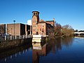
 Darley Abbey Mills and River Derwent, Derby (4428929185).jpg 1,600 × 1,200; 425 KB
-
 Darley Park, towards the Cricket Club - geograph.org.uk - 417083.jpg 640 × 480; 116 KB
-
 Deans Field - geograph.org.uk - 417050.jpg 640 × 480; 148 KB
-

-
 Derby - Lombes Mill - geograph.org.uk - 3242829.jpg 4,032 × 3,024; 2.6 MB
-

-
 Derby Council house and River derwent.jpg 640 × 480; 79 KB
-
 Derby Council house and River derwent2.jpg 640 × 480; 66 KB
-
 Derwent Confluence - geograph.org.uk - 298050.jpg 640 × 480; 181 KB
-
 Derwent dam.jpg 1,671 × 1,198; 431 KB
-
 Derwent in spate - geograph.org.uk - 1421134.jpg 480 × 640; 102 KB
-
 Derwent island dam(large).jpg 1,200 × 867; 202 KB
-
 Derwent Mouth - geograph.org.uk - 1541622.jpg 640 × 428; 81 KB
-
 Derwent Mouth.jpg 640 × 339; 115 KB
-
 Derwent Reflections - geograph.org.uk - 932400.jpg 640 × 426; 175 KB
-
 Derwent River near Allestree - geograph.org.uk - 214318.jpg 640 × 480; 129 KB
-
 Derwent River weir, Derbyshire - geograph.org.uk - 941733.jpg 640 × 480; 78 KB
-
 Derwent Riverbank - geograph.org.uk - 932357.jpg 640 × 420; 216 KB
-
 Derwent Valley Heritage Way - geograph.org.uk - 1248100.jpg 640 × 480; 168 KB
-
 Derwent Valley upstream of Whatstandwell.jpg 2,160 × 1,440; 553 KB
-
 Down the path to Stoke Ford - geograph.org.uk - 1596151.jpg 640 × 480; 125 KB
-
 DVH Way - geograph.org.uk - 1319728.jpg 640 × 480; 113 KB
-
 EarthStopperOnTheBanksofTheDerwentByJosephWright.jpg 527 × 432; 105 KB
-
 Empty river - geograph.org.uk - 718965.jpg 640 × 480; 112 KB
-

-
 Fallen trees in the River Derwent - geograph.org.uk - 584516.jpg 640 × 482; 119 KB
-
 Felled tree trunk - geograph.org.uk - 1166572.jpg 640 × 480; 116 KB
-
 Fishing Platform - geograph.org.uk - 1107116.jpg 640 × 427; 81 KB
-

-
 Fishing The Derwent - geograph.org.uk - 1012992.jpg 426 × 640; 332 KB
-
 Flooded gardens - geograph.org.uk - 666563.jpg 640 × 480; 106 KB
-
 Flow Monitoring Weir - geograph.org.uk - 1183482.jpg 640 × 427; 101 KB
-
 Flow Monitoring Weir - geograph.org.uk - 1183487.jpg 640 × 427; 108 KB
-

-
 Footpath along the river Derwent - geograph.org.uk - 557919.jpg 430 × 640; 219 KB
-
 Footpath beside the River Derwent - geograph.org.uk - 1248058.jpg 640 × 480; 192 KB
-
 Footpath beside the River Derwent - geograph.org.uk - 1248080.jpg 640 × 480; 179 KB
-
 Footpath beside the River Derwent - geograph.org.uk - 1248111.jpg 640 × 480; 148 KB
-

-
 Footpath from Bramley Lane - geograph.org.uk - 1587974.jpg 640 × 480; 68 KB
-
 Footpath signpost on Whitewells Road - geograph.org.uk - 1738668.jpg 640 × 480; 55 KB
-
 Footpath view of the River Derwent - geograph.org.uk - 1128944.jpg 640 × 480; 136 KB
-
 Former gateway by the Derwent - geograph.org.uk - 1729987.jpg 3,872 × 2,592; 5.89 MB
-
 Froggatt Bridge and the River Derwent - geograph.org.uk - 742963.jpg 640 × 480; 111 KB
-
 Froggatt Edge - Footpath - geograph.org.uk - 752747.jpg 640 × 480; 117 KB
-
 Hanging Gates - geograph.org.uk - 462167.jpg 640 × 480; 98 KB
-
 Hathersage - track beside River Derwent - geograph.org.uk - 628981.jpg 409 × 640; 104 KB
-
 Himalayan Balsam by the River Derwent - geograph.org.uk - 1017812.jpg 640 × 427; 136 KB
-
 Island in Derwent Reservoir, with Howden Dam behind.jpg 639 × 414; 205 KB
-
 Lady Clough Looking South - geograph.org.uk - 1469414.jpg 640 × 427; 87 KB
-
 Leadmill Bridge, view of the river Derwent.jpg 3,000 × 2,250; 1.51 MB
-
 Life Buoy or Swing^ - geograph.org.uk - 1183258.jpg 640 × 427; 168 KB
-
 Lombe's Mill print Darley-Factory p105.png 592 × 392; 269 KB
-
 Looking Downstream Along the Derwent - geograph.org.uk - 1494202.jpg 640 × 427; 92 KB
-
 Low flying balloon. (29515196767).jpg 4,016 × 6,016; 14.34 MB
-
 Masson Mill, Matlock Bath - geograph.org.uk - 1170173.jpg 640 × 421; 78 KB
-
 Matlock - panoramio (1).jpg 2,048 × 1,360; 1.8 MB
-
 Matlock - panoramio (2).jpg 2,048 × 1,360; 2.44 MB
-

-
 Matlock Bath - geograph.org.uk - 462759.jpg 640 × 480; 88 KB
-
 Matlock Bath - geograph.org.uk - 499990.jpg 640 × 480; 127 KB
-
 Matlock Bath - geograph.org.uk - 557380.jpg 640 × 480; 97 KB
-

-
 Matlock Bath from White Tor - geograph.org.uk - 426713.jpg 480 × 640; 67 KB
-
-

-
 Milford Mill weir - geograph.org.uk - 293788.jpg 640 × 480; 130 KB
-
 Moonlit Derwent - geograph.org.uk - 958506.jpg 640 × 427; 136 KB
-
 Moorland Meander - geograph.org.uk - 1491027.jpg 640 × 427; 147 KB
-
 Nether Hall across the Derwent - geograph.org.uk - 1730029.jpg 3,872 × 2,592; 5.2 MB
-

-
 Old Sluice - geograph.org.uk - 1058558.jpg 640 × 426; 179 KB
-
 On reflection - geograph.org.uk - 700881.jpg 640 × 480; 97 KB
-
 Ordnance Survey One-Inch Sheet 111 Buxton & Matlock, Published 1962.jpg 8,251 × 9,878; 12.75 MB
-
 Ordnance Survey One-Inch Sheet 111 Buxton and Matlock, Published 1947.jpg 8,165 × 9,535; 12.98 MB
-
 Ordnance Survey One-Inch Sheet 45 Buxton & Matlock, Published 1923.jpg 11,908 × 8,825; 13.36 MB
-
 Ordnance Survey Sheet SK 19 (43 19) Derwent Dale, Published 1946.jpg 7,135 × 8,740; 5.9 MB
-
 Ordnance Survey Sheet SK 25 Wirksworth, Published 1951.jpg 7,418 × 7,884; 5.78 MB
-
 Ordnance Survey Sheet SK 35 Crich, Published 1951.jpg 7,398 × 7,864; 5.78 MB
-
 Over the Derwent to Swains Head - geograph.org.uk - 1490950.jpg 427 × 640; 78 KB
-
 Path beside the River Derwent - geograph.org.uk - 718967.jpg 640 × 480; 101 KB
-
 Pipeline over The Derwent - geograph.org.uk - 1012984.jpg 640 × 426; 279 KB
-
 Private Fishing on the River Derwent - geograph.org.uk - 1598103.jpg 640 × 480; 107 KB
-
 Railway Bridge over the River Derwent, Derby.jpg 3,000 × 2,000; 5.14 MB
-
 Railway Viaduct over River Derwent - geograph.org.uk - 244881.jpg 640 × 431; 289 KB
-

-
 Reflections - geograph.org.uk - 777276.jpg 640 × 480; 103 KB
-
 Reflections in the Derwent at Chatsworth - geograph.org.uk - 1430825.jpg 640 × 480; 102 KB
-

-
 River Cliff - geograph.org.uk - 1015733.jpg 426 × 640; 211 KB
-
 River Derwent , Matlock Bath - geograph.org.uk - 2327997.jpg 1,280 × 856; 219 KB
-
 River Derwent - Cromford 29-04-06.jpg 600 × 480; 145 KB
-
 River Derwent - from Bridge - geograph.org.uk - 3132187.jpg 640 × 480; 98 KB
-
 River Derwent - from Bridge - geograph.org.uk - 3132190.jpg 640 × 480; 106 KB
-
 River Derwent - geograph.org.uk - 1023425.jpg 640 × 480; 127 KB
-
 River Derwent - geograph.org.uk - 1244002.jpg 640 × 480; 104 KB
-
 River Derwent - geograph.org.uk - 1246655.jpg 640 × 480; 151 KB
-
 River Derwent - geograph.org.uk - 1567806.jpg 640 × 428; 85 KB
-
 River Derwent - geograph.org.uk - 1567816.jpg 640 × 428; 68 KB
-
 River Derwent - geograph.org.uk - 1860329.jpg 640 × 480; 212 KB
-
 River Derwent - geograph.org.uk - 1860459.jpg 543 × 640; 123 KB
-
 River Derwent - geograph.org.uk - 1860464.jpg 640 × 480; 171 KB
-
 River Derwent - geograph.org.uk - 1860643.jpg 640 × 480; 161 KB
-
 River Derwent - geograph.org.uk - 1860652.jpg 640 × 480; 139 KB
-
 River Derwent - geograph.org.uk - 1860796.jpg 640 × 480; 203 KB
-
 River Derwent - geograph.org.uk - 1860829.jpg 640 × 480; 165 KB
-
 River Derwent - geograph.org.uk - 1860839.jpg 640 × 476; 142 KB
-
 River Derwent - geograph.org.uk - 1860939.jpg 640 × 480; 125 KB
-
 River Derwent - geograph.org.uk - 1860956.jpg 640 × 480; 142 KB
-
 River Derwent - geograph.org.uk - 2326391.jpg 800 × 531; 115 KB
-
 River Derwent - geograph.org.uk - 298031.jpg 640 × 480; 182 KB
-
 River Derwent - geograph.org.uk - 298038.jpg 640 × 480; 172 KB
-
 River Derwent - geograph.org.uk - 298046.jpg 640 × 480; 190 KB
-
 River Derwent - geograph.org.uk - 3601055.jpg 3,648 × 2,736; 3.42 MB
-
 River Derwent - geograph.org.uk - 384750.jpg 427 × 640; 317 KB
-
 River Derwent - geograph.org.uk - 406912.jpg 640 × 456; 68 KB
-
 River Derwent - geograph.org.uk - 462453.jpg 640 × 480; 75 KB
-
 River Derwent - geograph.org.uk - 5669267.jpg 1,024 × 615; 153 KB
-
 River Derwent - geograph.org.uk - 718963.jpg 640 × 480; 109 KB
-
 River Derwent - geograph.org.uk - 783882.jpg 640 × 480; 106 KB
-
-
 River Derwent above the weir - geograph.org.uk - 557940.jpg 430 × 640; 219 KB
-
 River Derwent and Chatsworth Park - geograph.org.uk - 650373.jpg 640 × 480; 56 KB
-
 River Derwent and Hall Leys Park - geograph.org.uk - 1288111.jpg 640 × 405; 94 KB
-
 River Derwent and houses - geograph.org.uk - 775568.jpg 640 × 480; 142 KB
-

-
 River Derwent at Ambaston - geograph.org.uk - 117837.jpg 640 × 480; 93 KB
-
 River Derwent at Calver - geograph.org.uk - 1428106.jpg 640 × 480; 107 KB
-
 River Derwent at Chatsworth - geograph.org.uk - 1353820.jpg 640 × 480; 85 KB
-
 River Derwent at Chatsworth - geograph.org.uk - 648267.jpg 480 × 640; 108 KB


.jpg)


.jpg)
.jpg)


.jpg)


.jpg)


.jpg)


.jpg)

.jpg)
.jpg)


_Derwent_Dale,_Published_1946.jpg)


