Category:Rivers of Dorset
둘러보기로 이동
검색으로 이동
Ceremonial counties of England: Bedfordshire · Berkshire · Buckinghamshire · Cambridgeshire · Cheshire · Cornwall · Cumbria · Derbyshire · Devon · Dorset · Durham · East Riding of Yorkshire · East Sussex · Essex · Gloucestershire · Greater London · Greater Manchester · Hampshire · Herefordshire · Hertfordshire · Isle of Wight · Kent · Lancashire · Leicestershire · Lincolnshire · Merseyside · Norfolk · North Yorkshire · Northamptonshire · Northumberland · Nottinghamshire · Oxfordshire · Rutland · Shropshire · Somerset · South Yorkshire · Staffordshire · Suffolk · Surrey · Tyne and Wear · Warwickshire · West Midlands · West Sussex · West Yorkshire · Wiltshire · Worcestershire
City-counties: Bristol ·
Former historic counties: Huntingdonshire ·
Other former counties:
City-counties: Bristol ·
Former historic counties: Huntingdonshire ·
Other former counties:
위키미디어 분류 | |||||
| 미디어 올리기 | |||||
| 다음 종류에 속함 | |||||
|---|---|---|---|---|---|
| 다음 주제들의 교집합 분류임 | |||||
| 도싯주 | |||||
잉글랜드의 주 .jpg)   | |||||
| 목소리 오디오 | |||||
| 다음 종류에 속함 |
| ||||
| 위치 | |||||
| 정부 소재지 | |||||
| 인구수 |
| ||||
| 면적 |
| ||||
| 다음과 다름 | |||||
| 다음과 같다고 여겨짐 | 도싯 (잉글랜드의 옛 주, 잉글랜드의 전례주, 1844년) | ||||
| 공식 웹사이트 | |||||
 | |||||
하위 분류
다음은 이 분류에 속하는 하위 분류 27개 가운데 27개입니다.
A
- River Asker (8 F)
B
- Blackwater River (River Axe) (5 F)
- River Bride, Dorset (13 F)
C
- River Cale (8 F)
- River Cerne (17 F)
- River Char (10 F)
- Corfe River (7 F)
- River Crane, Dorset (24 F)
D
F
J
- River Jordan, Dorset (4 F)
L
M
- Moors River, Dorset (8 F)
P
- River Piddle (31 F)
R
- River Mude (5 F)
S
- Shreen Water (11 F)
T
- River Tarrant (13 F)
W
- River Wey, Dorset (16 F)
- River Winniford (8 F)
- River Winterborne (23 F)
Y
"Rivers of Dorset" 분류에 속하는 미디어
다음은 이 분류에 속하는 파일 22개 가운데 22개입니다.
-
 Brook-Side Pool - geograph.org.uk - 1473998.jpg 640 × 427; 139 KB
-
 Leaden Stour, Hurn - geograph.org.uk - 1061204.jpg 640 × 480; 87 KB
-
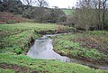 Mangerton River, Dorset - geograph-2889907.jpg 640 × 430; 106 KB
-
 Mangerton River, Dorset - geograph-2893139.jpg 640 × 430; 125 KB
-
 Martinstown, South Winterborne - geograph.org.uk - 1529488.jpg 640 × 480; 113 KB
-
 River Hooke, Kingcombe Meadows, DWT geograph - 3515602.jpg 4,608 × 3,456; 5.87 MB
-
 River Lodden from Lawn Bridge - geograph.org.uk - 413060.jpg 480 × 640; 106 KB
-
 River Lym - geograph.org.uk - 712744.jpg 640 × 480; 279 KB
-
 River Mude, Mudeford - geograph.org.uk - 2027725.jpg 800 × 600; 439 KB
-
 River Simene near Symondsbury.jpg 640 × 430; 113 KB
-
 River Synderford map.png 1,361 × 1,508; 171 KB
-
 Sherford River, Organford.jpg 640 × 480; 193 KB
-
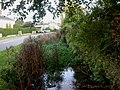
 Shreen Water - geograph.org.uk - 413174.jpg 640 × 480; 113 KB
-
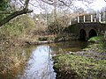
 The hump-back bridge - geograph.org.uk - 1560357.jpg 640 × 427; 127 KB
-
 The South Winterbourne - geograph.org.uk - 1235534.jpg 640 × 480; 114 KB
-
 The Winterbourne at Martinstown - geograph.org.uk - 1022497.jpg 640 × 420; 112 KB
-

-

-
 Winterbourne Stream - geograph.org.uk - 967357.jpg 640 × 480; 126 KB
-
 River with Alders near Sherford Bridge - geograph.org.uk - 30992.jpg 640 × 430; 83 KB
-
 Sydling Water and bank with fields beyond - geograph.org.uk - 311212.jpg 640 × 480; 145 KB
-
 The river from West Bay harbour bridge - geograph.org.uk - 25107.jpg 640 × 480; 326 KB


