Category:Rivers of North Yorkshire
둘러보기로 이동
검색으로 이동
Ceremonial counties of England: Bedfordshire · Berkshire · Buckinghamshire · Cambridgeshire · Cheshire · Cornwall · Cumbria · Derbyshire · Devon · Dorset · Durham · East Riding of Yorkshire · East Sussex · Essex · Gloucestershire · Greater London · Greater Manchester · Hampshire · Herefordshire · Hertfordshire · Isle of Wight · Kent · Lancashire · Leicestershire · Lincolnshire · Merseyside · Norfolk · North Yorkshire · Northamptonshire · Northumberland · Nottinghamshire · Oxfordshire · Rutland · Shropshire · Somerset · South Yorkshire · Staffordshire · Suffolk · Surrey · Tyne and Wear · Warwickshire · West Midlands · West Sussex · West Yorkshire · Wiltshire · Worcestershire
City-counties: Bristol ·
Former historic counties: Huntingdonshire ·
Other former counties:
City-counties: Bristol ·
Former historic counties: Huntingdonshire ·
Other former counties:
위키미디어 분류 | |||||
| 미디어 올리기 | |||||
| 다음 종류에 속함 | |||||
|---|---|---|---|---|---|
| 다음 주제들의 교집합 분류임 | |||||
| 노스요크셔주 | |||||
ceremonial county in England, UK      | |||||
| 다음 종류에 속함 |
| ||||
| 다음의 한 부분임 | |||||
| 위치 | |||||
| 정부 소재지 | |||||
| 만들어진 날 |
| ||||
| 인구 수 |
| ||||
| 면적 |
| ||||
| 다음과 다름 | |||||
| 공식 웹사이트 | |||||
 | |||||
하위 분류
다음은 이 분류에 속하는 하위 분류 39개 가운데 39개입니다.
A
- Arnsgill (3 F)
B
C
- River Cover (24 F)
D
E
F
G
- River Greta (Lune) (14 F)
K
- River Kyle (1 F)
L
- River Laver (23 F)
M
N
O
R
- River Riccal (2 F)
S
- Sea Cut (Scalby Beck) (12 F)
- River Skirfare (9 F)
T
- River Tame, North Yorkshire (5 F)
U
W
- River Wiske (11 F)
"Rivers of North Yorkshire" 분류에 속하는 미디어
다음은 이 분류에 속하는 파일 33개 가운데 33개입니다.
-

-
 Great Ghyll, West Scrafton - geograph.org.uk - 1077753.jpg 600 × 450; 122 KB
-
 Hartforth Bridge over Hartforth Beck.jpg 4,000 × 1,800; 5.08 MB
-
 Ingleton 04.JPG 1,438 × 1,308; 602 KB
-
 Ingleton 05.JPG 1,729 × 1,517; 916 KB
-
 Ingleton 07.JPG 1,912 × 1,800; 1.17 MB
-
 Pole and rock strata, Otterburn - geograph.org.uk - 619110.jpg 640 × 480; 147 KB
-
 River bed, Otterburn - geograph.org.uk - 619115.jpg 640 × 480; 175 KB
-
 River Burn, near Masham.jpg 3,600 × 2,400; 11.29 MB
-
 Sandsend Bridge (41676376530).jpg 4,032 × 3,024; 1.24 MB
-
 Scalby Beck (geograph 2696982).jpg 1,024 × 768; 284 KB
-
 Staithes MMB 32 Roxby Beck.jpg 4,188 × 2,652; 4.87 MB
-
 The footbridge near Levisham Church - geograph.org.uk - 1376519.jpg 640 × 427; 500 KB
-
 The stream near Levisham Church - geograph.org.uk - 1376515.jpg 427 × 640; 442 KB
-
 Tramway Bridge over Old Beck - geograph.org.uk - 734487.jpg 640 × 572; 154 KB
-
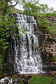 Waterfall - geograph.org.uk - 502517.jpg 427 × 640; 172 KB
-
 Waterfall in Fosse Gill - geograph.org.uk - 564042.jpg 640 × 480; 127 KB
-
 Weir on Skelton Beck - geograph.org.uk - 250956.jpg 640 × 480; 92 KB
-
 White Beck - geograph.org.uk - 1451892.jpg 640 × 480; 148 KB
-
 White Beck - geograph.org.uk - 1451900.jpg 480 × 640; 136 KB
-
 Brow Gill - geograph.org.uk - 157874.jpg 480 × 640; 183 KB
-
 Canoests at Aldwark - geograph.org.uk - 186517.jpg 640 × 479; 44 KB
-
 Debris catchment on river - geograph.org.uk - 1421583.jpg 640 × 425; 312 KB
-
 Gill Beck, Glusburn - geograph.org.uk - 724718.jpg 640 × 480; 94 KB
-
 Gill Beck, Glusburn - geograph.org.uk - 724725.jpg 640 × 480; 82 KB
-
 Little Dale beck - geograph.org.uk - 640281.jpg 640 × 480; 39 KB
-
 Nettle Dale - geograph.org.uk - 117346.jpg 640 × 480; 93 KB
-
 River near Healey - geograph.org.uk - 101527.jpg 640 × 480; 151 KB
-
 Riverbank pair say hello - geograph.org.uk - 478490.jpg 640 × 427; 59 KB
-
 Riverside trees at Tanfield - geograph.org.uk - 567200.jpg 480 × 640; 156 KB
-
 The Cray Gill - geograph.org.uk - 487611.jpg 640 × 480; 153 KB
-
 The River Tutt - geograph.org.uk - 679626.jpg 480 × 640; 98 KB
-
 Wall meets River in Cragdale. - geograph.org.uk - 295231.jpg 480 × 640; 266 KB


.jpg)
.jpg)


