Category:Rock formations
Jump to navigation
Jump to search
stone mass | |||||
| Upload media | |||||
| Subclass of |
| ||||
|---|---|---|---|---|---|
| Made from material | |||||
| Different from | |||||
| |||||
English: Rock formations − rock in geologic formations and erosion landforms – in geography, natural rock landforms.
See also: List of rock formations.
See also: List of rock formations.
Subcategories
This category has the following 108 subcategories, out of 108 total.
!
- Quality images of rock formations (235 F)
+
- Photo challenge/2016 - June - Rock formations (4 P, 160 F)
A
- Amphitheatres (landforms) (5 F)
B
C
- Cemented screes (1 F)
D
E
- Entablatures (geology) (7 F)
F
G
H
I
K
- Karst windows (7 F)
L
M
N
O
P
R
- Rock islands in lakes (11 F)
S
- Scallops (geology) (6 F)
- Scree runs (6 F)
- Shut-ins (4 F)
- Solution tubes (1 F)
- Split rocks (6 F)
T
U
- Under-cliffs (9 F)
V
W
Z
Media in category "Rock formations"
The following 200 files are in this category, out of 387 total.
(previous page) (next page)-
0038. Pared de Cerro Caleta (12932210404).jpg 768 × 1,024; 285 KB
-
13fc81b35db9bb7c5489c2a70923423b (1).jpg 560 × 709; 69 KB
-
A rock shrine - Flickr - odako1.jpg 1,285 × 1,920; 1.34 MB
-
A rock, the ocean and the boys, who never stood still.jpg 2,098 × 2,289; 2.39 MB
-
Affioramento di travertino 01.jpg 737 × 1,600; 240 KB
-
Affioramento di travertino 02.jpg 1,600 × 1,097; 399 KB
-
At Signal Hill - St. John's, Newfoundland 2019-08-08 (01).jpg 5,828 × 3,278; 14.77 MB
-
At Signal Hill - St. John's, Newfoundland 2019-08-08 (02).jpg 6,015 × 1,203; 6.6 MB
-
Atlantide.JPG 2,896 × 1,944; 2.73 MB
-
Northern end of the Dead Sea (NYPL b10607452-80355).tiff 4,237 × 5,083; 61.62 MB
-
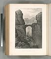
Entrance to the valley of Petra (NYPL b10607452-80703).jpg 3,810 × 4,400; 3.8 MB
-
Entrance to the valley of Petra (NYPL b10607452-80703).tiff 3,810 × 4,400; 47.97 MB
-
Rock foms in Wâdy Hamr. This valley leads up to Jebel et Tih (NYPL b10607452-80733).jpg 3,915 × 4,498; 3.19 MB
-
Rock foms in Wâdy Hamr. This valley leads up to Jebel et Tih (NYPL b10607452-80733).tiff 3,915 × 4,498; 50.39 MB
-
An eroded sentinel - survivor of the primeval flood (NYPL b11707184-G88F105 003F).tif 3,072 × 1,752; 15.4 MB
-
The Castles, from head of Hance's Cove (NYPL b11707184-G88F105 005F).tif 3,072 × 1,739; 15.29 MB
-
The Guardian Giants - work of erosion on the Rim (NYPL b11707184-G88F105 016F).tiff 3,072 × 1,782; 15.66 MB
-
Rocks in the Canon de Chelle-950 ft (NYPL b11707237-G89F271 014ZF).tif 3,072 × 2,062; 18.13 MB
-
Funnel Rock (NYPL b11707258-G89F316 004F).tiff 3,072 × 1,757; 15.44 MB
-
South Farallon Island, The Low Arch (NYPL b11707258-G89F316 006F).tiff 3,072 × 1,743; 15.32 MB
-
Rocks at mouth of Ten Mile River, Mendocino Co (NYPL b11707260-G89F318 008F).tiff 3,072 × 1,720; 15.12 MB
-
Cajun Valley. View of horse riders (NYPL b11707275-G89F333 001ZF).tiff 3,072 × 2,155; 18.94 MB
-
Cave Rock, Eastern shore of Lake Tahoe (NYPL b11707277-G89F340 005F).tiff 3,072 × 1,782; 15.66 MB
-
Cave Rock, Lake Tahoe. Teams on the road (NYPL b11707277-G89F340 006F).tiff 3,072 × 1,720; 15.12 MB
-
Cave Rock, Eastern shore of Lake Tahoe, from the North (NYPL b11707277-G89F340 007F).tiff 3,072 × 1,784; 15.68 MB
-
Cave Rock, Lake Tahoe (NYPL b11707277-G89F340 022F).tiff 3,072 × 1,771; 15.57 MB
-
Shakespeare Rock, Glenbrook, Lake Tahoe (NYPL b11707277-G89F340 023F).tiff 3,072 × 1,712; 15.05 MB
-
Natural Bridge near Back Horn Spring (NYPL b11707308-G89F384 076ZF).tiff 3,072 × 1,938; 17.04 MB
-
Rooster Rock, Columbia River (NYPL b11707314-1529724) (cropped).jpg 1,458 × 2,186; 3.44 MB
-
Rooster Rock, Columbia River (NYPL b11707314-1529724).jpg 6,438 × 3,088; 22.04 MB
-
Rooster Rock, Columbia River (NYPL b11707314-1529724).tiff 7,230 × 5,428; 112.28 MB
-
Profile Rock, Fall River (NYPL b11707416-G90F014 022F).tiff 3,072 × 1,680; 14.77 MB
-
Sphynx Rock (NYPL b11707416-G90F014 072ZF).tiff 3,072 × 1,950; 17.14 MB
-
Sphynx Rock (NYPL b11707416-G90F014 073ZF).tiff 3,072 × 1,891; 16.62 MB
-
Views of rock formations in Deer Park near La Salle (NYPL b11707439-G90F162 013F).tiff 3,072 × 1,733; 15.23 MB
-
Views of rock formations in Deer Park near La Salle (NYPL b11707439-G90F162 014F).tiff 3,072 × 1,752; 15.4 MB
-
Views of rock formations in Deer Park near La Salle (NYPL b11707439-G90F162 015F).tiff 3,072 × 1,675; 14.72 MB
-
The Altar (NYPL b11707475-G90F197 010F).tiff 3,072 × 1,738; 15.28 MB
-
Wandering Willie's Spring (NYPL b11707475-G90F197 013F).tiff 3,072 × 1,717; 15.09 MB
-
Leaning Towers, Perry Park (NYPL b11707497-G90F022 002F).tiff 3,072 × 1,847; 16.24 MB
-
Arch at Deer Creek (NYPL b11707497-G90F022 013ZF).tiff 3,072 × 1,941; 17.06 MB
-
Arch at Deer Creek, Platte Canon (Canyon) (NYPL b11707497-G90F022 014ZF).tiff 3,072 × 1,910; 16.79 MB
-
View of two women at the Rocking Stone (NYPL b11707504-G90F226 008F).tiff 3,072 × 1,667; 14.65 MB
-
Pulpit Rock, Nahant (NYPL b11707525-G90F250 008F).tiff 3,072 × 1,695; 14.9 MB
-
Mother Grundy (NYPL b11707543-G90F028 027ZF).tiff 3,072 × 1,912; 16.81 MB
-
Mother Grundy (NYPL b11707543-G90F028 052ZF).tiff 3,072 × 1,925; 16.92 MB
-
The Elephant (NYPL b11707577-G90F034 009ZF).tiff 3,072 × 1,976; 17.37 MB
-
The mountain demon, Manitou Park (NYPL b11707581-G90F036 021ZF).tiff 3,072 × 1,952; 17.16 MB
-
The Dome (NYPL b11707605-G90F004 015ZF).tiff 3,072 × 1,912; 16.81 MB
-
Mother Murhroom (Mushroom). Garden of the Gods (NYPL b11707606-G90F040 108ZF).tiff 3,072 × 1,893; 16.64 MB
-
Miner's Castle (NYPL b11707609-G90F403 001F).tiff 3,072 × 1,673; 14.71 MB
-
Immortal Volcano, Grand Portal, Pictured Rocks (NYPL b11707609-G90F403 003F).tiff 3,072 × 1,718; 15.1 MB
-
Grand Portal looking out, Pictured Rocks (NYPL b11707609-G90F403 004F).tiff 3,072 × 1,694; 14.89 MB
-
Under the Arch of Chapel Rock (NYPL b11707609-G90F403 005F).tiff 3,072 × 1,774; 15.59 MB
-
Interior view of Grand Portal. Pictured Rocks (NYPL b11707609-G90F403 006F).tiff 3,072 × 1,769; 15.55 MB
-
Chapel, west view. Pictured Rocks (NYPL b11707609-G90F403 007F).tiff 3,072 × 1,695; 14.9 MB
-
Chapel, east view. Pictured Rocks (NYPL b11707609-G90F403 008F).tiff 3,072 × 1,695; 14.9 MB
-
Chapel, interior view. Pictured Rocks (NYPL b11707609-G90F403 009F).tiff 3,072 × 1,683; 14.79 MB
-
East view of Chapel. Pictured Rocks (NYPL b11707609-G90F403 010F).tiff 3,072 × 1,764; 15.51 MB
-
Approach to Devil's Kitchen (NYPL b11707610-G90F409 004ZF).tiff 3,072 × 1,919; 16.87 MB
-
Devil's kitchen (NYPL b11707610-G90F409 020ZF).tiff 3,072 × 2,111; 18.56 MB
-
Fish cave, Marquette (NYPL b11707612-G90F410 010F).tiff 3,072 × 1,671; 14.69 MB
-
Monumental Park (NYPL b11707654-G90F046 002F).tiff 3,072 × 1,730; 15.21 MB
-
Monument Park (NYPL b11707654-G90F046 005F).tiff 3,072 × 1,700; 14.94 MB
-
Monument Park. Phantom rock (NYPL b11707654-G90F046 008F).tiff 3,072 × 1,756; 15.44 MB
-
Monument Park. The Sentinel (NYPL b11707654-G90F046 009F).tiff 3,072 × 1,704; 14.98 MB
-
Mushroom rock. Natural monuments in Monument Park (NYPL b11707654-G90F046 010F).tiff 3,072 × 1,728; 15.19 MB
-
Phanton rock. Natural monuments in Monument Park (NYPL b11707654-G90F046 011F).tiff 3,072 × 1,737; 15.27 MB
-
Monument Point, looking East (NYPL b11707654-G90F046 015ZF).tiff 3,072 × 1,917; 16.85 MB
-
Quaker rocks (NYPL b11707654-G90F046 016ZF).tiff 3,072 × 1,933; 16.99 MB
-
Sandstone rock formations (NYPL b11707654-G90F046 017ZF).tiff 3,072 × 1,926; 16.93 MB
-
Sandstone rock formations (NYPL b11707654-G90F046 018ZF).tiff 3,072 × 1,890; 16.61 MB
-
The Sphynx. (View of rock formations.) (NYPL b11707654-G90F046 020ZF).tiff 3,072 × 1,885; 16.57 MB
-
Austin's Glen (NYPL b11707654-G90F046 027ZF).tiff 3,072 × 1,925; 16.92 MB
-
Citadel tower, Monument valley (NYPL b11707654-G90F046 028ZF).tiff 3,072 × 1,925; 16.92 MB
-
Jelly cakes. Monument valley (NYPL b11707654-G90F046 029ZF).tiff 3,072 × 1,892; 16.63 MB
-
The Utes' Medicinal monument, Monument Park (NYPL b11707654-G90F046 031ZF).tiff 3,072 × 1,908; 16.77 MB
-
The Colonnade, Monument Park (NYPL b11707654-G90F046 032ZF).tiff 3,072 × 1,911; 16.8 MB
-
The Colonnade, Monument Park (NYPL b11707654-G90F046 033ZF).tiff 3,072 × 1,920; 16.88 MB
-
Ute Medicine monument (NYPL b11707654-G90F046 036ZF).tiff 3,072 × 1,927; 16.94 MB
-
The Quakers, Monument Park (NYPL b11707654-G90F046 037ZF).tiff 3,072 × 1,935; 17.01 MB
-
Profile rocks, Pleasant Park (NYPL b11707654-G90F046 038ZF).tiff 3,072 × 1,926; 16.93 MB
-
Anvil rock (NYPL b11707654-G90F046 040ZF).tiff 3,072 × 1,934; 17 MB
-
Vulcan's workshop, Monument Park (NYPL b11707654-G90F046 041ZF).tiff 3,072 × 1,896; 16.67 MB
-
Stone-still, Monument Park (NYPL b11707654-G90F046 042ZF).tiff 3,072 × 1,912; 16.81 MB
-
Pike's Peak from Monument Park (NYPL b11707654-G90F046 043ZF).tiff 3,072 × 1,925; 16.92 MB
-
Pike's Peak from Monument Park (NYPL b11707654-G90F046 044ZF).tiff 3,072 × 1,921; 16.89 MB
-
Vulcan's workshop, Monument Park (NYPL b11707654-G90F046 045ZF).tiff 3,072 × 1,903; 16.73 MB
-
Vulcan's anvil, Monument Park (NYPL b11707654-G90F046 046ZF).tiff 3,072 × 1,930; 16.97 MB
-
The dunces' parliament, Monument Park (NYPL b11707654-G90F046 047ZF).tiff 3,072 × 1,922; 16.89 MB
-
Lot's wife (NYPL b11707654-G90F046 048ZF).tiff 3,072 × 1,925; 16.92 MB
-
"The Dutch wedding." Monument Park (NYPL b11707654-G90F046 049ZF).tiff 3,072 × 1,920; 16.88 MB
-
The Flying Dutchman. Monument Park (NYPL b11707654-G90F046 050ZF).tiff 3,072 × 1,925; 16.92 MB
-
Dutch Wedding rocks, Monument Park, Col (NYPL b11707654-G90F046 051ZF).tiff 3,072 × 1,910; 16.79 MB
-
Vulcan's anvil, Monument Park (NYPL b11707654-G90F046 052ZF).tiff 3,072 × 1,908; 16.77 MB
-
The Cathedral, Hart's Ledge, N. Conway (NYPL b11707660-G90F468 036F).tiff 3,072 × 1,635; 14.37 MB
-
The Cathedral. Hart's Ledge, North Conway, N.H (NYPL b11707660-G90F468 037F).tiff 3,072 × 1,660; 14.59 MB
-
Temple of Isis, Williams Canon (NYPL b11707666-G90F058 026ZF).tiff 3,072 × 1,898; 16.68 MB
-
Profile Rock, east side (NYPL b11707979-G91F125 006F).tiff 2,988 × 1,728; 14.77 MB
-
Pulpit Rock, looking up, White Mountain Notch, N.H (NYPL b11708022-G91F017 214F).tiff 3,072 × 1,656; 14.56 MB
-
Pulpit Rock, lookimg down, White Mountain Notch, N.H (NYPL b11708022-G91F017 216F).tiff 3,072 × 1,629; 14.32 MB
-
Fairy's Arch Way (NYPL b11708086-G91F027 028F).tiff 3,072 × 1,628; 14.31 MB
-
Interior of the Devil's Den, Hart's Ledge, No. Conway, N.H (NYPL b11708087-G91F028 134F).tiff 3,072 × 1,656; 14.56 MB
-
Table Rock, Dixville Notch (NYPL b11708166-G91F038 022F).tiff 3,072 × 1,711; 15.04 MB
-
Table Rock, Dixville Notch (NYPL b11708166-G91F038 023F).tiff 3,072 × 1,729; 15.2 MB
-
Devil's Bean Pot, Purgatory, Mount Vernon, N.H (NYPL b11708172-G91F040 015F).tiff 3,072 × 1,760; 15.47 MB
-
Pulpit Rock, Warwick, N.Y (NYPL b11708218-G91F093 035F).tiff 2,988 × 1,728; 14.77 MB
-
View of sea with rock formation (NYPL b11708946-G92F129 004F).tiff 3,072 × 1,718; 15.1 MB
-
View of men standing on rocks (NYPL b11708946-G92F129 006F).tiff 3,072 × 1,679; 14.76 MB
-
View of rocks, water and trees (NYPL b11708946-G92F129 007F).tiff 3,072 × 1,699; 14.93 MB
-
View of a rocky beach (NYPL b11708946-G92F129 008F).tiff 3,072 × 1,663; 14.62 MB
-
Rock formations (NYPL b11708947-G92F130 011ZF).tiff 3,072 × 1,916; 16.84 MB
-
Rock formation (NYPL b11708947-G92F130 013ZF).tiff 3,072 × 1,915; 16.83 MB
-
Rock formations (NYPL b11708947-G92F130 015ZF).tiff 3,072 × 1,935; 17.01 MB
-
Rock formation (NYPL b11708947-G92F130 023ZF).tiff 3,072 × 1,929; 16.96 MB
-
Femme assise sur un rocher (NYPL b12390850-490670).jpg 9,526 × 8,016; 12.17 MB
-
Femme assise sur un rocher (NYPL b12390850-490670).tiff 9,526 × 8,016; 218.47 MB
-
Bare Rock Trail Surface at Lake Roland.jpg 3,024 × 4,032; 7.49 MB
-
Beachcombers (5910090208).jpg 3,215 × 2,144; 3.59 MB
-
Bella Coola rock formation.jpg 3,888 × 5,184; 6.61 MB
-
Biri Rock Formation of Northern Samar.jpg 3,000 × 2,000; 8.21 MB
-
Bowling Pin (6736258467).jpg 3,072 × 4,608; 6.1 MB
-
Brown Rock Formation Arid Dawn 374762.jpg 6,000 × 4,000; 1.73 MB
-
Burro canyon formation.jpg 4,608 × 3,456; 6.59 MB
-
Bãi đá Cầu Mỵ.jpg 2,048 × 1,152; 671 KB
-
Cantilever stone.jpg 1,024 × 820; 294 KB
-
Cape Foulwind, showing rock formations (3057617032).jpg 3,583 × 2,329; 2.19 MB
-
Caramoan Wall of Rock.jpg 2,448 × 3,264; 3.89 MB
-
Centennial Organ New Cave, Wombeyan (2429900423).jpg 765 × 1,024; 493 KB
-
Cesarskie Skałki Głuszyca.jpg 1,836 × 3,264; 2.41 MB
-
Chatfield Trail Rock Cave.jpg 4,032 × 3,024; 13.67 MB
-
Christmas Tree Pass (5557403113).jpg 2,736 × 3,648; 3.9 MB
-
Cjampanili de Val Montanaie.jpg 3,840 × 2,880; 3.5 MB
-
Close up of the rock turret on Miners Castle. (4322ac41-07fe-48e3-90a2-080bca348632).JPG 5,472 × 3,648; 14.33 MB
-
Coastal rock formation.jpg 1,536 × 2,048; 892 KB
-
Couple d'atlante.JPG 1,944 × 2,896; 2.59 MB
-
Cracked Rock in West Hartford Reservoir, Connecticut (October 2020).jpg 4,032 × 3,024; 6.32 MB
-
Craggy rock face - Flickr - S. Rae.jpg 2,448 × 3,264; 3.08 MB
-
Crystal-shaped rock formation in West Hartford Reservoir, Connecticut (October 2020).jpg 4,032 × 3,024; 7.32 MB
-
Devils Garden.jpg 604 × 402; 51 KB
-
Devils Punchbowl State Natural Area.jpg 4,000 × 2,252; 4.17 MB
-
Dragon Rock in West Hartford Reservoir, Connecticut (October 2020).jpg 3,324 × 2,929; 7.36 MB
-
Dziurawe Oko formacja skalna.jpg 2,736 × 3,648; 6.21 MB
-
Détail couple atlante.JPG 1,944 × 2,896; 2.49 MB
-
Egg Rock, Numinbah Valley, circa 1970 QUT-433.jpg 3,471 × 5,224; 2.95 MB
-
Elephant Rock (48186394557).jpg 768 × 1,024; 209 KB
-
Encumeada, Madeira, PR 1.3 trail along black rock formation.jpg 4,000 × 3,000; 4.33 MB
-
Espinaso Formation.jpg 4,000 × 3,000; 2.9 MB
-
Folded rock, Kali Gandaki valley north of Jomsom (4524206366).jpg 1,600 × 468; 394 KB
-
Formacja skalna kamieniołomu Gębury.jpg 5,120 × 3,840; 4.82 MB
-
Gardien des bois.jpg 1,544 × 2,344; 641 KB
-
Giant's Thumb on the Appalachian Trail near Raccoon Hill, Salisbury, Connecticut.jpg 3,024 × 4,032; 18.71 MB
-
Graduation Cap (6234234743).jpg 1,181 × 900; 948 KB
-
Granite Arch.jpg 4,032 × 2,268; 3.91 MB
-
Great view from davis mountains - panoramio.jpg 1,280 × 960; 644 KB
-
Guerrier atlante.JPG 1,944 × 2,896; 2.54 MB
-
Vues de l'Amérique du Nord (NYPL Hades-118427-54553).tif 8,600 × 2,502; 61.56 MB
-
The mountain spring. Near Cozzen's Dock, West Point (NYPL Hades-1803876-1659413).tiff 7,230 × 5,428; 112.28 MB
-
Bridge and Hudson River near Luzerne (NYPL Hades-1826170-1662528).tiff 7,230 × 5,428; 112.28 MB
-
Extremity of Adley's Falls (NYPL Hades-1826172-1662530).tiff 7,230 × 5,428; 112.28 MB
-
Commencement of the Falls of Canada Creek (NYPL Hades-1826176-1662534).tiff 7,230 × 5,428; 112.28 MB
-
General view of Niagara from the Canadian side (NYPL Hades-1826180-1662538).tiff 7,230 × 5,428; 112.28 MB
-
Deer Creek Falls (NYPL Hades-1826183-1662541).tiff 5,428 × 7,230; 112.28 MB
-
Passaic Falls (NYPL Hades-1826190-1662548).tiff 7,230 × 5,428; 112.28 MB
-
View on the Passaic River (NYPL Hades-1826191-1662549).tiff 7,230 × 5,428; 112.28 MB

