Category:Rudawy Janowickie
Jump to navigation
Jump to search
Deutsch: Der Landeshuter Kamm in Polen ist das östlichste Teilgebirge der Westsudeten und bedeckt eine Fläche von etwa 90 km²
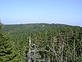
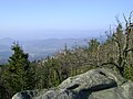
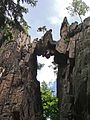
English: The Rudawy Janowickie is a mountain range in Western Sudetes in Poland

mountain range  | |||||
| Upload media | |||||
| Instance of | |||||
|---|---|---|---|---|---|
| Part of | |||||
| Location |
| ||||
| Mountain range | |||||
| Highest point |
| ||||
 | |||||
Subcategories
This category has the following 15 subcategories, out of 15 total.
C
- Czarnowski Potok (2 F)
D
- Dzicza Góra (4 F)
G
J
- Janówka (8 F)
O
- Ostra Mała (6 F)
P
- Palace in Janowice Wielkie (24 F)
- Przełęcz Kowarska (13 F)
R
- Rozdroże pod Bobrzakiem (4 F)
S
- Skalnik (14 F)
- Sokolec Castle (7 F)
- Szwajcarka Hostel (9 F)
W
- Wołek (Rudawy Janowickie) (3 F)
Pages in category "Rudawy Janowickie"
This category contains only the following page.
Media in category "Rudawy Janowickie"
The following 196 files are in this category, out of 196 total.
-
 2016 Droga w Karpnikach.jpg 4,454 × 2,889; 9.74 MB
-
 2016 Krzyżna Góra, Góry Sokole, Sudety 2.jpg 3,436 × 1,991; 4.02 MB
-
 2016 Krzyżna Góra, Góry Sokole, Sudety 3.jpg 4,059 × 2,728; 8.44 MB
-
 Bolzenschloss13.jpg 2,481 × 1,861; 1.82 MB
-
 Bolzenschloss14.jpg 2,560 × 1,920; 2.04 MB
-
 Bóbr w Ciechanowicach sierpień 2010.JPG 2,484 × 3,325; 2.99 MB
-
 Błękitne Jeziorko - Wyrobisko po kopalni pirytów.JPG 3,456 × 2,592; 3.01 MB
-
 Czartówka.JPG 4,928 × 3,264; 4.1 MB
-
 Diabelny Kościół.JPG 4,928 × 3,264; 3.82 MB
-
 Diabelny ołtarz.JPG 4,928 × 3,264; 3.95 MB
-
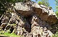
 Diabelskie Skały.JPG 4,928 × 3,264; 4.22 MB
-
 Divisions of the Sudetes.svg 1,576 × 991; 195 KB
-
 Dzicza Góra - szczyt.JPG 3,264 × 4,928; 4.02 MB
-
 Dzicza Góra.jpg 1,522 × 1,032; 501 KB
-
 Enis.JPG 3,264 × 4,928; 3.9 MB
-
 Fajka-.JPG 3,264 × 4,928; 3.98 MB
-
 Fajka-Dziubek.JPG 4,928 × 3,264; 4.07 MB
-
 Fajka.JPG 4,928 × 3,264; 4.01 MB
-
 Gory Olowiane (5).jpg 4,608 × 3,456; 4.56 MB
-
 Gory Olowiane (7).jpg 4,608 × 3,456; 4.3 MB
-
 Gory Olowiane (Widok z Rozanki).jpg 14,896 × 1,696; 5.41 MB
-
 Góry Sokole - 1.jpg 4,874 × 2,849; 9.34 MB
-
 Góry Sokole widok z Janowic Wielkich.jpg 2,304 × 1,728; 785 KB
-
 Góry Sokole widok z Radomierza.jpg 2,304 × 1,728; 756 KB
-
 Głaz pamięci hm. Janusza Boissé.jpg 1,440 × 2,560; 2.4 MB
-
 IR Rudawy.JPG 2,048 × 1,360; 507 KB
-
 Kamieniołom dolomitu.jpg 4,928 × 3,264; 4.07 MB
-
 Kamienna Gora ze stokow Dlugosza. W tle Wielka Kopa. 12.4.1998r.jpg 1,427 × 652; 265 KB
-
 Kamienne hałdy.JPG 4,928 × 3,264; 3.93 MB
-
 Kiklop.JPG 4,928 × 3,264; 3.92 MB
-
 Kolorowe Jeziorka - Błękitne Jeziorko.JPG 2,592 × 3,456; 2.85 MB
-
 Kolorowe jeziorka - purpurowe.jpg 2,816 × 2,112; 2.47 MB
-
 Kolorowe Jeziorka w Rudawach Janowickich - jeziorko niebieskie.jpg 1,018 × 1,812; 534 KB
-
 Kolorowe Jeziorka w Rudawach Janowickich.jpg 1,018 × 1,812; 334 KB
-
 Konie Apokalipsy (Skalnik) (1).jpg 3,968 × 2,976; 4.16 MB
-
 Konie Apokalipsy (Skalnik) (2).jpg 3,968 × 2,976; 7.06 MB
-
 Konie Apokalipsy (Skalnik) (3).jpg 2,976 × 3,968; 3.79 MB
-
 Kozie Górki i Szubienicza (700) z Pisarzowic.jpg 3,837 × 2,877; 2.67 MB
-
 Krzyżna Góra i Sokolik.jpg 4,272 × 2,848; 4.59 MB
-
 Landeshuter-Kamm-Blick1.jpg 2,469 × 1,389; 1.31 MB
-
 Landeshuter-Kamm-Blick2.jpg 2,524 × 1,420; 1.36 MB
-
 Landeshuter-Kamm-FreieKoppe-1.jpg 2,560 × 1,920; 1.68 MB
-
 Landeshuter-Kamm-FreieKoppe-2.jpg 2,560 × 1,920; 1.49 MB
-
 Landeshuter-Kamm-Friesensteine-1.jpg 2,560 × 1,920; 1.44 MB
-
 Landeshuter-Kamm-Friesensteine-2.jpg 3,077 × 2,545; 1.62 MB
-
 Landeshuter-Kamm-Friesensteine-3.jpg 2,560 × 1,920; 1.69 MB
-
 Landeshuter-Kamm-Friesensteine-4.jpg 2,560 × 1,920; 1.3 MB
-
 Landeshuter-Kamm-Friesensteine-5.jpg 2,560 × 1,920; 1.36 MB
-
 Landeshuter-Kamm-Gedenkstein.jpg 2,560 × 1,920; 1.26 MB
-
 Landeshuter-Kamm-Steinbank.jpg 2,448 × 1,836; 1.21 MB
-
 Landeshuter-Kamm-Wegestein-1.jpg 2,560 × 1,920; 1.45 MB
-
 Landeshuter-Kamm-Wegestein-2.jpg 2,560 × 1,920; 1.32 MB
-
 Landeshuter-Kamm-Wegestein-3.jpg 1,961 × 1,471; 1.3 MB
-
 Landeshuter-Kamm-Wegestein-4.jpg 2,141 × 1,606; 1.19 MB
-
 Landeshuter-Kamm-Wegestein-5.jpg 2,560 × 1,920; 1.33 MB
-
 Landeshuter-Kamm-Wegestein-6.jpg 1,769 × 1,327; 1.04 MB
-
 Landeshuter-Kamm-Wegestein-7.jpg 1,920 × 2,560; 1.38 MB
-
 Landeshuter-Kammweg-1.jpg 2,525 × 1,683; 1.26 MB
-
 Landeshuter-Kammweg-2.jpg 2,483 × 1,655; 1.44 MB
-
 Landeshuter-Kammweg-3.jpg 2,560 × 1,707; 1.66 MB
-
 Lew czuwający.JPG 4,928 × 3,264; 3.99 MB
-
 Lwia Góra 718 m npm.JPG 2,592 × 3,456; 3.11 MB
-
 Masyw -Starościńskie Skały.JPG 4,928 × 3,264; 2.89 MB
-
 Masyw Skalnika -Rudawy Janowickie.JPG 4,928 × 3,264; 2.67 MB
-
 Masyw Skalnika.JPG 4,928 × 3,264; 2.9 MB
-
 Masyw Starościnskich Skał.JPG 4,928 × 3,264; 3.88 MB
-
 Masyw Swiniej Góry.JPG 4,928 × 3,264; 4.1 MB
-
 Masyw Świniej Góry.JPG 4,928 × 3,264; 4.03 MB
-
 Miedzianka Janowice way.jpg 3,968 × 2,976; 3.75 MB
-
 Miedzianka krzyz pokutny.jpg 3,968 × 2,976; 2.87 MB
-
 Miedzianka widok na Sokole Gory.jpg 3,968 × 2,976; 3.04 MB
-
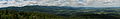
 Mniszkow panorama 01.jpg 6,716 × 1,854; 2.89 MB
-
 Most (rudawy janowickie).jpg 1,200 × 1,600; 1.08 MB
-
 Mrowiec i Mysłakowice.JPG 3,200 × 1,802; 1.94 MB
-
 Mrowiec schody.jpg 3,200 × 2,400; 3 MB
-
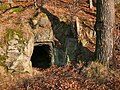 Mrowiec wejście do groty.jpg 3,200 × 2,400; 3.75 MB
-
 Muchomory Lato 2005.jpg 2,048 × 1,360; 874 KB
-
 Mężykowa.JPG 4,928 × 3,264; 4.03 MB
-
 Okolice Miedzianki skaly.jpg 3,968 × 2,976; 3.62 MB
-
 Okolice Miedzianki.jpg 3,968 × 2,976; 1.94 MB
-
 Ostra Mała 935 m npm, maj 2005.JPG 1,600 × 1,200; 492 KB
-
 Ostra Mała mit.3.JPG 3,072 × 2,304; 2.67 MB
-
 Ostra Mała mit.JPG 3,072 × 2,304; 2.73 MB
-
 Ostra Mała mit1.JPG 3,072 × 2,304; 2.45 MB
-
 Ostra Mała mit2.JPG 3,072 × 2,304; 2.64 MB
-
 Ostra Mała mit4.JPG 3,072 × 2,304; 2.77 MB
-
 Ostra Mała mit5.JPG 3,072 × 2,304; 2.78 MB
-
 Panorama Karkonoszy.jpg 20,073 × 3,190; 9.94 MB
-
 Park Miniatur6.jpg 2,048 × 1,536; 873 KB
-
 Pick of Skalnik, Rudawy Janowickie (1).jpg 2,814 × 3,138; 2.26 MB
-
 Pick of Skalnik, Rudawy Janowickie (2).jpg 3,968 × 2,976; 5.61 MB
-
 Pick of Skalnik, Rudawy Janowickie (3).jpg 3,807 × 2,855; 3.41 MB
-
 Pick of Skalnik, Rudawy Janowickie (4).jpg 2,938 × 3,605; 4.99 MB
-
 Pick of Skalnik, Rudawy Janowickie (5).jpg 3,968 × 2,976; 6.09 MB
-
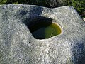
 Piec.jpg 745 × 480; 91 KB
-
 Pieklisko-See-1.jpg 2,552 × 2,376; 1.96 MB
-
 Pieklisko-See-2.jpg 1,920 × 2,560; 1.78 MB
-
 Pieklisko-See-3.jpg 1,920 × 2,560; 1.82 MB
-
 Pieklisko.JPG 3,264 × 4,352; 3.22 MB
-
 Pisarzowice 2020.jpg 3,968 × 2,976; 3.87 MB
-
 Potok Janówka.JPG 2,592 × 3,456; 2.86 MB
-
 Potok-Janówka-1.jpg 1,920 × 2,560; 1.38 MB
-
 Potok-Janówka-2.jpg 1,803 × 2,461; 1.53 MB
-
 Potok-Janówka-3.jpg 2,560 × 1,707; 1.47 MB
-
 Potok-Janówka-4.jpg 2,558 × 1,705; 1.65 MB
-
 Przelecz pod Bobrzakiem (okolica).jpg 3,440 × 2,355; 1.3 MB
-
 Przelecz pod Bobrzakiem.jpg 3,968 × 2,976; 5.36 MB
-
 Przełęcz Strużnicka.JPG 4,928 × 3,264; 3.4 MB
-
 Przybkowice panorama 01.jpg 12,760 × 2,262; 7.84 MB
-
 Rozdroże pod Bielcem.JPG 4,928 × 3,264; 2.9 MB
-
 Rośliny w Czarnowie (1).jpg 2,976 × 3,968; 3.39 MB
-
 Rośliny w Czarnowie (2).jpg 2,976 × 3,968; 3.27 MB
-
 Rośliny w Czarnowie (3).jpg 3,968 × 2,976; 2.01 MB
-
 Rudawy Janowickie - 1.jpg 4,436 × 2,802; 9.08 MB
-
 Rudawy Janowickie - 2.jpg 4,606 × 3,117; 12.43 MB
-
 Rudawy Janowickie - 3.jpg 3,703 × 2,598; 9.11 MB
-
 Rudawy Janowickie - 4.jpg 3,841 × 2,700; 7.58 MB
-
 Rudawy Janowickie in the fog - Flickr - jcubic.jpg 6,064 × 4,040; 1.36 MB
-
 Rudawy Janowickie ~120715-S.jpg 2,560 × 1,920; 1.17 MB
-
 Rudawy Janowickie, Błękitne Jeziorko.jpg 4,874 × 3,219; 13.64 MB
-
 Rudawy Janowickie, błękitne jeziorko1-2.jpg 3,984 × 1,632; 3.21 MB
-
 Rudawy Janowickie, błękitne jeziorko1.jpg 2,304 × 1,728; 1.8 MB
-
 Rudawy Janowickie, błękitne jeziorko2.jpg 2,304 × 1,728; 1.85 MB
-
 Rudawy Janowickie, pirytowa skała przy purpurowym jeziorku.jpg 2,304 × 1,728; 1.9 MB
-
 Rudawy Janowickie, pniak - 17.08.2022.jpg 1,767 × 1,890; 1.59 MB
-
 Rudawy Janowickie, pniak - 2022.08.17.jpg 1,729 × 1,905; 1.94 MB
-
 Rudawy Janowickie, Purpurowe Jeziorko - 1.jpg 4,952 × 3,283; 12.48 MB
-
 Rudawy Janowickie, Purpurowe Jeziorko - 2.jpg 4,778 × 3,159; 11.83 MB
-
 Rudawy Janowickie, Skalny Most.jpg 2,304 × 1,728; 1.86 MB
-
 Rudawy Janowickie, Starościńskie Skały, widok w kierunku Gór Sokolich.jpg 2,304 × 1,728; 1.28 MB
-
 Rudawy Janowickie, Starościńskie Skały.jpg 1,728 × 2,304; 1.95 MB
-
 Rudawy Janowickie, zakaz wjazdu do lasu - 2022.08.17.jpg 2,136 × 3,349; 3.24 MB
-
 Rudawy Janowickie.jpg 1,420 × 963; 282 KB
-
 RudawyJan2.jpg 3,264 × 1,836; 307 KB
-
 RudawyJanowickie-Sokoli KrzyznaGora.jpg 3,888 × 2,592; 2.95 MB
-
 Rumowisko skalne.JPG 4,928 × 3,264; 4.01 MB
-
 Rylec.JPG 4,928 × 3,264; 4.64 MB
-
 Róg 1 Maja i Wojska Polskiego - Janowice Wielkie.jpg 3,064 × 1,929; 695 KB
-
 Rędziny, Rudawy Janowickie 1.jpg 2,304 × 1,728; 1.19 MB
-
 Salamona Skały.JPG 4,928 × 3,264; 3.98 MB
-
 Schronisko Szwajcarka, Rudawy Janowickie.jpg 4,000 × 2,667; 9.76 MB
-
 Skalne Bramy10.JPG 735 × 464; 84 KB
-
 Skalne Bramy3.JPG 737 × 470; 58 KB
-
 Skalnik mit.JPG 3,072 × 2,304; 2.75 MB
-
 Skalnik mit0.jpg 5,635 × 2,209; 3.72 MB
-
 Skalnik mit1.JPG 3,072 × 2,304; 2.83 MB
-
 Skalnik mit2.JPG 3,072 × 2,304; 2.81 MB
-
 Skalnik mit3.JPG 3,072 × 2,304; 2.69 MB
-
 Skalnik miti.JPG 3,072 × 2,304; 2.83 MB
-
 Skalny most.jpg 414 × 649; 71 KB
-
 Skalny Most.JPG 2,592 × 3,456; 2.87 MB
-
 Skaly Fajka.JPG 426 × 648; 72 KB
-
 Skála na úbočí Wolku.jpg 433 × 648; 75 KB
-
 Skály na úbočí Wolku.jpg 733 × 471; 109 KB
-
 Sokolik-FilarZachodni4.JPG 2,048 × 1,536; 396 KB
-
 Sokoliki - Sudety Zima 01.jpg 1,544 × 1,024; 992 KB
-
 Sokoliki - w tle Karkonosze.jpg 2,924 × 1,817; 833 KB
-
 Spojrzenie na Janowice Wielkie.jpg 3,072 × 2,304; 1.57 MB
-
 Starościeńskie Skały.JPG 737 × 501; 69 KB
-
 Starościeńskie Skały1.JPG 421 × 660; 57 KB
-
 Starościnskie Skały (czy kiedyś tu powróci?).JPG 4,928 × 3,264; 4.03 MB
-
 Starościnskie Skały.JPG 4,928 × 3,264; 3.99 MB
-
 Starościńskie Skały 2013.JPG 2,592 × 3,456; 2.95 MB
-
 Strużnica-Starościńskie Skały.JPG 4,928 × 3,264; 3.99 MB
-
 Strużnickie Skały -Skała.JPG 4,928 × 3,264; 4.1 MB
-
 Szczyt góry.JPG 4,928 × 3,264; 4.05 MB
-
 Szlak niebieski Czarnow Skalnik (1).jpg 3,968 × 2,976; 4.61 MB
-
 Szlak niebieski Czarnow Skalnik (2).jpg 3,968 × 2,976; 4.73 MB
-
 Szlak niebieski Czarnow Skalnik (3).jpg 2,976 × 3,968; 7.42 MB
-
 Szubieniczna i Jagoda z Czarnowa.jpg 3,724 × 2,327; 2.2 MB
-
 Szubieniczna z Czarnowa.jpg 3,968 × 2,976; 5.32 MB
-
 Szwajcarka.jpg 1,688 × 1,116; 715 KB
-
 Trzcinsko 01.jpg 3,456 × 2,304; 3.4 MB
-
 Trzcinsko fot mariuszjbie.jpg 649 × 433; 301 KB
-
 Ul. Chłopska - Janowice Wielkie.jpg 3,072 × 1,922; 1.33 MB
-
 Ul. Kopernika w Janowicach Wielkich - lesniczówka.jpg 2,304 × 3,072; 1.64 MB
-
 Ul. Wojska Polskiego - Janowice Wielkie.jpg 3,072 × 2,304; 1.65 MB
-
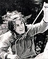 Wanda Rutkiewicz, Góry Sokole, fot. Seweryn Bidziński.jpg 812 × 987; 236 KB
-
 Widok na Kotlinę Jeleniogórską - panoramio.jpg 3,872 × 2,592; 4.92 MB
-
 Widok na Salamona Skały.JPG 4,928 × 3,264; 3.98 MB
-
 Widok z Przełęczy Rędzińskiej na Góry Krucze - panoramio.jpg 3,872 × 2,592; 4.6 MB
-
 Widok z wieży widokowej w Radomierzu.jpg 4,163 × 2,775; 4.27 MB
-
 Wielka Kopa - panoramio.jpg 3,872 × 2,592; 3.58 MB
-
 Wielka Kopa. mit 1.JPG 2,535 × 1,692; 2.92 MB
-
 Wilczysko-.JPG 4,928 × 3,264; 3.92 MB
-
 Wilczysko-drogowskaz.JPG 4,928 × 3,264; 3.94 MB
-
 Wilczysko.JPG 4,928 × 3,264; 4.06 MB
-
 Wilczysko;.JPG 4,928 × 3,264; 4.1 MB
-
 Wilkowyja in Rudawy Janowickie.jpg 3,968 × 2,976; 3.48 MB
-
 Wolek-krzyz na szczycie.jpg 527 × 700; 180 KB
-
 Wspinaczka skałkowa - Sokolik.jpg 3,072 × 2,304; 2.01 MB
-
 Zamek Bolczów w jesiennej szacie.jpg 3,456 × 2,592; 3.3 MB
-
 Zamek Bolczów w Rudawach Janowickich.jpg 3,456 × 2,592; 3.12 MB
-
 Znak GSS w Rudawach Janowickich.jpg 4,320 × 2,880; 2.11 MB
-
 Znak pomiarowy na szczycie Mężykowej.JPG 4,928 × 3,264; 4.07 MB
-
 Świnia Góra.JPG 4,928 × 3,264; 4 MB


.jpg)
.jpg)


_(1).jpg)
_(2).jpg)
_(3).jpg)
_z_Pisarzowic.jpg)


.jpg)


.jpg)
.jpg)
.jpg)
.jpg)
.jpg)


.jpg)


.jpg)
.jpg)
.jpg)


.JPG)


.jpg)
.jpg)
.jpg)


.jpg)