Category:Rugby, Warwickshire
Zur Navigation springen
Zur Suche springen
Ort in in Warwickshire, England, UK  | |||||
| Medium hochladen | |||||
| Ist ein(e) | |||||
|---|---|---|---|---|---|
| Ort | Borough of Rugby, Warwickshire, West Midlands, England | ||||
| Einwohnerzahl |
| ||||
| Verschieden von | |||||
| offizielle Website | |||||
 | |||||
Unterkategorien
Es werden 14 von insgesamt 14 Unterkategorien in dieser Kategorie angezeigt:
In Klammern die Anzahl der enthaltenen Kategorien (K), Seiten (S), Dateien (D)
A
B
C
I
M
- Maps of Rugby, Warwickshire (7 D)
P
R
- Rugby Co-operative Society (6 D)
S
- Signs in Rugby, Warwickshire (5 D)
T
W
Medien in der Kategorie „Rugby, Warwickshire“
Folgende 200 Dateien sind in dieser Kategorie, von 905 insgesamt.
(vorherige Seite) (nächste Seite)-
 "Birth of the Egg Ball" - The Close, Rugby School - geograph.org.uk - 5224023.jpg 4.730 × 3.677; 5,33 MB
-
 "Magic Scissors" barber shop in Rugby - geograph.org.uk - 5224040.jpg 4.802 × 3.665; 3,89 MB
-
 "Raglan Arms" public house, Rugby - geograph.org.uk - 5343338.jpg 1.600 × 1.071; 411 KB
-
 "That's Shoe Business" - geograph.org.uk - 5224043.jpg 3.888 × 5.184; 4,28 MB
-
 "The Squirrel" public house, Rugby - geograph.org.uk - 5340263.jpg 1.600 × 1.230; 492 KB
-

-
 A J Bar and accommodation, Dunchurch Road - geograph.org.uk - 5323963.jpg 3.966 × 3.087; 2,04 MB
-
 A4071 - geograph.org.uk - 2731638.jpg 640 × 370; 43 KB
-
 A426 Leicester Road, Rugby - geograph.org.uk - 5647782.jpg 640 × 428; 87 KB
-
 AA former BTH east gate.jpg 2.048 × 1.536; 768 KB
-
 Allotments on Clifton Road - geograph.org.uk - 1287277.jpg 640 × 427; 133 KB
-
 Apple tree with flock of thrushes - geograph.org.uk - 2208132.jpg 640 × 405; 101 KB
-
 Approaching Ashlawn Road bridge - geograph.org.uk - 5320669.jpg 4.715 × 3.049; 4,53 MB
-
 Ashlawn Cutting Nature Reserve - geograph.org.uk - 1121447.jpg 640 × 428; 130 KB
-
 Ashlawn Cutting Nature Reserve - geograph.org.uk - 1121448.jpg 640 × 428; 139 KB
-
 Ask Rugby - geograph.org.uk - 2344255.jpg 856 × 1.280; 183 KB
-
 Avenue of limes, A45 eastbound - geograph.org.uk - 1432627.jpg 640 × 480; 519 KB
-
 B4112 Harborough Road towards Rugby - geograph.org.uk - 4474909.jpg 1.024 × 722; 257 KB
-

-
 Barby Road - geograph.org.uk - 3908489.jpg 640 × 480; 82 KB
-
 Barby Road - geograph.org.uk - 3908494.jpg 640 × 480; 87 KB
-
 Barby Road heading north - geograph.org.uk - 3908500.jpg 640 × 480; 71 KB
-
 Bawnmore Road Play Area - geograph.org.uk - 1653407.jpg 640 × 480; 68 KB
-
 Bawnmore Road Play Area, Bilton - geograph.org.uk - 1007673.jpg 640 × 428; 106 KB
-
 Bawnmore Road Play Area, Bilton - geograph.org.uk - 1007686.jpg 640 × 428; 131 KB
-

-
 Benchmark beside porch of LA Central - geograph.org.uk - 3991492.jpg 694 × 1.024; 131 KB
-
 Benchmark on building behind Town House - geograph.org.uk - 3970658.jpg 683 × 1.024; 232 KB
-
 Benchmark on Dunchurch Road building - geograph.org.uk - 3983051.jpg 701 × 1.024; 190 KB
-

-
 Benchmark on miniature range, Dunchurch Road - geograph.org.uk - 3983123.jpg 683 × 1.024; 202 KB
-
 Benchmark on Rugby School building, Oak Street - geograph.org.uk - 3970711.jpg 1.024 × 683; 266 KB
-

-

-
 Benchmark on wall of ^16 Horton Crescent - geograph.org.uk - 3968939.jpg 1.024 × 683; 229 KB
-
 Benchmark on ^59 Church Street - geograph.org.uk - 3983289.jpg 683 × 1.024; 156 KB
-
 Biart Place flats - geograph.org.uk - 1287279.jpg 640 × 419; 84 KB
-
 Bilton Road, Rugby (B4642) - geograph.org.uk - 3908515.jpg 640 × 480; 94 KB
-
 Bilton Road, Rugby - geograph.org.uk - 1086441.jpg 428 × 640; 79 KB
-
 Bilton Sunset - geograph.org.uk - 1817848.jpg 640 × 480; 16 KB
-

-

-
 Boots Farm - geograph.org.uk - 37599.jpg 640 × 480; 79 KB
-
 Bridge Street bridge - geograph.org.uk - 5320445.jpg 5.202 × 3.465; 2,83 MB
-
 Building behind Town House, Horton Crescent - geograph.org.uk - 3970687.jpg 1.024 × 683; 163 KB
-
 Building by Rugby Station - geograph.org.uk - 4902628.jpg 640 × 426; 51 KB
-
 Butlers Leap - geograph.org.uk - 3908707.jpg 640 × 480; 72 KB
-
 Butlers Leap, Rugby - geograph.org.uk - 2151934.jpg 640 × 480; 101 KB
-
 Butterfield Gardens, Rugby - geograph.org.uk - 4674228.jpg 1.280 × 960; 248 KB
-
 Café Vin Cinq, Rugby - geograph.org.uk - 5648389.jpg 640 × 428; 113 KB
-
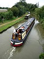 Canal, Rugby, Warwickshire - geograph.org.uk - 1971979.jpg 768 × 1.024; 203 KB
-
 Car park next to Rugby station - geograph.org.uk - 5319882.jpg 5.202 × 3.465; 3,3 MB
-
 Castle Buildings, Castle Street, Rugby - geograph.org.uk - 5340271.jpg 1.016 × 1.600; 408 KB
-
 Cathiron - geograph.org.uk - 457535.jpg 640 × 480; 139 KB
-
 Cement Silos - geograph.org.uk - 2085263.jpg 640 × 480; 74 KB
-
 Chinese warrior off Sheep Street - geograph.org.uk - 5324006.jpg 2.445 × 1.686; 693 KB
-
 Church Walk, Rugby - geograph.org.uk - 5935035.jpg 960 × 1.280; 645 KB
-
 Churchside Arcade, Rugby - geograph.org.uk - 5647910.jpg 640 × 428; 92 KB
-
 Clifton Brook - geograph.org.uk - 3908698.jpg 640 × 480; 104 KB
-
 Clifton Brook - geograph.org.uk - 3908706.jpg 478 × 640; 109 KB
-
 Clifton Road - geograph.org.uk - 3908710.jpg 640 × 480; 79 KB
-
 Clifton Road bridge - geograph.org.uk - 5320450.jpg 5.202 × 3.465; 5,4 MB
-
 Clifton Road, Rugby - geograph.org.uk - 5575583.jpg 1.280 × 851; 356 KB
-
 Clifton-On-Dunsmore Pillbox - geograph.org.uk - 2005032.jpg 640 × 480; 103 KB
-
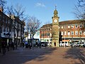 Clock Tower, Rugby Market Place - geograph.org.uk - 5648354.jpg 640 × 480; 149 KB
-
 Coronation of Charles III - Rugby.jpg 5.152 × 3.864; 7,82 MB
-
 Couronnement de Charles III - Rugby.jpg 3.864 × 5.152; 7,81 MB
-
 Cycling Signs in Rugby Town Centre - geograph.org.uk - 2085687.jpg 3.072 × 2.304; 1,8 MB
-
 Demolished works, near Rugby station - geograph.org.uk - 1294230.jpg 640 × 413; 112 KB
-
-
 Disused bridge over the railway - geograph.org.uk - 6000303.jpg 640 × 480; 37 KB
-
 Disused quarry and railway line - geograph.org.uk - 2731642.jpg 640 × 452; 45 KB
-
 Disused railway viaduct at the Rugby Golf Club - geograph.org.uk - 4477214.jpg 1.024 × 720; 278 KB
-
 Drayton Leys, Hillside - geograph.org.uk - 1007976.jpg 640 × 428; 124 KB
-
 Dreyer Close, Bilton - geograph.org.uk - 983807.jpg 640 × 428; 85 KB
-
 Dumpster storage compound, Rugby, Warwickshire (1).JPG 5.152 × 3.864; 6,4 MB
-
 Dumpster storage compound, Rugby, Warwickshire (2).JPG 5.152 × 3.864; 7,12 MB
-
 Dunchurch Road, Rugby - geograph.org.uk - 5401403.jpg 1.952 × 1.400; 832 KB
-
 Dunchurch Road, Rugby - geograph.org.uk - 5401407.jpg 2.048 × 1.536; 1,53 MB
-
 Ecton Leys, Hillside - geograph.org.uk - 1008115.jpg 640 × 428; 105 KB
-
 Elsie Road, Rugby - geograph.org.uk - 5697067.jpg 640 × 640; 89 KB
-
 Entering Clifton upon Dunsmore - geograph.org.uk - 3908713.jpg 640 × 480; 60 KB
-

-
 Entrance to St Cross Hospital - geograph.org.uk - 3218122.jpg 1.280 × 960; 443 KB
-

-
 Farm building off Barby Road - geograph.org.uk - 3908491.jpg 640 × 480; 75 KB
-
 Farm Grove, Rugby - geograph.org.uk - 1121344.jpg 640 × 429; 95 KB
-

-
 Field entrance off Barby Road - geograph.org.uk - 3908497.jpg 640 × 480; 71 KB
-
 Fields by Barby Road - geograph.org.uk - 3218147.jpg 1.280 × 959; 337 KB
-

-

-
 Former Alstom site, Rugby - geograph.org.uk - 1012791.jpg 640 × 428; 92 KB
-
 Former cemetery chapel, Clifton Road Cemetery, Rugby - geograph.org.uk - 5340257.jpg 1.515 × 1.600; 679 KB
-
 Former Central Station, Rugby - geograph.org.uk - 1120247.jpg 640 × 428; 112 KB
-
 Former Herbert Grey College, Rugby - geograph.org.uk - 5648092.jpg 640 × 480; 190 KB
-

-
 Former weathercock, Rugby church - geograph.org.uk - 5648114.jpg 480 × 640; 53 KB
-
 Frank Whittle memorial, Rugby - geograph.org.uk - 1332107.jpg 640 × 480; 130 KB
-
 Freight Train near Rugby Station - geograph.org.uk - 2339011.jpg 640 × 422; 68 KB
-
 Furrow Close - geograph.org.uk - 3290340.jpg 640 × 361; 52 KB
-
 Gas Street, Rugby - geograph.org.uk - 5575241.jpg 851 × 1.280; 391 KB
-
 GCR Clifton Road overbridge - geograph.org.uk - 1670898.jpg 960 × 1.280; 241 KB
-
 GE Energy works - geograph.org.uk - 3955719.jpg 1.024 × 683; 146 KB
-
 Ghost sign, Regent Street, Rugby - geograph.org.uk - 5343287.jpg 1.600 × 1.176; 464 KB
-
 Ghost sign, Rugby - geograph.org.uk - 5339747.jpg 3.316 × 5.455; 5,52 MB
-
 Grand Union between Norton and Braunston (364944530).jpg 1.544 × 1.024; 960 KB
-
 Grazing west of Barby Road - geograph.org.uk - 3908493.jpg 640 × 480; 70 KB
-
 Great Central walk south of Pytchley Road bridge - geograph.org.uk - 5320659.jpg 5.202 × 3.465; 5,08 MB
-
 Greater Spotted Woodpecker 1 (6823846584).jpg 1.076 × 1.708; 1,06 MB
-
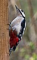 Greater Spotted Woodpecker 1a (6823845240).jpg 940 × 1.524; 774 KB
-
 Greater Spotted Woodpecker 2 (6823845762).jpg 1.064 × 912; 632 KB
-
 Greater Spotted Woodpecker 3 (6823847942).jpg 924 × 868; 460 KB
-
 Greater Spotted Woodpecker 4 (6823846970).jpg 976 × 764; 434 KB
-
 Greater Spotted Woodpecker 5 (6969969933).jpg 988 × 1.428; 718 KB
-
 Gully from Quarry Close - geograph.org.uk - 1620684.jpg 480 × 640; 100 KB
-
 Gully into Quarry Close - geograph.org.uk - 1619432.jpg 480 × 640; 71 KB
-
 Hair By Claire - geograph.org.uk - 2007833.jpg 640 × 480; 61 KB
-
 Hair by Genesis - geograph.org.uk - 808504.jpg 640 × 440; 80 KB
-
 Harborough Fields - geograph.org.uk - 479278.jpg 640 × 480; 104 KB
-
 Harborough Fields - geograph.org.uk - 479284.jpg 640 × 480; 127 KB
-
 Harborough Parva - geograph.org.uk - 479260.jpg 640 × 480; 109 KB
-
 Harris Academy, Rugby - geograph.org.uk - 5323934.jpg 4.105 × 2.801; 1,68 MB
-
 Harvester Restaurant, Rugby - geograph.org.uk - 6266924.jpg 1.024 × 768; 171 KB
-
 High Street, Rugby - geograph.org.uk - 2344024.jpg 1.280 × 856; 243 KB
-
 High Street, Rugby - geograph.org.uk - 6024066.jpg 1.600 × 900; 383 KB
-
 Hillmorton Road bridge - geograph.org.uk - 5320470.jpg 5.202 × 3.465; 6,54 MB
-
 Hillmorton Road bridge from old platform - geograph.org.uk - 5320495.jpg 5.202 × 3.465; 5,82 MB
-
 Hillmorton Road Bridge, Rugby - geograph.org.uk - 1120298.jpg 640 × 428; 114 KB
-
 Hillmorton Road, Rugby - geograph.org.uk - 6141089.jpg 1.872 × 1.208; 1,25 MB
-
 Hillmorton Road, Rugby - geograph.org.uk - 6187887.jpg 1.892 × 1.236; 1,59 MB
-
 Hillmorton-Ashlawn Newsagents - geograph.org.uk - 2741427.jpg 640 × 480; 58 KB
-
 Hollowell Way, Brownsover - geograph.org.uk - 1657745.jpg 1.280 × 856; 167 KB
-
 Hospital of St Cross, Rugby - geograph.org.uk - 3908499.jpg 640 × 480; 73 KB
-

-
 House on Bilton Road, Rugby - geograph.org.uk - 3908513.jpg 640 × 480; 80 KB
-
 Houses and playground off Barnaby Road, Rugby - geograph.org.uk - 5612721.jpg 1.024 × 768; 225 KB
-
 Houses on Hillmorton Road, Rugby - geograph.org.uk - 5401616.jpg 2.006 × 1.478; 1,12 MB
-
 Houses on Hillmorton Road, Rugby - geograph.org.uk - 5401617.jpg 2.032 × 1.514; 1,12 MB
-
 Houses on Hillmorton Road, Rugby - geograph.org.uk - 5401623.jpg 1.998 × 1.470; 986 KB
-
 Houses on Hillmorton Road, Rugby - geograph.org.uk - 6187890.jpg 1.884 × 1.224; 1,08 MB
-

-
 Image from page 636 of "The Bell System technical journal" (1922) (14569539429).jpg 1.638 × 1.032; 369 KB
-
 Industrial units off Boughton Road - geograph.org.uk - 3908694.jpg 640 × 480; 43 KB
-

-
 International Stores ghost sign, Sheep Street, Rugby - geograph.org.uk - 5341597.jpg 2.891 × 4.754; 2,76 MB
-
 Joto Hobbies - geograph.org.uk - 2344276.jpg 856 × 1.280; 237 KB
-
 JSPhillpotts & Marian.jpg 803 × 911; 88 KB
-
 Junction of Clifton Road and Moultrie Road - geograph.org.uk - 3991627.jpg 1.024 × 683; 143 KB
-
 Junction of Watts Lane with the A428 - geograph.org.uk - 1562129.jpg 640 × 426; 40 KB
-
 Ken Marriot Leisure Centre - geograph.org.uk - 2965233.jpg 2.000 × 1.500; 418 KB
-
 Kinman Way, Rugby - geograph.org.uk - 1014044.jpg 640 × 428; 82 KB
-
 LA Central, Gas Street - geograph.org.uk - 3991498.jpg 1.024 × 683; 158 KB
-
 Langton Road at the junction of Hillmorton Road - geograph.org.uk - 5401624.jpg 2.048 × 1.536; 824 KB
-
 Large industrial unit, Rugby - geograph.org.uk - 2846096.jpg 640 × 430; 42 KB
-
 Lawford Road entering Rugby - geograph.org.uk - 6187294.jpg 1.892 × 1.236; 1,4 MB
-
 Lawrence Sheriff School, Rugby - geograph.org.uk - 5935399.jpg 1.280 × 960; 306 KB
-
 Lawrence Sheriff Street, Rugby - geograph.org.uk - 6187876.jpg 1.844 × 1.154; 1,31 MB
-
 Lea Crescent, Newbold on Avon - geograph.org.uk - 1515121.jpg 640 × 428; 60 KB
-
 Leicester Road (A426) heading out of Rugby - geograph.org.uk - 5612724.jpg 1.024 × 615; 122 KB
-

-
 Leicester Road, Rugby - geograph.org.uk - 4673114.jpg 960 × 1.280; 318 KB
-
 London-skolars2.jpg 1.300 × 976; 933 KB
-
 Long Furlong, Hillside - geograph.org.uk - 1008118.jpg 640 × 428; 130 KB
-
 Long Furlong, Hillside - geograph.org.uk - 1008679.jpg 640 × 428; 134 KB
-
 Long Lawford - geograph.org.uk - 331068.jpg 640 × 480; 127 KB
-

-
 Looking east along Cymbeline Way - geograph.org.uk - 1701246.jpg 640 × 426; 91 KB
-

-

-
 Looking north along the black path - geograph.org.uk - 1398657.jpg 640 × 607; 172 KB
-

-

-
 Looking south along Juliet Drive - geograph.org.uk - 1701251.jpg 640 × 426; 67 KB
-

-
 Low railway bridge over Murray Road - geograph.org.uk - 3908585.jpg 640 × 480; 64 KB
-
 Lower Hillmorton Road bridge - geograph.org.uk - 5320466.jpg 5.202 × 3.465; 3,57 MB
-
 Lower Hilmorton Road railway bridge (2) - geograph.org.uk - 1287285.jpg 640 × 426; 165 KB
-
 Lower Hilmorton Road railway bridge - geograph.org.uk - 1287283.jpg 640 × 600; 174 KB
-
 Lower Rainsbrook Farm - geograph.org.uk - 1093264.jpg 640 × 480; 80 KB
-
 Lymantriinae sp. - geograph.org.uk - 121551.jpg 640 × 480; 45 KB
-
 Macready Theatre, Rugby School - geograph.org.uk - 5343213.jpg 1.600 × 1.239; 577 KB
-
 Magnet fishing near Masters Bridge, Rugby - geograph.org.uk - 6251765.jpg 1.600 × 1.065; 869 KB
-

-
-
 McDonald's as seen from KFC, Rugby - geograph.org.uk - 3473153.jpg 1.936 × 2.592; 1,03 MB
-
 Meat and Steak.JPG 1.694 × 1.008; 450 KB
-
 Miniature range, Rugby School, Dunchurch Road - geograph.org.uk - 3983143.jpg 1.024 × 683; 171 KB
-
 Mitchell ^ Butler ghost sign, Paradise Street, Rugby - geograph.org.uk - 5340012.jpg 1.014 × 1.600; 419 KB
-

-
 Multi storey car park - geograph.org.uk - 3908576.jpg 640 × 480; 71 KB
-
 Narrowboat - Corona (3700320963).jpg 2.048 × 1.362; 332 KB
-

-

-
 Nature reserve along old railway path - geograph.org.uk - 5320505.jpg 5.202 × 3.465; 6,11 MB
-
 Nature reserve ponds - geograph.org.uk - 5320516.jpg 5.202 × 3.465; 4,95 MB
-
 Nature Reserve, Rugby, Warwickshire - geograph.org.uk - 1972000.jpg 1.024 × 768; 282 KB
-
 Near Rugby Station - geograph.org.uk - 3645938.jpg 640 × 430; 57 KB
-
 New Big School, Rugby School - geograph.org.uk - 5648442.jpg 640 × 480; 131 KB
-
 New Bilton Footbridge - geograph.org.uk - 3774966.jpg 1.024 × 768; 257 KB


.jpg)


_-_geograph.org.uk_-_3908515.jpg)


.JPG)
.JPG)


.jpg)


.jpg)
.jpg)
.jpg)
.jpg)
.jpg)
.jpg)


_(14569539429).jpg)


_heading_out_of_Rugby_-_geograph.org.uk_-_5612724.jpg)
,_heading_into_Rugby_town_centre_-_geograph.org.uk_-_5612700.jpg)


_-_geograph.org.uk_-_1287285.jpg)


.jpg)


