Category:Rushton, Northamptonshire
Jump to navigation
Jump to search
English: Rushton is a small village in Northamptonshire. It is north-east of Rothwell. The village has a primary school with a current roll of seventy-two pupils and a pub (which serves food in the evenings) opposite the village cricket pitch.
village and civil parish in Northamptonshire, England, UK  | |||||
| Upload media | |||||
| Instance of | |||||
|---|---|---|---|---|---|
| Location | North Northamptonshire, Northamptonshire, East Midlands, England | ||||
 | |||||
Subcategories
This category has the following 6 subcategories, out of 6 total.
A
- All Saints' Church, Rushton (15 F)
G
P
R
- Rushton Cricket Club (3 F)
T
- The Thornhill Arms, Rushton (2 F)
Media in category "Rushton, Northamptonshire"
The following 190 files are in this category, out of 190 total.
-
 A substation of some sort^ - geograph.org.uk - 2792742.jpg 640 × 430; 78 KB
-
 A43 towards Barford Bridge - geograph.org.uk - 3798934.jpg 3,264 × 2,448; 2.27 MB
-
 Access to private fishing - geograph.org.uk - 2792674.jpg 640 × 471; 162 KB
-
 All Saints Church - geograph.org.uk - 4880005.jpg 2,000 × 1,500; 590 KB
-
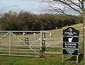 Alpaca farm east of Rothwell (2) - geograph.org.uk - 153715.jpg 640 × 490; 162 KB
-
 Alpaca farm east of Rothwell - geograph.org.uk - 153713.jpg 640 × 490; 100 KB
-
 Animal pen - geograph.org.uk - 2792731.jpg 640 × 499; 144 KB
-
 Arable field near Pipewell - geograph.org.uk - 4130683.jpg 1,024 × 680; 272 KB
-
 Arable land near Pipewell - geograph.org.uk - 4125089.jpg 800 × 531; 139 KB
-
 Around Prologis Park, Kettering - geograph.org.uk - 5055036.jpg 480 × 640; 77 KB
-
 Around Prologis Park, Kettering - geograph.org.uk - 5055037.jpg 480 × 640; 74 KB
-
 Around Prologis Park, Kettering - geograph.org.uk - 5055039.jpg 480 × 640; 72 KB
-
 Around Prologis Park, Kettering - geograph.org.uk - 5055042.jpg 480 × 640; 60 KB
-
 Around Prologis Park, Kettering - geograph.org.uk - 5055043.jpg 480 × 640; 49 KB
-
 Around Prologis Park, Kettering - geograph.org.uk - 5055048.jpg 480 × 640; 89 KB
-
 Around Prologis Park, Kettering - geograph.org.uk - 5055051.jpg 640 × 480; 69 KB
-
 Around Prologis Park, Kettering - geograph.org.uk - 5055053.jpg 480 × 640; 74 KB
-
 Around Prologis Park, Kettering - geograph.org.uk - 5055056.jpg 480 × 640; 62 KB
-
 Around Prologis Park, Kettering - geograph.org.uk - 5055058.jpg 480 × 640; 60 KB
-
 Around Prologis Park, Kettering - geograph.org.uk - 5055061.jpg 480 × 640; 68 KB
-
 Around Prologis Park, Kettering - geograph.org.uk - 5055064.jpg 640 × 480; 55 KB
-
 Around Prologis Park, Kettering - geograph.org.uk - 5055066.jpg 480 × 640; 80 KB
-
 Around Prologis Park, Kettering - geograph.org.uk - 5055067.jpg 480 × 640; 66 KB
-
 Around Prologis Park, Kettering - geograph.org.uk - 5055068.jpg 480 × 640; 67 KB
-
 Around Prologis Park, Kettering - geograph.org.uk - 5055074.jpg 480 × 640; 63 KB
-
 Around Prologis Park, Kettering - geograph.org.uk - 5055084.jpg 480 × 640; 88 KB
-
 Around Prologis Park, Kettering - geograph.org.uk - 5055087.jpg 480 × 640; 70 KB
-
 Around Prologis Park, Kettering - geograph.org.uk - 5055094.jpg 640 × 480; 65 KB
-
 Around Prologis Park, Kettering - geograph.org.uk - 5055099.jpg 480 × 640; 69 KB
-
 Around the Sir John Lowther Centre - geograph.org.uk - 5055107.jpg 480 × 640; 72 KB
-
 Around the Sir John Lowther Centre - geograph.org.uk - 5055109.jpg 480 × 640; 85 KB
-
 Around the Sir John Lowther Centre - geograph.org.uk - 5055116.jpg 480 × 640; 78 KB
-
 Around the Sir John Lowther Centre - geograph.org.uk - 5055118.jpg 480 × 640; 84 KB
-
 Around the Sir John Lowther Centre - geograph.org.uk - 5055124.jpg 480 × 640; 78 KB
-
 Around the Sir John Lowther Centre - geograph.org.uk - 5055173.jpg 480 × 640; 96 KB
-
 Around the Sir John Lowther Centre - geograph.org.uk - 5055174.jpg 480 × 640; 73 KB
-
 Around the Sir John Lowther Centre - geograph.org.uk - 5055175.jpg 480 × 640; 130 KB
-
 Around the Sir John Lowther Centre - geograph.org.uk - 5055177.jpg 480 × 640; 70 KB
-
 Around the Sir John Lowther Centre - geograph.org.uk - 5055179.jpg 480 × 640; 67 KB
-
 Around the Sir John Lowther Centre - geograph.org.uk - 5055182.jpg 480 × 640; 83 KB
-
 Barford Meadows - geograph.org.uk - 4587684.jpg 3,456 × 2,304; 3.31 MB
-
 Barford Meadows Nature Reserve - geograph.org.uk - 3798887.jpg 3,264 × 2,448; 1.7 MB
-
 Beside Monk's Arbour Wood - geograph.org.uk - 5472736.jpg 509 × 640; 85 KB
-
 Branch line to Corby - geograph.org.uk - 1767410.jpg 640 × 480; 43 KB
-
 Bridge over the track - geograph.org.uk - 5055121.jpg 480 × 640; 94 KB
-

-
 CCTV Cameras in Operation - geograph.org.uk - 2792715.jpg 640 × 516; 110 KB
-
 Coming to the roundabout - geograph.org.uk - 5820973.jpg 1,600 × 900; 314 KB
-

-
 Desborough Road - geograph.org.uk - 5547291.jpg 640 × 480; 396 KB
-
 Desborough Road near Rushton - geograph.org.uk - 5547298.jpg 640 × 480; 450 KB
-

-
 Desborough Road northwards - geograph.org.uk - 2792716.jpg 640 × 471; 126 KB
-
 Desborough Road northwards - geograph.org.uk - 2792723.jpg 640 × 506; 118 KB
-
 Desborough Road southwards - geograph.org.uk - 2792717.jpg 640 × 502; 116 KB
-
 Desborough Road southwards - geograph.org.uk - 2792724.jpg 640 × 465; 73 KB
-
 Desborough Road towards Desborough - geograph.org.uk - 2792679.jpg 640 × 545; 117 KB
-
 Desborough Road towards Rushton - geograph.org.uk - 2792675.jpg 640 × 547; 117 KB
-
 Desborough Road towards Rushton - geograph.org.uk - 2792680.jpg 640 × 474; 109 KB
-
 Driveway to Woodlands Farm - geograph.org.uk - 2792732.jpg 640 × 478; 63 KB
-
 Entrance to Bunker's Hill Farm - geograph.org.uk - 5492253.jpg 480 × 640; 110 KB
-
 Entrance to Springfield Farm - geograph.org.uk - 2792718.jpg 640 × 359; 46 KB
-
 Entrance to the Eventing Course - geograph.org.uk - 5492245.jpg 480 × 640; 63 KB
-
 Entrance to Tresham Triangular Lodge - geograph.org.uk - 4336758.jpg 680 × 1,024; 345 KB
-
 ET was here... - geograph.org.uk - 4124304.jpg 1,024 × 680; 445 KB
-
 Farm road - geograph.org.uk - 389283.jpg 640 × 427; 92 KB
-
 Farmland at Pipewell - geograph.org.uk - 1831825.jpg 640 × 480; 123 KB
-
 Farmland at Rushton - geograph.org.uk - 4124357.jpg 1,024 × 680; 239 KB
-
 Farmland near Glendon Hall - geograph.org.uk - 3677333.jpg 2,592 × 1,944; 1.45 MB
-
 Farmland near Rushton - geograph.org.uk - 4130696.jpg 800 × 531; 155 KB
-
 Farmland near Rushton Hall - geograph.org.uk - 5538326.jpg 1,280 × 850; 672 KB
-
 Farmland near White Lodge Farm - geograph.org.uk - 4131978.jpg 800 × 531; 146 KB
-
 Field alongside the railway - geograph.org.uk - 2792681.jpg 640 × 445; 82 KB
-
 Field of broad beans - geograph.org.uk - 4132008.jpg 800 × 531; 166 KB
-

-
 Fields near White Gates Farm - geograph.org.uk - 3271106.jpg 2,592 × 1,944; 1.29 MB
-
 Fields south of Rushton - geograph.org.uk - 3271096.jpg 2,592 × 1,944; 1.32 MB
-
 Fields west of Rushton - geograph.org.uk - 3447946.jpg 2,000 × 1,500; 517 KB
-
 Fields west of Rushton - geograph.org.uk - 3484682.jpg 2,000 × 1,500; 519 KB
-
 Footpath To Desborough - geograph.org.uk - 2542010.jpg 1,496 × 1,122; 800 KB
-
 Gaultney Wood - geograph.org.uk - 4782731.jpg 640 × 458; 48 KB
-
 Grass trees and molehills - geograph.org.uk - 2792689.jpg 640 × 492; 95 KB
-
 Hipswell Road - geograph.org.uk - 2792743.jpg 640 × 471; 75 KB
-
 Hipswell Road railway bridge - geograph.org.uk - 2792735.jpg 640 × 487; 64 KB
-
 Hipswell Road roundabout - geograph.org.uk - 2792744.jpg 640 × 449; 66 KB
-
 Hipswell Road towards Rothwell - geograph.org.uk - 2792736.jpg 640 × 449; 56 KB
-
 Home Field Farm - geograph.org.uk - 4744512.jpg 640 × 337; 40 KB
-
 In Pipewell village - geograph.org.uk - 5472735.jpg 480 × 640; 72 KB
-
 Junction on the A43 north of Kettering - geograph.org.uk - 6197120.jpg 1,860 × 1,184; 1.16 MB
-
 Man holds up the A43 in Kettering - geograph.org.uk - 6225032.jpg 1,906 × 1,260; 1.2 MB
-
 Manor Road Rushton - geograph.org.uk - 1429194.jpg 640 × 480; 66 KB
-
 Midland Main Line crosses Manor Road - geograph.org.uk - 4880013.jpg 2,000 × 1,500; 574 KB
-
 Midland Main Line towards Kettering - geograph.org.uk - 2792683.jpg 640 × 519; 85 KB
-
 Midland Main Line towards Kettering - geograph.org.uk - 2792737.jpg 640 × 538; 65 KB
-
 Midland Main Line towards Leicester - geograph.org.uk - 2792684.jpg 640 × 550; 81 KB
-
 Midland Main Line towards Leicester - geograph.org.uk - 2792738.jpg 640 × 525; 84 KB
-
 Oakley Road - geograph.org.uk - 4130656.jpg 800 × 531; 99 KB
-
 Oakley Road at Lower Lodge Farm - geograph.org.uk - 5492241.jpg 480 × 640; 87 KB
-
 Oakley Road near Pipewell - geograph.org.uk - 5492239.jpg 480 × 640; 53 KB
-

-

-
 Past White Lodge Farm - geograph.org.uk - 2792687.jpg 640 × 522; 111 KB
-
 Pedestrian crossing on the A43 north of Kettering - geograph.org.uk - 6197132.jpg 1,920 × 1,280; 1.34 MB
-
 Pipeline site - geograph.org.uk - 2792719.jpg 640 × 455; 81 KB
-
 Pipewell - geograph.org.uk - 2792690.jpg 640 × 472; 114 KB
-
 Pipewell information board - geograph.org.uk - 2792691.jpg 640 × 436; 98 KB
-
 Pipewell Road northwards - geograph.org.uk - 2792733.jpg 640 × 528; 104 KB
-
 Pipewell Road view - geograph.org.uk - 5472739.jpg 480 × 640; 45 KB
-
 Ploughed field next to Alder Wood - geograph.org.uk - 4130686.jpg 800 × 531; 166 KB
-
 Pond at Pipewell - geograph.org.uk - 1831822.jpg 640 × 480; 114 KB
-
 Pond at Pipewell - geograph.org.uk - 2792692.jpg 640 × 457; 68 KB
-
 Private - geograph.org.uk - 2792695.jpg 640 × 472; 149 KB
-
 Private fishing notice board - geograph.org.uk - 2792676.jpg 640 × 577; 91 KB
-
 Private Road to Upper Lodge - geograph.org.uk - 4130701.jpg 800 × 531; 134 KB
-
 Private Woods KEEP OUT - geograph.org.uk - 2792696.jpg 640 × 425; 128 KB
-
 Prologis Park - geograph.org.uk - 2792745.jpg 640 × 490; 50 KB
-
 Railway bridge on Station Road - geograph.org.uk - 3484723.jpg 2,000 × 1,500; 554 KB
-
 Railway bridge, Station Road, Rushton - geograph.org.uk - 3271103.jpg 2,592 × 1,944; 1.4 MB
-
 Railway near Rushton - geograph.org.uk - 5547295.jpg 640 × 480; 382 KB
-
 Railway to Corby - geograph.org.uk - 3798873.jpg 3,264 × 2,448; 3.1 MB
-
 Road beside Lady Mary's Spinney - geograph.org.uk - 5492244.jpg 480 × 640; 50 KB
-
 Road closed - geograph.org.uk - 3485441.jpg 2,000 × 1,500; 557 KB
-

-
 Road to Storefield Lodge - geograph.org.uk - 4130646.jpg 1,024 × 680; 292 KB
-
 Road to White Lodge Farm - geograph.org.uk - 5492243.jpg 480 × 640; 52 KB
-
 Rockingham road roundabout - geograph.org.uk - 2071474.jpg 640 × 480; 56 KB
-
 Rolling farmland - geograph.org.uk - 4744511.jpg 640 × 397; 45 KB
-
 Rushton church - geograph.org.uk - 5492246.jpg 480 × 640; 56 KB
-
 Rushton Hall - Gardens ^ Fishpond - geograph.org.uk - 5989362.jpg 1,024 × 768; 185 KB
-
 Rushton Hall - geograph.org.uk - 5984932.jpg 4,032 × 3,024; 4.76 MB
-
 Rushton Primary School - geograph.org.uk - 3484746.jpg 2,000 × 1,500; 667 KB
-
 Rushton Road - geograph.org.uk - 3446901.jpg 2,000 × 1,500; 515 KB
-
 Rushton Road - geograph.org.uk - 3447741.jpg 2,000 × 1,500; 518 KB
-
 Rushton Road - geograph.org.uk - 3485404.jpg 2,000 × 1,447; 527 KB
-
 Rushton Triangular Lodge (geograph 6752104).jpg 1,032 × 970; 687 KB
-
 Rushton Triangular Lodge - geograph.org.uk - 5547288.jpg 640 × 481; 444 KB
-
 Rushton Triangular Lodge - geograph.org.uk - 6040568.jpg 1,200 × 1,600; 503 KB
-

-
 Service Road-Hipswell Road - geograph.org.uk - 2792746.jpg 640 × 493; 71 KB
-
 Shallow railway cutting - geograph.org.uk - 4782736.jpg 640 × 426; 43 KB
-
 Sideroad near Pipewell - geograph.org.uk - 5472733.jpg 480 × 640; 55 KB
-
 Station Road - geograph.org.uk - 2792727.jpg 640 × 501; 81 KB
-
 Station Road Rushton - geograph.org.uk - 1429192.jpg 640 × 425; 52 KB
-
 Stiles Spinney - geograph.org.uk - 3446807.jpg 2,000 × 1,500; 623 KB
-
 The entrance to Kettering Business Park on the A43 - geograph.org.uk - 6225031.jpg 1,920 × 1,280; 1.09 MB
-
 The former railway station at Glendon and Rushton.jpg 6,000 × 4,000; 2.17 MB
-
 The Midland main line at Rushton - geograph.org.uk - 4375377.jpg 1,600 × 1,064; 327 KB
-

-
 The Old Rectory - geograph.org.uk - 2792728.jpg 640 × 504; 121 KB
-
 The Rail Authority sign on bridge - geograph.org.uk - 2792685.jpg 640 × 538; 100 KB
-
 The Wilderness - geograph.org.uk - 2522262.jpg 640 × 427; 85 KB
-
 Thornhill Arms, Rushton 1995 - geograph.org.uk - 5049484.jpg 2,359 × 1,277; 3.02 MB
-
 Through the screens - geograph.org.uk - 2792730.jpg 640 × 579; 98 KB
-
 Towards Corby - geograph.org.uk - 5055127.jpg 480 × 640; 87 KB
-
 Towards Desborough - geograph.org.uk - 2792657.jpg 640 × 515; 67 KB
-
 Towards Glendon - geograph.org.uk - 5492250.jpg 480 × 640; 101 KB
-
 Towards Kettering - geograph.org.uk - 5055130.jpg 480 × 640; 83 KB
-
 Towards Pipewell - geograph.org.uk - 2792686.jpg 640 × 529; 62 KB
-
 Towards Pipewell - geograph.org.uk - 2792693.jpg 640 × 435; 74 KB
-
 Towards Pipewell - geograph.org.uk - 2792697.jpg 640 × 486; 112 KB
-
 Towards Pipewell - geograph.org.uk - 2792734.jpg 640 × 536; 61 KB
-
 Towards Rushton - geograph.org.uk - 2792658.jpg 640 × 480; 72 KB
-
 Towards Rushton - geograph.org.uk - 2792694.jpg 640 × 546; 107 KB
-
 Towards Rushton - geograph.org.uk - 5492248.jpg 480 × 640; 87 KB
-
 Towards White Lodge Farm - geograph.org.uk - 2792659.jpg 640 × 509; 105 KB
-
 Track towards Pipewell Upper Lodge - geograph.org.uk - 2792660.jpg 640 × 460; 70 KB
-
 Tree in a hedge - geograph.org.uk - 4744508.jpg 640 × 421; 44 KB
-
 Valley by the railway line - geograph.org.uk - 4744506.jpg 640 × 426; 50 KB
-
 View from High Street, Rushton - geograph.org.uk - 3448000.jpg 2,000 × 1,500; 597 KB
-
 Wall round Rushton Hall estate - geograph.org.uk - 3447961.jpg 2,000 × 1,500; 556 KB
-
 West of Desborough Road - geograph.org.uk - 2792677.jpg 640 × 528; 148 KB
-
 Wheat field and Storefield Wood - geograph.org.uk - 4130652.jpg 800 × 531; 129 KB
-
 Wheat field near Great Oakley - geograph.org.uk - 4125080.jpg 1,024 × 680; 295 KB
-
 Campsite near Rushton - geograph.org.uk - 379035.jpg 640 × 480; 136 KB
-
 Country Road. - geograph.org.uk - 428738.jpg 640 × 480; 76 KB
-

-
 Glendon Junction - geograph.org.uk - 153703.jpg 640 × 480; 183 KB
-
 Headland alongside the rape. - geograph.org.uk - 438948.jpg 640 × 480; 108 KB
-
 High Street, Rushton - geograph.org.uk - 49074.jpg 480 × 640; 109 KB
-
 Looking towards Hiltons End - geograph.org.uk - 416178.jpg 640 × 480; 87 KB
-
 More rape. - geograph.org.uk - 438955.jpg 640 × 480; 107 KB
-
 Railway - geograph.org.uk - 377270.jpg 640 × 480; 74 KB
-
 Rushton - geograph.org.uk - 379028.jpg 640 × 480; 97 KB
-
 Rushton road - geograph.org.uk - 416162.jpg 640 × 480; 122 KB
-
 Rushton, Northamptonshire - geograph.org.uk - 49068.jpg 640 × 480; 111 KB
-
 Town's Close Lodge - geograph.org.uk - 389207.jpg 640 × 427; 165 KB
-
 Track off Pipewell road - geograph.org.uk - 387910.jpg 640 × 480; 62 KB
-
 Track to Storefield - geograph.org.uk - 387898.jpg 640 × 456; 54 KB
-
 View to the east - geograph.org.uk - 416191.jpg 640 × 456; 82 KB
-
 Violet lane - geograph.org.uk - 379015.jpg 640 × 480; 131 KB


_-_geograph.org.uk_-_153715.jpg)


.jpg)


