Category:SVG maps of Région Bretagne
Jump to navigation
Jump to search
Administrative regions and territorial collectivity of Metropolitan France (‡ since start of 2016):
Auvergne-Rhône-Alpes‡ · Bourgogne-Franche-Comté‡ · Brittany · Centre-Val de Loire · Corsica · Grand Est‡ · Hauts-de-France‡ · Île-de-France · Normandy‡ · New Aquitaine‡ · Occitania‡ · Pays de la Loire · Provence-Alpes-Côte d'Azur
Former administrative regions of Metropolitan France (until end of 2015):
Alsace · Aquitaine · Auvergne · Burgundy · Champagne-Ardenne · Franche-Comté · Languedoc-Roussillon · Limousin · Lorraine · Midi-Pyrénées · Nord-Pas-de-Calais · Lower Normandy · Upper Normandy · Picardy · Poitou-Charentes · Rhône-Alpes
Overseas departments and regions: Guadeloupe · Martinique · French Guiana · Réunion · Mayotte
Overseas collectivities: Saint Barthélemy · Saint-Martin · Saint Pierre and Miquelon · French Polynesia · Wallis and Futuna · French Southern and Antarctic Lands+
Sui generis territories: New Caledonia · Clipperton Island+

Subcategories
This category has only the following subcategory.
!
Media in category "SVG maps of Région Bretagne"
The following 13 files are in this category, out of 13 total.
-
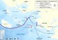 Battle of Quiberon Bay - 1759-11-20 - map-fr.svg 1,820 × 1,265; 790 KB
-
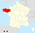
 Bretagne region location map.svg 1,615 × 1,001; 477 KB
-
 Bretagne region locator map.svg 2,000 × 1,922; 557 KB
-
 Bretagne region locator map2.svg 2,000 × 1,922; 300 KB
-
 Bretagne region map (DPJ-2020).svg 507 × 553; 42 KB
-
 Carte BZH.svg 732 × 629; 70 KB
-
 Carte régionale - Bretagne.svg 1,000 × 960; 28 KB
-
 Députés sortants de Bretagne en 2017.svg 1,257 × 651; 93 KB
-
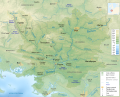
 Oust River Drainage Basin map-fr.svg 1,954 × 1,573; 817 KB
-
 Réseaux ferrés en Bretagne.svg 1,044 × 712; 41 KB
-
 Vilaine River Drainage Basin map-br.svg 1,954 × 1,573; 805 KB
-
 Vilaine River Drainage Basin map-fr.svg 1,954 × 1,573; 799 KB
-
 Vilaine River Drainage Basin map-mk.svg 1,954 × 1,573; 1.1 MB


.svg)


