Category:SVG maps of rivers
Jump to navigation
Jump to search
Subcategories
This category has the following 3 subcategories, out of 3 total.
D
S
- SVG maps of rivers of Colombia (13 F)
- SVG maps of rivers of Russia (70 F)
Media in category "SVG maps of rivers"
The following 48 files are in this category, out of 48 total.
-
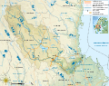 Dalälven drainage basin administrative map-fr.svg 3,543 × 2,803; 3.56 MB
-
 Dalälven drainage basin map-fr.svg 3,543 × 2,803; 3.55 MB
-
 Dalälven drainage basin topographic map-fr.svg 3,543 × 2,803; 3.57 MB
-
 Europe laea location map-es.svg 1,401 × 1,198; 2.06 MB
-
 Europe laea location map.svg 1,401 × 1,198; 2.21 MB
-
 France blank 1.svg 1,796 × 1,797; 265 KB
-
 France blank 2.svg 1,796 × 1,797; 261 KB
-
 France blank.svg 1,796 × 1,797; 240 KB
-
 France blank3.svg 1,796 × 1,796; 973 KB
-
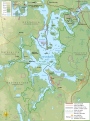
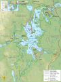
 Fundy National Park topographic map-fr.svg 1,043 × 1,076; 5.36 MB
-
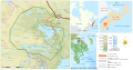
 Färnebofjärden National Park flood satellite map-fr.svg 3,511 × 4,693; 4.67 MB
-
 Färnebofjärden National Park flooding comparison topographic map-fr.svg 3,511 × 4,693; 1.7 MB
-
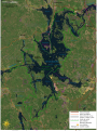 Färnebofjärden National Park satellite map-fr.svg 1,772 × 2,368; 2.41 MB
-
 Färnebofjärden National Park topographic flood map-fr.svg 3,511 × 4,693; 1.69 MB
-
 Färnebofjärden National Park topographic map-fr.svg 3,511 × 4,693; 1.69 MB
-
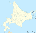
 Hokkaidō géolocalisation 000.svg 1,720 × 1,593; 1.4 MB
-
 Hokkaidō géolocalisation relief 000.png 1,720 × 1,593; 1.97 MB
-
 Hokkaidō géolocalisation relief 000.svg 1,720 × 1,593; 1.2 MB
-
 Hokkaidō géolocalisation relief.svg 1,720 × 1,593; 1.64 MB
-
 Hokkaidō géolocalisation.svg 1,720 × 1,593; 1.39 MB
-
 Hooghly River.svg 1,689 × 7,678; 9.81 MB
-
 Kanagawa géolocalisation relief.svg 1,720 × 1,331; 1.85 MB
-
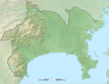
 Kanagawa géolocalisation.svg 1,720 × 1,331; 585 KB
-
 Kejimkujik National Park.svg 3,146 × 1,655; 4.27 MB
-
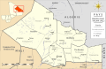 Kidal administrative map-fr.svg 6,200 × 4,015; 729 KB
-
 Kidal topographic map-fr.svg 6,200 × 4,015; 3.54 MB
-
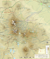
 Kilauea topographic map-fr.svg 3,543 × 2,480; 5.22 MB
-
 Map of the Rhône river.svg 1,700 × 1,600; 527 KB
-
 Mount Cayley topographic map-fr.svg 3,352 × 5,747; 3.69 MB
-
 Mount Jefferson (Oregon) topographic map-fr.svg 1,772 × 1,369; 2.26 MB
-
 Padjelanta Sarek Stora Sjöfallet National Park reindeer herding map-fr.svg 2,127 × 1,759; 4.04 MB
-
 Padjelanta Sarek Stora Sjöfallet National Park topographic map-fr.svg 2,095 × 1,759; 8.24 MB
-
 Pamir drainage basin map-fr.svg 3,543 × 2,271; 4.59 MB
-
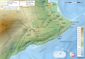
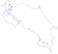 Rio-Tempisque.svg 2,396 × 2,222; 73 KB
-
 Saitama-ken géolocalisation relief.svg 1,715 × 1,098; 1.84 MB
-
 Saitama-ken géolocalisation.svg 1,715 × 1,098; 1.68 MB
-
 Thames map.svg 347 × 205; 16 KB
-
 The Cumbrian and Durham Derwents.svg 1,821 × 898; 8 MB
-
 Three Sisters Range topographic map-en.svg 3,305 × 4,351; 2.87 MB
-
 Three Sisters Range topographic map-fr.svg 3,305 × 4,351; 3.73 MB
-
 Three Sisters topographic map-fr.svg 2,835 × 3,300; 4.72 MB
-
 Topographic map of Garonne and Adour.svg 642 × 627; 2.9 MB
-
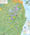
 Topographic map of South-West France with main rivers and cities.svg 1,028 × 885; 2.9 MB
-
 Wicklow Mountains hiking map-fr.svg 1,049 × 1,232; 3.19 MB
-
 Wicklow Mountains milieux végétaux map-fr.svg 1,049 × 1,232; 3.39 MB
-
 Wicklow Mountains mine map-fr.svg 1,049 × 1,232; 3.17 MB
-
 Wicklow Mountains National Park map-fr.svg 1,049 × 1,232; 3.39 MB
-
 Wicklow Mountains topographic map-fr.svg 1,050 × 1,234; 2.94 MB


_topographic_map-fr.svg)


