Category:Saints Peter and Paul Church (Mönichwald)
Jump to navigation
Jump to search
| Object location | | View all coordinates using: OpenStreetMap |
|---|
cemetery in Waldbach-Mönichwald, Austria  | |||||
| Upload media | |||||
| Instance of | |||||
|---|---|---|---|---|---|
| Named after | |||||
| Location | Waldbach-Mönichwald, Hartberg-Fürstenfeld District, Styria, Austria | ||||
| Heritage designation | |||||
 | |||||
Subcategories
This category has only the following subcategory.
Media in category "Saints Peter and Paul Church (Mönichwald)"
The following 40 files are in this category, out of 40 total.
-
 AT-81860 Kath. Pfarrkirche hll. Peter und Paul und Friedhof Mönichwald 02.JPG 3,456 × 5,184; 4.71 MB
-
 AT-81860 Kath. Pfarrkirche hll. Peter und Paul und Friedhof Mönichwald 03.JPG 3,456 × 5,184; 4.83 MB
-
 AT-81860 Kath. Pfarrkirche hll. Peter und Paul und Friedhof Mönichwald 04.JPG 3,456 × 5,184; 4.06 MB
-
 AT-81860 Kath. Pfarrkirche hll. Peter und Paul und Friedhof Mönichwald 05.JPG 3,456 × 5,184; 4.61 MB
-
 AT-81860 Kath. Pfarrkirche hll. Peter und Paul und Friedhof Mönichwald 06.JPG 5,184 × 3,456; 6.6 MB
-
 AT-81860 Kath. Pfarrkirche hll. Peter und Paul und Friedhof Mönichwald 07.JPG 3,456 × 5,184; 4.34 MB
-
 AT-81860 Kath. Pfarrkirche hll. Peter und Paul und Friedhof Mönichwald 08.JPG 3,456 × 5,184; 7.76 MB
-
 AT-81860 Kath. Pfarrkirche hll. Peter und Paul und Friedhof Mönichwald 09.JPG 5,184 × 3,456; 9.41 MB
-
 AT-81860 Kath. Pfarrkirche hll. Peter und Paul und Friedhof Mönichwald 10.JPG 3,456 × 5,184; 7.3 MB
-
 AT-81860 Kath. Pfarrkirche hll. Peter und Paul und Friedhof Mönichwald 11.JPG 5,184 × 3,456; 8.9 MB
-
 AT-81860 Kath. Pfarrkirche hll. Peter und Paul und Friedhof Mönichwald 12.JPG 3,456 × 5,184; 6.9 MB
-
 AT-81860 Kath. Pfarrkirche hll. Peter und Paul und Friedhof Mönichwald 13.JPG 5,184 × 3,456; 5.16 MB
-
 AT-81860 Kath. Pfarrkirche hll. Peter und Paul und Friedhof Mönichwald 14.JPG 3,456 × 5,184; 8.72 MB
-
 AT-81860 Kath. Pfarrkirche hll. Peter und Paul und Friedhof Mönichwald 15.JPG 3,456 × 5,184; 4.02 MB
-
 AT-81860 Kath. Pfarrkirche hll. Peter und Paul und Friedhof Mönichwald 16.JPG 3,456 × 5,184; 8.87 MB
-
 AT-81860 Kath. Pfarrkirche hll. Peter und Paul und Friedhof Mönichwald 17.JPG 5,184 × 3,456; 5.79 MB
-
 AT-81860 Kath. Pfarrkirche hll. Peter und Paul und Friedhof Mönichwald 18.JPG 3,456 × 5,184; 6.98 MB
-
 AT-81860 Kath. Pfarrkirche hll. Peter und Paul und Friedhof Mönichwald 19.JPG 3,456 × 5,184; 4.91 MB
-
 AT-81860 Kath. Pfarrkirche hll. Peter und Paul und Friedhof Mönichwald 20.JPG 3,456 × 5,184; 6.7 MB
-
 AT-81860 Kath. Pfarrkirche hll. Peter und Paul und Friedhof Mönichwald 56.JPG 3,456 × 5,184; 7.66 MB
-
 AT-81860 Kath. Pfarrkirche hll. Peter und Paul und Friedhof Mönichwald 57.JPG 3,456 × 5,184; 4.67 MB
-
 AT-81860 Kath. Pfarrkirche hll. Peter und Paul und Friedhof Mönichwald 58.JPG 3,456 × 5,184; 7.58 MB
-
 AT-81860 Kath. Pfarrkirche hll. Peter und Paul und Friedhof Mönichwald 59.JPG 3,456 × 5,184; 6.65 MB
-
 AT-81860 Kath. Pfarrkirche hll. Peter und Paul und Friedhof Mönichwald 60.JPG 3,456 × 5,184; 7.35 MB
-
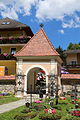
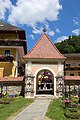
 Mönichwald - Friedhof mit Friedhofstor.jpg 2,481 × 3,308; 5.83 MB
-
 Mönichwald - Gemeindeamt mit unterirdischer Kapelle und Friedhof.jpg 3,567 × 2,676; 5.36 MB
-
 Mönichwald - Kirche hll Peter und Paul - Grabstein von Pfarrer Erenbert Schweigert 1796.jpg 2,720 × 3,628; 7.08 MB
-
 Mönichwald - Kirche hll Peter und Paul mit Friedhofsmauer.jpg 3,389 × 2,541; 4.94 MB
-
 Mönichwald - Kruzifix an der Kirche hll Peter und Paul.jpg 2,649 × 3,532; 4.82 MB
-
 Mönichwald - Park und Kirche hll Peter und Paul und Gemeindeamt.jpg 3,192 × 2,394; 4.47 MB
-
 Mönichwald - Seegasthof Breineder und Kirche hll Peter und Paul.jpg 4,000 × 3,000; 6.93 MB
-
 Pfarrkirche Mönichwald.jpg 3,264 × 4,928; 7.96 MB
-
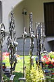
 Saints Peter and Paul Church (Mönichwald) War Memorial 01.jpg 5,582 × 3,722; 5.91 MB
-
 Saints Peter and Paul Church (Mönichwald) War Memorial 02.jpg 4,491 × 2,994; 3.58 MB
-
 Saints Peter and Paul Church Mönichwald 01.jpg 4,000 × 6,000; 10.76 MB
-
 Saints Peter and Paul Church Mönichwald 02.jpg 3,484 × 5,226; 3.95 MB
-
 Saints Peter and Paul Church Mönichwald 03.jpg 3,654 × 5,481; 4.71 MB
-
 Saints Peter and Paul Church Mönichwald 04.jpg 5,625 × 3,750; 4.55 MB
-
 Saints Peter and Paul Church Mönichwald 05.jpg 5,847 × 3,898; 5.03 MB
-
 Saints Peter and Paul Church Mönichwald 06.jpg 3,709 × 5,563; 4.28 MB


_War_Memorial_01.jpg)
_War_Memorial_02.jpg)


