Category:San Leandro, California
Zur Navigation springen
Zur Suche springen
Ort im US-Bundesstaat Kalifornien    | |||||
| Medium hochladen | |||||
| Ist ein(e) |
| ||||
|---|---|---|---|---|---|
| Ort | Alameda County, Kalifornien, Pacific States Region | ||||
| Liegt am oder im Gewässer | |||||
| Einwohnerzahl |
| ||||
| Fläche |
| ||||
| Höhe über dem Meeresspiegel |
| ||||
| offizielle Website | |||||
 | |||||
Unterkategorien
Es werden 9 von insgesamt 9 Unterkategorien in dieser Kategorie angezeigt:
In Klammern die Anzahl der enthaltenen Kategorien (K), Seiten (S), Dateien (D)
Seiten in der Kategorie „San Leandro, California“
Diese Kategorie enthält nur die folgende Seite.
Medien in der Kategorie „San Leandro, California“
Folgende 28 Dateien sind in dieser Kategorie, von 28 insgesamt.
-

-

-

-
 Anthony Chabot Family Campground view of Lake Chabot.jpg 2.000 × 1.500; 1,38 MB
-
 CAMap-doton-San Leandro.png 209 × 230; 4 KB
-

-
 Childrensmemorialdetailsanleandro.jpg 4.000 × 3.000; 5,16 MB
-

-
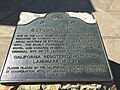 EstudilloHomePlaque.jpg 2.016 × 1.512; 1,53 MB
-
 Eucalyptus trees at dusk.JPG 4.000 × 3.000; 5,09 MB
-
 Flag of San Leandro, California.gif 360 × 216; 7 KB
-
 Fusion - panoramio.jpg 2.592 × 1.552; 1,21 MB
-

-
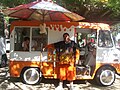 ICE CREAM TRUCK PARTY 006.JPG 2.816 × 2.112; 1,12 MB
-
 Jogging on the dam - panoramio.jpg 2.592 × 1.552; 327 KB
-
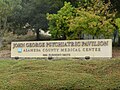 Johngeorgepsychiatricpavilion.jpg 4.000 × 3.000; 4,89 MB
-
 Lake Chabot (pb160884).jpg 800 × 600; 272 KB
-
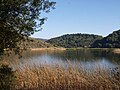
 Lakechabot.jpg 3.440 × 2.056; 1,28 MB
-
 Old San Leandro, San Leandro, CA, USA - panoramio (1).jpg 3.192 × 2.350; 903 KB
-
 OSI soft - panoramio.jpg 2.592 × 1.456; 847 KB
-
 Peaceful return - panoramio.jpg 2.592 × 1.552; 1,39 MB
-
 Rancho San Antonio.JPG 2.736 × 3.648; 2,15 MB
-
 San Lorenzo Ashland.jpg 4.592 × 3.448; 7,86 MB
-
 Seal of San Leandro, California.jpg 100 × 100; 9 KB
-
 Tree root and sunshine - panoramio.jpg 2.929 × 1.918; 3,2 MB
-
 Upper San Leandro Reservoir aerial.jpg 3.431 × 2.200; 2,18 MB
-
 CA 13 certified.pdf 1.275 × 1.650; 690 KB
-
 California US Congressional District 13 (since 2013).tif 2.016 × 998; 2,98 MB
.jpg)


.jpg)


._Waited_50_minutes._It_was_worth_it._-pizza_-sanleandro_(17151139468).jpg)


.jpg)

.jpg)


