Category:September 2005 in County Tyrone
Jump to navigation
Jump to search
English: Images taken in County Tyrone, Northern Ireland in this month of 2005 (not the date of the upload).
| Jan | Feb | Mar | Apr | May | Jun | Jul | Aug | Sep | Oct | Nov | Dec | ||
| ← | 5 | 1 | 13 | 1 | 6 | 8 | 5 | 8 | 60 | 83 | 76 | 153 | → |
|---|
Media in category "September 2005 in County Tyrone"
The following 60 files are in this category, out of 60 total.
-
 Ancestral home of James Buchanan - geograph.org.uk - 55612.jpg 512 × 383; 64 KB
-
 Approach to Fintona - geograph.org.uk - 55644.jpg 512 × 383; 66 KB
-
 Badoney Church and Barnes Gap - geograph.org.uk - 52793.jpg 640 × 479; 145 KB
-
 Badoney Upper Church of Ireland - geograph.org.uk - 52794.jpg 491 × 368; 42 KB
-
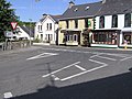
 Ballygawley Co. Tyrone - geograph.org.uk - 62151.jpg 512 × 383; 71 KB
-
 Ballyreagh Presbyterian Church - geograph.org.uk - 62147.jpg 512 × 383; 66 KB
-
 Barnesmore Gap - geograph.org.uk - 52795.jpg 512 × 383; 59 KB
-

-
 Beragh County Tyrone - geograph.org.uk - 55621.jpg 512 × 383; 51 KB
-
 Broughderg Post Office - geograph.org.uk - 52803.jpg 512 × 393; 42 KB
-
 Burrell's Folly, Drumquin - geograph.org.uk - 62062.jpg 512 × 383; 100 KB
-
 Carnlea Crossroads - geograph.org.uk - 55639.jpg 512 × 383; 51 KB
-
 Church of Ireland Fintona - geograph.org.uk - 56025.jpg 512 × 383; 61 KB
-
 Church of Ireland Seskinore - geograph.org.uk - 56021.jpg 512 × 383; 41 KB
-
 Cranagh County Tyrone - geograph.org.uk - 52796.jpg 640 × 479; 140 KB
-
 Crooked Bridge, Drumquin - geograph.org.uk - 62069.jpg 512 × 383; 73 KB
-
 Dromore Abbey - geograph.org.uk - 55654.jpg 512 × 383; 66 KB
-
 Dromore County Tyrone - geograph.org.uk - 55656.jpg 512 × 383; 71 KB
-
 Drumhonish Townland - geograph.org.uk - 62065.jpg 512 × 383; 41 KB
-

-
 Drumquin Pres Church and graveyard - geograph.org.uk - 62064.jpg 512 × 383; 55 KB
-
 Drumquin, County Tyrone - geograph.org.uk - 62070.jpg 512 × 383; 61 KB
-
 Eden Orange Hall.jpg 512 × 383; 49 KB
-
 Erganagh House, Glenpark Road, Omagh - geograph.org.uk - 52088.jpg 512 × 383; 56 KB
-
 Fintona Police Station - geograph.org.uk - 55652.jpg 512 × 383; 40 KB
-
 First Omagh Presbyterian Church - geograph.org.uk - 53580.jpg 512 × 385; 52 KB
-
 Gortin Co. Tyrone - geograph.org.uk - 52788.jpg 512 × 384; 59 KB
-
 Greencastle Co Tyrone - geograph.org.uk - 52804.jpg 512 × 383; 42 KB
-
 Half way house - geograph.org.uk - 62074.jpg 512 × 383; 73 KB
-
 Killyclogher - east of Omagh - geograph.org.uk - 52073.jpg 512 × 383; 45 KB
-
 Kirlish Castle near Drumquin - geograph.org.uk - 62054.jpg 512 × 383; 103 KB
-
 Looking towards Drumduff Hill - geograph.org.uk - 55613.jpg 512 × 383; 63 KB
-
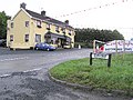
 McAtee's Bar, Fintona - geograph.org.uk - 55650.jpg 512 × 383; 71 KB
-
 Mountfield Village - geograph.org.uk - 52806.jpg 512 × 383; 46 KB
-
 Moylagh Crossroads - geograph.org.uk - 55626.jpg 512 × 383; 50 KB
-
 Mullaghmore House - geograph.org.uk - 52757.jpg 512 × 385; 56 KB
-
 New Lough, Gortin - geograph.org.uk - 130538.jpg 640 × 479; 152 KB
-
 NI Owenkill river-Plumbridge.jpg 512 × 383; 96 KB
-
 Oak Lough and New Lough - geograph.org.uk - 70060.jpg 640 × 479; 158 KB
-
 Old Mill Antiques - geograph.org.uk - 62158.jpg 512 × 383; 51 KB
-
 Omagh - Church of Ireland - geograph.org.uk - 53560.jpg 512 × 384; 39 KB
-
 Omagh - Market Street - geograph.org.uk - 54345.jpg 512 × 385; 64 KB
-
 Omagh Baptist Church - geograph.org.uk - 53582.jpg 512 × 384; 50 KB
-
 Omagh Evangelical Church - geograph.org.uk - 53585.jpg 512 × 384; 37 KB
-
 Omagh Free Methodist Church - geograph.org.uk - 53586.jpg 512 × 384; 44 KB
-
 Omagh Free Presbyterian Church - geograph.org.uk - 53584.jpg 512 × 384; 45 KB
-
 Omagh Gospel Hall - geograph.org.uk - 53581.jpg 512 × 384; 50 KB
-
 Omagh Methodist Church - geograph.org.uk - 53570.jpg 512 × 384; 50 KB
-
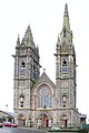 Omagh Sacred Heart Church - The Chapel - geograph.org.uk - 53556.jpg 428 × 640; 81 KB
-
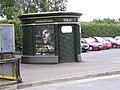 Omagh's only public toilet - geograph.org.uk - 70453.jpg 640 × 479; 124 KB
-
 Peat collection at Arvalee - geograph.org.uk - 55610.jpg 512 × 383; 61 KB
-
 Plumbridge Co. Tyrone - geograph.org.uk - 130535.jpg 640 × 479; 109 KB
-
 Plumbridge Post Office - geograph.org.uk - 130531.jpg 640 × 458; 143 KB
-
 Sixmilecross, County Tyrone - geograph.org.uk - 55615.jpg 512 × 383; 43 KB
-
 St Patricks RC Church, Drumquin - geograph.org.uk - 68235.jpg 640 × 479; 87 KB
-
 Swinging Bars roundabout - geograph.org.uk - 52079.jpg 512 × 383; 66 KB
-
 The Leap bridge - geograph.org.uk - 53214.jpg 512 × 383; 91 KB
-
 The Village store, Seskinore - geograph.org.uk - 55635.jpg 512 × 383; 62 KB
-
 Tyrone countryside - geograph.org.uk - 62076.jpg 512 × 383; 67 KB
-
 Windmill - geograph.org.uk - 54352.jpg 512 × 383; 38 KB


