Category:Shirwell
Jump to navigation
Jump to search
village in the United Kingdom  | |||||
| Upload media | |||||
| Instance of | |||||
|---|---|---|---|---|---|
| Location | North Devon, Devon, South West England, England | ||||
| Population |
| ||||
 | |||||
Subcategories
This category has the following 2 subcategories, out of 2 total.
C
Y
- Youlston Park (2 F)
Media in category "Shirwell"
The following 200 files are in this category, out of 274 total.
(previous page) (next page)-
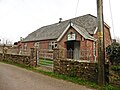
 'Dutch' bungalow, at Shirwell Cross - geograph.org.uk - 6087203.jpg 1,024 × 773; 146 KB
-
 'The Old Post Office' Shirwell Cross - geograph.org.uk - 6087230.jpg 1,024 × 768; 118 KB
-
 A boundary stone on Cott bridge on the River Yeo - geograph.org.uk - 1858354.jpg 768 × 1,024; 299 KB
-

-
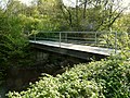
 A bridge on Rookbear Lane as seen from upstream - geograph.org.uk - 2236528.jpg 1,024 × 642; 230 KB
-

-

-

-

-
-
 A bridge over a stream near Rookbear Lane - geograph.org.uk - 2236700.jpg 1,024 × 680; 331 KB
-

-
 A bridge over Bradiford Water at Broomhill Hotel - geograph.org.uk - 2237483.jpg 1,024 × 680; 242 KB
-

-

-

-

-

-
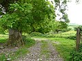 A farm track near Plaistow Barton - geograph.org.uk - 812956.jpg 640 × 480; 119 KB
-
 A footbridge on the River Yeo at Snapper - geograph.org.uk - 1858470.jpg 1,024 × 768; 324 KB
-

-
 A Restricted Byway in Raleigh Wood - geograph.org.uk - 3570522.jpg 1,200 × 1,600; 840 KB
-
 A stile just above Muddiford. - geograph.org.uk - 812985.jpg 480 × 640; 136 KB
-

-

-
 A39 at Upcott Cross - geograph.org.uk - 522453.jpg 640 × 425; 66 KB
-
 A39 passing Waytown farm - geograph.org.uk - 522434.jpg 640 × 425; 90 KB
-
-
 Access to Chilbridge Farm - geograph.org.uk - 1709487.jpg 640 × 480; 82 KB
-

-
 An old bridge at Snapper - geograph.org.uk - 3314755.jpg 1,600 × 1,063; 996 KB
-

-

-

-

-
 Approaching Muddiford and Milltown on the B3230 - geograph.org.uk - 1747711.jpg 1,024 × 768; 248 KB
-
 Approaching Shirwell - geograph.org.uk - 367575.jpg 640 × 480; 84 KB
-
 B3230 in Gotcombe Wood - geograph.org.uk - 6109088.jpg 1,600 × 1,200; 971 KB
-
 Barn above Newbarn Wood - geograph.org.uk - 731380.jpg 640 × 426; 122 KB
-
 Barn at Glebelands - geograph.org.uk - 5151589.jpg 1,024 × 768; 168 KB
-
 Bend in the A39 at Sherwell - geograph.org.uk - 1709489.jpg 640 × 480; 91 KB
-
 Blackpool Bridge on the River Yeo - geograph.org.uk - 1858359.jpg 1,024 × 768; 339 KB
-
 Blackpool Bridge on the River Yeo - geograph.org.uk - 1858364.jpg 1,024 × 768; 314 KB
-

-

-
 Bradiford Water - geograph.org.uk - 6086592.jpg 1,024 × 768; 229 KB
-
 Bridge over the River Yeo, Arlington - geograph.org.uk - 1824791.jpg 2,000 × 1,494; 1.13 MB
-
 Bridge pillar, Arlington House estate - geograph.org.uk - 6568606.jpg 533 × 800; 139 KB
-
 Brightlycott Farm, near Shirwell - geograph.org.uk - 5361078.jpg 6,000 × 4,000; 4.89 MB
-
 Bulldog Fish Farm by the River Yeo - geograph.org.uk - 3570517.jpg 1,600 × 899; 560 KB
-
 Burridge - geograph.org.uk - 418342.jpg 640 × 480; 58 KB
-
 Chelfham Viaduct, aerial 2018 (1) - geograph.org.uk - 5960332.jpg 640 × 427; 83 KB
-
 Chelfham Viaduct, aerial 2018 (2) - geograph.org.uk - 5960343.jpg 640 × 427; 93 KB
-
 Chelfham Viaduct, aerial 2018 (3) - geograph.org.uk - 5960352.jpg 640 × 427; 79 KB
-
 Collard Bridge on the River Yeo - geograph.org.uk - 1858424.jpg 1,024 × 768; 314 KB
-
 Collard Bridge on the River Yeo - geograph.org.uk - 1858431.jpg 1,024 × 768; 287 KB
-
-
 Communications mast at Shirwell Cross - geograph.org.uk - 6087205.jpg 1,024 × 778; 211 KB
-
 Construction of the new Collard Bridge - geograph.org.uk - 4294346.jpg 3,000 × 4,000; 4.69 MB
-
 Construction of the new Collard Bridge - geograph.org.uk - 4294360.jpg 4,000 × 3,000; 4.96 MB
-
 Cott Bridge on the River Yeo - geograph.org.uk - 1858307.jpg 1,024 × 768; 324 KB
-
 Cott Bridge on the River Yeo - geograph.org.uk - 1858328.jpg 1,024 × 768; 308 KB
-

-
-
 Coxley Barton - geograph.org.uk - 5364925.jpg 6,000 × 4,000; 5.5 MB
-

-
-
 Drive of Youlston Park - geograph.org.uk - 4540933.jpg 1,282 × 1,600; 381 KB
-

-
 Feeder to the Yeo valley - geograph.org.uk - 6087248.jpg 1,024 × 781; 250 KB
-
 Fields above Sloley Barton - geograph.org.uk - 4609898.jpg 1,024 × 768; 302 KB
-

-
 Fields looking towards Sloley Barton - geograph.org.uk - 522449.jpg 640 × 425; 83 KB
-
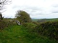
 Footpath on the Shirwell Road - geograph.org.uk - 1888451.jpg 2,560 × 1,920; 1.03 MB
-
 Ford Farm - geograph.org.uk - 731395.jpg 640 × 374; 68 KB
-
 Former Chapel, Shirwell Cross - geograph.org.uk - 6087211.jpg 1,024 × 746; 159 KB
-
 Hartland View - geograph.org.uk - 5151587.jpg 1,024 × 768; 171 KB
-
 Hartland View farm - geograph.org.uk - 522467.jpg 640 × 425; 86 KB
-
 Hartpiece Farm - geograph.org.uk - 5361065.jpg 6,000 × 4,000; 5.51 MB
-
 Hartpiece Farm - geograph.org.uk - 6086909.jpg 1,024 × 768; 240 KB
-
 Hartpiece from Burridge - geograph.org.uk - 1709506.jpg 640 × 480; 65 KB
-
 Hartpiece, between the B3230 and A39 - geograph.org.uk - 782054.jpg 640 × 480; 57 KB
-
 Hay bales, South Wooley Farm - geograph.org.uk - 4609346.jpg 1,024 × 768; 257 KB
-
 Hillside above the Yeo Valley - geograph.org.uk - 6087233.jpg 1,024 × 767; 132 KB
-
 House and postbox, Shirwell - geograph.org.uk - 6087236.jpg 1,024 × 755; 153 KB
-

-
 House repairs at South Woolley - geograph.org.uk - 4540937.jpg 1,600 × 1,200; 1.58 MB
-
 Housing estate, Shirwell Cross - geograph.org.uk - 6087208.jpg 1,024 × 768; 124 KB
-
 Inside St Peter, Shirwell (1) - geograph.org.uk - 4580199.jpg 480 × 640; 59 KB
-
 Inside St Peter, Shirwell (2) - geograph.org.uk - 4580200.jpg 480 × 640; 51 KB
-
 Inside St Peter, Shirwell (3) - geograph.org.uk - 4580201.jpg 467 × 640; 46 KB
-
 Inside St Peter, Shirwell (4) - geograph.org.uk - 4580202.jpg 640 × 476; 81 KB
-
 Inside St Peter, Shirwell (5) - geograph.org.uk - 4580203.jpg 640 × 480; 38 KB
-
 Inside St Peter, Shirwell (6) - geograph.org.uk - 4580204.jpg 640 × 480; 67 KB
-
 Inside St Peter, Shirwell (7) - geograph.org.uk - 4580209.jpg 640 × 480; 43 KB
-
 Inside St Peter, Shirwell (8) - geograph.org.uk - 4580217.jpg 480 × 640; 44 KB
-
 Inside St Peter, Shirwell (9) - geograph.org.uk - 4580218.jpg 640 × 476; 74 KB
-

-
 King Bridge on Bradiford Water - geograph.org.uk - 2237474.jpg 1,024 × 680; 253 KB
-
 Kingdon's Garden - geograph.org.uk - 367560.jpg 640 × 480; 97 KB
-
 Lake in Woolley Wood - geograph.org.uk - 4541235.jpg 1,600 × 1,200; 1.44 MB
-
 Lane to Hartpiece - geograph.org.uk - 6086907.jpg 1,024 × 768; 179 KB
-
 Lane to Upcott - geograph.org.uk - 4609827.jpg 1,024 × 768; 285 KB
-
 Lay-by on A39 Shirwell Road - geograph.org.uk - 4540916.jpg 1,600 × 1,200; 1.22 MB
-
 Lodge for Arlington Court estate - geograph.org.uk - 4540949.jpg 1,600 × 1,200; 1.55 MB
-

-
 Looking down the River Yeo from the new Collard Bridge - geograph.org.uk - 4423931.jpg 4,000 × 3,000; 4.13 MB
-

-

-

-
 Marshland by River Yeo in Woolley Wood - geograph.org.uk - 5896987.jpg 1,200 × 1,600; 835 KB
-

-

-
 Minor road passes lane to Upcott - geograph.org.uk - 522462.jpg 640 × 425; 65 KB
-
 Minor road to Blackpool Bridge - geograph.org.uk - 6087243.jpg 1,024 × 768; 208 KB
-
 Minor road to Shirwell - geograph.org.uk - 4609801.jpg 1,024 × 768; 194 KB
-

-
 Mobile Library visits Shirwell - geograph.org.uk - 6087238.jpg 1,024 × 766; 171 KB
-
 New Barn Farm - geograph.org.uk - 6087231.jpg 1,024 × 768; 148 KB
-
 North Devon , Grassy Field ^ Cattle - geograph.org.uk - 4862294.jpg 6,000 × 4,000; 6.8 MB
-
 North Devon , Grassy Field ^ Stream - geograph.org.uk - 4861317.jpg 6,000 × 4,000; 7.28 MB
-
 North Devon , Rookbear Lane - geograph.org.uk - 4861319.jpg 6,000 × 4,000; 6.49 MB
-
 North Devon , Small Stream - geograph.org.uk - 4861318.jpg 6,000 × 4,000; 6.1 MB
-
 North Devon , Small Stream - geograph.org.uk - 4861320.jpg 6,000 × 4,000; 6.8 MB
-
 North Hill - geograph.org.uk - 782010.jpg 640 × 480; 67 KB
-

-

-
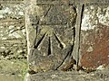 Ordnance Survey Cut Mark - geograph.org.uk - 3724448.jpg 4,000 × 3,000; 4.64 MB
-
 Ordnance Survey Cut Mark - geograph.org.uk - 5021425.jpg 436 × 640; 109 KB
-
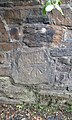 Ordnance Survey Cut Mark - geograph.org.uk - 5021434.jpg 383 × 640; 105 KB
-
 Passing Plaistow Mill on the B3230 - geograph.org.uk - 1747738.jpg 1,024 × 768; 262 KB
-
 Path over Tucker's Bridge - geograph.org.uk - 5896977.jpg 1,600 × 1,200; 822 KB
-
 Plaistow Barton - geograph.org.uk - 812960.jpg 640 × 426; 87 KB
-
 Plaistow Mills - geograph.org.uk - 5150623.jpg 1,024 × 842; 262 KB
-
 Plaistown Mill on Bradiford Water - geograph.org.uk - 2237416.jpg 1,024 × 680; 198 KB
-
 Pudnor Hill - geograph.org.uk - 6086914.jpg 1,024 × 768; 250 KB
-
 Pudnor Wood - geograph.org.uk - 6086911.jpg 1,024 × 768; 203 KB
-
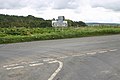
 Radio Mast, Shirwell Cross - geograph.org.uk - 731386.jpg 426 × 640; 66 KB
-
 Rhododendron in the Woolley Belt - geograph.org.uk - 4540939.jpg 1,600 × 1,200; 1.88 MB
-
 River Yeo in Woolley Wood - geograph.org.uk - 5896992.jpg 1,200 × 1,600; 857 KB
-

-
 Road junction for Snapper - geograph.org.uk - 4540926.jpg 1,600 × 1,200; 1.1 MB
-
 Road to Chilbridge Farm - geograph.org.uk - 4609398.jpg 1,024 × 768; 254 KB
-
 Road to King's Warren - geograph.org.uk - 4609378.jpg 1,024 × 768; 220 KB
-
 Roadworks on the B3230 near Plaistow Mill - geograph.org.uk - 5313523.jpg 4,000 × 3,000; 4.49 MB
-
 Sepscott Wood near the River Yeo - geograph.org.uk - 4423982.jpg 4,000 × 3,000; 5.3 MB
-
 Shed at New Barn Farm - geograph.org.uk - 6087235.jpg 1,024 × 768; 144 KB
-
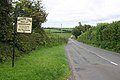
 Shirwell on the A39 - geograph.org.uk - 781987.jpg 640 × 480; 105 KB
-
 Shirwell primary school.jpg 3,968 × 2,976; 4.3 MB
-
 Shirwell Road at Upcott Cross - geograph.org.uk - 5151597.jpg 1,024 × 768; 159 KB
-
 Shirwell skittle alley - Queen Victoria's railway carriage (from S).jpg 3,968 × 2,232; 3.87 MB
-
 Shirwell skittle alley - Queen Victoria's railway carriage (from SE).jpg 3,968 × 2,232; 3.68 MB
-
 Shirwell skittle alley - Queen Victoria's railway carriage (from W).jpg 2,976 × 3,968; 5.06 MB
-
 Shirwell Town - geograph.org.uk - 781992.jpg 640 × 427; 68 KB
-
 Shirwell Village Hall - geograph.org.uk - 6087240.jpg 1,024 × 768; 198 KB
-
 Shirwell, Plaistow Mill - geograph.org.uk - 86257.jpg 640 × 431; 113 KB
-
 Sloley Barton - geograph.org.uk - 782003.jpg 640 × 480; 46 KB
-

-
 Smallcombe Bridge on the River Yeo - geograph.org.uk - 1858029.jpg 1,024 × 768; 299 KB
-
 Smallcombe Bridge over the River Yeo - geograph.org.uk - 5897000.jpg 1,200 × 1,600; 895 KB
-
 Snapper Halt on the Lynton ^ Barnstaple Railway - geograph.org.uk - 3314790.jpg 2,764 × 1,842; 2.14 MB
-
 Snapper Packhorse bridge - geograph.org.uk - 3293162.jpg 640 × 479; 98 KB
-
 South Hill - geograph.org.uk - 782044.jpg 640 × 480; 71 KB
-
 St Peter, Shirwell, altar - geograph.org.uk - 4580213.jpg 640 × 477; 74 KB
-
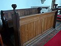 St Peter, Shirwell, choir stalls - geograph.org.uk - 4580211.jpg 640 × 480; 60 KB
-
 St Peter, Shirwell, churchyard (i) - geograph.org.uk - 4580146.jpg 640 × 480; 59 KB
-
 St Peter, Shirwell, churchyard (ii) - geograph.org.uk - 4580148.jpg 640 × 480; 55 KB
-
 St Peter, Shirwell, churchyard (iii) - geograph.org.uk - 4580149.jpg 640 × 480; 80 KB
-
 St Peter, Shirwell, churchyard (iv) - geograph.org.uk - 4580150.jpg 640 × 460; 58 KB
-
 St Peter, Shirwell, churchyard (ix) - geograph.org.uk - 4580162.jpg 640 × 460; 98 KB
-
 St Peter, Shirwell, churchyard (v) - geograph.org.uk - 4580151.jpg 640 × 480; 60 KB
-
 St Peter, Shirwell, churchyard (vi) - geograph.org.uk - 4580152.jpg 640 × 480; 76 KB
-

-
 St Peter, Shirwell, churchyard (x) - geograph.org.uk - 4580164.jpg 480 × 640; 93 KB
-
 St Peter, Shirwell, churchyard (xi) - geograph.org.uk - 4580167.jpg 640 × 480; 63 KB
-
 St Peter, Shirwell, churchyard (xii) - geograph.org.uk - 4580155.jpg 640 × 480; 80 KB
-
 St Peter, Shirwell, incumbency board - geograph.org.uk - 4580207.jpg 465 × 640; 55 KB
-
 St Peter, Shirwell, lectern - geograph.org.uk - 4580214.jpg 480 × 640; 60 KB
-
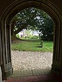
 St Peter, Shirwell, lych gate - geograph.org.uk - 4574893.jpg 640 × 480; 79 KB
-
 St Peter, Shirwell, memorial (a) - geograph.org.uk - 4580170.jpg 469 × 640; 41 KB
-
 St Peter, Shirwell, memorial (b) - geograph.org.uk - 4580175.jpg 475 × 640; 39 KB
-
 St Peter, Shirwell, memorial (c) - geograph.org.uk - 4580177.jpg 640 × 480; 63 KB
-
 St Peter, Shirwell, memorial (d) - geograph.org.uk - 4580179.jpg 640 × 480; 82 KB
-
 St Peter, Shirwell, memorial (e) - geograph.org.uk - 4580190.jpg 640 × 472; 41 KB
-
 St Peter, Shirwell, memorial (h) - geograph.org.uk - 4580197.jpg 471 × 640; 40 KB
-
 St Peter, Shirwell, memorials (f) - geograph.org.uk - 4580192.jpg 640 × 480; 41 KB
-
 St Peter, Shirwell, memorials (g) - geograph.org.uk - 4580193.jpg 480 × 640; 56 KB
-
 St Peter, Shirwell, pulpit - geograph.org.uk - 4580210.jpg 640 × 480; 66 KB
-
 St Peter, Shirwell, The Last Supper - geograph.org.uk - 4580206.jpg 640 × 480; 50 KB
-
 Steep road down to Plaistow Mills - geograph.org.uk - 4609867.jpg 1,024 × 768; 215 KB
-
 Sunnymeade on the B3230 - geograph.org.uk - 5150615.jpg 1,024 × 768; 167 KB
-
 Telephone exchange, Toll Bar Cross - geograph.org.uk - 4609406.jpg 1,024 × 768; 244 KB
-
 Terraced houses at Shirwell Cross - geograph.org.uk - 6087226.jpg 1,024 × 805; 142 KB
-

-
 The A39 into Burridge - geograph.org.uk - 1709513.jpg 640 × 480; 84 KB
-
-

-
 The B3230 approaching Muddiford - geograph.org.uk - 1747719.jpg 1,024 × 768; 290 KB
-
 The B3230 approaching the Broomhill Art Hotel - geograph.org.uk - 1747757.jpg 1,024 × 768; 239 KB
-
 The B3230 at the junction with the Shirwell road - geograph.org.uk - 1747731.jpg 1,024 × 768; 287 KB


_-_geograph.org.uk_-_5960332.jpg)
_-_geograph.org.uk_-_5960343.jpg)
_-_geograph.org.uk_-_5960352.jpg)


_-_geograph.org.uk_-_4580199.jpg)
_-_geograph.org.uk_-_4580200.jpg)
_-_geograph.org.uk_-_4580201.jpg)
_-_geograph.org.uk_-_4580202.jpg)
_-_geograph.org.uk_-_4580203.jpg)
_-_geograph.org.uk_-_4580204.jpg)
_-_geograph.org.uk_-_4580209.jpg)
_-_geograph.org.uk_-_4580217.jpg)
_-_geograph.org.uk_-_4580218.jpg)


.jpg)
.jpg)
.jpg)


_-_geograph.org.uk_-_4580146.jpg)
_-_geograph.org.uk_-_4580148.jpg)
_-_geograph.org.uk_-_4580149.jpg)
_-_geograph.org.uk_-_4580150.jpg)
_-_geograph.org.uk_-_4580162.jpg)
_-_geograph.org.uk_-_4580151.jpg)
_-_geograph.org.uk_-_4580152.jpg)
_-_geograph.org.uk_-_4580154.jpg)
_-_geograph.org.uk_-_4580164.jpg)
_-_geograph.org.uk_-_4580167.jpg)
_-_geograph.org.uk_-_4580155.jpg)


_-_geograph.org.uk_-_4580170.jpg)
_-_geograph.org.uk_-_4580175.jpg)
_-_geograph.org.uk_-_4580177.jpg)
_-_geograph.org.uk_-_4580179.jpg)
_-_geograph.org.uk_-_4580190.jpg)
_-_geograph.org.uk_-_4580197.jpg)
_-_geograph.org.uk_-_4580192.jpg)
_-_geograph.org.uk_-_4580193.jpg)


