Category:Sint Jacobsstraat 171, Utrecht
Jump to navigation
Jump to search
| Object location | | View all coordinates using: OpenStreetMap |
|---|
house in Utrecht, Netherlands  | |||||
| Upload media | |||||
| Instance of | |||||
|---|---|---|---|---|---|
| Location | Utrecht, Netherlands | ||||
| Located on street | |||||
| Heritage designation |
| ||||
 | |||||
|
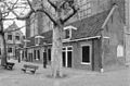
This is a category about rijksmonument number 36147
|
| Address |
|
Media in category "Sint Jacobsstraat 171, Utrecht"
The following 4 files are in this category, out of 4 total.
-
 Exterieur OVERZICHT - Utrecht - 20306259 - RCE.jpg 1,200 × 788; 280 KB
-
 Gedankenkopf Jacobikerk.jpg 3,072 × 2,304; 1.41 MB
-
 Gedankenkopf Kriester Utrecht.jpg 703 × 1,028; 206 KB
-
 Rijksmonument36147.JPG 2,560 × 1,920; 1.04 MB


