Category:Sites of Special Scientific Interest in Cornwall
Jump to navigation
Jump to search
Wikimedia category | |||||
| Upload media | |||||
| Instance of | |||||
|---|---|---|---|---|---|
| Category combines topics | |||||
| Cornwall | |||||
historic county of England; Celtic nation    | |||||
| Instance of | |||||
| Part of | |||||
| Location |
| ||||
| Capital | |||||
| Heritage designation | |||||
| Population |
| ||||
| Area |
| ||||
| Different from | |||||
| official website | |||||
 | |||||
Subcategories
This category has the following 18 subcategories, out of 18 total.
A
C
G
- Great Wheal Fortune (7 F)
- Greena Moor, Cornwall (1 F)
K
- Kelsey Head (16 F)
M
- Marazion Marsh Nature Reserve (22 F)
P
- Penberthy Croft Mine (5 F)
- Porth Nanven (27 F)
S
T
Media in category "Sites of Special Scientific Interest in Cornwall"
The following 39 files are in this category, out of 39 total.
-
 360 degrees of sea - geograph.org.uk - 567599.jpg 640 × 480; 52 KB
-
 Breney Common, Luxulyan - geograph.org.uk - 61643.jpg 640 × 455; 64 KB
-
 Church Cove - geograph.org.uk - 34901.jpg 640 × 480; 107 KB
-
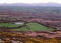
 Chyenhal Moor from the air - geograph.org.uk - 3162723.jpg 1,200 × 677; 362 KB
-
 Cliffs north of Lizard Head - geograph.org.uk - 218974.jpg 450 × 600; 131 KB
-

-
 De Lank Quarries, Hantergantick - geograph.org.uk - 278119.jpg 640 × 480; 91 KB
-
 Gwendreath turn - geograph.org.uk - 411552.jpg 640 × 480; 63 KB
-

-
 Helford River - geograph.org.uk - 740013.jpg 640 × 480; 131 KB
-
 Loe Pool.jpg 1,280 × 960; 435 KB
-

-
 Merthen Quay - geograph.org.uk - 746573.jpg 640 × 480; 89 KB
-
 Merthen Woods - geograph.org.uk - 739998.jpg 640 × 480; 121 KB
-
 Merthen Woods from Tremayne Quay - geograph.org.uk - 746554.jpg 640 × 480; 75 KB
-
 Montbretia (Crocosmia), Rosenannon Downs - geograph.org.uk - 222008.jpg 479 × 640; 164 KB
-
 Pednvounder beach and Treen Cliff - geograph.org.uk - 229773.jpg 640 × 268; 92 KB
-
 Pednvounder beach from treen cliff.jpg 2,700 × 1,800; 1.29 MB
-
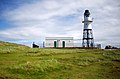 Peninnis Head lighthouse - geograph.org.uk - 934805.jpg 640 × 420; 247 KB
-
 Peninnis Head lighthouse - geograph.org.uk - 934829.jpg 640 × 480; 294 KB
-
 Pulpit Rock, Peninnis Head, Scilly - geograph.org.uk - 1584965.jpg 640 × 347; 71 KB
-
 Retire Common - geograph.org.uk - 998691.jpg 640 × 480; 94 KB
-
 Rose Bay Willow Herb, Rosenannon Downs - geograph.org.uk - 222006.jpg 640 × 479; 172 KB
-
 Rosenannon Downs with unfenced road - geograph.org.uk - 221925.jpg 640 × 480; 78 KB
-
 Spoil heaps near Wheal Alfred - geograph.org.uk - 36078.jpg 480 × 640; 106 KB
-
 St Erth Pits, St Erth.jpg 2,402 × 2,113; 2.56 MB
-
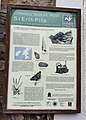 St Erth Pits.jpg 1,913 × 2,669; 1.38 MB
-
 St Mewan Beacon - geograph.org.uk - 81030.jpg 640 × 404; 97 KB
-
 Sylvia's Meadow - geograph.org.uk - 34657.jpg 640 × 480; 108 KB
-

-
 Track in Croft Pascoe Forest - geograph.org.uk - 1542187.jpg 427 × 640; 100 KB
-
 Treen Cliff - geograph.org.uk - 712222.jpg 640 × 618; 111 KB
-
 Treen Cliff and Pednvounder beach - geograph.org.uk - 711950.jpg 640 × 613; 106 KB
-
 Tumulus on Rosenannon Downs - geograph.org.uk - 221611.jpg 640 × 480; 79 KB
-
 Vegetation on Retire Common - geograph.org.uk - 1060611.jpg 640 × 480; 116 KB
-
 View across the Tamar south of Bere Ferrers.jpg 3,563 × 2,630; 2.81 MB
-
 Watermill Cove - geograph.org.uk - 72878.jpg 640 × 480; 147 KB
-
 Watermill Cove - geograph.org.uk - 932188.jpg 640 × 450; 300 KB
-
 West Bassett Stamps - geograph.org.uk - 353846.jpg 640 × 426; 117 KB


_with_heather,_Rosenannon_Downs_-_geograph.org.uk_-_222005.jpg)


,_Rosenannon_Downs_-_geograph.org.uk_-_222008.jpg)


