Category:Smethwick
Vai alla navigazione
Vai alla ricerca
town in Sandwell Metropolitan Borough, England  | |||||
| Carica un file multimediale | |||||
| Istanza di | |||||
|---|---|---|---|---|---|
| Luogo | Sandwell, West Midlands, Midlands Occidentali, Inghilterra | ||||
| Lingua ufficiale | |||||
| Popolazione |
| ||||
 | |||||
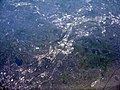
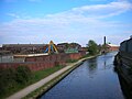
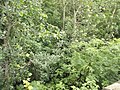
The industrial town of Smethwick in West Midlands, England.
Sottocategorie
Questa categoria contiene le 32 sottocategorie indicate di seguito, su un totale di 32.
B
C
- Chance's Glassworks (14 F)
E
- Engine Arm Aqueduct (13 F)
G
H
- Holly Lodge High School (2 F)
L
- Londonderry, West Midlands (5 F)
M
N
P
- Paxton House, Smethwick (1 F)
R
- Rolfe Street baths (12 F)
S
- Smethwick Old Church (9 F)
- Smethwick Baths (6 F)
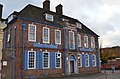
- Smethwick Council House (4 F)
- Smethwick fire 2013 (3 F)
- Soho Foundry (9 F)
- Summit Bridge, Smethwick (4 F)
V
W
- Waterloo Hotel Smethwick (5 F)
File nella categoria "Smethwick"
Questa categoria contiene 132 file, indicati di seguito, su un totale di 132.
-
 'The Barleycorn' - geograph.org.uk - 1217936.jpg 600 × 450; 223 KB
-
-

-
 Aerial Photo - raf 540 78 sffo 0003 (Soho Triangle).png 3 097 × 2 540; 3,86 MB
-
 Aerial Photo - raf 540 78 sffo 0003.png 5 304 × 4 353; 19,68 MB
-
 BCN Old Main Line - Pope's Bridge.jpg 1 600 × 1 064; 395 KB
-
 BearPlaqueRJH01.jpg 2 060 × 1 948; 2,06 MB
-
 Bearwood Market - geograph.org.uk - 1217906.jpg 600 × 450; 253 KB
-
 BearwoodRJH01.jpg 4 000 × 3 000; 2,31 MB
-
 BearwoodRJH03.JPG 4 000 × 3 000; 3,04 MB
-
 BearwoodRJH06TheWaterloo.JPG 4 000 × 3 000; 2,46 MB
-
 BearwoodRJH07TheWaterloo.JPG 3 667 × 2 745; 1,44 MB
-
 BearwoodRJH08TheWaterloo.JPG 3 823 × 2 867; 2,89 MB
-
 BearwoodRJH09TheWaterloo.JPG 3 909 × 2 933; 2,73 MB
-
 BearwoodRJH10LloydsBankCapeHill.JPG 2 933 × 3 909; 2,86 MB
-
 BearwoodRJH11LloydsBankCapeHill.JPG 3 823 × 2 867; 2,22 MB
-
 BearwoodRJH12LloydsBankCapeHill.JPG 3 821 × 2 865; 4,78 MB
-
 Birchcroft House Smethwick.jpg 1 063 × 1 417; 1,25 MB
-
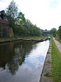
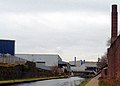
 Birmingham Canal - panoramio (20).jpg 2 816 × 2 112; 2,28 MB
-
 Birmingham Canal - panoramio (23).jpg 2 816 × 2 112; 2,29 MB
-
 Birmingham Canal - panoramio (24).jpg 2 816 × 2 112; 2,8 MB
-
 Birmingham Canal. - geograph.org.uk - 107930.jpg 640 × 326; 121 KB
-
 BlackPatchMap.jpg 1 005 × 880; 172 KB
-
 Blue plaque Soho Foundry.jpg 1 324 × 1 291; 1,26 MB
-

-
 Chance Glassworks with canalside buildings 2012.jpg 3 142 × 2 257; 1,37 MB
-
 Chance House - Spon Lane South, Smethwick (33383789701).jpg 4 608 × 3 456; 6,17 MB
-
 Chance House - Spon Lane South, Smethwick (33383826631).jpg 4 608 × 3 456; 6,01 MB
-
 Chance House - Spon Lane South, Smethwick (33471205266).jpg 4 608 × 3 456; 6,32 MB
-

-
 Crystal Drive, Smethwick (32697690373).jpg 4 608 × 3 456; 6,01 MB
-
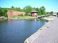
 Engine Arm Basin.jpg 2 592 × 1 944; 1,5 MB
-
 Engine Arm Smethwick - panoramio.jpg 2 048 × 1 536; 1,24 MB
-
 Eulogy to Galton Bridge on NCR 5 - geograph.org.uk - 1439317.jpg 640 × 426; 321 KB
-
 From the Secret Garden - Midland Metropolitan Hospital.jpg 4 608 × 3 456; 6,11 MB
-
 Fungus (4174799332).jpg 3 168 × 3 544; 5,68 MB
-
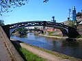
 Galton Bridge - Smethwick - panoramic (7187363395).jpg 4 784 × 1 216; 798 KB
-
 Galton Bridge, Smethwick - panoramio (1).jpg 2 048 × 1 536; 1,32 MB
-
 Galton Bridge, Smethwick - panoramio.jpg 2 048 × 1 536; 1,33 MB
-
 Galton Bridges - geograph.org.uk - 1000060.jpg 640 × 480; 118 KB
-
 GaltonBridgeRJH01.JPG 4 000 × 3 000; 3,4 MB
-
 Gauging station near Engine Arm Aqueduct.jpg 1 944 × 2 592; 1,15 MB
-

-
 Guru Nanak Gurdwara Smethwick.jpg 896 × 498; 246 KB
-
 Handsworth from the air (geograph 4937102).jpg 3 264 × 2 448; 4,17 MB
-
 Henry Hope & Sons Ltd hardware catalogue1930.jpeg 4 312 × 6 312; 7,45 MB
-
 Horseley Iron Works name on bridge at Smethwick Junction.jpg 2 592 × 1 944; 1 008 KB
-
 Jewellery Line - Roebuck Lane, Smethwick - London Midland 172 222 (7372725678).jpg 4 288 × 3 216; 3,6 MB
-
 Jewellery Line - Roebuck Lane, Smethwick - Telford Way Bridge (7187500679).jpg 4 288 × 3 216; 3,67 MB
-
 Karela (3465938334).jpg 3 582 × 2 916; 7,34 MB
-
 Lightwood House - geograph.org.uk - 1217878.jpg 600 × 450; 281 KB
-
 Lightwoods Park - geograph.org.uk - 1217857.jpg 600 × 450; 364 KB
-
 M+B Blue Gates pub Smethwick.JPG 2 043 × 1 728; 732 KB
-
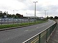
 M5 Elevated Section, Oldbury - geograph.org.uk - 107923.jpg 640 × 584; 182 KB
-
 Mark van hoen 2011.jpg 1 652 × 1 652; 1,09 MB
-
 Matchday at the Hawthorns - geograph.org.uk - 1748404.jpg 2 272 × 1 712; 976 KB
-
 Methodist Church Bearwood (2).jpg 2 984 × 4 256; 5,96 MB
-
 Methodist Church Bearwood (3).jpg 4 576 × 3 168; 7,09 MB
-
 Methodist Church Bearwood (4).jpg 2 976 × 4 048; 6,19 MB
-

-
 Near Rabone Lane - geograph.org.uk - 39486.jpg 640 × 459; 102 KB
-
 Octagonal BCN canal Toll house at Smethwick top lock.jpg 2 592 × 1 944; 1,53 MB
-
 Okra (3465129237).jpg 3 192 × 2 562; 4,12 MB
-
 Orange and green (3465148473).jpg 2 128 × 4 192; 6,64 MB
-
 Plane flying over Sandwell (32668223114).jpg 4 608 × 3 456; 5,51 MB
-
 Plane flying over Sandwell (33383289751).jpg 4 608 × 3 456; 5,96 MB
-
 Plane flying over Sandwell (33383301971).jpg 4 608 × 3 456; 5,66 MB
-
 Rood End, Oldbury - geograph.org.uk - 107926.jpg 640 × 408; 130 KB
-
 Rope marks on the ironwork of a canal bridge.jpg 3 008 × 2 000; 1,46 MB
-
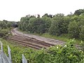
 Roving bridges at Smethwick Junction.jpg 2 592 × 1 944; 1,57 MB
-
 Rutland Road signage Smethwick.jpg 1 469 × 2 813; 546 KB
-
 RutlandRoadSignSmethwick.jpg 951 × 256; 79 KB
-
 Smethwick - Elim Pentecostal Church - geograph.org.uk - 999920.jpg 640 × 480; 59 KB
-
 Smethwick - Guru Nanak Gurdwara - panoramio.jpg 2 816 × 2 112; 2,1 MB
-
 Smethwick Galton Bridge Station - High Level - bridge (7186744083).jpg 4 288 × 3 216; 3,36 MB
-
 Smethwick Galton Bridge Station - High Level - down to Platform 2 (7186764923).jpg 3 216 × 4 288; 3,35 MB
-
 Smethwick Galton Bridge Station - High Level - Galton Bridge (7186736447).jpg 4 288 × 3 216; 3,83 MB
-
 Smethwick Galton Bridge Station - High Level - Oldbury Road (7401502258).jpg 4 288 × 3 216; 3,4 MB
-
 Smethwick Galton Bridge Station - High Level - Summit Crescent (7372711192) (2).jpg 4 288 × 3 216; 3,82 MB
-
 Smethwick Galton Bridge Station - main entrance (7186859221).jpg 4 288 × 3 216; 3,64 MB
-
 Smethwick Galton Bridge Station - sign (7186753851).jpg 3 216 × 4 288; 2,38 MB
-
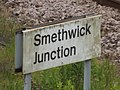
 Smethwick Galton Bridge Station - Smethwick Junction (7186867147).jpg 4 288 × 3 216; 3,5 MB
-
 Smethwick Galton Bridge Station - Smethwick Junction (7186869781) (2).jpg 4 288 × 3 216; 3,73 MB
-
 Smethwick Galton Bridge Station - Smethwick Junction (7372085590).jpg 4 288 × 3 216; 3,33 MB
-
 Smethwick Galton Bridge Station - Smethwick Junction - bridge (7372095022) (2).jpg 4 288 × 3 216; 3,67 MB
-

-
 Smethwick Galton Bridge Station - Smethwick Junction - Nine Leasowes (7372091952).jpg 4 288 × 3 216; 3,83 MB
-
 Smethwick Galton Bridge Station - Smethwick Junction - Nine Leasowes (7372093410).jpg 4 288 × 3 216; 3,43 MB
-
 Smethwick Galton Bridge Station - Smethwick Junction - Oldbury Road (7372090214).jpg 4 288 × 3 216; 3,47 MB
-
 Smethwick Galton Bridge Station - Smethwick Junction - sign (7186868225).jpg 4 288 × 3 216; 2,6 MB
-
 Smethwick Gurdwara - geograph.org.uk - 234468.jpg 640 × 480; 43 KB
-
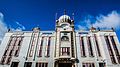
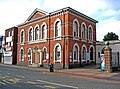
 Smethwick Library - High Street, Smethwick (7402729082).jpg 4 288 × 3 216; 2,96 MB
-
 Smethwick Library - High Street, Smethwick - red door (7402739132).jpg 3 216 × 4 288; 3,5 MB
-
 Smethwick Library - High Street, Smethwick - signs (7402732180).jpg 3 216 × 4 288; 3,46 MB
-
 Smethwick Library, High Street, Smethwick, West Midlands, UK.jpg 300 × 222; 26 KB
-
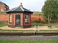
 Smethwick Locks, Toll House - panoramio (1).jpg 2 048 × 1 536; 1,24 MB
-
 Smethwick Locks, Toll House - panoramio.jpg 2 048 × 1 536; 1,26 MB
-
 Smethwick public library .jpg 2 868 × 2 418; 2,83 MB
-
 Smethwick public library.jpg 2 104 × 1 867; 702 KB
-
 Smethwick Pump House - panoramio.jpg 2 048 × 1 536; 1,21 MB
-
 Smethwick toll house.jpg 1 639 × 1 675; 362 KB
-
 Soho Foundry Loop west canal bridge.jpg 2 592 × 1 944; 1,21 MB
-
 Soho Foundry Smethwick West Midlands (geograph 3400614).jpg 3 872 × 2 454; 3,08 MB
-
 Soho near Smethwick - Soho Railway Bridge - BCN Main Line (23885519927).jpg 4 608 × 3 456; 5,99 MB
-
 Street Atlas of Birmingham - 1939 - Sheet 06 - Smethwick.jpg 1 000 × 773; 520 KB
-
-

-
-

-

-

-
 T.W. Camm (front).jpg 1 050 × 1 626; 207 KB
-
 T.W. Camm.jpg 1 038 × 1 626; 170 KB
-
 The 'old' Grove cinema - geograph.org.uk - 1217991.jpg 600 × 450; 215 KB
-
 The Blue Gates.jpg 2 464 × 1 632; 795 KB
-
 The Kings Head, Bearwood - geograph.org.uk - 1217919.jpg 600 × 450; 229 KB
-
 The Old School House - Crystal Drive, Smethwick (33128599870).jpg 4 608 × 3 456; 5,93 MB
-
 The Old School House - Crystal Drive, Smethwick (33512362585).jpg 4 608 × 3 456; 6,06 MB
-
 Thimblemill Library (1).jpg 4 752 × 3 030; 5,68 MB
-
 Tollhouse and Smethwick Top Lock in 2004.jpg 3 008 × 2 000; 1,73 MB
-
 Train - panoramio (26).jpg 1 936 × 1 936; 1,15 MB
-
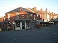
 Waterloo Road, Smethwick - geograph.org.uk - 1780235.jpg 640 × 480; 230 KB
-
 Wednesbury Museum - 2016-11-30 - Andy Mabbett - 17.jpg 3 872 × 2 592; 4,79 MB
-
 Wills's Cigarettes - Borough of Smethwick - 1906.jpg 806 × 1 506; 200 KB
-
 Winson Green Junction toll island.jpg 2 592 × 1 944; 1,59 MB
-
 WWII Smethwick Russia tank - IWM P 233.jpg 1 415 × 1 080; 375 KB
-
 A457 at Galton Bridge - geograph.org.uk - 999895.jpg 640 × 480; 58 KB
-
 A457 looking west - geograph.org.uk - 999909.jpg 640 × 480; 72 KB
-
 Barnford Hill Park - geograph.org.uk - 343643.jpg 640 × 480; 99 KB
-
 Brasshouse Lane Pumping Station - geograph.org.uk - 733827.jpg 640 × 427; 110 KB
-
-
 Schools in Crocketts Lane. - geograph.org.uk - 654882.jpg 640 × 480; 60 KB


.png)


.jpg)
.jpg)
.jpg)


_at_West_Smethwick_-_geograph.org.uk_-_29896.jpg)

.jpg)
.jpg)
.jpg)
.jpg)
.jpg)


.jpg)
.jpg)


.jpg)


.jpg)
.jpg)
.jpg)


.jpg)
.jpg)
.jpg)


.jpg)
.jpg)
.jpg)
.jpg)
.jpg)


.jpg)
.jpg)
.jpg)
.jpg)
_(2).jpg)
.jpg)
.jpg)
.jpg)
_(2).jpg)
.jpg)
_(2).jpg)
.jpg)
.jpg)
.jpg)
.jpg)
.jpg)

.jpg)
.jpg)
.jpg)

.jpg)


.jpg)
.jpg)

_(2).jpg)
.jpg)
.jpg)
_(2).jpg)
.jpg)
.jpg)
.jpg)


.jpg)
.jpg)
.jpg)

.jpg)


.jpg)