Category:South End, Boston
Jump to navigation
Jump to search
Wikipedia article: South End, Boston
neighborhood in Boston, Massachusetts, United States of America  | |||||
| Upload media | |||||
| Instance of | |||||
|---|---|---|---|---|---|
| Location | Boston, Suffolk County, Massachusetts | ||||
| Different from | |||||
 | |||||
Subcategories
This category has the following 43 subcategories, out of 43 total.
- Maps of South End, Boston (18 F)
A
B
- Boston Dispensary (12 F)
- Boston Female Asylum (7 F)
- Boston Medical Center (28 F)
C
- Charlie's Sandwich Shoppe (4 F)
- Columbia Theatre (Boston) (20 F)
- Concord Square (Boston) (11 F)
- Cyclorama (Boston) (5 F)
D
F
G
- Grand Opera House (Boston) (29 F)
H
- Harriet Tubman Park, Boston (2 F)
- Houses in South End, Boston (10 F)
L
- Lenox Street Carhouse (3 F)
- Lenox Street station (4 F)
- Lion of South End (1 F)
N
- Newton Street station (3 F)
O
- Odd Fellows Hall, Boston (22 F)
P
- Parker Memorial Hall (4 F)
S
U
- Union Park Street (4 F)
- Union Park Street station (5 F)
W
- Windsor Theatre (Boston) (8 F)
- Worcester Square station (3 F)
Media in category "South End, Boston"
The following 64 files are in this category, out of 64 total.
-
 "Bowfront houses" in South End, Boston, Massachusetts LCCN2011632380.tif 5,014 × 6,539; 187.64 MB
-
 "Bowfront" buildings on Warren Street in South End, Boston, Massachusetts LCCN2011632397.tif 4,804 × 6,154; 169.19 MB
-
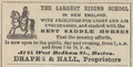 1869 Draper Hall RidingSchool Boston.png 445 × 226; 164 KB
-
 1898 FryePrivateSchool Boston ad WhereToEducate USA.png 363 × 550; 57 KB
-
 2008 public library SouthEnd Boston 3016240847.jpg 800 × 600; 150 KB
-
 2008 SouthEnd snow Boston 3188476678.jpg 1,600 × 1,200; 1.28 MB
-
 2010 BerkeleySt Boston3.jpg 3,648 × 2,736; 3.75 MB
-
 2010 BerkeleySt ColumbusAve Boston3.jpg 3,648 × 2,736; 4.28 MB
-
 2010 ColumbusAve BerkeleySt Boston2.jpg 3,648 × 2,736; 4.33 MB
-
 2010 ColumbusAve BerkeleySt Boston3.jpg 3,648 × 2,736; 4.32 MB
-
 2010 ColumbusAve Boston.jpg 3,648 × 2,736; 4.03 MB
-
 2010 TremontSt BerkeleySt Boston4.jpg 3,648 × 2,736; 3.81 MB
-
 2011 BostonMA 6367624621.jpg 1,024 × 681; 768 KB
-
 2011 SouthEnd Boston 5576671995.jpg 2,208 × 1,701; 832 KB
-
 2011 SouthEnd Boston 5907264438.jpg 704 × 395; 307 KB
-
 2011 SouthEnd Boston 6315690963.jpg 3,888 × 2,592; 5.45 MB
-
 2011 SouthEnd Boston 6316212474.jpg 3,888 × 2,592; 4.74 MB
-
 2012 SouthEnd Boston 6837599327.jpg 3,148 × 1,771; 2.86 MB
-
 2590431508 Army Navy Boston 1917.jpg 1,200 × 924; 274 KB
-
 Annual report (IA annualreport18851892norf).pdf 837 × 1,264, 304 pages; 22 MB
-
 Appleton and Dartmouth.jpg 1,961 × 1,721; 782 KB
-
 Back Bay & South End Photo Walk.jpg 5,817 × 3,402; 7.82 MB
-
 Benjamin Franklin Institute of Technology, Boston MA.jpg 3,072 × 2,304; 2.38 MB
-
 Boston Black and White.jpg 5,312 × 2,988; 3.11 MB
-
 Boston Herald Traveler Building.jpg 5,965 × 4,857; 1.97 MB
-
 Boston Sculptors Gallery, Boston MA.jpg 3,072 × 2,304; 1.8 MB
-
 BostonMA JoshuaBatesSchool.jpg 1,024 × 680; 234 KB
-
 Columbus and Dartmouth1.jpg 1,667 × 2,258; 683 KB
-
 Copley Place aerial view, December 2018.JPG 5,184 × 3,888; 6.82 MB
-
 Don Bosco Technical High School, Warrenton Street.jpg 5,959 × 4,853; 1.67 MB
-
 East Berkeley Street Outbound, Boston MA.jpg 2,816 × 2,112; 1.97 MB
-
 Food Trucks.jpg 6,000 × 4,000; 8.63 MB
-
 Harriet Tubman Memorial, Boston (back).jpg 540 × 720; 75 KB
-
 Harriet Tubman Memorial, Boston (front, uncropped).jpg 720 × 540; 114 KB
-
 Joe Wex Dog Recreation Space, Boston MA.jpg 2,816 × 2,112; 2.8 MB
-
 JohnsonSchool TremontSt Boston HomansSketches1851.jpg 523 × 484; 196 KB
-
 Newland Street Park - Boston, MA - DSC06812.jpg 5,472 × 3,648; 14.3 MB
-
 Northeasterly from roof of 100 Arlington Street.jpg 5,973 × 4,863; 2.48 MB
-
 OCOT SoWa First Friday 5-1-09 055.jpg 1,506 × 1,000; 1.76 MB
-
 OCOT SoWa First Friday 5-1-09 172.jpg 1,506 × 1,000; 1.01 MB
-
 OtisSchool LancasterSt Boston HomansSketches1851.jpg 521 × 497; 201 KB
-
 Pierre Lallement Bike Path, South End, Boston MA.jpg 4,032 × 3,024; 5.54 MB
-
 Possible former trolley wire holder on Appleton Street, March 2017.JPG 4,320 × 3,240; 3.83 MB
-
 Shawmut Avenue, southerly from the corner of Tremont Street.jpg 5,975 × 4,865; 1.56 MB
-
 Sign, Pierre Lallement Bike Path, South End, Boston MA.jpg 4,032 × 3,024; 5.5 MB
-
 South End from old John Hancock Building, February 1959.jpg 5,863 × 4,754; 2.94 MB
-
 South End John Hancock Tower.jpg 2,048 × 1,529; 474 KB
-
 Southwesterly from the Railroad Bridge on Harrison Avenue.jpg 5,971 × 4,857; 1.92 MB
-
 St. Charles Street cul-de-sac.jpg 4,703 × 3,762; 8.13 MB
-
 Tot Lot on Troy Street.jpg 5,976 × 4,794; 2.53 MB
-
 Tremont and Union2.jpg 2,304 × 1,728; 775 KB
-
 Tremont Clarendon.jpg 2,304 × 1,728; 681 KB
-
 Union Park2.jpg 2,304 × 1,728; 1.1 MB
-
 Union Park4.jpg 2,304 × 1,728; 1.03 MB
-
 UnionPark Shawmut.jpg 1,728 × 2,304; 536 KB
-
 View east from Prudential Tower 1960s postcard.jpg 1,506 × 962; 395 KB
-
 View from old John Hancock Building looking towards South Boston, 1959.jpg 5,731 × 4,502; 3.07 MB
-
 Wallys Cafe, Boston MA.jpg 3,072 × 2,304; 2.01 MB
-
 Warren and Dartmouth.jpg 2,078 × 1,724; 830 KB
-
 Warren and Dartmouth2.jpg 1,641 × 2,243; 961 KB
-
 WellsSchool McLeanSt Boston HomansSketches1851.jpg 518 × 495; 186 KB
-
 Wikivoyage-boston south end banner.jpg 2,100 × 300; 665 KB
-
 Worcester Square - DPLA - 4d8319143709b797e2a7b30335315f9e.jpg 800 × 643; 94 KB
-
 Yarn bomb, South End (6758823743).jpg 1,630 × 2,303; 1.82 MB


.jpg)
.jpg)


.jpg)