Category:South Littleton
Naar navigatie springen
Naar zoeken springen
plaats in Worcestershire  | |||||
| Media uploaden | |||||
| Is een | |||||
|---|---|---|---|---|---|
| Locatie | Wychavon, Worcestershire, West Midlands, Engeland | ||||
| Inwonertal |
| ||||
| Oppervlakte |
| ||||
 | |||||
Ondercategorieën
Deze categorie bevat de volgende 3 subcategorieën, van de 3 in totaal.
L
- HM Prison Long Lartin (1 B)
M
Media in categorie "South Littleton"
Deze categorie bevat de volgende 70 bestanden, van in totaal 70.
-
 Alongside Buckle Street - geograph.org.uk - 2761740.jpg 4.320 × 3.240; 5,04 MB
-
 Ascend Sheen Hill - geograph.org.uk - 2759614.jpg 4.320 × 3.240; 4,25 MB
-
 Boundary Stone - geograph.org.uk - 2761744.jpg 3.240 × 4.320; 4,62 MB
-
 Churchyard cross (geograph 6584159).jpg 768 × 1.024; 343 kB
-
 Cottage drive and footpath - geograph.org.uk - 2759597.jpg 4.320 × 3.240; 4,55 MB
-
 Driveway and footpath - geograph.org.uk - 2759399.jpg 4.320 × 3.240; 5,04 MB
-
 Field edge path - geograph.org.uk - 2759634.jpg 4.320 × 3.240; 4,58 MB
-
 Fields next to Long Lartin Prison - geograph.org.uk - 2825297.jpg 640 × 480; 66 kB
-
 Footpath junction (1) - geograph.org.uk - 2759230.jpg 4.320 × 3.240; 5,01 MB
-
 Footpath junction (2) - geograph.org.uk - 2759232.jpg 4.320 × 3.240; 4,8 MB
-
 Footpath junction (3) - geograph.org.uk - 2759235.jpg 4.320 × 3.240; 4,66 MB
-
 Footpath leaves the road - geograph.org.uk - 2761734.jpg 4.320 × 3.240; 4,73 MB
-
 Footpath meets the road - geograph.org.uk - 2759413.jpg 4.320 × 3.240; 5,14 MB
-
 Footpath to Sheen Hill (2) - geograph.org.uk - 2759227.jpg 4.320 × 3.240; 4,76 MB
-
 Footpath to Sheen Hill - geograph.org.uk - 5325578.jpg 640 × 480; 133 kB
-
 Footpaths cross - geograph.org.uk - 2759602.jpg 4.320 × 3.240; 5,01 MB
-
 Four ways to go - geograph.org.uk - 2759611.jpg 4.320 × 3.240; 5,09 MB
-
 Houses in South Littleton - geograph.org.uk - 2766742.jpg 640 × 480; 49 kB
-
 Houses in South Littleton - geograph.org.uk - 2766981.jpg 640 × 480; 60 kB
-

-
 Housing by the prison - geograph.org.uk - 2759431.jpg 4.320 × 3.240; 4,77 MB
-
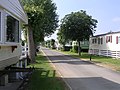
 Housing estate off Shinehill Lane - geograph.org.uk - 1985508.jpg 640 × 480; 66 kB
-
 Littleton Pastures (1) - geograph.org.uk - 2759648.jpg 4.320 × 3.240; 4,77 MB
-
 Littleton Pastures (2) - geograph.org.uk - 2760465.jpg 4.320 × 3.240; 5,13 MB
-
 Long Lartin Prison (1) - geograph.org.uk - 2759224.jpg 4.320 × 3.240; 4,69 MB
-
 Long Lartin Prison (2) - geograph.org.uk - 2759365.jpg 4.320 × 3.240; 4,29 MB
-
 Long Lartin Prison (3) - geograph.org.uk - 2759592.jpg 4.320 × 3.240; 5,14 MB
-
 Long Lartin Prison - geograph.org.uk - 5088575.jpg 2.000 × 1.333; 1,54 MB
-
 Missing footpath - geograph.org.uk - 2759348.jpg 4.320 × 3.240; 4,7 MB
-
 On time - geograph.org.uk - 2759304.jpg 4.320 × 3.240; 4,59 MB
-
 Over the ditch - geograph.org.uk - 2759652.jpg 4.320 × 3.240; 4,98 MB
-
 Power Lines near Long Lartin - geograph.org.uk - 2766730.jpg 640 × 480; 56 kB
-
 Road to Offenham - geograph.org.uk - 2767031.jpg 640 × 480; 69 kB
-
 Sheenhill Farm (1) - geograph.org.uk - 2759372.jpg 4.320 × 3.240; 4,37 MB
-
 Sheenhill Farm (2) - geograph.org.uk - 2759382.jpg 4.320 × 3.240; 4,54 MB
-
 Sheenhill Farm (3) - geograph.org.uk - 2759388.jpg 4.320 × 3.240; 4,49 MB
-
 Shinehill Lane - geograph.org.uk - 55715.jpg 640 × 504; 161 kB
-
 Shinehill Road, South Littleton - geograph.org.uk - 1985511.jpg 640 × 480; 61 kB
-
 South Littleton - geograph.org.uk - 55711.jpg 640 × 497; 163 kB
-
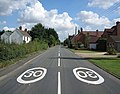
 South Littleton boundary sign - geograph.org.uk - 634132.jpg 640 × 480; 59 kB
-
 St Michael's Church - geograph.org.uk - 4937425.jpg 800 × 600; 162 kB
-
-
 Towards London - geograph.org.uk - 2759281.jpg 4.320 × 3.240; 4,98 MB
-
 Towards Sheen Hill - geograph.org.uk - 2759605.jpg 4.320 × 3.240; 5,08 MB
-
 Towards Worcester - geograph.org.uk - 2759240.jpg 4.320 × 3.240; 4,84 MB
-
 View to Sheenhill Farm - geograph.org.uk - 1985504.jpg 640 × 480; 112 kB
-
 Westland Wessex HAS1 (WS-58), UK - Navy AN1175767.jpg 1.024 × 678; 441 kB
-
 Activities for Horses - geograph.org.uk - 55719.jpg 640 × 480; 170 kB
-
 Blackminster Business Park - geograph.org.uk - 424080.jpg 640 × 480; 104 kB
-
 Bridle Path, Offenham - geograph.org.uk - 743805.jpg 640 × 480; 86 kB
-
 Caravans at Offenham Park - geograph.org.uk - 639553.jpg 640 × 480; 86 kB
-
 Clayfield Crossing - geograph.org.uk - 55694.jpg 640 × 480; 171 kB
-

-
 Fence on footpath near Offenham Park - geograph.org.uk - 713252.jpg 640 × 480; 67 kB
-
 Fields near Clayfield Crossing - geograph.org.uk - 55698.jpg 640 × 480; 160 kB
-

-

-

-
 Footpath to the Littletons, Offenham - geograph.org.uk - 747783.jpg 640 × 480; 90 kB
-
 Housing Estate off Shinehill Lane - geograph.org.uk - 55723.jpg 640 × 384; 127 kB
-

-
 Level Crossing - geograph.org.uk - 422981.jpg 640 × 480; 113 kB
-
 Looking East from bridge 104-51 - geograph.org.uk - 313175.jpg 640 × 480; 118 kB
-
 Looking West - geograph.org.uk - 424086.jpg 480 × 640; 144 kB
-
 Neat rows of vegetables at Bretforton. - geograph.org.uk - 5729.jpg 640 × 480; 77 kB
-
 Pheasants at Offenham Park - geograph.org.uk - 639826.jpg 640 × 480; 129 kB
-
 The Fish and Anchor Crossing - geograph.org.uk - 625223.jpg 640 × 480; 67 kB
-
 Units on Blackminster Business Park - geograph.org.uk - 424078.jpg 640 × 480; 113 kB
-
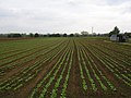
 Young lettuce variety - geograph.org.uk - 420366.jpg 640 × 480; 208 kB
-
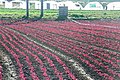 Young red lettuce - geograph.org.uk - 420363.jpg 640 × 427; 169 kB


.jpg)


_-_geograph.org.uk_-_2759230.jpg)
_-_geograph.org.uk_-_2759232.jpg)
_-_geograph.org.uk_-_2759235.jpg)


_-_geograph.org.uk_-_2759227.jpg)


_-_geograph.org.uk_-_2759648.jpg)
_-_geograph.org.uk_-_2760465.jpg)
_-_geograph.org.uk_-_2759224.jpg)
_-_geograph.org.uk_-_2759365.jpg)
_-_geograph.org.uk_-_2759592.jpg)


_-_geograph.org.uk_-_2759372.jpg)
_-_geograph.org.uk_-_2759382.jpg)
_-_geograph.org.uk_-_2759388.jpg)


,_UK_-_Navy_AN1175767.jpg)


