Category:South Witham
Jump to navigation
Jump to search
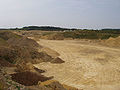
English: South Witham is a village in South Kesteven, Lincolnshire, situated close to the Leicestershire and Rutland borders. It is bisected by the young River Witham, about three miles to the east of its source. It is the point on the A1 where it enters Lincolnshire from the south, near The Fox Inn. On the road to Wymondham (Mill Lane) is a large limestone quarry owned by Ennstone Johnston (based at Breedon on the Hill), containing around 3.2 million tonnes of limestone. Nearby to the south is RAF Cottesmore. The church is dedicated to St John the Baptist and included in the Withams group of churches are North Witham, Stainby and Gunby.
village and civil parish in the South Kesteven district of Lincolnshire, England  | |||||
| Upload media | |||||
| Instance of | |||||
|---|---|---|---|---|---|
| Location | South Kesteven, Lincolnshire, East Midlands, England | ||||
 | |||||
Subcategories
This category has the following 4 subcategories, out of 4 total.
Media in category "South Witham"
The following 115 files are in this category, out of 115 total.
-
 A quarried landscape - geograph.org.uk - 5590486.jpg 10,000 × 3,496; 7.56 MB
-
 A1 (Ermine Street) layby - geograph.org.uk - 4331314.jpg 1,024 × 768; 95 KB
-
 A1 northbound - geograph.org.uk - 3502069.jpg 2,256 × 1,504; 1.65 MB
-
 A1 northbound enters Lincolnshire - geograph.org.uk - 3553564.jpg 2,049 × 1,212; 1.36 MB
-
 A1 northbound layby - geograph.org.uk - 5500411.jpg 640 × 428; 83 KB
-
 A1 Southbound, The Fox Truck Stop - geograph.org.uk - 3465962.jpg 1,303 × 700; 607 KB
-
 Alongside 'The Forty Acre' wood - geograph.org.uk - 5131158.jpg 3,776 × 2,520; 3.06 MB
-
-
 Arch bridge to carry a disused railway - geograph.org.uk - 1277264.jpg 640 × 480; 119 KB
-
 Arched gateway - geograph.org.uk - 5398245.jpg 4,896 × 3,672; 6.96 MB
-
 Bench Mark, Thistleton Lane bridge - geograph.org.uk - 4800712.jpg 884 × 1,280; 373 KB
-

-

-
 Bridge on Thistleton Lane - geograph.org.uk - 4800709.jpg 1,280 × 960; 400 KB
-
 Broken land - geograph.org.uk - 5590474.jpg 4,896 × 3,672; 6.65 MB
-

-
 DAF bus in a narrow lane - geograph.org.uk - 6200678.jpg 4,896 × 3,672; 6.36 MB
-
 Defibrillator box - geograph.org.uk - 6200677.jpg 3,672 × 4,896; 6.09 MB
-

-
 EIIR wallbox - geograph.org.uk - 6200676.jpg 3,672 × 4,896; 6.19 MB
-
 Entering Lincolnshire, A1 - geograph.org.uk - 3187192.jpg 640 × 430; 38 KB
-
 Entrance to South Witham - geograph.org.uk - 3575051.jpg 640 × 480; 51 KB
-
 Entrance to the Cribbs Meadow National Nature Reserve - geograph.org.uk - 3715383.jpg 3,776 × 2,520; 4.27 MB
-
 Exit at South Witham - geograph.org.uk - 4219163.jpg 640 × 480; 213 KB
-
 Farm Track near Wymondham - geograph.org.uk - 145848.jpg 640 × 427; 177 KB
-
 Farmland by the A1 near North Witham - geograph.org.uk - 2621945.jpg 640 × 294; 26 KB
-
 Field gate on the south side of Broadgate Road - geograph.org.uk - 3516469.jpg 768 × 1,024; 522 KB
-
 Field gates on the north side of Broadgate Road - geograph.org.uk - 3516463.jpg 1,024 × 768; 183 KB
-
 Fields off Moor Lane - geograph.org.uk - 3277576.jpg 2,256 × 1,504; 822 KB
-
 First bridge over the River Witham (geograph 3715264).jpg 3,776 × 2,520; 4.26 MB
-
 First ford across the River Witham - geograph.org.uk - 3715386.jpg 3,776 × 2,520; 4.24 MB
-
 Footpath off Thistleton Lane - geograph.org.uk - 4800710.jpg 1,280 × 960; 568 KB
-
 Ford on the River Witham at South Witham - geograph.org.uk - 1840747.jpg 3,872 × 2,592; 2.4 MB
-
 Former industrial railway - geograph.org.uk - 5590464.jpg 6,000 × 4,000; 7.6 MB
-
 Former railway embankment - geograph.org.uk - 5590459.jpg 12,414 × 1,947; 7.58 MB
-
 High Street, South Witham - geograph.org.uk - 3516421.jpg 1,024 × 614; 128 KB
-
 If this looks more like a railway bridge . . . - geograph.org.uk - 4800708.jpg 1,280 × 960; 268 KB
-
 Ironstone railway embankment - geograph.org.uk - 1926894.jpg 800 × 600; 138 KB
-
 Ironstone railway relic - geograph.org.uk - 1926857.jpg 800 × 600; 261 KB
-

-
 Junction of Broadgate Road and Occupation Road - geograph.org.uk - 3516459.jpg 1,024 × 768; 130 KB
-
 Junction of Moor Lane and The Drift - geograph.org.uk - 4321878.jpg 3,088 × 2,056; 3.26 MB
-
 Layby on Northbound A1 - geograph.org.uk - 4219182.jpg 640 × 480; 272 KB
-
 Leone Tollemache1891 census.jpg 1,406 × 191; 93 KB
-
 Lines of trees mark old railways - geograph.org.uk - 1926814.jpg 800 × 600; 122 KB
-
 Low bridge - geograph.org.uk - 1301694.jpg 640 × 480; 59 KB
-
 Mill Lane - geograph.org.uk - 4322357.jpg 3,088 × 2,056; 3.45 MB
-

-

-

-
 Mill Lane west of South Witham - geograph.org.uk - 4322362.jpg 3,088 × 2,056; 2.87 MB
-
 Moor Lane - geograph.org.uk - 5520330.jpg 4,000 × 3,000; 4.92 MB
-
 Moor Lane - geograph.org.uk - 5520343.jpg 4,000 × 3,000; 4.93 MB
-
 Moor Lane - geograph.org.uk - 5520347.jpg 4,000 × 3,000; 4.69 MB
-
 Moore Lane - geograph.org.uk - 4321965.jpg 3,088 × 2,056; 2.88 MB
-
 North Witham Road leaving South Witham - geograph.org.uk - 3059756.jpg 4,000 × 3,000; 4.36 MB
-
 Northbound A1, Exit for South Witham - geograph.org.uk - 4219156.jpg 640 × 480; 260 KB
-
 Northbound A1, Witham Common - geograph.org.uk - 4219174.jpg 640 × 480; 225 KB
-
 Not a playground - geograph.org.uk - 5590492.jpg 4,000 × 6,000; 3.8 MB
-
 Old houses on High Street, South Witham - geograph.org.uk - 3516432.jpg 1,024 × 768; 112 KB
-
 Old railway bridge over Thistleton Lane - geograph.org.uk - 4321849.jpg 3,088 × 2,056; 3.63 MB
-
 Old railway bridge over Thistleton Lane - geograph.org.uk - 4322721.jpg 3,088 × 2,056; 3.12 MB
-
 Overgrown trackbed of ironstone railway - geograph.org.uk - 1926837.jpg 800 × 600; 285 KB
-
 Parking Available at Regular Intervals - geograph.org.uk - 4219176.jpg 640 × 480; 237 KB
-

-
 Pill Box near Temple Hill, South Witham. - geograph.org.uk - 397059.jpg 424 × 640; 125 KB
-
 Quarry face - geograph.org.uk - 5590471.jpg 4,896 × 3,672; 6.69 MB
-
 Quarry offices - geograph.org.uk - 5590497.jpg 6,000 × 4,000; 4.5 MB
-
 Quarry sign - geograph.org.uk - 5590489.jpg 6,000 × 4,000; 6.14 MB
-

-
 River Witham entering South Witham (geograph 3717003).jpg 3,776 × 2,520; 4.13 MB
-
 Roadside nature reserve at Broadgate Road, South Witham - geograph.org.uk - 4546456.jpg 4,000 × 3,000; 4.3 MB
-
 Roadside nature reserve at Broadgate Road, South Witham - geograph.org.uk - 4546460.jpg 4,000 × 3,000; 4.09 MB
-
 Roadside verge - geograph.org.uk - 5590450.jpg 6,000 × 4,000; 7.07 MB
-
 Roadside verge on North Witham Road - geograph.org.uk - 3059763.jpg 4,000 × 3,000; 4.36 MB
-
 Route of a former ironstone railway - geograph.org.uk - 5520370.jpg 4,000 × 3,000; 4.97 MB
-
 Route of a former ironstone railway - geograph.org.uk - 5520380.jpg 4,000 × 3,000; 4.7 MB
-
 Rutland Close, South Witham - geograph.org.uk - 3516425.jpg 1,024 × 768; 136 KB
-
 Service 28 - geograph.org.uk - 6200675.jpg 4,896 × 3,672; 6.87 MB
-
 Shades of blue - geograph.org.uk - 1927328.jpg 800 × 600; 177 KB
-
 Sharp bend in Moor Lane - geograph.org.uk - 3567383.jpg 2,256 × 1,504; 2.45 MB
-
 South west Lincolnshire countryside - geograph.org.uk - 1743770.jpg 640 × 427; 99 KB
-
 South Witham Limestone Quarry - geograph.org.uk - 1927380.jpg 800 × 600; 227 KB
-
 South Witham limestone quarry - geograph.org.uk - 1927385.jpg 800 × 600; 164 KB
-
 South Witham Nature Reserve - geograph.org.uk - 169503.jpg 640 × 480; 57 KB
-
 South Witham Nature Reserve - geograph.org.uk - 462184.jpg 640 × 480; 62 KB
-
 South Witham quarry - geograph.org.uk - 5296723.jpg 800 × 435; 123 KB
-
 South Witham Shop - geograph.org.uk - 6200671.jpg 4,896 × 3,672; 6.6 MB
-
 South Witham turn off, A1 - geograph.org.uk - 2511224.jpg 640 × 283; 26 KB
-
 South Witham village shop - geograph.org.uk - 5398243.jpg 4,896 × 3,672; 6.38 MB
-
 South Witham's village shop - geograph.org.uk - 3516441.jpg 1,024 × 615; 142 KB
-
 South Witham, Lincolnshire, England. Village shop c.1911.JPG 1,565 × 930; 854 KB
-
 Start of the Witham detour - geograph.org.uk - 3720239.jpg 3,776 × 2,520; 4 MB
-
 Tamus communis - geograph.org.uk - 5590453.jpg 3,068 × 2,758; 3.13 MB
-
 Temple Hill, South Witham - geograph.org.uk - 169488.jpg 640 × 480; 68 KB
-
 The Angel by the church, South Witham - geograph.org.uk - 89908.jpg 640 × 480; 60 KB
-
 The Fox - geograph.org.uk - 3187204.jpg 640 × 430; 38 KB
-
 The Quarry - geograph.org.uk - 5590496.jpg 6,000 × 4,000; 3.89 MB
-
 The River Witham leaving South Witham - geograph.org.uk - 3719815.jpg 3,776 × 2,520; 4.12 MB
-
 The Witham Valley at South Witham - geograph.org.uk - 3721352.jpg 3,776 × 2,520; 4.31 MB
-
 Track from the A1 towards Battlebourn Head - geograph.org.uk - 5445138.jpg 3,776 × 2,520; 4.18 MB
-
 Track onto the A1 - geograph.org.uk - 5445131.jpg 3,776 × 2,520; 4.08 MB
-

-
 Two gates, on Mill lane - geograph.org.uk - 5541782.jpg 3,776 × 2,520; 2.91 MB
-
 View from Moor Lane - geograph.org.uk - 5520338.jpg 4,000 × 3,000; 4.72 MB
-
 View of a rainbow from the Travelodge South Witham car park - geograph.org.uk - 5542678.jpg 4,096 × 2,304; 2.39 MB
-
 Village sign for South Witham - geograph.org.uk - 3059752.jpg 4,000 × 3,000; 3.99 MB
-

-
 White Fields off Moor Lane - geograph.org.uk - 3277579.jpg 2,256 × 1,504; 1.19 MB
-
 Over the hill. - geograph.org.uk - 389070.jpg 424 × 640; 101 KB
-
 Railway Bridge - geograph.org.uk - 164603.jpg 640 × 427; 93 KB
-
 River Witham tributary - geograph.org.uk - 200033.jpg 640 × 480; 88 KB
-
 South Witham Quarry - geograph.org.uk - 196031.jpg 640 × 480; 76 KB
-

-
 Woodland near South Witham. - geograph.org.uk - 397055.jpg 640 × 424; 180 KB
_layby_-_geograph.org.uk_-_4331314.jpg)


.jpg)


.jpg)


