Category:Springville, Utah
Zur Navigation springen
Zur Suche springen
Stadt im US-Bundesstaat Utah   | |||||
| Medium hochladen | |||||
| Ist ein(e) | |||||
|---|---|---|---|---|---|
| Ort | Utah County, Utah | ||||
| Liegt am oder im Gewässer |
| ||||
| Datum der Gründung, Erstellung, Entstehung, Erbauung |
| ||||
| Einwohnerzahl |
| ||||
| Fläche |
| ||||
| Höhe über dem Meeresspiegel |
| ||||
| offizielle Website | |||||
 | |||||
English: Media related to Springville, Utah (also known as Art City), a city in southern Utah County, Utah, United States.
Unterkategorien
Es werden 20 von insgesamt 20 Unterkategorien in dieser Kategorie angezeigt:
In Klammern die Anzahl der enthaltenen Kategorien (K), Seiten (S), Dateien (D)
B
D
E
- Historic Springville Cemetery (leer)
F
- Springville Fire Department (4 D)
H
M
N
P
- Parks in Springville, Utah (25 D)
S
- Springville World Folkfest (2 D)
T
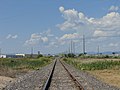
- Tintic Branch Line (22 D)
W
- W.W. Clyde Company (2 D)
Z
- 84663 (ZIP Code) (1 D)
Medien in der Kategorie „Springville, Utah“
Folgende 101 Dateien sind in dieser Kategorie, von 101 insgesamt.
-
 Center St Bike Lane end sign, Springville, Utah Jun 17.jpg 2.592 × 1.944; 2,36 MB
-
 City limits sign, S 2600 West, Springville, Utah, May 16.jpg 2.592 × 1.944; 2,71 MB
-
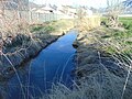
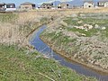
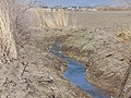
 Down at Dry Creek from eastside of SR-51, Mar 17.jpg 2.592 × 1.944; 1,91 MB
-
 East at confluence of Dry Creek and unnamed stream, Springville, UT, Mar 17.jpg 2.592 × 1.944; 1,93 MB
-
 East at Hobble Creek Canyon Parkway trailhead, Springville, Utah, May 16.jpg 2.592 × 1.944; 2,33 MB
-
 East end of Dry Creek culvert under S 950 W, Springville, UT, Mar 17.jpg 2.592 × 1.944; 2,14 MB
-
 East on Dry Creek from S 1400 W, Springville, UT, Mar 17.jpg 2.592 × 1.944; 2,09 MB
-
 East on Dry Creek from S 1700 West, Springville, UT, Mar 17.jpg 2.592 × 1.944; 2,4 MB
-
 East on Dry Creek from S 1750 West, Springville, UT, Mar 17.jpg 2.592 × 1.944; 2,32 MB
-
 East on Dry Creek from S 1950 W, Springville, UT, Mar 17.jpg 2.592 × 1.944; 2,39 MB
-
 East on Dry Creek from SR-51, Mar 17.jpg 2.592 × 1.944; 2 MB
-
 East on Dry Creek, Springville from Dry Creek Trial, UT, Mar 17.jpg 2.592 × 1.944; 2,02 MB
-
 East on SR 77 at 2000 W, Springville, Utah, Oct 16.jpg 2.592 × 1.944; 2,37 MB
-
 East on SR-77 at N 2600 W & S 400 W intersection in Springville, Utah, May 16.jpg 2.592 × 1.944; 2,42 MB
-
 East on W 400 South at I-15 interchange, Springville, Utah, May 16.jpg 2.592 × 1.944; 2,38 MB
-
 East toward I-15 and SR-75 interchange, Feb 16.jpg 2.816 × 2.112; 2,18 MB
-
 East toward junction of US-89 and SR-75, Feb 16.jpg 2.816 × 2.112; 2,26 MB
-
 East toward junction of US-89 and SR-77, Feb 16.jpg 2.816 × 2.112; 2,45 MB
-
 End of northbound BNSF train in Springville, Utah, May 16.jpg 2.592 × 1.944; 2,33 MB
-
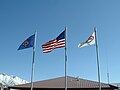 Flags at W. W. Clyde & Company in northern Springville, Utah - panoramio.jpg 1.280 × 960; 324 KB
-
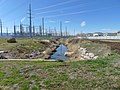
 Flowserve pond, Springville, Utah, Oct 16.jpg 2.592 × 1.944; 2,25 MB
-
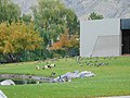 Fowl near Flowserve pond, Springville, Utah, Oct 16.jpg 2.592 × 1.944; 2,41 MB
-
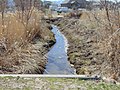
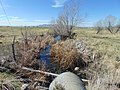
 Hobble Creek in Springville, Utah May 17.jpg 2.592 × 1.944; 2,16 MB
-
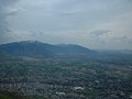
 Looking down on central Springville, Jun 04.jpg 1.280 × 960; 305 KB
-
 Looking down on east Mapleton, Utah, Jun 04.jpg 1.280 × 960; 313 KB
-
 Looking down on east Springville, Jun 04.jpg 1.280 × 960; 307 KB
-
 Looking down on north Springville, Jun 04.jpg 1.280 × 960; 306 KB
-
 Looking down on Utah Lake, Jun 04.jpg 1.280 × 960; 307 KB
-
 Looking down on west Mapleton, Utah, Jun 04.jpg 1.280 × 960; 305 KB
-
 Mobile phone towers, south Springville, Utah, Aug 15.jpg 2.816 × 2.112; 2,46 MB
-
 Moon & flag over Central Bank, Jun 17.jpg 2.592 × 1.944; 2,15 MB
-
 Nest4.JPG 2.048 × 1.536; 1,98 MB
-
 Norhtwest on Dry Creek at Tintic Branch, Springville, UT, Mar 17.jpg 2.592 × 1.944; 2,1 MB
-
 North along Dry Creek from SR-77, Mar 17.jpg 2.592 × 1.944; 2,37 MB
-
 North along Dry Creek to its source, Mar 17.jpg 2.592 × 1.944; 2,06 MB
-
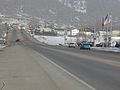
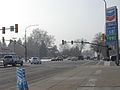
 North along South Main Street, Springville, Utah Apr 16.jpg 2.592 × 1.944; 2,38 MB
-
 North at Evergreen Dr & SR-51, Springville, Utah, Apr 16.jpg 2.592 × 1.944; 2,37 MB
-
 North at South Main St & US-89 in Springville, Utah, Apr 16.jpg 2.592 × 1.944; 2,36 MB
-
 North at West 400 South (SR-77) railway overpass, Jan 09.jpg 2.816 × 2.112; 2,81 MB
-
 North on Main St at city limits, Spanish Fork, Utah, May 16.jpg 2.592 × 1.944; 2,37 MB
-
 North on S Main St in Springville, Utah, Jun 16.jpg 2.592 × 1.944; 2,37 MB
-
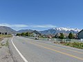
 North on US-89, Springville-Mapleton, Jul 15.jpg 2.816 × 2.112; 2,64 MB
-
 North toward junction of US-89 and SR-75, Feb 16.jpg 2.816 × 2.112; 2,23 MB
-
 North toward merge of US-89 and SR-51, Apr 16.jpg 2.592 × 1.944; 2,44 MB
-
 North toward merge of US-89 and SR-51, Feb 16.jpg 2.816 × 2.112; 2,69 MB
-
 Northeast at West 400 South (SR-77) I-15 overpass (close up), Jan 09.jpg 2.816 × 2.112; 2,76 MB
-
 Northeast at West 400 South (SR-77) I-15 overpass, Jan 09.jpg 2.816 × 2.112; 2,7 MB
-
 Northeast on Dry Creek from S 1200 W, Mar 17.jpg 2.592 × 1.944; 2,25 MB
-
 Northeast on Dry Creek from S 950 W in Springville, Utah, March 2017.jpg 2.592 × 1.944; 2,19 MB
-
 Northeast on Dry Creek from W 1350 S, Springville, Utah, Mar 17.jpg 2.592 × 1.944; 1,94 MB
-
 Northeast on Dry Creek, Springville from Dry Creek Trial, UT, Mar 17.jpg 2.592 × 1.944; 2,11 MB
-
 Northeast on Tintic Branch from 1600 S, Springville, Utah, May 16.jpg 2.592 × 1.944; 2,26 MB
-
 Northwest on Dry Creek from Outlook Apts., Mar 17.jpg 2.592 × 1.944; 2,34 MB
-
 Northwest on Dry Creek, Springville from Dry Creek Trial, UT, Mar 17.jpg 2.592 × 1.944; 2,06 MB
-
 Northwest on Dry Creek, Springville from near east end of Dry Creek Trial, UT, Mar 17.jpg 2.592 × 1.944; 2,03 MB
-
 Pipe draining into Dry Creek, Springville, UT, Mar 17.jpg 2.592 × 1.944; 2,08 MB
-
 Railway bridge over E 1600 S, Springville, Utah, May 16.jpg 2.592 × 1.944; 2,41 MB
-
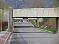
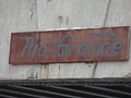 Rio Grande sign over SR-51, Jan 16.jpg 2.816 × 2.112; 2,3 MB
-
 South along SR-51 in south Springville, Utah.jpg 2.592 × 1.944; 2,45 MB
-
 South at source of Dry Creek, Springville, UT, Mar 17.jpg 2.592 × 1.944; 2 MB
-
 South at West 400 South (SR-77) railway overpass, Jan 09.jpg 2.816 × 2.112; 2,45 MB
-
 South toward divergence of US-89 and SR-51, Feb 16.jpg 2.816 × 2.112; 2,01 MB
-
 Southeast on Dry Creek from Outlook Apts., Mar 17.jpg 2.592 × 1.944; 2,27 MB
-
 Southwest on Dry Creek from S 1200 W, Mar 17.jpg 2.592 × 1.944; 2,18 MB
-
 Southwest on Dry Creek from S 950 W in Springville, Utah, March 2017.jpg 2.592 × 1.944; 2,06 MB
-
 Southwest on Dry Creek from W 1350 S, Springville, UT, Mar 17.jpg 2.592 × 1.944; 2,36 MB
-
 Southwest on Dry Creek toward Dry Creek Trail, Springville, UT, Mar 17.jpg 2.592 × 1.944; 2,03 MB
-
 Southwest on Tintic Branch from 1600 S, Springville, Utah, May 16.jpg 2.592 × 1.944; 2,41 MB
-
 Springville Bank 1891 Looking East.jpg 3.240 × 2.320; 2,86 MB
-
 Springville fire bell (39787980400).jpg 4.419 × 2.659; 3 MB
-
 Springville maintenance vehicle at Springville Rotary Park, Sep 16.jpg 2.592 × 1.944; 2,24 MB
-
 Springville Police car, older style, Utah.JPG 2.816 × 2.112; 2,72 MB
-
 Springville Police vehicle in Utah.JPG 2.816 × 2.112; 2,55 MB
-
 SpringvilMtns.jpg 2.272 × 1.704; 1,73 MB
-
 The Pond & Hobble Creek.pdf 2.550 × 1.650; 3,14 MB
-
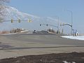
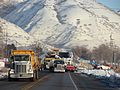
 UT SR-77 construction, east at I-15 interchange, Jan 09 (green light).jpg 2.816 × 2.112; 2,66 MB
-
 UT SR-77 construction, east at I-15 interchange, Jan 09 (red light).jpg 2.816 × 2.112; 2,63 MB
-
 UT SR-77 construction, east at railroad crossing, Jan 09.jpg 2.816 × 2.112; 2,53 MB
-
 UT SR-77 construction, east viaduct, Jan 09.jpg 2.816 × 2.112; 2,57 MB
-
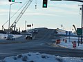 UT SR-77 construction, west at I-15 interchange, Jan 09.jpg 2.816 × 2.112; 2,24 MB
-
 UT SR-77 construction, west at railroad crossing, Jan 09.jpg 2.816 × 2.112; 2,27 MB
-
 UTA bus on Main Street in Springville, Utah, May 17.jpg 2.592 × 1.944; 2,35 MB
-
 UTA bus on northbound I-15, Springville, Utah, Aug 16.jpg 2.592 × 1.944; 2,2 MB
-
 Utah Lake from Springville.JPG 1.200 × 1.600; 558 KB
-
 Utah Railway sign over SR-51, Jan 16.jpg 2.816 × 2.112; 1,86 MB
-
 Welcome to Springville on State Rd.JPG 2.816 × 2.112; 2,71 MB
-
 West along Dry Creek from SR-51, Mar 17.jpg 2.592 × 1.944; 2,1 MB
-
 West at Dry Creek under Tintic Branch, May 17.jpg 2.592 × 1.944; 2,18 MB
-
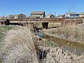
 West at Hobble Creek under Main St, Jun 17.jpg 2.592 × 1.944; 2,28 MB
-
 West at West 400 South (SR-77) railway overpass, Jan 09.jpg 2.816 × 2.112; 2,55 MB
-
 West end of Dry Creek culvert under S 950 W, Springville, UT, Mar 17.jpg 2.592 × 1.944; 2,26 MB
-
 West on 1600 South in Springville, UT, Mar 17.jpg 2.592 × 1.944; 2,39 MB
-
 West on Dry Creek from S 1400 W, Springville, UT, Mar 17.jpg 2.592 × 1.944; 2,21 MB
-
 West on Dry Creek from S 1700 West, Springville, UT, Mar 17.jpg 2.592 × 1.944; 2,41 MB
-
 West on Dry Creek from S 1750 West Springville, UT, Mar 17.jpg 2.592 × 1.944; 2,25 MB
-
 West on Dry Creek, Springville from Dry Creek Trial, UT, Mar 17.jpg 2.592 × 1.944; 2,09 MB
-
 West on SR 77 at 2000 W, Springville, Utah, Oct 16.jpg 2.592 × 1.944; 2,33 MB
-
 West on SR-77 at N 2600 W & S 400 W in Springville, Utah, May 16.jpg 2.592 × 1.944; 2,35 MB
-
 West toward junction of US-89 and SR-75, Feb 16.jpg 2.816 × 2.112; 2,32 MB
-
 West toward junction of US-89 and SR-77, Feb 16.jpg 2.816 × 2.112; 2,11 MB
-
 West toward western end of SR-75, Feb 16.jpg 2.816 × 2.112; 2,1 MB


_railway_overpass,_Jan_09.jpg)


_I-15_overpass_(close_up),_Jan_09.jpg)
_I-15_overpass,_Jan_09.jpg)


_railway_overpass,_Jan_09.jpg)


.jpg)


.jpg)
.jpg)


_railway_overpass,_Jan_09.jpg)


Kategorien:
- Cities in Utah
- Populated places in Utah County, Utah
- Populated places in Utah Valley
- Suburban communities in Utah
- Populated places established in 1853
- 1853 establishments in the United States
- 1853 in Utah
- Locations along Interstate 15 in Utah County, Utah
- Locations along U.S. Route 50 in Utah (1926-1953) in Utah County, Utah
- Locations along U.S. Route 50 Alternate in Utah County, Utah
- Locations along U.S. Route 89 in Utah County, Utah
- Locations along U.S. Route 91 in Utah (1926-1974) in Utah County, Utah
- Locations along Utah State Route 8 (1910-1977)
- Locations along Utah State Route 51
- Locations along Utah State Route 77
- Locations along Utah State Route 79 (1935-1953)