Category:Stülpe
Jump to navigation
Jump to search
human settlement in Germany _Schlo%C3%9F.jpg) Il castello | |||||
| Upload media | |||||
| Instance of |
| ||||
|---|---|---|---|---|---|
| Location | Nuthe-Urstromtal, Teltow-Fläming District, Brandenburg, Germany | ||||
| Area |
| ||||
| Elevation above sea level |
| ||||
 | |||||
Subcategories
This category has the following 5 subcategories, out of 5 total.
Media in category "Stülpe"
The following 52 files are in this category, out of 52 total.
-
 Denkmal 1. und 2.Weltkrieg In Stülpe - panoramio.jpg 1,944 × 2,592; 2.54 MB
-
 Dorffest in Stülpe - panoramio.jpg 4,575 × 3,046; 4.96 MB
-
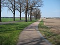 Fläming Skate Strecke S4 bei Stülpe - panoramio.jpg 2,592 × 1,944; 2.46 MB
-
 Fläming-Skate Rastplatz am RK2 - panoramio.jpg 2,592 × 1,944; 2.81 MB
-
 Fläming-Skate Strecke RK1 zwischen Stülpe und Holbeck - panoramio.jpg 2,592 × 1,944; 2.93 MB
-
 Fläming-Skate Strecke S12 - RK5 - Willkommen in Schlenzer - panoramio.jpg 2,592 × 1,944; 1.4 MB
-
 Heuernte - die Erste bei Stülpe - panoramio.jpg 3,264 × 2,448; 3.17 MB
-
 Heuernte oder Dokumenta - panoramio.jpg 3,264 × 2,448; 3.1 MB
-
 Lausitz Luftsport- & Techniktage 2013-Hinflug by-RaBoe 1111.jpg 2,600 × 1,727; 1.05 MB
-
 Lausitz Luftsport- & Techniktage 2013-Hinflug by-RaBoe 1112.jpg 2,600 × 1,727; 1.38 MB
-
 Lausitz Luftsport- & Techniktage 2013-Hinflug by-RaBoe 1113.jpg 2,600 × 1,727; 1.4 MB
-
 Lausitz Luftsport- & Techniktage 2013-Hinflug by-RaBoe 1114.jpg 2,600 × 1,727; 1.27 MB
-
 Lausitz Luftsport- & Techniktage 2013-Hinflug by-RaBoe 1115.jpg 2,600 × 1,727; 946 KB
-
 Lausitz Luftsport- & Techniktage 2013-Hinflug by-RaBoe 1116.jpg 2,600 × 1,727; 1.31 MB
-
 Lausitz Luftsport- & Techniktage 2013-Hinflug by-RaBoe 1117.jpg 2,600 × 1,727; 843 KB
-
 Lausitz Luftsport- & Techniktage 2013-Hinflug by-RaBoe 1118.jpg 2,600 × 1,727; 883 KB
-
 Lausitz Luftsport- & Techniktage 2013-Hinflug by-RaBoe 1119.jpg 2,600 × 1,725; 838 KB
-
 Lausitz Luftsport- & Techniktage 2013-Hinflug by-RaBoe 1120.jpg 2,600 × 1,726; 752 KB
-
 Lausitz Luftsport- & Techniktage 2013-Hinflug by-RaBoe 1121.jpg 2,600 × 1,727; 1,011 KB
-
 Lausitz Luftsport- & Techniktage 2013-Hinflug by-RaBoe 1122.jpg 2,600 × 1,727; 837 KB
-
 Lausitz Luftsport- & Techniktage 2013-Hinflug by-RaBoe 1123.jpg 2,600 × 1,727; 949 KB
-
 Lausitz Luftsport- & Techniktage 2013-Hinflug by-RaBoe 1124.jpg 2,600 × 1,727; 1.04 MB
-
 Lausitz Luftsport- & Techniktage 2013-Hinflug by-RaBoe 1125.jpg 2,600 × 1,727; 954 KB
-
 NU-Stülpe Heidchengraben Blick nach Osten.jpg 4,032 × 3,024; 4.39 MB
-
 NU-Stülpe Heidchengraben Blick nach Westen.jpg 4,032 × 3,024; 5.86 MB
-
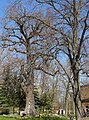
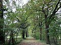 NU-Stülpe-Eichenallee (Stieleiche (Quercus robur) (Allee)) Stülpe 2021-12-21 1.jpg 4,032 × 3,024; 5.63 MB
-
 Nuthe-Urstromtal Stülpe Ortsansicht 01.jpg 4,032 × 3,024; 2.48 MB
-
 Nuthe-Urstromtal Stülpe Ortsansicht 02.jpg 4,032 × 3,024; 2.93 MB
-
 Nuthe-Urstromtal Stülpe Ortsansicht 03.jpg 4,032 × 3,024; 2.51 MB
-
 Nuthe-Urstromtal Stülpe Ortsansicht 04.jpg 4,032 × 3,024; 2.28 MB
-
 Nuthe-Urstromtal Stülpe Ortsansicht 05.jpg 4,032 × 3,024; 2.89 MB
-
 Nuthe-Urstromtal Stülpe Ortsansicht 06.jpg 4,032 × 3,024; 4.39 MB
-
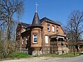
 Nuthe-Urstromtal-Stülpe ehemaliges Forsthaus Kastanienweg 9.jpg 4,032 × 3,024; 4.23 MB
-
 Nuthe-Urstromtal-Stülpe Kita.jpg 4,032 × 3,024; 4.03 MB
-
 Nuthe-Urstromtal-Stülpe Schule.jpg 4,032 × 3,024; 4.01 MB
-
 Seitenblicke Radfernweg Berlin -Leipzig - panoramio.jpg 2,592 × 1,944; 2.79 MB
-
 Storchennest in Stülpe - panoramio.jpg 2,592 × 1,944; 1.41 MB
-
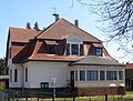
 Stülpe Baruther Straße 4 Wohnhaus.jpg 4,032 × 3,024; 2.7 MB
-
 Stülpe Stülper Schlossweg Blick auf Golmberg.jpg 4,032 × 3,024; 2.97 MB
-
 Stülpe Stülper Schlossweg geharzte Kiefern am Merzdorfer Weg.jpg 4,032 × 3,024; 4.71 MB
-
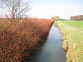
 Stülpe Wolfsbuschgraben nördlich von Stülpe Blick nach Osten.jpg 4,032 × 3,024; 4.72 MB
-
 Stülpe Wolfsbuschgraben nördlich von Stülpe Blick nach Süden.jpg 4,032 × 3,024; 4.23 MB
-
 Stülpe Wolfsbuschgraben nördlich von Stülpe Blick nach Westen.jpg 4,032 × 3,024; 5.7 MB
-
 Stülpe Wolfsbuschgraben südlich von Stülpe Blick nach Norden.jpg 4,032 × 3,024; 4.86 MB
-
 Stülpe Wolfsbuschgraben südlich von Stülpe Blick nach Osten.jpg 4,032 × 3,024; 3.46 MB
-
 StülpeBaruther36.jpg 4,414 × 3,317; 1.32 MB
-
 StülpeGleisrest.jpg 2,880 × 2,162; 3.28 MB
-
 StülpeKastanienallee16.jpg 2,620 × 1,976; 1.89 MB
-
 StülpeKastanienallee9.jpg 3,399 × 2,552; 4.94 MB
-
 StülpeLieper27.jpg 3,195 × 2,410; 3.63 MB
-
 StülpeNDEicheKastanienweg.jpg 2,389 × 3,221; 5.63 MB
-
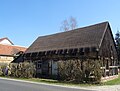
 StülpeSpeicher.jpg 3,648 × 2,736; 5.66 MB


_(Allee))_St%C3%BClpe_2021-12-21_1.jpg)


