Category:St. Andreas (Ahrbrück)
Jump to navigation
Jump to search
| Object location | | View all coordinates using: OpenStreetMap |
|---|
 | |||||
| Upload media | |||||
| Instance of | |||||
|---|---|---|---|---|---|
| Named after | |||||
| Location | Ahrbrück, Altenahr, Ahrweiler, Rhineland-Palatinate, Germany | ||||
| Significant event |
| ||||
 | |||||
Subcategories
This category has only the following subcategory.
Media in category "St. Andreas (Ahrbrück)"
The following 7 files are in this category, out of 7 total.
-
 1962 Brueck Kirche Grundsteinlegung.jpg 534 × 812; 73 KB
-
 2007 12 Ahrbrück Dorfbilder (59).jpg 2,048 × 1,536; 963 KB
-
 2010 02 Ahrbrück (16).jpg 3,264 × 2,448; 2.14 MB
-
 2010 04 11 Kirche u Pfarrhaus.jpg 2,592 × 1,944; 1.28 MB
-
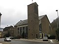 Ahrbrueck Sankt Andreaskirche.jpg 3,264 × 2,448; 1.62 MB
-
 Ahrbrueck St. Andreas innen.jpg 3,264 × 2,448; 1.9 MB
-
 Sankt Andreas.JPG 1,800 × 1,200; 515 KB

.jpg)
.jpg)


