Category:St Day
Jump to navigation
Jump to search
village and civil parish in Cornwall, England, UK .jpg) | |||||
| Upload media | |||||
| Instance of |
| ||||
|---|---|---|---|---|---|
| Location | Cornwall, South West England, England | ||||
| Population |
| ||||
 | |||||
English: St Day is a village and civil parish in Cornwall, UK, situated between the village of Chacewater and the larger town of Redruth.
Nederlands: St Day is een plaats in het bestuurlijke gebied Kerrier, in het Engelse graafschap Cornwall. De plaats telt ca. 1800 inwoners.
Subcategories
This category has the following 4 subcategories, out of 4 total.
D
- St Day Old Church (11 F)
S
- St Day Clock Tower (5 F)
Media in category "St Day"
The following 44 files are in this category, out of 44 total.
-
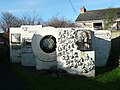 Artwork display at Gwennap Pit, St Day - geograph.org.uk - 4798434.jpg 2,048 × 1,536; 789 KB
-
 Bridge over public footpath at Scorrier - geograph.org.uk - 1955326.jpg 480 × 640; 139 KB
-
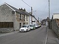 Church Street - geograph.org.uk - 6279011.jpg 800 × 600; 83 KB
-
 Community library - geograph.org.uk - 6278998.jpg 800 × 600; 88 KB
-
 Cottage rooves - geograph.org.uk - 6278978.jpg 800 × 600; 113 KB
-
 Derelict fields - geograph.org.uk - 6275202.jpg 800 × 600; 146 KB
-
 Door in the ruined church of St Day (4945639212).jpg 1,646 × 2,474; 4.04 MB
-
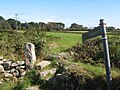 Footpath to Trefula - geograph.org.uk - 6278990.jpg 800 × 600; 132 KB
-
 Ford at Little Carharrack - geograph.org.uk - 4682144.jpg 6,000 × 4,000; 6.51 MB
-
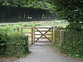 Gateway on the Coast to Coast Trail - geograph.org.uk - 1955296.jpg 640 × 480; 108 KB
-
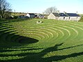
 Gwennap Pit - geograph.org.uk - 3799276.jpg 640 × 480; 89 KB
-
 Gwennap Pit chapel and visitor centre, St Day - geograph.org.uk - 4798448.jpg 1,995 × 1,482; 641 KB
-
 Gwennap Pit near Redruth - geograph.org.uk - 6456381.jpg 1,799 × 1,199; 456 KB
-
 Gwennap Pit, St Day - geograph.org.uk - 4798418.jpg 2,048 × 1,536; 741 KB
-
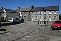 Market Square - geograph.org.uk - 836720.jpg 640 × 427; 99 KB
-
 Minor road at St Aubyn Farm - geograph.org.uk - 1955362.jpg 480 × 640; 69 KB
-

-

-
-
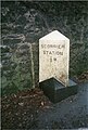
 Ordnance Survey Cut Mark - geograph.org.uk - 4450663.jpg 480 × 640; 132 KB
-
 Pink Moors - geograph.org.uk - 6279002.jpg 800 × 600; 96 KB
-
 Railway bridge over A3047, Scorrier - geograph.org.uk - 4884020.jpg 1,600 × 1,200; 299 KB
-
 Scorrier Christian Fellowship - geograph.org.uk - 5150926.jpg 2,048 × 1,536; 2.33 MB
-
 Secluded lane - geograph.org.uk - 6279006.jpg 600 × 800; 145 KB
-
 Sign, Mills Street, St Day (4948237138).jpg 1,349 × 1,579; 2.18 MB
-
 St Day 1 (4910356417).jpg 2,444 × 1,440; 2.48 MB
-
 St Day 2 (4910353693).jpg 2,248 × 1,808; 2.69 MB
-
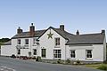
 St Day Inn (4910350947).jpg 2,240 × 1,857; 2.77 MB
-

-
-
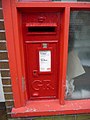
 St. Day, the post office - geograph.org.uk - 3705996.jpg 480 × 640; 68 KB
-
 St.Aubyn Farm - geograph.org.uk - 6278992.jpg 800 × 600; 81 KB
-
 St.Aubyn United Mine - geograph.org.uk - 6278987.jpg 800 × 600; 138 KB
-
 Star Inn, Vogue (4930359896).jpg 2,321 × 1,547; 1.72 MB
-
 The 'pulpit', Gwennap Pit - geograph.org.uk - 4798402.jpg 2,048 × 1,536; 727 KB
-
 The lane past Gwennap Pit, Busveal, St Day - geograph.org.uk - 4798456.jpg 2,048 × 1,536; 810 KB
-
 The Star Inn at Vogue - geograph.org.uk - 1955358.jpg 640 × 480; 68 KB
-
 Track and hedge - geograph.org.uk - 6275219.jpg 600 × 800; 170 KB
-
 Unity. - panoramio.jpg 4,000 × 2,248; 4.84 MB
-
 Van ^ Truck Centre, Scorrier - geograph.org.uk - 5476089.jpg 640 × 402; 57 KB
-

-
 Vogue Hill - geograph.org.uk - 836667.jpg 640 × 427; 116 KB
-
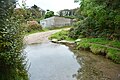
 Vogue shute - geograph.org.uk - 1955353.jpg 640 × 480; 134 KB
-
 Wheal Unity mine in Cornwall.jpg 2,592 × 1,944; 918 KB


.jpg)


.jpg)
.jpg)
.jpg)


.jpg)


