Category:Stahnsdorf
Vai alla navigazione
Vai alla ricerca
comune tedesco    | |||||
| Carica un file multimediale | |||||
| Istanza di |
| ||||
|---|---|---|---|---|---|
| Luogo | circondario di Potsdam-Mittelmark, Brandeburgo, Germania | ||||
| Indirizzo stradale |
| ||||
| Popolazione |
| ||||
| Superficie |
| ||||
| Altezza sul mare |
| ||||
| sito web ufficiale | |||||
 | |||||
Deutsch: Die Gemeinde Stahnsdorf gehört zum Landkreis Potsdam-Mittelmark, Land Brandenburg, Deutschland.
Français : La commune de Stahnsdorf fait partie de l'arrondissement Potsdam-Mittelmark, état fédéral de Brandebourg, Allemagne.
Sottocategorie
Questa categoria contiene le 16 sottocategorie indicate di seguito, su un totale di 16.
B
- Bäke in Stahnsdorf (1 F)
C
G
L
N
S
- Stolpersteine in Stahnsdorf (4 F)
T
- Teltowkanal in Stahnsdorf (26 F)
File nella categoria "Stahnsdorf"
Questa categoria contiene 48 file, indicati di seguito, su un totale di 48.
-
 DE-BB 12-0-69-604 Stahnsdorf COA.png 288 × 323; 52 KB
-
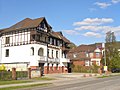
 14532 Stahnsdorf Eichenweg - panoramio - Karl-Heinz Böhm.jpg 1 280 × 960; 824 KB
-
 14532 Stahnsdorf Eichenweg - panoramio.jpg 1 280 × 960; 859 KB
-
 Anni-Krauss-Straße OdF Stahnsdorf.jpg 3 264 × 2 176; 6,13 MB
-
 Atlas für Berliner Schulen - Berlin und Umgegend 1913 (Zehlendorf).jpg 747 × 680; 421 KB
-

-

-

-
 Früherer Zustand, Ortseingang Stahnsdorf, Potsdamer Allee - panoramio.jpg 3 456 × 2 592; 4,22 MB
-
 Geheimnisvoll - panoramio.jpg 3 072 × 2 304; 3,26 MB
-
 Grashüpfer-Viertel Stahnsdorf im Bau.jpg 3 483 × 2 385; 8,96 MB
-
 Gruener Weg - Biker Weg - geo.hlipp.de - 35346.jpg 640 × 480; 126 KB
-
 KAS-Enser, Gerhard-Bild-35509-2.jpg 796 × 1 123; 96 KB
-
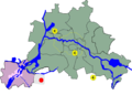 Lage Stahnsdorf bei Berlin.png 588 × 420; 34 KB
-
 Sanatorium (219918905).jpeg 2 048 × 1 365; 1,07 MB
-
 Sanatorium (219918909).jpeg 1 365 × 2 048; 667 KB
-
 Sanatorium (219918933).jpeg 2 048 × 1 586; 940 KB
-
 Sanatorium (219918935).jpeg 1 365 × 2 048; 652 KB
-
 Sanatorium (219918947).jpeg 2 048 × 1 365; 574 KB
-
 Sanatorium (219918987).jpeg 1 365 × 2 048; 519 KB
-
 Schenkendorfer Weg, Kreuzung mit dem Weg von Ruhlsdorf nach Güterfelde - panoramio.jpg 3 456 × 2 592; 4,56 MB
-
 Schleusengarten Stahnsdorf - geo.hlipp.de - 35362.jpg 640 × 480; 134 KB
-

-

-

-

-
 Stahnsdorf - Dorfanger (Village Green) - geo.hlipp.de - 35356.jpg 640 × 480; 131 KB
-
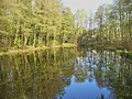
 Stahnsdorf - Dorfteich (Village Pond) - geo.hlipp.de - 35358.jpg 640 × 480; 137 KB
-
 Stahnsdorf - Gruener Weg - geo.hlipp.de - 35341.jpg 640 × 480; 133 KB
-
 Stahnsdorf - Gruener Weg - geo.hlipp.de - 35342.jpg 640 × 480; 125 KB
-

-
 Stahnsdorf - Kirchstrasse - geo.hlipp.de - 35360.jpg 640 × 480; 101 KB
-
 Stahnsdorf - Kosmo - geo.hlipp.de - 35352.jpg 640 × 480; 75 KB
-
 Stahnsdorf - Kriegesdenkmal (War Memorial) - geo.hlipp.de - 35354.jpg 640 × 480; 128 KB
-
 Stahnsdorf - Kuetscher Stuben - geo.hlipp.de - 35353.jpg 640 × 480; 93 KB
-
 Stahnsdorf - Ruhlsdorfer Strasse - geo.hlipp.de - 35347.jpg 640 × 480; 82 KB
-
 Stahnsdorf - Teich (Pond) - geo.hlipp.de - 35349.jpg 640 × 480; 112 KB
-
 Stahnsdorf - Wannseestrasse - geo.hlipp.de - 35363.jpg 640 × 480; 83 KB
-
 Stahnsdorf - Wilhelm-Kuelz-Strasse - geo.hlipp.de - 35348.jpg 640 × 480; 71 KB
-
 Stahnsdorf - Wilhelm-Kuelz-Strasse - geo.hlipp.de - 35355.jpg 640 × 480; 81 KB
-

-
 Stahnsdorf in PM.png 299 × 299; 7 KB
-
 Stahnsdorf, Separationsweg am Abzweig von der Ruhlsdorfer Straße - panoramio.jpg 2 592 × 3 456; 1,83 MB
-
 Wende-Menschenkette-Stahnsdorf.jpg 2 917 × 1 945; 2,64 MB
-
 Wüste Mark.jpg 10 295 × 10 240; 11,62 MB
-
 Wüstemark.jpg 4 000 × 3 000; 1,55 MB
-

-


.jpg)

_-_geo.hlipp.de_-_35359.jpg)
_-_geo.hlipp.de_-_35357.jpg)


.jpeg)
.jpeg)
.jpeg)
.jpeg)
.jpeg)
.jpeg)


_-_geo.hlipp.de_-_32142.jpg)
_-_geo.hlipp.de_-_35356.jpg)
_-_geo.hlipp.de_-_35358.jpg)


_-_geo.hlipp.de_-_35343.jpg)


_-_geo.hlipp.de_-_35354.jpg)


_-_geo.hlipp.de_-_35349.jpg)


_-_geo.hlipp.de_-_35361.jpg)


_-_panoramio.jpg)
_-_panoramio.jpg)