Category:Stonesfield
Jump to navigation
Jump to search
village and civil parish in West Oxfordshire, England  | |||||
| Upload media | |||||
| Instance of | |||||
|---|---|---|---|---|---|
| Location | West Oxfordshire, Oxfordshire, South East England, England | ||||
| Population |
| ||||
| Said to be the same as | Stonesfield (Wikimedia duplicated page, civil parish) | ||||
| official website | |||||
 | |||||
Subcategories
This category has the following 2 subcategories, out of 2 total.
M
- Stonesfield Mosaic (5 F)
Media in category "Stonesfield"
The following 145 files are in this category, out of 145 total.
-

-
 Aerial view north east down Stonesfield Road from Stonesfield.jpg 3,992 × 2,992; 2.91 MB
-
 Aerial view of Stonesfield Methodist Church, Oxfordshire.jpg 3,992 × 2,992; 1.89 MB
-
 Aerial view of Stonesfield sports pitch and village hall.jpg 3,992 × 2,992; 1.43 MB
-
 Akeman Street at the junction of Woodstock Road - geograph.org.uk - 6278261.jpg 1,804 × 1,202; 1.31 MB
-
 Akeman Street, Oxfordshire Way - geograph.org.uk - 190239.jpg 640 × 427; 64 KB
-
 Arable field near Stonesfield - geograph.org.uk - 1057012.jpg 426 × 640; 87 KB
-

-
 Arable land near Kingswood Farm - geograph.org.uk - 1057015.jpg 640 × 426; 87 KB
-
 Arable land near Stonesfield - geograph.org.uk - 1056945.jpg 640 × 426; 75 KB
-
 Benchmark on 'The Old Bakery' - geograph.org.uk - 4248715.jpg 1,024 × 683; 325 KB
-
 Benchmark on cottage at Combe Road junction - geograph.org.uk - 4247642.jpg 683 × 1,024; 150 KB
-
 Benchmark on Methodist Church - geograph.org.uk - 4248648.jpg 683 × 1,024; 291 KB
-
 Benchmark on St James Church - geograph.org.uk - 4248475.jpg 683 × 1,024; 251 KB
-
 Boot Street, Stonesfield, Oxon - geograph.org.uk - 6512537.jpg 709 × 1,024; 255 KB
-
 Bridge at Kingswood Bottom - geograph.org.uk - 3358422.jpg 640 × 427; 240 KB
-
 Bridge over the River Evenlode - geograph.org.uk - 2772102.jpg 640 × 480; 75 KB
-

-
 Callow Farm Shop.jpg 1,689 × 1,256; 1.43 MB
-
 Chapel and Farmhouse - geograph.org.uk - 6657430.jpg 5,472 × 3,648; 4.44 MB
-
 Combe Saw Mill steam day - geograph.org.uk - 264377.jpg 640 × 427; 77 KB
-
 Cottage and farm by The Ridings, Stonesfield - geograph.org.uk - 6264674.jpg 1,920 × 1,280; 953 KB
-
 Cottages in High Street, Stonesfield - geograph.org.uk - 2038725.jpg 640 × 533; 111 KB
-
 Evenlode, Stonesfield.jpg 3,456 × 2,304; 619 KB
-
 Farmland at Stonesfield Riding - geograph.org.uk - 3358462.jpg 640 × 427; 234 KB
-
 Farmland near Stonesfield - geograph.org.uk - 4294172.jpg 2,592 × 1,944; 1.81 MB
-
 Field and path by The Ridings, Stonesfield - geograph.org.uk - 6264658.jpg 1,920 × 1,280; 1.59 MB
-
 Flat Landscape near Stonesfield - geograph.org.uk - 6657344.jpg 5,184 × 3,456; 2.24 MB
-
 Footbridge in Kingswood Bottom - geograph.org.uk - 4785350.jpg 6,000 × 4,000; 4.93 MB
-
 Footbridge over Evenlode during flood - geograph.org.uk - 2668436.jpg 1,600 × 1,200; 495 KB
-
 Footpath alongside King's Wood - geograph.org.uk - 3364138.jpg 640 × 427; 208 KB
-
 Footpath alongside Wootton Wood - geograph.org.uk - 3364142.jpg 640 × 427; 166 KB
-
 Footpath leading to Brook Lane, Stonesfield.jpg 4,128 × 3,096; 6.04 MB
-
 Footpath near King's Wood - geograph.org.uk - 3364133.jpg 640 × 427; 199 KB
-
 Footpath towards Limbeck Farm - geograph.org.uk - 3364171.jpg 640 × 427; 203 KB
-
 Footpath-road junction south of Stonesfield - geograph.org.uk - 4247275.jpg 1,024 × 683; 153 KB
-

-
 Harvested field by Limbeck Farm - geograph.org.uk - 4790150.jpg 6,000 × 4,000; 5.41 MB
-
 Harvested field near Callow Farm - geograph.org.uk - 4789150.jpg 6,000 × 4,000; 5.68 MB
-
 Harvested field near Kingswood Farm - geograph.org.uk - 4789136.jpg 6,000 × 4,000; 5.16 MB
-
 Houses and war memorial beside Combe Road - geograph.org.uk - 4247697.jpg 1,024 × 683; 169 KB
-

-
 Junction on Shakespeare's Way - geograph.org.uk - 3364214.jpg 640 × 427; 203 KB
-
 King's Wood from B4437 - geograph.org.uk - 1472369.jpg 442 × 640; 127 KB
-
 King's Wood, Blenheim Estate. - panoramio.jpg 3,456 × 4,608; 4.4 MB
-
 Laughton Hill, Stonesfield, Oxon - geograph.org.uk - 6512513.jpg 731 × 1,024; 214 KB
-
 Limbeck Farm - geograph.org.uk - 3364156.jpg 640 × 427; 164 KB
-
 Limbeck Farm - geograph.org.uk - 3364186.jpg 640 × 427; 238 KB
-
 Limbeck Farm - geograph.org.uk - 4790178.jpg 6,000 × 4,000; 4.01 MB
-
 Limbeck Farm buildings - geograph.org.uk - 3364160.jpg 640 × 427; 196 KB
-
 Limbeck Farm buildings - geograph.org.uk - 3364164.jpg 640 × 427; 244 KB
-
 Longore, Stonesfield - geograph.org.uk - 6278266.jpg 1,906 × 1,260; 1.19 MB
-
 Maltster and Shovel pub advertisement.jpg 982 × 1,412; 1.14 MB
-
 Meadows near Stonesfield - geograph.org.uk - 2831634.jpg 640 × 480; 46 KB
-
 Minor road into Stonesfield from the west - geograph.org.uk - 4247074.jpg 1,024 × 683; 238 KB
-
 Minor road north towards Spratts Farm - geograph.org.uk - 4247162.jpg 1,024 × 683; 230 KB
-
 Notoaks Wood - geograph.org.uk - 2772089.jpg 640 × 480; 105 KB
-
 Old Bakery, Stonesfield.jpg 3,456 × 2,304; 3.18 MB
-
 Oolitic limestone, Stonesfield - geograph.org.uk - 1013666.jpg 640 × 426; 82 KB
-
 Oxfordshire Way - geograph.org.uk - 4787246.jpg 640 × 480; 99 KB
-
 Oxfordshire Way - geograph.org.uk - 4787254.jpg 640 × 480; 59 KB
-
 Path east from Stonesfield Riding - geograph.org.uk - 190206.jpg 640 × 427; 120 KB
-
 Pond Hill, Stonesfield - geograph.org.uk - 6657434.jpg 4,721 × 3,290; 3.87 MB
-
 Potato field near Limbeck Farm - geograph.org.uk - 4790193.jpg 6,000 × 4,000; 4.92 MB
-
 River Evenlode, Stonesfield - geograph.org.uk - 2038764.jpg 640 × 427; 112 KB
-
 Road past Limbeck Farm - geograph.org.uk - 3364181.jpg 640 × 427; 200 KB
-
 Road to North Farm - geograph.org.uk - 6657444.jpg 5,385 × 2,853; 5.95 MB
-
 Road to Stonesfield - geograph.org.uk - 1056953.jpg 640 × 426; 65 KB
-
 Road to Stonesfield - geograph.org.uk - 1117690.jpg 640 × 426; 84 KB
-
 Roman Villa Stonesfield.jpg 2,560 × 1,440; 1.07 MB
-
 Rough patch past Limbeck Farm - geograph.org.uk - 4790165.jpg 6,000 × 4,000; 5.13 MB
-

-
 Ruddy Lane near Stonesfield - geograph.org.uk - 1056996.jpg 640 × 426; 102 KB
-

-
 Shakespeare's Way - geograph.org.uk - 4763692.jpg 640 × 480; 119 KB
-
 Shakespeare's Way - geograph.org.uk - 4763697.jpg 640 × 480; 91 KB
-
 Shakespeare's Way - geograph.org.uk - 4764359.jpg 640 × 480; 104 KB
-
 Shakespeare's Way - geograph.org.uk - 4764362.jpg 640 × 480; 91 KB
-
 Shakespeare's Way - geograph.org.uk - 4789167.jpg 6,000 × 4,000; 5.08 MB
-
 Shakespeare's Way - geograph.org.uk - 4789403.jpg 6,000 × 4,000; 5.67 MB
-
 Spratts Farm - geograph.org.uk - 4247116.jpg 1,024 × 683; 251 KB
-
 St James the Great church, Stonesfield - geograph.org.uk - 4294164.jpg 2,592 × 1,944; 1.25 MB
-
 St James' Church - geograph.org.uk - 4246562.jpg 1,024 × 683; 142 KB
-
 Stepped footpath - geograph.org.uk - 2979025.jpg 2,000 × 3,008; 2.17 MB
-
 Stockley Plantation, Stonesfield - geograph.org.uk - 1056979.jpg 640 × 426; 95 KB
-
 Chapel in Stonesfield - geograph.org.uk - 1014970.jpg 640 × 426; 74 KB
-
 Stonesfield and Church - geograph.org.uk - 611527.jpg 640 × 480; 139 KB
-
 Stonesfield at dusk.jpg 4,128 × 3,096; 6.51 MB
-
 Stonesfield Common - geograph.org.uk - 5667166.jpg 640 × 480; 87 KB
-
 Stonesfield Green, Oxfordshire, showing The White Horse pub.jpg 4,032 × 3,024; 3.09 MB
-
 Stonesfield lockup.jpg 2,304 × 3,456; 803 KB
-
 Stonesfield Methodist Church - geograph.org.uk - 4248675.jpg 683 × 1,024; 155 KB
-
 Stonesfield Methodist church - geograph.org.uk - 4293558.jpg 2,592 × 1,944; 1.73 MB
-
 Stonesfield Methodist Church.jpg 4,128 × 3,096; 4.24 MB
-
 Stonesfield Riding - geograph.org.uk - 4789155.jpg 6,000 × 4,000; 5.25 MB
-
 Stonesfield Scout Hut.jpg 1,600 × 1,200; 407 KB
-
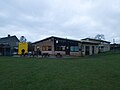 Stonesfield Sports & Social Club.jpg 3,992 × 2,992; 1.7 MB
-
 Stonesfield Telephone Exchange, Oxon (1) - geograph.org.uk - 5180732.jpg 2,592 × 1,944; 1.35 MB
-
 Stonesfield Telephone Exchange, Oxon (2) - geograph.org.uk - 5180738.jpg 2,592 × 1,944; 1.42 MB
-
 Stonesfield.jpg 2,572 × 1,929; 751 KB
-
 StonesfieldSpoil.jpg 3,456 × 2,304; 544 KB
-
 Stoney Cotswold field - geograph.org.uk - 1117703.jpg 426 × 640; 135 KB
-
 Stonsefield war memorial - geograph.org.uk - 6278264.jpg 1,280 × 1,920; 1.22 MB
-
 Straight but not Roman - geograph.org.uk - 6657339.jpg 5,184 × 3,456; 6.2 MB
-
 Stubble field at Stonesfield - geograph.org.uk - 1013655.jpg 640 × 426; 96 KB
-
 Stubble field near Stonesfield - geograph.org.uk - 1057000.jpg 640 × 426; 85 KB
-
 The B4437 by King's Wood - geograph.org.uk - 4707723.jpg 1,500 × 999; 236 KB
-
 The B4437 to Wootton - geograph.org.uk - 4707726.jpg 1,500 × 999; 169 KB
-
 The B4437 to Wootton - geograph.org.uk - 4707727.jpg 1,500 × 999; 141 KB
-
 The Black Head, Stonesfield - geograph.org.uk - 2978972.jpg 1,600 × 1,063; 408 KB
-
 The Evenlode near Stonesfield - geograph.org.uk - 6659016.jpg 1,600 × 1,067; 831 KB
-
 The footpath to Charlbury - geograph.org.uk - 4421003.jpg 2,592 × 1,944; 1.63 MB
-
 The Oxfordshire Way leaving Stonesfield - geograph.org.uk - 4293519.jpg 2,592 × 1,944; 2.19 MB
-
 The Ridings, Stonesfield - geograph.org.uk - 6278267.jpg 1,898 × 1,246; 1,016 KB
-
 The Ridings, Stonesfield, Oxon - geograph.org.uk - 4975105.jpg 1,024 × 683; 164 KB
-
 The road from Stonesfield to Wootton - geograph.org.uk - 4294168.jpg 2,592 × 1,944; 1.85 MB
-
 The road into Stonesfield from Combe - geograph.org.uk - 4846494.jpg 1,024 × 683; 219 KB
-

-

-

-
 The White Horse, Stonesfield - geograph.org.uk - 6264624.jpg 1,920 × 1,280; 1.28 MB
-
 Towards Limbeck Farm - geograph.org.uk - 3364148.jpg 640 × 427; 171 KB
-
 Track in King's Wood - geograph.org.uk - 4789405.jpg 6,000 × 4,000; 4.75 MB
-
 Tree on Akeman Street - geograph.org.uk - 259702.jpg 640 × 427; 97 KB
-

-
 View of Stonesfield, Oxfordshire from a drone over Greenfield Crescent.jpg 3,952 × 2,962; 2.12 MB
-
 Western entrance to the Blenheim Estate - geograph.org.uk - 611659.jpg 640 × 480; 179 KB
-
 Woodstock Road, Stonesfield - geograph.org.uk - 6278263.jpg 1,920 × 1,280; 984 KB
-
 Woodstock Road, Stonesfield - geograph.org.uk - 6278265.jpg 1,920 × 1,280; 856 KB
-
 Airstrip at Oaklands Farm - geograph.org.uk - 1117684.jpg 640 × 426; 103 KB
-
 Airstrip, Oaklands Farm - geograph.org.uk - 1056959.jpg 640 × 426; 71 KB
-

-
 Arable land near Fawler - geograph.org.uk - 1014320.jpg 640 × 426; 99 KB
-
 B4437 passing through Sheer's Copse - geograph.org.uk - 1472363.jpg 640 × 443; 103 KB
-
 Corner of Stonesfield and Akeman - geograph.org.uk - 190237.jpg 427 × 640; 84 KB
-
 Country lane in springtime. - geograph.org.uk - 396135.jpg 640 × 480; 151 KB
-
 Dip in road at Bagg's Bottom - geograph.org.uk - 190223.jpg 640 × 427; 92 KB
-
 Field near Stonesfield - geograph.org.uk - 190458.jpg 640 × 427; 120 KB
-
 Footpath onto North Leigh Common - geograph.org.uk - 321152.jpg 640 × 480; 125 KB
-
 Grintleyhill Bridge - geograph.org.uk - 6843.jpg 640 × 480; 101 KB
-
 Kingswood Farm from B4437 - geograph.org.uk - 190231.jpg 640 × 427; 49 KB
-
 Lane junction - geograph.org.uk - 321147.jpg 640 × 480; 103 KB
-
 Roadside tree near Notoaks Wood - geograph.org.uk - 190233.jpg 640 × 427; 100 KB
-
 Tree and Ash Copse - geograph.org.uk - 85436.jpg 640 × 427; 84 KB
-
 Woodland edge - geograph.org.uk - 321146.jpg 640 × 480; 114 KB


_-_geograph.org.uk_-_5180732.jpg)
_-_geograph.org.uk_-_5180738.jpg)


,_The_Ridings,_Stonesfield,_Oxon_-_geograph.org.uk_-_4974890.jpg)
,_The_Ridings,_Stonesfield,_Oxon_-_geograph.org.uk_-_4974908.jpg)
_-_sign,_The_Ridings,_Stonesfield,_Oxon_-_geograph.org.uk_-_4974938.jpg)


