Category:Strathkanaird
Jump to navigation
Jump to search
human settlement in Highland, Scotland, UK | |||||
| Upload media | |||||
| Instance of | |||||
|---|---|---|---|---|---|
| Location |
| ||||
 | |||||
English: Strathkanaird (also Strathcanaird) is a Ross-shire crofting township around seven miles north of Ullapool.
Subcategories
This category has the following 2 subcategories, out of 2 total.
C
- River Canaird, Strathkanaird (15 F)
- Loch a' Chroisg, Strathkanaird (12 F)
Media in category "Strathkanaird"
The following 11 files are in this category, out of 11 total.
-

-
 Fence Corner, strathcanaird - geograph.org.uk - 227654.jpg 640 × 384; 47 KB
-
 Loch Dubh Power Station and Penstock - geograph.org.uk - 322452.jpg 640 × 480; 77 KB
-
-
 Ordnance Survey One-Inch Sheet 20 Ullapool, Published 1958.jpg 8,295 × 9,848; 10.28 MB
-

-
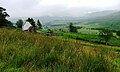
 Strathcanaird - geograph.org.uk - 7245.jpg 640 × 346; 112 KB
-
 Strathcanaird phone box - geograph.org.uk - 526596.jpg 640 × 482; 95 KB
-
 Strathcannaird post box - geograph.org.uk - 1937927.jpg 960 × 720; 205 KB
-
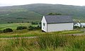 Telephone Exchange, Strathcanaird - geograph.org.uk - 222681.jpg 640 × 384; 67 KB
-
 The Old Road, Strathcanaird - geograph.org.uk - 243604.jpg 640 × 384; 96 KB


