Category:Streymoy
Jump to navigation
Jump to search

island in the Faroe Islands .jpg)  | |||||
| Upload media | |||||
| Instance of | |||||
|---|---|---|---|---|---|
| Part of | |||||
| Location |
| ||||
| Located in or next to body of water | |||||
| Connects with | |||||
| Capital | |||||
| Highest point |
| ||||
| Population |
| ||||
| Area |
| ||||
 | |||||
Subcategories
This category has the following 40 subcategories, out of 40 total.
A
C
- Coasts of Streymoy (1 F)
E
- Eiðiskollur (11 F)
- Eiðisvatn (3 F)
G
- Gamlarætt (3 F)
H
- Hvítanes (1 P, 5 F)
K
- Kollafjørður (fjord) (6 F)
L
- Langasandur (4 F)
- Leynar (1 P, 10 F)
M
- Mýlingur (1 P, 4 F)
N
- Nesvík (6 F)
- Niðara Vatn (6 F)
- Norðradalur (1 P, 14 F)
O
- Oyggjarvegur (1 P, 4 F)
- Oyrareingir (1 P, 7 F)
S
- Signabøur (1 P, 5 F)
- Skælingur (1 P, 4 F)
- Streymin Bridge (12 F)
- Syðradalur (Streymoy) (1 P, 6 F)
V
- Vestmannabjørgini (1 P, 11 F)
- Við Áir (15 F)
Media in category "Streymoy"
The following 77 files are in this category, out of 77 total.
-
 A Stone Arch Bridge in Skælingur Streymoy Faroe Islands.JPG 3,648 × 2,736; 2.29 MB
-
 Angelica archangelica Streymoy Faroe Islands.jpg 960 × 720; 169 KB
-
 Coastal Cliffs - panoramio.jpg 2,250 × 1,674; 723 KB
-
 Detailed map streymoy 2006.jpg 1,088 × 1,533; 575 KB
-
 Eiði from Eiðiskollur.jpg 3,744 × 2,221; 2.15 MB
-
 Faroe Islands - panoramio (7).jpg 2,436 × 1,668; 3.03 MB
-
 Faroe Islands - panoramio (8).jpg 2,436 × 1,668; 3.84 MB
-
 Faroe Islands, Streymoy, Oyrareingir.jpg 2,144 × 1,424; 2.03 MB
-
 Faroe Road - panoramio.jpg 2,190 × 1,590; 995 KB
-
 Faroe stamp 482 maria cruise - mylingur sunnanifra.jpg 367 × 247; 40 KB
-
 Faroe stamp 483 maria cruise - mylingur nordanifra.jpg 368 × 247; 41 KB
-
 Faroese stamp 589 ancient lithographs 1839.jpg 486 × 340; 99 KB
-
 Färöer Streymoy 01.JPG 3,444 × 2,586; 4.67 MB
-
 Färöer Streymoy 02.JPG 3,444 × 2,586; 4.21 MB
-
 Färöer Streymoy 03.JPG 3,444 × 2,586; 4.23 MB
-
 Färöer Streymoy 04.JPG 3,444 × 2,586; 3.95 MB
-
 Färöer Streymoy 05.JPG 3,444 × 2,586; 5.48 MB
-
 Färöer Streymoy 06.JPG 3,444 × 2,586; 4.99 MB
-
 Färöer Streymoy 07.JPG 3,444 × 2,586; 5.43 MB
-
 Färöer Streymoy 08.JPG 3,444 × 2,586; 4.72 MB
-
 Färöer Streymoy 09.JPG 3,444 × 2,586; 4.98 MB
-
 Färöer Streymoy 10.JPG 3,444 × 2,586; 5.19 MB
-
 Färöer Streymoy 11.JPG 3,444 × 2,586; 5 MB
-
 Färöer Streymoy 12.JPG 3,444 × 2,586; 5.46 MB
-
 Färöer Streymoy 13.JPG 3,444 × 2,586; 5.88 MB
-
 Färöer Streymoy 14.JPG 3,444 × 2,586; 6.34 MB
-
 Färöer Streymoy 15.JPG 3,444 × 2,586; 6.46 MB
-
 Färöer Streymoy 16.JPG 3,444 × 2,586; 6.33 MB
-
 Färöer Streymoy 17.JPG 3,444 × 2,586; 6.23 MB
-
 Färöer Streymoy 18.JPG 3,444 × 2,586; 6.16 MB
-
 Färöer Streymoy 19.JPG 3,444 × 2,586; 7.03 MB
-
 Färöer Streymoy 20.JPG 3,444 × 2,586; 5.62 MB
-
 Färöer Streymoy 21.JPG 3,444 × 2,586; 5.91 MB
-
 Färöer Streymoy 22.JPG 3,444 × 2,586; 5.46 MB
-
 Färöer Streymoy 23.JPG 3,444 × 2,586; 5.55 MB
-
 Färöer Streymoy 24.JPG 3,444 × 2,586; 4.88 MB
-
 Färöer Streymoy 25.JPG 3,444 × 2,586; 5.27 MB
-
 Färöer Streymoy 26.JPG 3,444 × 2,586; 5.23 MB
-
 Färöer Streymoy 27.JPG 3,444 × 2,586; 5.64 MB
-
 Hvalviksvegur, Faroe Islands.jpg 3,575 × 2,382; 8.67 MB
-
 Is03155-Droga na Sornfelli.jpg 3,008 × 2,000; 1.75 MB
-
 Is03159-Droga z Sornfelli.jpg 3,008 × 2,000; 1.93 MB
-
 Is03224-Koltur-w tle Streymoy.jpg 2,931 × 1,949; 1.72 MB
-
 Is03230-Streymoy.jpg 3,008 × 2,000; 1.79 MB
-
 Is03238-Streymoy.jpg 3,008 × 2,000; 1.69 MB
-
 Is03247-Streymoy.jpg 2,937 × 1,953; 1.97 MB
-
 Is03248-Streymoy.jpg 3,008 × 2,000; 2.06 MB
-
 Is03253-Streymoy.jpg 3,008 × 2,000; 2.29 MB
-
 Is03255-Streymoy.jpg 3,008 × 2,000; 2.57 MB
-
 Kogeren.jpg 2,592 × 3,888; 7.51 MB
-
 Mountains in the Faroes - panoramio.jpg 1,749 × 1,256; 383 KB
-
 Position of Streymoy on Faroe map.png 688 × 1,035; 19 KB
-
 PostnummurStreymoy.jpg 571 × 511; 86 KB
-
 Ranunculus sp. Streymoy Faroe Islands2.jpg 960 × 720; 184 KB
-
 Road to Nowhere (Unsplash).jpg 9,708 × 4,577; 7.57 MB
-
 Route 60 Streymoy Sandoy (map, Faroe).jpg 591 × 507; 63 KB
-
 Saksun.Streymoy.1.jpg 3,872 × 2,592; 2.1 MB
-
 Sandoy, Trøllhøvdið, Hestur, Koltur and Streymoy Faroe Islands.JPG 3,648 × 2,736; 2.01 MB
-
 South of Haldarsvík view towards south.JPG 4,608 × 3,456; 6.27 MB
-
 Streymin Bridge.jpg 2,384 × 1,188; 940 KB
-
 Streymoy (cropped).png 453 × 425; 66 KB
-
 Streymoy and Eysturoy Faroe Islands Fish Farming in the Sea.JPG 4,608 × 3,456; 6.77 MB
-
 Streymoy auf der Fähre nach Suduröy 1.JPG 3,444 × 2,586; 4.33 MB
-
 Streymoy auf der Fähre nach Suduröy 2.JPG 3,444 × 2,586; 4.73 MB
-
 Streymoy Faroe Islands3.jpg 960 × 720; 143 KB
-
 Streymoy in the mountains (2), faroe islands.jpg 554 × 965; 74 KB
-
 Streymoy in the mountains, faroe islands.jpg 560 × 853; 62 KB
-
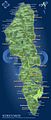 Streymoy map.jpg 601 × 1,413; 228 KB
-
 Streymoy, Isole Faroe - panoramio.jpg 2,798 × 2,132; 6.22 MB
-
 Streymoy.jpg 673 × 398; 25 KB
-
 Streymoy.png 574 × 1,441; 217 KB
-
 Tangafjordur seen from Hoyvik on Streymoy.JPG 4,608 × 3,456; 6.17 MB
-
 Vaade Streymoy saarel Tórshavnist põhjas.jpg 640 × 480; 19 KB
-

-

-

-
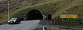 Vágatunnilin's entrance in Streymoy.jpg 800 × 293; 74 KB


.jpg)
.jpg)


.jpg)
.jpg)


.png)


,_faroe_islands.jpg)


