Category:Sumska Street, Kharkiv
Jump to navigation
Jump to search
| Object location | | View all coordinates using: OpenStreetMap |
|---|
(begin)
| Object location | | View all coordinates using: OpenStreetMap |
|---|
(end)
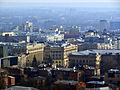
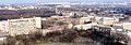
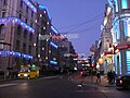
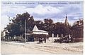
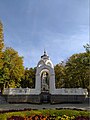
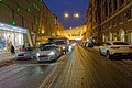
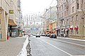
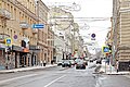
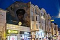
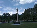
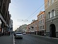
the main street of Kharkiv, Ukraine  | |||||
| Upload media | |||||
| Instance of | |||||
|---|---|---|---|---|---|
| Location | Kharkiv, Kharkiv Raion, Kharkiv Oblast, Ukraine | ||||
| Connects with | |||||
| Length |
| ||||
 | |||||
Famoust and central street in Kharkiv.
Subcategories
This category has the following 60 subcategories, out of 60 total.
0
- Sumska St., 1 (Kharkiv) (68 F)
- Sumska St., 2 (Kharkiv) (38 F)
- Sumska St., 3 (Kharkiv) (32 F)
- Sumska St., 4 (Kharkiv) (25 F)
- Sumska St., 5 (Kharkiv) (41 F)
- Sumska St., 6 (Kharkiv) (40 F)
- Sumska St., 7 (Kharkiv) (27 F)
1
- Sumska St., 11 (Kharkiv) (7 F)
- Sumska St., 13 (Kharkiv) (12 F)
- Sumska St., 14 (Kharkiv) (12 F)
- Sumska St., 17 (Kharkiv) (103 F)
- Sumska St., 18/20 (Kharkiv) (50 F)
- Sumska St., 19 (Kharkiv) (75 F)
2
- Sumska St., 28 (Kharkiv) (9 F)
- Sumska St., 23 (Kharkiv) (59 F)
- Sumska St., 26 (Kharkiv) (24 F)
3
- Sumska 37, Kharkiv (42 F)
- Sumska 39, Kharkiv (73 F)
4
- Sumska 41, Kharkiv (44 F)
- Sumska 45, Kharkiv (14 F)
- Sumska 46 (22 F)
- Sumska 49, Kharkiv (27 F)
- Sumska St., 43 (Kharkiv) (54 F)
- Sumska St., 44 (Kharkiv) (97 F)
5
- Sumska 55, Kharkiv (60 F)
- Sumska 57, Kharkiv (13 F)
- Sumska St., 52 (Kharkiv) (47 F)
6
- Sumska 65, Kharkiv (8 F)
- Sumska 67, Kharkiv (8 F)
- Giprokoks (9 F)
7
8
- Sumska 80, Kharkiv (8 F)
- Sumska 82, Kharkiv (56 F)
- Sumska 84, Kharkiv (11 F)
- Sumska 88, Kharkiv (26 F)
- Sumska 82a, Kharkiv (7 F)
9
- Sumska 98, Kharkiv (9 F)
- Sumska St., 106a (Kharkiv) (6 F)
- Sumska St., 108 (Kharkiv) (5 F)
- Sumska St., 112 (Kharkiv) (3 F)
- Sumska St., 116 (Kharkiv) (5 F)
- Sumska St., 122 (Kharkiv) (11 F)
- Sumska 96, Kharkiv (16 F)
F
K
- KhVVKIU (7 F)
M
- Mirror Stream (52 F)
N
- Navruz (5 F)
P
- Palace of marriage (Kharkiv) (44 F)
S
V
- Voenved (8 F)
Media in category "Sumska Street, Kharkiv"
The following 81 files are in this category, out of 81 total.
-
 1941oct25SumskayaStreetOccupation.jpg 2,378 × 1,373; 663 KB
-
 2-й троллейбус.jpg 1,600 × 1,200; 468 KB
-
 63-101-2406 001 Kharkiv reg.jpg 4,752 × 3,168; 3.23 MB
-
 Funeral of Hennadiy Kernes by Kharkivian (013).jpg 4,608 × 3,456; 6.29 MB
-
 Funeral of Hennadiy Kernes by Kharkivian (014).jpg 4,608 × 3,456; 6.29 MB
-
 Funeral of Hennadiy Kernes by Kharkivian (030).jpg 4,608 × 3,456; 5.71 MB
-
 Funeral of Hennadiy Kernes by Kharkivian (031).jpg 4,608 × 3,456; 6.23 MB
-
 Funeral of Hennadiy Kernes by Kharkivian (032).jpg 4,608 × 3,456; 6.23 MB
-
 Funeral of Hennadiy Kernes by Kharkivian (053).jpg 4,608 × 3,456; 5.73 MB
-
 Funeral of Hennadiy Kernes by Kharkivian (054).jpg 4,608 × 3,456; 6.22 MB
-
 Funeral of Hennadiy Kernes by Kharkivian (056).jpg 4,608 × 3,456; 6.15 MB
-
 Funeral of Hennadiy Kernes by Kharkivian (058).jpg 4,608 × 3,456; 5.92 MB
-
 Kharkiv Oblast after shelling (2).jpg 960 × 540; 102 KB
-
 Kharkiv Radiotechnical College.jpg 2,816 × 2,112; 1,005 KB
-
 Kharkov air force university 01.jpg 3,604 × 1,899; 2.15 MB
-
 Kharkov air force university 02.jpg 3,648 × 2,736; 3.45 MB
-
 Kharkov air force university 03.jpg 2,026 × 1,572; 1.12 MB
-
 Kharkov DTP 1.JPG 3,264 × 2,448; 2.25 MB
-
 Kharkov DTP 2.JPG 3,264 × 2,448; 2.23 MB
-
 Kharkov oblsovet EN.jpg 3,648 × 2,736; 10.83 MB
-
 Kharkov oblsovet.jpg 3,648 × 2,736; 6.69 MB
-
 Kharkov oblsovet1.jpg 3,648 × 2,736; 6.6 MB
-
 Kharkov Pion Khvvkiurv.jpg 2,712 × 957; 2.04 MB
-
 Kharkov Pion Sumskaya Dinamovskaya.jpg 3,648 × 2,736; 8.59 MB
-
 Kharkov Pion Sumskaya.jpg 3,648 × 2,736; 8.85 MB
-
 Kharkov1981-04-Sumskaya.jpg 5,129 × 3,307; 4.35 MB
-
 KharkovGorkyParkAlley.jpg 3,264 × 2,448; 1.19 MB
-
 KharkovSumskayaIvanovaStreetBeforeNewYearNight.JPG 3,584 × 2,016; 2.8 MB
-
 KharkovSumskayaStreetBeforeNewYearNight.JPG 3,648 × 2,736; 4.54 MB
-
 KharkovSumskayaStreetNewYear.JPG 2,560 × 1,920; 2.36 MB
-
 Mironositsky01.jpg 1,826 × 1,186; 489 KB
-
 Mirror Stream 01.jpg 4,160 × 3,120; 5.81 MB
-
 Mirror Stream 02.jpg 3,000 × 4,000; 1.99 MB
-
 Mirror Stream 03.jpg 3,000 × 4,000; 2.42 MB
-
 Mirror Stream 04.jpg 3,000 × 4,000; 3.07 MB
-
 Stellar (218991481).jpeg 2,048 × 1,367; 881 KB
-
 Sums'ka - panoramio.jpg 2,816 × 2,112; 2.62 MB
-
 Sumska Street in Kharkiv (1).jpg 3,968 × 2,976; 5.53 MB
-
 Sumska Street in Kharkiv (2).jpg 3,968 × 2,976; 5.42 MB
-
 Sumska Street, Kharkiv - 01.jpg 4,042 × 2,689; 9.42 MB
-
 Sumska Street, Kharkiv - 02.jpg 4,256 × 2,832; 12.72 MB
-
 Sumska Street, Kharkiv 2021 - 01.jpg 4,752 × 3,168; 11.6 MB
-
 Sumska Street, Kharkiv 2021 - 02.jpg 4,752 × 3,168; 10.59 MB
-
 Sumskaya 110.JPG 3,264 × 2,448; 2.13 MB
-
 Sumskaya str, Kharkiv, c1900.jpg 1,481 × 984; 287 KB
-
 Sumskaya Street, 74.jpg 800 × 508; 199 KB
-
 Sumskaya street.jpg 1,112 × 1,456; 287 KB
-
 Sumskaya39Kharkov.jpg 860 × 533; 219 KB
-
 Sumskayaa street,Kharkiv.jpg 1,200 × 1,600; 861 KB
-
 Trinklera street.jpg 3,648 × 2,736; 7.81 MB
-
 Будинок купця Лисикова вул. Сумська, 4.jpg 6,000 × 4,000; 4.91 MB
-
 Вечірній Дзеркальний струмінь, або Скляний струмінь, Пам'ятник Перемоги.jpg 2,048 × 1,536; 783 KB
-
 Вул. Сумська, 18 20 Будинок Ради з'їзду гірничопромисловців півдня.jpg 6,000 × 4,000; 6.94 MB
-
 Вул. Сумська, 18 20 Будинок Ради.jpg 6,000 × 4,000; 6.44 MB
-
 Вул. Сумська, 2.jpg 6,000 × 4,000; 5.81 MB
-
 Вул. Сумська, 26.jpg 6,000 × 4,000; 4.98 MB
-
 Графіті Місце, де час уповільнює свій хід 01.jpg 4,160 × 3,120; 6.1 MB
-
 Гуманоид в городском пейзаже 04.jpg 1,536 × 2,560; 1.77 MB
-
 Жб вул. Сумська, 26.jpg 6,000 × 4,000; 3.79 MB
-
 Житловий будинок вул. Сумська, 6.jpg 6,000 × 4,000; 7.56 MB
-
 Лещинский М.Я. Паспарту.jpg 2,500 × 1,521; 693 KB
-
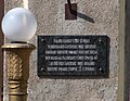
 Мемориальная доска Сергееву В. Г. , Харьков.jpg 2,039 × 1,309; 284 KB
-
 Пам ятник Архистратигу Михаїлу 01.jpg 4,160 × 3,120; 5.07 MB
-
 Пам ятник Архистратигу Михаїлу 02.jpg 4,160 × 3,120; 5.49 MB
-
 Пам ятник Архистратигу Михаїлу 03.jpg 3,000 × 4,000; 2.32 MB
-
 Платформа 9 ¾ 01.jpg 3,120 × 4,160; 7.63 MB
-
 Платформа 9 ¾ 02.jpg 3,120 × 4,160; 7.33 MB
-
 Платформа 9 ¾ 03.jpg 3,000 × 4,000; 2.98 MB
-
 Скульптура Аксакал.jpg 3,120 × 4,160; 9.81 MB
-
 Сумская 78 Навруз.JPG 3,264 × 2,448; 2.2 MB
-
 Сумская улица - panoramio (1).jpg 2,592 × 1,944; 2.86 MB
-
 Сумская улица - panoramio (2).jpg 2,592 × 1,944; 2.79 MB
-
 Сумская улица - panoramio (3).jpg 2,592 × 1,944; 2.67 MB
-
 Сумская улица - panoramio (4).jpg 2,592 × 1,944; 2.73 MB
-
 Сумская улица - panoramio.jpg 2,592 × 1,944; 2.85 MB
-
 Трам А экскурс.Подстанция Vizu2679.JPG 2,303 × 1,879; 1.14 MB
-
 Харе Кришна на Сумской.JPG 3,264 × 1,832; 3.44 MB
-
 Харьков Белгород автобус зимой.JPG 3,264 × 2,448; 2.72 MB
-
 Харьков Пасха 2011.JPG 3,042 × 2,288; 2.68 MB
-
 ХОГА после штурма Ягуаром 4.jpg 3,264 × 2,448; 3.14 MB
-
 Центр Харькова ночью.jpg 2,480 × 1,860; 662 KB


.jpg)
.jpg)
.jpg)
.jpg)
.jpg)
.jpg)
.jpg)
.jpg)
.jpg)
.jpg)


.jpeg)

.jpg)
.jpg)


.jpg)
.jpg)
.jpg)
.jpg)


