Category:Swinefleet
Jump to navigation
Jump to search
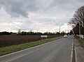
English: Swinefleet is a village and civil parish in the East Riding of Yorkshire, England. It is situated approximately 2 miles (3.2 km) south east of the town of Goole on the A161 road from Goole to Crowle. It lies on the south bank of the River Ouse.
village in the United Kingdom  | |||||
| Upload media | |||||
| Instance of | |||||
|---|---|---|---|---|---|
| Location | East Riding of Yorkshire, Yorkshire and the Humber, England | ||||
 | |||||
Subcategories
This category has the following 2 subcategories, out of 2 total.
S
- Swinefleet War Memorial (1 F)
Media in category "Swinefleet"
The following 200 files are in this category, out of 307 total.
(previous page) (next page)-
 "The Ship Inn", Swinefleet - geograph.org.uk - 6085655.jpg 5,184 × 3,888; 5.55 MB
-
 'The Old Mill' - geograph.org.uk - 2210059.jpg 2,000 × 1,245; 2.57 MB
-
 2 metre trig point, Reading Gate - geograph.org.uk - 3814891.jpg 1,024 × 768; 143 KB
-
 A bench on New Lane, Reedness - geograph.org.uk - 2337130.jpg 800 × 600; 231 KB
-
 A choice of views, west end of Swinefleet - geograph.org.uk - 3496784.jpg 1,024 × 768; 117 KB
-
 A drain junction - geograph.org.uk - 5736313.jpg 4,606 × 3,454; 7.22 MB
-
 A farm road towards Moors Farm - geograph.org.uk - 2337061.jpg 800 × 600; 175 KB
-
 A sliver of land - geograph.org.uk - 3700884.jpg 1,024 × 768; 119 KB
-
-
 A Tree - geograph.org.uk - 143300.jpg 640 × 480; 66 KB
-
 A view of Common Farm - geograph.org.uk - 6085621.jpg 4,950 × 3,849; 4.33 MB
-
 A view of The Old Mill, Swinefleet - geograph.org.uk - 6085668.jpg 4,964 × 3,507; 3.62 MB
-
 A War Memorial - geograph.org.uk - 1992121.jpg 800 × 600; 214 KB
-
 Access to the river bank - geograph.org.uk - 2304070.jpg 1,024 × 768; 142 KB
-

-
 After the harvest - geograph.org.uk - 2018214.jpg 1,024 × 768; 135 KB
-
 Another "Pub with No Beer" The George Inn Swinefleet - geograph.org.uk - 5736231.jpg 4,586 × 3,426; 4.49 MB
-
 Bankside Farm - geograph.org.uk - 334612.jpg 640 × 480; 82 KB
-
 Bankside Farm - geograph.org.uk - 4052829.jpg 640 × 480; 57 KB
-
 Bankside Farm - geograph.org.uk - 6085617.jpg 4,971 × 3,768; 5.62 MB
-
 Barns at farm on the outskirts of Swinefleet - geograph.org.uk - 6179702.jpg 1,600 × 978; 383 KB
-
 Barns at King's Causeway Farm - geograph.org.uk - 6002772.jpg 1,500 × 995; 1.43 MB
-
 Bench and Lane - geograph.org.uk - 143298.jpg 640 × 480; 78 KB
-
 Blossoming heart alongside Reading Gate - geograph.org.uk - 3502119.jpg 1,024 × 768; 148 KB
-
 Bog Gate - geograph.org.uk - 3503188.jpg 1,024 × 768; 133 KB
-
 Bridge carrying Reading Gate over a drain - geograph.org.uk - 3501660.jpg 1,024 × 768; 106 KB
-
 Buildings at Hall Farm, Swinefleet - geograph.org.uk - 3496793.jpg 1,024 × 768; 140 KB
-
 Buried Level Crossing - geograph.org.uk - 334617.jpg 640 × 480; 98 KB
-
 Caroline Square, Swinefleet - geograph.org.uk - 365017.jpg 640 × 427; 47 KB
-
 Cemetery Chapel - geograph.org.uk - 1561958.jpg 640 × 426; 118 KB
-
 Cereal field, east of Reading Gate - geograph.org.uk - 3502212.jpg 1,024 × 768; 159 KB
-
 Cereal field, east of Reading Gate - geograph.org.uk - 3503184.jpg 1,024 × 768; 158 KB
-
 Cereal field, north of Readingate Farm - geograph.org.uk - 3502128.jpg 1,024 × 768; 168 KB
-
 Cereal field, west of Reading Gate - geograph.org.uk - 3502061.jpg 1,024 × 768; 110 KB
-
 Cereals growing east of Quay Lane - geograph.org.uk - 3496837.jpg 1,024 × 768; 198 KB
-
 Cereals growing in Quay Field - geograph.org.uk - 3503181.jpg 1,024 × 768; 138 KB
-
 Chapel of rest in Swinefleet Cemetery - geograph.org.uk - 6085645.jpg 5,184 × 3,888; 6.4 MB
-
 Cherry Tree Farm - geograph.org.uk - 1224132.jpg 640 × 480; 34 KB
-
 Cherry Tree Farm - geograph.org.uk - 6085676.jpg 5,069 × 3,888; 4.08 MB
-

-
 Cherry Tree Farm, west of Reedness - geograph.org.uk - 3622689.jpg 1,024 × 614; 78 KB
-
 Church Acres, off Church Lane, Swinefleet - geograph.org.uk - 1701571.jpg 1,024 × 768; 114 KB
-
 Church Lane junction - geograph.org.uk - 3522119.jpg 640 × 480; 117 KB
-
 Church Lane junction at Swinefleet - geograph.org.uk - 3523927.jpg 640 × 378; 90 KB
-
 Citizenlink Office, Swinefleet - geograph.org.uk - 2304328.jpg 1,024 × 768; 171 KB
-
 Clough west of Swinefleet - geograph.org.uk - 397864.jpg 640 × 480; 142 KB
-
 Converted windmill from Mill Trod (Track) - geograph.org.uk - 5736125.jpg 5,152 × 3,864; 6.57 MB
-
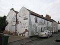
 Cottages on High Street, Swinefleet - geograph.org.uk - 2304351.jpg 1,024 × 768; 159 KB
-
 Course of the Axholme Light Railway (2) - geograph.org.uk - 1965124.jpg 1,024 × 768; 205 KB
-
 Crop field east of Quay Lane - geograph.org.uk - 4052850.jpg 640 × 480; 67 KB
-
 Crop field, Yokefleet Farm - geograph.org.uk - 4052825.jpg 640 × 480; 59 KB
-
 Crossmoor Bank (1) - geograph.org.uk - 3501649.jpg 1,024 × 768; 102 KB
-
 Crossmoor Bank (2) - geograph.org.uk - 3501992.jpg 1,024 × 768; 135 KB
-
 Crowle Moors - geograph.org.uk - 488012.jpg 640 × 480; 97 KB
-
 Development site in Swinefleet - geograph.org.uk - 2304075.jpg 1,024 × 768; 198 KB
-
 Disused Railway line - geograph.org.uk - 1212973.jpg 640 × 480; 89 KB
-
 Ditch and field west of Crow Tree Farm - geograph.org.uk - 5631947.jpg 1,500 × 1,125; 1.53 MB
-
 Ditch with farm track south of King's Causeway - geograph.org.uk - 2210946.jpg 2,000 × 1,500; 2.94 MB
-
 Double bend, Reading Gate - geograph.org.uk - 3814740.jpg 1,024 × 768; 138 KB
-
 Drain heading east from Quay Lane - geograph.org.uk - 6085608.jpg 5,055 × 3,791; 4.64 MB
-
 Drain in Quay Field - geograph.org.uk - 3502193.jpg 1,024 × 768; 178 KB
-
 Drain on the east side of Reading Gate - geograph.org.uk - 3502170.jpg 1,024 × 768; 195 KB
-
 Drain on the west side of New Lane - geograph.org.uk - 3815643.jpg 1,024 × 768; 122 KB
-
 Drain west of Reading Gate - geograph.org.uk - 3502002.jpg 1,024 × 768; 174 KB
-
 Drainage ditch beside the A161 - geograph.org.uk - 2549863.jpg 1,600 × 1,200; 560 KB
-
 Drainage ditch, west of Quay Lane - geograph.org.uk - 3501586.jpg 1,024 × 615; 144 KB
-
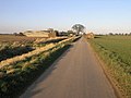
 Dunmires Lane (track) - geograph.org.uk - 2942445.jpg 1,024 × 768; 185 KB
-
 Dyke and Bridge - geograph.org.uk - 334619.jpg 640 × 480; 106 KB
-
 Edge of a field of oil seed rape - geograph.org.uk - 3501620.jpg 1,024 × 768; 179 KB
-
 Emerging crop, north of Swinefleet Peat Works - geograph.org.uk - 3814882.jpg 1,024 × 768; 152 KB
-
 Entering 30 limit for Swinefleet - geograph.org.uk - 3522054.jpg 640 × 443; 92 KB
-
 Entering sunny Swinefleet - geograph.org.uk - 1740761.jpg 640 × 473; 62 KB
-

-
 Entering Swinefleet from Reedness - geograph.org.uk - 5736185.jpg 3,777 × 2,786; 3.24 MB
-
 Entrance to Mount Pleasant Farm from Quart Lane - geograph.org.uk - 5736346.jpg 4,584 × 3,424; 6.09 MB
-
 Farm buildings on Reading Gate, (road) - geograph.org.uk - 2337028.jpg 800 × 600; 240 KB
-
 Farm track off Reading Gate - geograph.org.uk - 2533139.jpg 1,024 × 768; 168 KB
-
 Farm track west of Quay Lane - geograph.org.uk - 3501637.jpg 1,024 × 768; 150 KB
-
 Farm track, Quay Field - geograph.org.uk - 3503177.jpg 1,024 × 768; 161 KB
-
 Farmhouse at Cherry Tree over frozen field - geograph.org.uk - 2210156.jpg 2,000 × 1,527; 2.9 MB
-
 Farmhouse, Quayfields Farm - geograph.org.uk - 5631964.jpg 1,500 × 1,125; 2.22 MB
-
 Farmland - geograph.org.uk - 356474.jpg 640 × 480; 94 KB
-
 Farmland east of Reading Gate - geograph.org.uk - 3814750.jpg 1,024 × 768; 123 KB
-
 Farmland north of Moors Farm - geograph.org.uk - 3814719.jpg 1,024 × 768; 150 KB
-
 Farmland north-west of Quay Lane - geograph.org.uk - 3501579.jpg 1,024 × 768; 146 KB
-
 Farmland off New Lane - geograph.org.uk - 2549868.jpg 1,600 × 1,200; 451 KB
-
 Farmland off the A161 - geograph.org.uk - 2549852.jpg 1,600 × 1,200; 456 KB
-
 Farmland off the A161 - geograph.org.uk - 2549859.jpg 1,600 × 1,200; 521 KB
-
 Farmland south-west of Quay Lane - geograph.org.uk - 3501590.jpg 1,024 × 768; 151 KB
-
 Farmland west of Puddiners Lane - geograph.org.uk - 3814647.jpg 1,024 × 768; 147 KB
-
 Farmland west of Reading Gate - geograph.org.uk - 3814681.jpg 1,024 × 768; 139 KB
-
 Field adjacent to Swinefleet Warping Drain - geograph.org.uk - 2684098.jpg 1,500 × 966; 1.22 MB
-
 Fields of SE7720 - geograph.org.uk - 1198513.jpg 640 × 480; 45 KB
-
 Fields off Quay Lane - geograph.org.uk - 5463084.jpg 1,024 × 576; 164 KB
-
 Fields towards Crowle Moors - geograph.org.uk - 488007.jpg 640 × 480; 98 KB
-
 Fields with drain south of Swinefleet - geograph.org.uk - 2684059.jpg 1,500 × 1,125; 1.28 MB
-
 Filling station and shop Swinefleet - geograph.org.uk - 5736199.jpg 4,582 × 3,420; 5.09 MB
-

-
 Flat Fields - geograph.org.uk - 143292.jpg 640 × 480; 79 KB
-
 Gravestones and chapel in Swinefleet churchyard - geograph.org.uk - 6002720.jpg 1,500 × 1,125; 2.33 MB
-
 Green Farm - geograph.org.uk - 143296.jpg 640 × 480; 62 KB
-
 Green roof Garage and Swinefleet church - geograph.org.uk - 1198610.jpg 640 × 480; 121 KB
-
 Grossmoor Bank - geograph.org.uk - 3025757.jpg 1,500 × 1,125; 1.35 MB
-
 Hall Farm - geograph.org.uk - 2549835.jpg 1,600 × 1,200; 325 KB
-
 Heightened flood defence Swinefleet - geograph.org.uk - 5736243.jpg 4,526 × 3,346; 4.75 MB
-
 High Street at Swinefleet.jpg 640 × 480; 85 KB
-
 High Street Swinefleet looking southwest - geograph.org.uk - 5736177.jpg 4,608 × 3,456; 5.05 MB
-
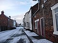
 High Street with a scattering of snow - geograph.org.uk - 1701574.jpg 1,024 × 768; 105 KB
-
 High Street, Swinefleet - geograph.org.uk - 3804104.jpg 640 × 427; 55 KB
-
 High West Moor Field, Moor Fields - geograph.org.uk - 3814656.jpg 1,024 × 768; 151 KB
-
 Humber Ranger Survey vessel on River Ouse - geograph.org.uk - 5736147.jpg 5,150 × 3,862; 7.65 MB
-
 Humber Renown, east of Saltmarshe Hall - geograph.org.uk - 3597931.jpg 1,024 × 614; 113 KB
-
 Ice and Sunshine - geograph.org.uk - 334611.jpg 640 × 480; 97 KB
-
 King's Causeway Farm , Swinefleet - geograph.org.uk - 1198602.jpg 640 × 487; 45 KB
-
 King's Causeway, Swinefleet - geograph.org.uk - 2109737.jpg 800 × 600; 209 KB
-
 Land drain at Swinefleet - geograph.org.uk - 397867.jpg 640 × 480; 104 KB
-
 Land drain parallel to Quay Lane (1) - geograph.org.uk - 3496807.jpg 1,024 × 768; 173 KB
-
 Land drain parallel to Quay Lane (2) - geograph.org.uk - 3496820.jpg 1,024 × 768; 160 KB
-
 Land drain running north-east from Quay Lane - geograph.org.uk - 3496822.jpg 1,024 × 768; 154 KB
-
 Levee on south side of River Ouse - geograph.org.uk - 5435840.jpg 1,500 × 768; 1.06 MB
-
 Long Shadows - geograph.org.uk - 334615.jpg 640 × 480; 93 KB
-
 Long Shores Fields - geograph.org.uk - 1224141.jpg 640 × 480; 40 KB
-

-
 Looking Towards Red House Farm - geograph.org.uk - 644011.jpg 640 × 480; 85 KB
-
 Low Street , Swinefleet - geograph.org.uk - 2549839.jpg 1,600 × 1,200; 403 KB
-
-

-
 Mill Trod (Track) alongside Cherry Tree Farm - geograph.org.uk - 5736603.jpg 4,604 × 3,450; 6.67 MB
-
 Mill Trod (Track) toward Swinefleet - geograph.org.uk - 5736613.jpg 4,594 × 3,438; 6.39 MB
-
 Moor Farm Trig Point - geograph.org.uk - 447440.jpg 640 × 480; 71 KB
-
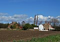
 Moors Farm - geograph.org.uk - 2741732.jpg 1,500 × 949; 1.41 MB
-
 Move on, please. There's nothing to see here - geograph.org.uk - 2692080.jpg 1,024 × 768; 174 KB
-
 Navigation beacon 21, east of Bank House - geograph.org.uk - 3585330.jpg 1,024 × 768; 182 KB
-
 Navigation beacon at Swinefleet - geograph.org.uk - 6085660.jpg 3,888 × 5,184; 4.66 MB
-
 Navigation beacons at Bank House - geograph.org.uk - 3585323.jpg 1,024 × 615; 103 KB
-
 Navigation mark by the Ouse - geograph.org.uk - 1326257.jpg 640 × 480; 61 KB
-

-
 New house on the east side of Quay Lane - geograph.org.uk - 3501572.jpg 1,024 × 768; 106 KB
-
 New houses on the edge of Swinefleet - geograph.org.uk - 3503176.jpg 1,024 × 768; 145 KB
-
 New Lane - geograph.org.uk - 1198596.jpg 640 × 480; 69 KB
-
 New Lane towards Reedness - geograph.org.uk - 2337124.jpg 800 × 600; 209 KB
-
 New Lane towards Reedness - geograph.org.uk - 2549873.jpg 1,600 × 1,200; 347 KB
-
 New Lane, near Reedness - geograph.org.uk - 2942443.jpg 1,024 × 697; 97 KB
-

-
 North bank of the Ouse, at Saltmarshe Hall - geograph.org.uk - 3585342.jpg 1,024 × 768; 144 KB
-
 North bank of the Ouse, near Bank House - geograph.org.uk - 3570977.jpg 1,024 × 768; 68 KB
-
 Nova Scotia Farm - geograph.org.uk - 1198505.jpg 640 × 480; 60 KB
-
 Nova Scotia Farm - geograph.org.uk - 1965140.jpg 1,024 × 768; 132 KB
-
 Nova Scotia Farm - geograph.org.uk - 5736339.jpg 4,524 × 3,340; 4.32 MB
-
 Oilseed rape crop, Nova Scotia Farm - geograph.org.uk - 4052837.jpg 640 × 480; 57 KB
-
 Old High Street at Swinefleet - geograph.org.uk - 397900.jpg 640 × 480; 68 KB
-
 On Reading Gate approaching Swinefleet - geograph.org.uk - 6085642.jpg 5,184 × 3,888; 5.61 MB
-
 Passing place on Reading Gate - geograph.org.uk - 3502021.jpg 1,024 × 768; 114 KB
-
 Passing places on Reading Gate - geograph.org.uk - 3502224.jpg 1,024 × 768; 101 KB
-
 Pilgrim's Rest - geograph.org.uk - 3502087.jpg 1,024 × 768; 109 KB
-
 Pipeline marker, Reading Gate - geograph.org.uk - 3814758.jpg 1,024 × 768; 131 KB
-
 Plough awaiting its next job - geograph.org.uk - 5463104.jpg 1,024 × 576; 144 KB
-
 Ploughed field, Swinefleet ^ Reedness Moor - geograph.org.uk - 3814761.jpg 1,024 × 768; 154 KB
-
 Ploughed land at Puddiners - geograph.org.uk - 3814634.jpg 1,024 × 768; 115 KB
-
 Potato crop, Bankside Farm - geograph.org.uk - 4052831.jpg 640 × 480; 61 KB
-
 Potato field - geograph.org.uk - 3025840.jpg 1,500 × 818; 1.11 MB
-
 Potato field - geograph.org.uk - 4052848.jpg 640 × 480; 68 KB
-
 Prospect of Swinefleet - geograph.org.uk - 5586055.jpg 5,320 × 2,922; 2.73 MB
-
 Pub and house on High Street, Swinefleet - geograph.org.uk - 5821048.jpg 1,499 × 1,015; 1.41 MB
-
 Puddiners Lane - geograph.org.uk - 3814638.jpg 1,024 × 768; 139 KB
-
 Puddiners Lane at the 1 metre spot height - geograph.org.uk - 3814671.jpg 1,024 × 768; 105 KB
-
 Puddiners Lane back toward Readingate Farm - geograph.org.uk - 5736356.jpg 4,592 × 3,434; 5.55 MB
-
 Puddiners Lane, a minor road - geograph.org.uk - 5736367.jpg 4,562 × 3,394; 5.39 MB
-
 Puddiners Lane, off the A161 - geograph.org.uk - 2337015.jpg 800 × 600; 175 KB
-
 Quart Lane - geograph.org.uk - 4052840.jpg 640 × 480; 58 KB
-
 Quart Lane - geograph.org.uk - 5463090.jpg 1,024 × 576; 152 KB
-
 Quay Lane (1) - geograph.org.uk - 3501599.jpg 1,024 × 768; 127 KB
-
 Quay Lane (2) - geograph.org.uk - 3501625.jpg 1,024 × 768; 115 KB
-
 Quay lane - geograph.org.uk - 1198510.jpg 640 × 480; 50 KB
-
 Quay Lane - geograph.org.uk - 3496834.jpg 1,024 × 768; 106 KB
-
 Quay Lane - geograph.org.uk - 4052828.jpg 640 × 480; 45 KB
-
 Quay Lane - geograph.org.uk - 4052834.jpg 640 × 480; 56 KB
-
 Quay Lane - geograph.org.uk - 4052843.jpg 640 × 480; 44 KB
-
 Quay Lane - geograph.org.uk - 4052853.jpg 640 × 480; 61 KB
-
 Quay lane and Mount Pleasant farm - geograph.org.uk - 1198517.jpg 640 × 480; 62 KB
-
 Quay Lane looking southeast - geograph.org.uk - 5463079.jpg 1,024 × 576; 124 KB
-
 Quay Lane Swinefleet - geograph.org.uk - 5736271.jpg 4,592 × 3,434; 4.72 MB
-
 Quay Lane toward Bankside Farm - geograph.org.uk - 5737139.jpg 1,438 × 1,913; 1.39 MB
-
 Quay Lane toward Nova Scotia Farm - geograph.org.uk - 5736327.jpg 4,522 × 3,338; 3.65 MB
-
 Quay Lane toward Nova Scotia Farm - geograph.org.uk - 5736333.jpg 4,608 × 3,456; 4.84 MB
-
 Quay Lane, north of Bankside Farm - geograph.org.uk - 3501576.jpg 1,024 × 768; 133 KB
-
 Quayfield Square, Swinefleet - geograph.org.uk - 2109726.jpg 800 × 600; 244 KB
-
 Queueing for a Pea - geograph.org.uk - 1172787.jpg 640 × 480; 186 KB
-
 Railway Cottages - geograph.org.uk - 2741746.jpg 1,500 × 1,044; 1.5 MB
-
 Railway remains - geograph.org.uk - 1965106.jpg 1,024 × 768; 213 KB
-
 Raised bank of River Ouse at Swinefleet - geograph.org.uk - 2683706.jpg 1,500 × 957; 1.26 MB
-
 Reading Gate (1) - geograph.org.uk - 3814715.jpg 1,024 × 768; 143 KB
-
 Reading Gate (2) - geograph.org.uk - 3814721.jpg 1,024 × 768; 107 KB
-

-
 Reading Gate - geograph.org.uk - 2533134.jpg 1,024 × 768; 195 KB
-
 Reading Gate - geograph.org.uk - 2684170.jpg 1,500 × 896; 1.08 MB
-
 Reading Gate - geograph.org.uk - 3502050.jpg 1,024 × 768; 97 KB
-
 Reading Gate - geograph.org.uk - 3502076.jpg 1,024 × 768; 102 KB
-
 Reading Gate at Readingate Farm - geograph.org.uk - 3502141.jpg 1,024 × 768; 124 KB
-
 Reading Gate at Readingate Farm - geograph.org.uk - 5463099.jpg 1,024 × 576; 122 KB


_-_geograph.org.uk_-_5736125.jpg)

_-_geograph.org.uk_-_1965124.jpg)


_-_geograph.org.uk_-_3501649.jpg)
_-_geograph.org.uk_-_3501992.jpg)


_-_geograph.org.uk_-_2942445.jpg)


_-_geograph.org.uk_-_2337028.jpg)


_near_Reedness_-_geograph.org.uk_-_1740750.jpg)


_-_geograph.org.uk_-_3496807.jpg)
_-_geograph.org.uk_-_3496820.jpg)


_alongside_Cherry_Tree_Farm_-_geograph.org.uk_-_5736603.jpg)
_toward_Swinefleet_-_geograph.org.uk_-_5736613.jpg)


_-_geograph.org.uk_-_3501599.jpg)
_-_geograph.org.uk_-_3501625.jpg)


_-_geograph.org.uk_-_3814715.jpg)
_-_geograph.org.uk_-_3814721.jpg)
_crosses_over_Quart_Lane_-_geograph.org.uk_-_2337037.jpg)


